Nepal Engineering Council

Nepal Engineering Council

Nepal Engineering Council (NEC) is a regulatory body established by the Government of Nepal to regulate and oversee the engineering profession in the country. Established under Nepal Engineering Council Act, 2055 It is responsible for maintaining and promoting the standards of engineering education, practice, and professional conduct in Nepal. It provides accreditation and recognition to engineering programs and institutions in Nepal It registers and licenses engineering professionals who meet the council’s standards and requirements. Objectives To prepare policies, plans and programs for the smooth functioning of the engineering profession and to execute them. To set norms and standards for engineering education in Nepal. To grant permission and approval to carry out engineering education to those engineering colleges and institutions that meet the required norms and standards and to honor their degrees and certificates. To monitor and inspect the quality of engineering education provided by the engineering colleges and institutions. To fix the qualification necessary in order to practice engineering profession and to register their name in the Council. To remove their name from the registration of the engineering council if found to violate the code of ethics. 1.Nepal Engineering Council Act 2055 • Date of publication : 2055-11-27 • Chapters: 7 • Clauses :38 • Amendment (I) : 2079-05-05 Some provisions of NEC Act 2055 Members = 21 1. President= 1 ( Bachelor’s degree + 15 years experience, Nominated by GoN) Current President : Er. Dr. Padma Bahadur Shahi 2. Vice President=1 (Bachelor’s degree + 10 years experience, Nominated by GoN) Current Vice-President : Er. Dr. Bikash Adhikari 3. Members = 7 (Bachelor’s degree + 7 years experience, one from each province, at least three women, Nominated by GoN) 4.Member=1 ( President of NEA) Current president of NEA : Er. Dr. Hari Bahadur Darlami NOTE : The president of NEA is also the ex-offcio of NEC. 5. Members=5 ( Elected from NEA) ( Though NEA members have tenure of 2 years, these members are elected for term of 4 years) 6. Member =1 ( Campus chief of any Engineering Campus, Nominated by GoN ) 7. Member=1 ( Representative from Institute of Engineering, T.U , Nominated by GON ) 8. Member=1 (Representative from the universities teaching engineering in Nepal, Nominated by GON ) 9. Members=2 (Bachelor’s degree + 7 years experience , at least one woman, Nominated by Council) 10. Member Secretary / Register =1 (Bachelor’s degree + 10 years experience, Appointed by GoN through open competition )                                                                      TOTAL=21 Current Register : Er. Shiw Mangal Giri Note: First President of NEC : Er. Ram Babu Sharma First register of NEC : Bindeswor Yadav  – Tenure Of members of NEC is 4 years. Ineligibility For Being A Member Of NEC Non-Nepalese citizen. Person whose name has been removed from book. Person whose property has been divided proportionately among the creditors for being bankrupt.  Person who has been punished by law. Mentally disordered person. Person who has received permanent resident (PR) certificate of any foreign country. Disqualification for being a MEMBER If above ineligibility criteria are valid. If resignation is approved from the post of member. If absent in council meetings for 3 times continuously without informing the council. Death. Meeting of the council Meetings of council should be held minimum 4 times in a year. Meetings can be held more than 4 times if called by the president. Meetings are held in the place and time finalized by the president. Meetings are presided by the president. If the president is absent, the vice-president presides over the meeting.  Minimum 50% of the members should be present in a meeting to fulfil the quorum.  Decisions are authenticated by the Member-secretary. Registration of name in NEC To register the name, an applicant should pass the exam conducted by the council. Minimum of 2 exams will be conducted by the council every year  A 5 member exam committee having at least one woman will be formed to conduct exams with the register as member secretary and the NEC member as coordinator. Name of the engineer will be removed from the in following case:  If he/she has qualities which make him/her ineligible to become a member of council ( mentioned earlier)  If a motion submitted to a meeting of council to remove the name from the book on charge of violating professional code of conduct is passed by two third majority (NOTE: To examine the violation of code of conduct by any member, a separate examination committee will be formed. The committee should prepare a report and submit the report to the meeting of the council) If the name of a person Who does not possess the required qualification has happened to be registered by fraud or error. Re-registration of the name :  An engineer whose name has been removed from the registration can apply for the registration of the name in the council after 1 year with sufficient evidences of him/her being innocent. Upon examination of the evidences, the council can reregister his/her name in the registration book. Recognition of academic institution and certificates of academic qualification:  Any institution should be granted recognition from the council before they start teaching any engineering subject. The council can grant temporary or permanent recognition to the educational institutions for teaching engineering subject after evaluation of the academic institution. The permanent recognition should be obtained by the institution after 5 years of getting temporary recognition ( NEC Regulation) The criteria set out for evaluation by the council are based on legal capabilities, academic capabilities, physical capabilities, manpower, infrastructure etc. To get the recognition from NEC, an institution should get minimum of 70 % score on evaluation criteria. The council inspects the academic institution on a regular basis in order to ensure that the institutions have continuously maintained the criteria set forth by the council. The … Read more
Theory of Structures Quiz Set-1

Theory of Structures Quiz

Welcome to “Theory of Structures Quiz Set-1 [2025]”! In this blog, we’ve curated 50+ thought-provoking multiple-choice questions covering the fundamental and advanced concepts of the theory of structures. “Theory of Structures Quiz Set-1 [2025]” is designed to help you refresh your basics, challenge your knowledge, and gain practical insights into the analysis and behavior of structural systems. Whether you’re a civil engineering student, a structural engineering professional, or preparing for competitive exams, this quiz is the perfect way to enhance your expertise in the theory of structures. Let’s dive into the “Theory of Structures Quiz Set-1 [2025]” and start exploring! Theory of Structures:  The Theory of Structures is a cornerstone of civil engineering, playing a crucial role in the design, analysis, and construction of structures. From bridges and buildings to towers and dams, understanding the behavior of structures under various loads is essential to ensure their safety, functionality, and durability. In this blog, we will explore the fundamental principles, methods, and applications of the Theory of Structures, highlighting its significance in the field of engineering. What is the Theory of Structures? The Theory of Structures is a branch of engineering that focuses on analyzing and predicting how structures respond to various forces, such as loads, stresses, and environmental conditions. It ensures that structures are stable, strong, and capable of withstanding the forces they are subjected to during their lifecycle. Principles of the Theory of Structures Equilibrium: A structure must be in a state of equilibrium, meaning all forces and moments acting on it must balance out. This principle is governed by Newton’s laws of motion. Compatibility: Deformations in a structure must be consistent with its boundary conditions and constraints. Ensures that no part of the structure experiences unintended displacements or distortions. Stress-Strain Relationship: Describes how materials deform under applied forces. Governed by Hooke’s Law for elastic materials and extended to plastic behavior for other cases. Load Distribution: Loads must be properly distributed to prevent localized stress concentrations that can lead to failure. Types of Structures Rigid Structures: Structures that do not deform significantly under load, such as steel frames and reinforced concrete. Flexible Structures: Structures that allow for significant deformation, like suspension bridges and cables. Static Structures: Structures that remain stationary under load, such as buildings and towers. Dynamic Structures: Structures designed to accommodate movement, such as moving bridges and earthquake-resistant buildings. Methods of Structural Analysis Analytical Methods: Use mathematical equations to calculate forces, moments, and deformations. Examples include the method of joints, method of sections, and moment distribution method. Graphical Methods: Use diagrams and graphical representations to analyze structures. Examples include force diagrams and bending moment diagrams. Numerical Methods: Use computational techniques to solve complex structural problems. Finite Element Method (FEM) is a popular numerical approach. Experimental Methods: Use physical models and tests to study structural behavior. Commonly used for large or unique structures. Common Structural Elements Beams: Horizontal members that resist bending and shear forces. Used in floors, roofs, and bridges. Columns: Vertical members that resist compressive forces. Provide support to beams and slabs. Trusses: Frameworks of interconnected members that resist axial forces. Common in bridges and roofs. Slabs: Flat, horizontal surfaces that distribute loads. Used in floors and roofs. Arches: Curved members that primarily resist compressive forces. Found in bridges, doors, and windows. Applications of the Theory of Structures Building Design: Ensures that residential, commercial, and industrial buildings are safe and functional. Bridge Engineering: Helps design bridges to withstand traffic loads, wind, and environmental factors. Tower Construction: Ensures stability and strength in tall structures like transmission towers and skyscrapers. Earthquake Engineering: Designs structures to resist seismic forces and minimize damage during earthquakes. Dams and Reservoirs: Ensures the stability of water-retaining structures under hydrostatic and hydrodynamic forces. Challenges in Structural Engineering Material Limitations: Materials like concrete and steel have specific limitations in strength and durability. Dynamic Loads: Structures must withstand varying loads, such as wind, earthquakes, and moving vehicles. Environmental Factors: Corrosion, temperature changes, and weathering can affect structural performance. Complex Designs: Modern architectural trends demand innovative and complex structural designs. Modern Advancements in Structural Engineering Finite Element Analysis (FEA): Allows engineers to model and analyze complex structures with high accuracy. Smart Materials: Materials that adapt to changing conditions, such as shape-memory alloys and self-healing concrete. Building Information Modeling (BIM): Integrates structural design with 3D modeling and project management tools. Sustainable Design: Focuses on eco-friendly materials and energy-efficient structures. Advanced Construction Techniques: Includes prefabrication, modular construction, and 3D printing of structural components.

Top 15 Photogrammetrist Interview Questions and Answers

Photogrammetrist Interview Questions

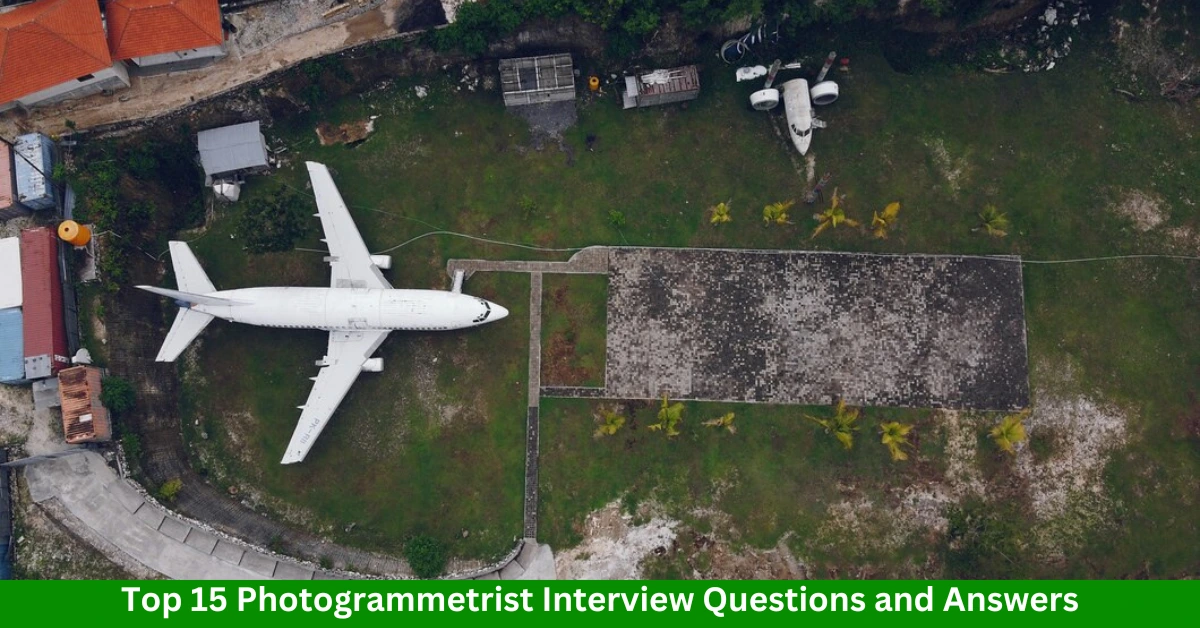
If you’re preparing for a photogrammetrist job interview, knowing the right questions and how to answer them can make all the difference. Photogrammetry is a specialized field that requires a combination of technical knowledge, problem-solving skills, and attention to detail. To help you stand out, we have compiled the top 15 photogrammetrist interview questions and answers. Photogrammetrist Interview Questions and Answers 1. What is Photogrammetry? Answer: Photogrammetry is the science and technology of obtaining reliable information about physical objects and the environment through the process of recording, measuring, and interpreting photographic images. It is commonly used in mapping, surveying, and 3D modeling. 2. Can you explain the difference between Aerial Photogrammetry and Terrestrial Photogrammetry? Answer: Aerial Photogrammetry involves taking photographs from an aircraft or drone to create maps or 3D models of large areas. Terrestrial Photogrammetry uses ground-based photographs to analyze and measure smaller areas or specific objects. 3. What are some common applications of Photogrammetry? Answer: Photogrammetry is used in various fields, including: Mapping and cartography Construction and civil engineering Archaeology Environmental monitoring Forestry and agriculture Video game and movie production (for 3D modeling) Read Also: 15 Best Transportation Analyst Interview Questions and Answers 4. What software tools are commonly used in Photogrammetry? Answer: Popular photogrammetry software tools include: Agisoft Metashape Pix4D DroneDeploy Trimble Inpho Bentley ContextCapture 5. How do you ensure accuracy in Photogrammetric projects? Answer: Accuracy can be ensured through: Proper calibration of cameras and equipment Using high-resolution images Applying ground control points (GCPs) Performing rigorous quality checks and validation 6. What is a Ground Control Point (GCP), and why is it important? Answer: A Ground Control Point is a physical point on the ground with known geographic coordinates. GCPs are crucial for aligning photogrammetric data with real-world locations, improving the accuracy of the final models or maps. Read Also: 15 Best Utility Mapping Specialist Interview Questions and Answers 7. How would you handle image distortions in Photogrammetry? Answer: Image distortions can be corrected by: Calibrating the camera to account for lens distortion Using photogrammetry software’s built-in correction tools Ensuring proper alignment of images during processing 8. Explain the concept of Bundle Adjustment in Photogrammetry. Answer: Bundle Adjustment is an optimization process used to refine 3D coordinates by minimizing errors between observed and projected image points. It adjusts the camera parameters and 3D points simultaneously to improve accuracy. Read Also: 10 Best Universities in Canada for 2025 9. What are Orthophotos, and how are they created? Answer: Orthophotos are geometrically corrected aerial photographs where distortions due to terrain and camera tilt are removed. They are created by processing raw images with photogrammetry software, often using digital elevation models (DEMs) for correction. 10. Can you describe the workflow for a Photogrammetry project? Answer: The typical workflow involves: Image acquisition (e.g., aerial or terrestrial photographs) Data preprocessing (e.g., geotagging, calibration) Image alignment 3D point cloud generation Model creation (e.g., DEMs, orthophotos, or 3D meshes) Validation and accuracy assessment Read Also: Top 15 Drone Operator and Analyst Interview Questions and Answers 11. What challenges have you faced in a Photogrammetry project, and how did you overcome them? Answer: Challenges may include poor image quality, lack of GCPs, or processing large datasets. Solutions involve: Reshooting images with better lighting conditions Using artificial GCPs Employing high-performance computing resources for processing 12. What is Stereoscopy, and why is it significant in Photogrammetry? Answer: Stereoscopy involves using two overlapping photographs to create a 3D perception of depth. It’s significant in photogrammetry for measuring distances and creating accurate 3D models. 13. How does LiDAR compare with Photogrammetry? Answer: LiDAR uses laser pulses to measure distances, while photogrammetry relies on images. Photogrammetry is generally more cost-effective and produces photo-realistic models, whereas LiDAR excels in capturing detailed elevation data in challenging environments. Read Also: Top 15 Hydrologist Interview Questions and Answers 14. What are the key qualities of a successful Photogrammetrist? Answer: A successful photogrammetrist should possess: Strong analytical and problem-solving skills Attention to detail Proficiency with photogrammetry software Knowledge of surveying and GIS principles 15. How do you stay updated with advancements in Photogrammetry? Answer: I stay updated by: Attending industry conferences and workshops Reading journals like the Photogrammetric Engineering & Remote Sensing Participating in online forums and webinars Exploring new tools and technologies in the field Conclusion Preparation is the key to acing your photogrammetry interview. By understanding these common questions and crafting thoughtful answers, you can confidently demonstrate your knowledge and skills. Good luck with your interview! FAQs Q1. Is photogrammetry a good career choice? Answer: Yes, photogrammetry offers diverse career opportunities in industries like mapping, construction, and entertainment, with competitive salaries. Q2. What qualifications are needed to become a photogrammetrist? Answer: A degree in geography, geomatics, surveying, or a related field is typically required, along with proficiency in photogrammetry software. Q3. How long does it take to learn photogrammetry? Answer: Basic skills can be acquired in a few months, but mastering advanced techniques may take years of practice and experience.

15 Best Transportation Analyst Interview Questions and Answers

Transportation Analyst

Transportation analyst play a crucial role in optimizing logistics and supply chain processes, ensuring efficient and cost-effective transportation systems. Preparing for an interview in this field requires a deep understanding of industry trends, tools, and problem-solving abilities. Here are 15 key interview questions and model answers to help you stand out. Best Transportation Analyst Interview Questions and Answers 1. What does a transportation analyst do? Answer: A transportation analyst evaluates and optimizes transportation systems by analyzing data, identifying inefficiencies, and recommending improvements to reduce costs, enhance delivery speed, and ensure regulatory compliance. 2. What software tools are you proficient in for transportation analysis? Answer: I have experience with: Transportation Management Systems (TMS) like SAP and Oracle. Data analysis tools like Excel, Tableau, and Power BI. Mapping software such as ArcGIS. Routing optimization tools like Route4Me and OptimoRoute. 3. How do you handle data discrepancies in your analysis? Answer: I address data discrepancies by: Verifying data sources. Cross-checking with historical data. Collaborating with teams to resolve inconsistencies. Documenting issues and ensuring accurate updates. Read Also: Top 15 GIS Specialist Interview Questions and Answers 4. What metrics do you focus on in transportation analysis? Answer: Key metrics include: Cost per shipment On-time delivery rate Fuel efficiency Freight cost as a percentage of sales Utilization of transportation assets 5. How do you optimize routes for cost savings and efficiency? Answer: I use: Advanced routing algorithms. Real-time traffic data. Historical delivery performance. Tools like GPS and GIS for accurate route planning. Collaboration with logistics teams for continuous improvement. Read Also: 10 Best Universities in the USA for 2025 6. Can you explain your approach to freight cost analysis? Answer: I: Analyze historical freight data to identify trends. Compare carrier rates and performance. Negotiate with vendors for better rates. Use predictive analytics to forecast costs. 7. What challenges have you faced in transportation analysis, and how did you overcome them? Answer: One challenge was inaccurate shipment data leading to inefficiencies. I resolved this by implementing a robust data validation process and integrating real-time tracking systems. Read Also: Top 15 Drone Operator and Analyst Interview Questions and Answers 8. How do you ensure compliance with transportation regulations? Answer: I stay updated with regulations by: Attending training and seminars. Collaborating with compliance teams. Regularly reviewing policies and ensuring alignment with operational practices. 9. What is your experience with supply chain optimization? Answer: I have optimized supply chains by: Reducing lead times through better supplier collaboration. Implementing just-in-time inventory systems. Enhancing warehouse-to-distribution workflows. Read Also: Top 15 Hydrologist Interview Questions and Answers 10. How do you manage relationships with carriers and vendors? Answer: I build strong relationships by: Regular communication and performance reviews. Negotiating fair contracts. Addressing concerns proactively to maintain partnerships. 11. What is the role of data visualization in transportation analysis? Answer: Data visualization helps: Identify trends and inefficiencies. Communicate findings effectively with stakeholders. Support decision-making through clear and actionable insights. Read Also: Top 15 Urban Planner Interview Questions and Answers 12. How do you forecast transportation demand? Answer: I use: Historical shipment data. Market trends and seasonal variations. Predictive analytics tools. Collaboration with sales and production teams for accurate projections. 13. What are your strategies for reducing transportation costs? Answer: My strategies include: Consolidating shipments to maximize truck utilization. Optimizing routes to minimize fuel consumption. Using multimodal transportation options. Negotiating better rates with carriers. Read Also: Top 22 Remote Sensing Analyst Interview Questions and Answers 14. How do you handle unexpected delays in the transportation process? Answer: I address delays by: Monitoring real-time shipment data. Communicating promptly with stakeholders. Identifying alternative solutions, such as rerouting or expedited shipping. 15. Where do you see the future of transportation analytics heading? Answer: The future includes: Integration of AI and machine learning for predictive analytics. Widespread use of IoT for real-time monitoring. Greater focus on sustainability and green logistics. Enhanced automation for faster and more accurate data analysis. Conclusion Transportation analysts play a pivotal role in streamlining logistics and improving operational efficiency. By mastering these questions and their answers, you can confidently showcase your expertise and problem-solving abilities in the field. Preparation is key to demonstrating your value and securing the role you aspire to.

15 Best Utility Mapping Specialist Interview Questions and Answers

Utility Mapping Specialist Interview Questions

Utility mapping is a critical field in modern infrastructure development, encompassing the identification and mapping of underground utilities like pipelines, cables, and water lines. For aspiring utility mapping specialists, interview preparation is essential to showcase their expertise. This blog outlines 15 of the most important utility mapping specialist interview questions along with model answers to help you succeed. Best Utility Mapping Specialist Interview Questions and Answers 1. What is utility mapping, and why is it important? Answer: Utility mapping involves identifying, locating, and documenting underground utilities like gas pipelines, sewer lines, and electrical cables. It is crucial to prevent accidents during construction, ensure proper maintenance, and support sustainable urban development. 2. What technologies are commonly used in utility mapping? Answer: The most common technologies include: Ground Penetrating Radar (GPR) Electromagnetic Induction GPS and GIS systems CCTV inspection for pipes Total Station and LiDAR for accurate mapping. Read Also: Top 15 LIDAR Technician Interview Questions & Answers 3. How do you ensure the accuracy of your utility maps? Answer: To ensure accuracy, I follow these practices: Use advanced equipment like GPR and LiDAR. Cross-verify data with historical records. Conduct field surveys and ground truthing. Use GIS software for data integration and error correction. 4. What are the challenges in utility mapping? Answer: Some challenges include: Inaccurate or outdated utility records. Interference from environmental factors like soil conditions. Limited access to certain areas. Detecting non-metallic utilities, which may require specialized tools. Read Also: Top 15 Drone Operator and Analyst Interview Questions and Answers 5. Can you explain the role of GIS in utility mapping? Answer: GIS is vital for: Storing, analyzing, and visualizing utility data. Integrating multiple data sources for a comprehensive map. Sharing and updating utility maps in real-time. Supporting decision-making in infrastructure projects. Read Also: Top 15 Hydrologist Interview Questions and Answers 6. How do you handle discrepancies between field data and existing utility records? Answer: I: Cross-check records with physical observations. Conduct additional surveys using advanced tools. Document discrepancies and update records in GIS. Collaborate with stakeholders to resolve conflicts. 7. What is Ground Penetrating Radar (GPR), and how does it work? Answer: GPR (Ground Penetrating Radar) is a non-invasive technology that uses electromagnetic waves to detect underground utilities. It works by sending radar signals into the ground and measuring the reflected signals to identify the location and depth of objects. 8. How do you prioritize safety during utility mapping projects? Answer: Safety is a top priority. I: Follow safety regulations and guidelines. Conduct risk assessments before starting work. Use protective equipment and signage. Train team members on safe operation of tools and handling hazardous materials. Read Also: Top 15 Environmental Consultant Interview Questions and Answers 9. What experience do you have with utility mapping software? Answer: I am proficient in: ArcGIS and QGIS for GIS analysis. AutoCAD for detailed utility drawings. Pipe-finder and GPR data analysis software. Cloud-based tools for data sharing and collaboration. Read Also: Top 15 GIS Specialist Interview Questions and Answers 10. Can you describe a challenging utility mapping project you worked on? Answer: In one project, outdated utility maps led to inconsistencies during field surveys. I resolved this by: Conducting additional GPR scans. Collaborating with local authorities to obtain accurate records. Updating GIS datasets for future use. Read Also: Top 15 Urban Planner Interview Questions and Answers 11. How do you manage large datasets in utility mapping projects? Answer: I manage large datasets by: Using cloud storage and collaborative platforms. Organizing data into structured layers in GIS. Automating repetitive tasks using scripts. Regularly backing up data to prevent loss. Read Also: 16 Geomatics Engineering Jobs in the United States 12. What is your approach to stakeholder communication? Answer: Clear and effective communication is key. I: Provide regular updates and detailed reports. Use visual tools like maps and 3D models for better understanding. Address concerns promptly and involve stakeholders in decision-making. 13. What methods do you use to detect non-metallic utilities? Answer: Non-metallic utilities can be detected using: Ground Penetrating Radar (GPR). Acoustic methods for pipeline detection. Electromagnetic tracking with transmitters. Read Also: Geomatics Engineering: Career, Job, & Salary in 2025 14. What are the environmental considerations in utility mapping? Answer: I ensure minimal environmental impact by: Using non-invasive technologies like GPR. Avoiding damage to ecosystems during surveys. Following environmental regulations and best practices. 15. Where do you see the future of utility mapping heading? Answer: The future of utility mapping lies in: Integration of AI and machine learning for data analysis. Increased use of drones for aerial surveys. Real-time data sharing through IoT devices. Improved accuracy through advancements in technology. Conclusion By preparing for these questions, you’ll demonstrate your technical knowledge, problem-solving abilities, and awareness of industry trends. Utility mapping specialists play a vital role in modern infrastructure projects, and showcasing your expertise can set you apart from other candidates.

Top 15 Drone Operator and Analyst Interview Questions and Answers

Drone Operator and Analyst

Drones have revolutionized industries, from agriculture and construction to media and surveillance. As a drone operator and analyst, you are expected to have technical expertise in flying drones and analyzing the data they collect. To help you ace your interview, here are the top 15 drone operator and analyst interview questions and answers that showcase your skills and knowledge. 15 Drone Operator and Analyst Interview Questions and Answers 1. What inspired you to become a drone operator and analyst? This question gauges your motivation for pursuing this career. Answer: I’ve always been fascinated by cutting-edge technology and its applications. Drones allow me to combine my interests in technology and data analysis to solve real-world problems across diverse industries. 2. What types of drones are you experienced with? Highlight your hands-on experience with different drone models. Answer: I’ve worked with commercial drones like DJI Phantom and Matrice for aerial photography and mapping, as well as fixed-wing drones like eBee for large-scale surveying projects. 3. What certifications do you hold for operating drones? Demonstrating your qualifications is crucial. Answer: I am FAA Part 107 certified (or equivalent in my country) and have completed specialized training in aerial mapping and thermal imaging. These certifications ensure safe and legal drone operations. Read Also: Top 15 Hydrologist Interview Questions and Answers 4. How do you plan a drone flight mission? This tests your technical and organizational skills. Answer: I begin by assessing the project requirements, studying the flight area using tools like Google Earth, and identifying potential hazards. I ensure all equipment is operational, upload flight plans to the drone, and monitor weather conditions for optimal flight safety. 5. Can you explain georeferencing and its importance in drone operations? Employers want to assess your data analysis skills. Answer: Georeferencing links aerial imagery to real-world coordinates, ensuring accuracy in maps and models. It’s crucial for applications like surveying, where precise spatial data is needed. Read Also: 16 Geomatics Engineering Jobs in the United States 6. How do you ensure the safety of your drone operations? Safety is a critical aspect of drone operations. Answer: I conduct pre-flight checks, follow aviation regulations, and maintain safe distances from people, buildings, and restricted areas. I also use apps like AirMap to check for airspace restrictions. 7. What software do you use for drone data analysis? Showcase your technical proficiency. Answer: I use Pix4D and DroneDeploy for mapping and 3D modeling, as well as GIS software like ArcGIS for spatial analysis. For thermal imaging, I rely on FLIR tools to interpret infrared data. Read Also: Top 15 Aerial Photogrammetrist Interview Questions & Answers 8. Describe a challenging project and how you managed it. Employers want to see your problem-solving abilities. Answer: In a recent project, weather changes interrupted a flight schedule. I adapted by splitting the mission into smaller sessions, ensuring data collection during clear weather. This approach minimized delays and maintained data quality. 9. How do you troubleshoot technical issues with drones? This question evaluates your technical problem-solving skills. Answer: I first identify the issue, whether it’s a hardware malfunction or software error. For hardware issues, I inspect components like propellers and sensors. For software, I check firmware updates and recalibrate the system. Read Also: Geomatics Engineering: Career, Job, & Salary in 2025 10. How do you interpret and present data collected by drones? Communication is key for effective reporting. Answer: I process raw data into actionable insights using analytics tools. For example, I create maps, 3D models, and heatmaps, presenting them in reports or visual presentations tailored to the client’s needs. 11. How do you ensure data security during drone operations? Data security is a growing concern in drone applications. Answer: I use encrypted storage for drone data, secure communication protocols during data transfer, and ensure compliance with regulations like GDPR when handling sensitive information. Read Also: GIS Analysis Services: Unlocking the Power of Spatial Data 12. What industries have you worked in as a drone operator? Highlight your versatility across sectors. Answer: I’ve worked in industries like construction for site monitoring, agriculture for crop health analysis, and energy for inspecting wind turbines and solar panels. Each project sharpened my skills in data collection and analysis. 13. How do you keep up with advancements in drone technology? Show your commitment to staying updated. Answer: I follow industry blogs, attend drone expos like InterDrone, and participate in online forums. Staying connected with professional organizations like AUVSI helps me learn about emerging trends and technologies. Read Also: Top 15 Imagery Analyst Interview Questions & Answers 14. How do you handle emergencies, such as losing connection with a drone mid-flight? Employers want to see your ability to act under pressure. Answer: I always program a safe return-to-home function. If a connection is lost, I follow protocol to regain control, monitor the drone’s last known position, and prioritize safe landing to avoid harm. 15. Where do you see the future of drone technology heading? This question tests your industry insights. Answer: The future lies in autonomous drones powered by AI, enabling real-time data collection and analysis. We’ll also see increased use in industries like logistics, disaster response, and urban planning. Conclusion Preparing for these top 15 drone operator and analyst interview questions and answers will help you showcase your technical expertise, analytical skills, and ability to handle real-world challenges. Focus on tailoring your responses with specific examples to leave a lasting impression. FAQs Q1: What qualifications do you need to become a drone operator? You typically need certifications like FAA Part 107 (or local equivalents), along with training in drone technology and data analysis. Q2: What industries hire drone operators? Industries include agriculture, construction, energy, media, public safety, and environmental monitoring. Q3: What is the average salary of a drone operator? Drone operators earn an average annual salary between $50,000 and $80,000, depending on experience and industry.

Top 15 Hydrologist Interview Questions and Answers

Hydrologist

A hydrologist plays a vital role in studying water resources, ensuring sustainable water management, and addressing environmental challenges. If you’re preparing for a hydrologist interview, showcasing your technical expertise, problem-solving skills, and understanding of water systems is crucial. This guide presents the top 15 hydrologist interview questions and answers to help you prepare confidently. 15 Hydrologist Interview Questions and Answers 1. What inspired you to pursue a career as a hydrologist? This question gauges your passion and motivation for the field. Answer: I have always been fascinated by the dynamics of water systems and their impact on ecosystems and human life. My desire to contribute to sustainable water management and address water-related challenges motivated me to pursue this career. 2. Can you explain the hydrologic cycle and its importance? This fundamental question tests your foundational knowledge. Answer: The hydrologic cycle describes the continuous movement of water through evaporation, condensation, precipitation, infiltration, and runoff. It’s essential for maintaining life, regulating climate, and replenishing water resources. Read Also: Top 15 Environmental Consultant Interview Questions and Answers 3. What tools or software do you use for hydrological analysis? Highlight your technical proficiency. Answer: I use tools like HEC-RAS for river analysis, SWAT for watershed modeling, and ArcGIS for spatial data analysis. These tools help assess water flow, predict floods, and evaluate water resource sustainability. 4. How do you conduct groundwater modeling? This technical question assesses your expertise. Answer: Groundwater modeling involves collecting data on aquifer properties, recharge rates, and water use. I use software like MODFLOW to simulate groundwater flow and predict impacts of water extraction or contamination. Read Also: Top 15 Urban Planner Interview Questions and Answers 5. What methods do you use to assess water quality? Demonstrate your knowledge of water quality testing. Answer: I collect samples and analyze parameters like pH, dissolved oxygen, turbidity, and pollutant levels using tools like spectrophotometers. These methods ensure compliance with water quality standards. 6. Can you describe a challenging hydrology project you worked on? Employers are looking for problem-solving skills. Answer: In a flood management project, unexpected weather changes caused data discrepancies. I updated models with real-time data, collaborated with meteorologists, and revised flood mitigation plans, successfully minimizing risks. Read Also: Top 15 GIS Specialist Interview Questions and Answers 7. How do you predict and manage flood risks? This question evaluates your ability to handle critical water-related challenges. Answer: I use hydrological models, historical data, and real-time monitoring to predict floods. By integrating GIS for spatial analysis and working with local authorities, I design effective flood mitigation strategies. 8. How do you stay updated on the latest trends in hydrology? Show your commitment to professional growth. Answer: I attend hydrology conferences, read journals like Water Resources Research, and participate in workshops. Staying connected with professional organizations like the American Geophysical Union also helps me remain informed. Read Also: Top 17 Geodetic Engineer Interview Questions and Answers 9. What’s your experience with watershed management? Share examples of your work in watershed planning. Answer: I worked on a watershed restoration project where I assessed erosion, land use, and water flow patterns. By implementing soil conservation techniques and reforestation, we improved water retention and reduced sedimentation. 10. How do you communicate technical findings to non-technical stakeholders? Communication is critical for effective collaboration. Answer: I simplify complex data using visuals like charts and maps. By focusing on key insights and practical implications, I ensure stakeholders understand the findings and their relevance. Read Also: Top 22 Remote Sensing Analyst Interview Questions and Answers 11. What is the importance of sustainable water resource management? Employers seek your understanding of sustainability. Answer: Sustainable water management ensures that current water needs are met without compromising future availability. It addresses issues like over-extraction, pollution, and climate change impacts on water systems. 12. How do you handle conflicts in water resource allocation? This question tests your negotiation and problem-solving skills. Answer: I rely on data-driven insights and stakeholder engagement to find equitable solutions. By presenting the long-term benefits of fair allocation, I encourage collaborative decision-making. Read Also: Top 15 Land Surveyor Interview Questions and Answers 13. What techniques do you use for erosion control? Showcase your knowledge of environmental management. Answer: I use techniques like planting vegetation, terracing, and constructing check dams. These methods reduce soil erosion, improve water retention, and protect water quality. 14. How do you evaluate the impact of climate change on water resources? Highlight your ability to address contemporary challenges. Answer: I analyze precipitation and temperature trends using climate models and assess their effects on water availability, flood risks, and droughts. This helps in designing adaptive water management strategies. Read Also: 16 Geomatics Engineering Jobs in the United States 15. Where do you see the future of hydrology? Employers are interested in your perspective on industry trends. Answer: The future of hydrology lies in leveraging technology like AI for predictive modeling, using IoT for real-time water monitoring, and focusing on integrated water resource management to address global water challenges. Conclusion Preparing for these top hydrologist interview questions and answers will help you stand out as a knowledgeable and confident candidate. Focus on blending technical expertise with real-world examples to showcase your capabilities. FAQs Q1: What qualifications are required to become a hydrologist? A bachelor’s degree in hydrology, environmental science, or a related field is typically required, with advanced degrees preferred for research roles. Q2: What industries hire hydrologists? Hydrologists are employed in industries such as environmental consulting, government agencies, academia, and private water management firms. Q3: How much does a hydrologist earn? Salaries vary based on location and experience, with average annual earnings ranging between $60,000 and $100,000.

Top 15 Environmental Consultant Interview Questions and Answers

Environmental Consultant Interview

If you’re aspiring to become an environmental consultant, being well-prepared for the interview is essential. Employers seek candidates with strong technical expertise, analytical skills, and a passion for sustainability. To help you stand out, here’s a list of the top 15 environmental consultant interview questions and answers to guide your preparation. 15 Environmental Consultant Interview Questions and Answers 1. Can you explain the role of an environmental consultant? This question tests your understanding of the profession. Answer: An environmental consultant provides expert advice to organizations on environmental issues, ensuring compliance with regulations and minimizing environmental impact. They conduct site assessments, prepare reports, and recommend sustainable solutions to clients. 2. Why do you want to work as an environmental consultant? Employers want to know your motivation. Answer: I am passionate about sustainability and helping organizations create a positive environmental impact. This role allows me to use my technical expertise and problem-solving skills to contribute to a greener future. Read Also: 16 Geomatics Engineering Jobs in the United States 3. What are the key environmental regulations you are familiar with? Highlight your knowledge of laws and guidelines. Answer: I am familiar with regulations such as the Clean Air Act, Clean Water Act, and Resource Conservation and Recovery Act (RCRA). Additionally, I understand global frameworks like ISO 14001 and local environmental compliance standards. 4. How do you conduct an Environmental Impact Assessment (EIA)? This technical question evaluates your procedural knowledge. Answer: I start by identifying project objectives and environmental factors. Then, I collect data, assess potential impacts, and propose mitigation measures. The findings are compiled into a report and submitted to regulatory bodies for review. 5. Can you describe a challenging project you managed and how you overcame obstacles? Showcase your problem-solving and project management skills. Answer: In a recent project, we faced unexpected soil contamination. I coordinated with specialists to conduct advanced testing, revised the remediation plan, and communicated changes to the client. This ensured the project stayed on track and complied with regulations. Read Also: Top 15 Urban Planner Interview Questions and Answers 6. What tools or software are you proficient in for environmental analysis? Demonstrate your technical expertise. Answer: I am proficient in software like ArcGIS for spatial analysis, AutoCAD for designing remediation plans, and environmental modeling tools such as CALPUFF and SWMM. These tools enhance accuracy and efficiency in my assessments. 7. How do you stay updated on the latest environmental trends and regulations? Employers value continuous learning. Answer: I regularly attend industry webinars, subscribe to environmental journals, and participate in professional organizations such as the Environmental Professionals Network. These help me stay informed about new regulations and sustainability trends. Read Also: Top 15 GIS Specialist Interview Questions and Answers 8. How would you handle a client who disregards your environmental recommendations? This question assesses your interpersonal and persuasion skills. Answer: I would communicate the potential legal, financial, and reputational risks of ignoring the recommendations. By presenting data and case studies, I aim to demonstrate the benefits of compliance and sustainable practices. 9. What experience do you have with waste management projects? Share specific examples of your expertise. Answer: I led a waste management project for a manufacturing plant, reducing waste by 30% through improved recycling protocols and sustainable sourcing. This included conducting audits, training staff, and implementing new technologies. 10. How do you prioritize tasks when managing multiple projects? Time management is critical for consultants. Answer: I use project management tools like Trello to organize tasks and set deadlines. I prioritize based on client needs, regulatory deadlines, and project complexity, ensuring consistent progress across all projects. Read Also: Top 17 Geodetic Engineer Interview Questions and Answers 11. What’s your experience with environmental remediation? This question tests your hands-on expertise. Answer: I have worked on soil and groundwater remediation projects, including designing cleanup strategies for oil spills and heavy metal contamination. I collaborated with teams to monitor progress and ensure regulatory compliance. 12. How do you communicate complex environmental data to non-technical stakeholders? Communication is key in consulting roles. Answer: I simplify technical jargon using visuals like graphs, infographics, and maps. By focusing on actionable insights and tailoring my language to the audience, I ensure the message is clear and impactful. Read Also: Top 22 Remote Sensing Analyst Interview Questions and Answers 13. What would you do if you discovered a regulatory violation during a project? This scenario tests your integrity and decision-making skills. Answer: I would immediately document the violation, inform the client, and recommend corrective actions. My priority would be ensuring compliance while minimizing legal and environmental risks. 14. How do you assess the sustainability of a project? Employers want to gauge your strategic approach. Answer: I evaluate the project’s lifecycle, energy usage, resource consumption, and waste generation. Using frameworks like the Triple Bottom Line, I recommend strategies that balance environmental, social, and economic benefits. Read Also: Top 15 Land Surveyor Interview Questions and Answers 15. Where do you see the future of environmental consulting heading? Show your understanding of industry trends. Answer: The future lies in leveraging technology like AI and IoT for real-time environmental monitoring. Additionally, there will be a growing focus on climate change adaptation, renewable energy integration, and circular economy principles. Conclusion Preparing for these top environmental consultant interview questions and answers will help you showcase your expertise, passion, and readiness for the role. By demonstrating both technical knowledge and soft skills, you can confidently make a lasting impression during your interview. FAQs Q1: What qualifications are required to become an environmental consultant? A bachelor’s degree in environmental science, engineering, or a related field is typically required, along with certifications like LEED or ISO 14001. Q2: How much does an environmental consultant earn? Salaries vary, but the average annual income for environmental consultants ranges between $60,000 and $80,000, depending on experience and location. Q3: What industries hire environmental consultants? Environmental consultants are hired by industries such as construction, manufacturing, energy, and government agencies.

Top 15 Urban Planner Interview Questions and Answers

Urban Planner Interview Questions

Urban planning plays a crucial role in shaping sustainable and livable cities, making it a highly sought-after profession. Whether you’re a fresh graduate or an experienced planner, preparing for an interview can be challenging. Employers look for candidates with a strong understanding of zoning laws, stakeholder engagement, and sustainable development practices. To help you stand out, we’ve compiled the top 15 urban planner interview questions and answers to guide your preparation. This blog post will not only equip you with detailed responses but also provide insights into what interviewers are looking for. From tackling complex planning scenarios to showcasing your expertise in transportation and housing policies, these questions will cover all essential aspects of urban planning. Read on to boost your confidence and ace your next interview! 15 Urban Planner Interview Questions and Answers 1. What inspired you to pursue a career in urban planning? Answer: Interviewers want to understand your motivation. You can mention your passion for creating sustainable communities, addressing urban challenges, or a specific event or project that inspired you. Highlight your commitment to enhancing the quality of life in cities and your desire to solve complex urban issues. 2. Can you explain the role of an urban planner in city development? Answer: Urban planners design and implement plans to manage land use and community development. They ensure sustainable growth by balancing economic, environmental, and social factors. Planners work on zoning regulations, housing policies, transportation systems, and public spaces to create well-functioning cities. 3. How do you approach stakeholder engagement in planning projects? Answer: Stakeholder engagement involves collaboration with residents, businesses, and government officials. Explain your process for organizing community meetings, conducting surveys, and incorporating feedback into your plans. Emphasize your communication skills and ability to mediate conflicts. Read Also: Geomatics Engineering: Career, Job, & Salary in 2025 4. What experience do you have with zoning regulations? Answer: Discuss your familiarity with local zoning laws and ordinances. Provide examples of how you’ve applied these regulations in past projects, such as land-use planning or development approval processes. Highlight your ability to ensure compliance while achieving project goals. 5. How do you integrate sustainability into your urban planning projects? Answer: Explain your strategies for incorporating green infrastructure, renewable energy, and low-impact development. Mention your focus on walkability, efficient public transportation, and waste reduction. Provide examples of how these measures have improved community outcomes. Read Also: Top 17 Geodetic Engineer Interview Questions and Answers 6. What tools or software do you use for urban planning? Answer: Discuss your proficiency with GIS software (e.g., ArcGIS, QGIS), AutoCAD, and planning tools like SketchUp. Explain how you use these to analyze spatial data, create zoning maps, and visualize development scenarios. 7. How do you address the housing affordability crisis in your plans? Answer: Mention strategies such as mixed-income housing, inclusionary zoning, and incentivizing affordable housing development. Share your experience in working with policymakers and developers to balance affordability with economic growth. Read Also: Top 22 Remote Sensing Analyst Interview Questions and Answers 8. Describe a challenging project and how you handled it. Answer: Provide a specific example of a complex project, such as reconciling conflicting stakeholder interests or addressing environmental concerns. Outline the steps you took to resolve challenges and ensure project success. 9. How do you stay updated on urban planning trends and policies? Answer: Mention attending conferences, subscribing to industry journals, and participating in professional networks like the American Planning Association (APA). Highlight your proactive approach to learning and adapting to new developments. Read Also: Top 15 Land Surveyor Interview Questions and Answers 10. What is your experience with transportation planning? Answer: Discuss projects where you’ve worked on improving mobility, reducing congestion, or designing transit-oriented developments. Emphasize your understanding of multimodal transportation systems and how they support sustainable urban growth. 11. How do you evaluate the success of a planning project? Answer: Explain how you measure outcomes such as increased community satisfaction, economic growth, and environmental sustainability. Mention tools like surveys, performance metrics, and data analysis to track results. Read Also: 15 Cartographic Designer Interview Questions 12. How do you handle conflicts among stakeholders? Answer: Share examples of mediating disputes between developers, residents, and policymakers. Highlight your ability to listen, find common ground, and propose win-win solutions while keeping the project on track. 13. What’s your experience with urban revitalization projects? Answer: Discuss projects where you’ve worked on redeveloping underutilized areas, improving infrastructure, or attracting investments. Highlight the economic, social, and environmental benefits your plans achieved. 14. How do you address climate change in urban planning? Answer: Explain your strategies for reducing carbon footprints through energy-efficient building designs, resilient infrastructure, and sustainable transportation. Mention your focus on adaptive measures to mitigate climate-related risks. Read Also: 15 Must-Ask Interview Questions for Cartographer 15. What is your vision for the future of urban planning? Answer: Share your perspective on emerging trends like smart cities, green infrastructure, and equitable development. Emphasize your commitment to creating livable, inclusive, and resilient urban environments. Conclusion Preparing for an urban planner interview involves showcasing your technical knowledge, problem-solving abilities, and passion for creating sustainable communities. Tailor your answers to reflect your expertise and alignment with the organization’s goals.

Top 15 GIS Specialist Interview Questions and Answers

GIS Specialist Interview Questions

In the ever-evolving field of Geographic Information Systems (GIS), GIS Specialists play a crucial role in analyzing spatial data, creating maps, and supporting decision-making processes across various industries. If you’re gearing up for an interview for a GIS Specialist position, preparation is key to showcasing your skills and expertise. In this blog, we’ve compiled the top 15 GIS Specialist interview questions and answers to help you prepare effectively. Whether you’re a seasoned professional or a fresh graduate, these questions cover both technical and behavioral aspects to give you the confidence to excel in your interview. 15 GIS Specialist Interview Questions and Answers 1. What inspired you to pursue a career in GIS? Answer: GIS combines technology, geography, and problem-solving. Share your story, like a fascination with mapping, an interest in urban planning, or how you enjoy turning data into actionable insights. 2. Can you explain the difference between raster and vector data in GIS? Answer: Raster data is pixel-based, often used for continuous data like satellite imagery. Vector data uses points, lines, and polygons for discrete features like roads or boundaries. 3. What GIS software and tools are you proficient in? Answer: List tools like ArcGIS, QGIS, AutoCAD, or any other software you’ve worked with. Mention additional skills in programming (e.g., Python) or database management (e.g., SQL). Read Also: QGIS Reviews 2024: Details, Pricing, & Features 4. How do you ensure data accuracy when working on GIS projects? Answer: Explain processes like verifying data sources, using high-quality inputs, conducting field checks, and employing data validation techniques during analysis. 5. Describe a GIS project you worked on and the challenges you faced. Answer: Provide a specific example. Detail the project’s objective, the challenges (e.g., incomplete data, tight deadlines), and how you overcame them to deliver results. Read Also: Top 17 Geodetic Engineer Interview Questions and Answers 6. How do you handle large datasets in GIS? Answer: Discuss using database management systems (e.g., PostgreSQL/PostGIS), optimizing workflows, and leveraging cloud-based GIS platforms to manage and analyze big data efficiently. 7. What is spatial analysis, and how do you use it in GIS projects? Answer: Spatial analysis examines the relationships between geographic features. Mention applications like proximity analysis, overlay analysis, and hotspot detection, along with real-world examples. 8. How do you stay updated with the latest trends in GIS technology? Answer: Highlight your engagement with webinars, online courses, GIS blogs, and professional networks like URISA or Esri events. 9. What are geodatabases, and why are they important in GIS? Answer: Geodatabases store spatial and attribute data, enabling efficient data management, analysis, and sharing. Discuss your experience with file or enterprise geodatabases. Read Also: 16 Geomatics Engineering Jobs in the United States 10. How do you communicate complex GIS concepts to non-technical stakeholders? Answer: Mention techniques like simplifying language, using visuals (maps and dashboards), and focusing on actionable insights relevant to their needs. 11. What programming languages do you use in GIS, and how have you applied them? Answer: Python is widely used for automation and analysis in GIS. Share examples like writing scripts for data processing or using libraries like ArcPy and Geopandas. Read Also: GRASS GIS Reviews 2025 & Product Details – GIS Software 12. Can you explain the concept of georeferencing and why it’s important? Answer: Georeferencing aligns spatial data to a coordinate system, ensuring its accuracy and compatibility. Cite examples like aligning scanned maps with real-world coordinates. 13. How do you handle errors or discrepancies in GIS data? Answer: Discuss strategies like cross-checking with reliable sources, field verification, and using data-cleaning tools to resolve inconsistencies. 14. What experience do you have with GIS in specific industries (e.g., urban planning, environmental management)? Answer: Tailor your answer to the job. Mention projects like analyzing land use for urban planning or mapping biodiversity for conservation efforts. Read Also: Top 15 Imagery Analyst Interview Questions & Answers 15. Why should we hire you as a GIS Specialist? Answer: Summarize your skills, experience, and passion for GIS. Highlight specific achievements that align with the company’s goals and showcase your value as a problem-solver. Final Thoughts A GIS Specialist interview is your opportunity to demonstrate your technical expertise and problem-solving skills. By preparing for these Top 15 GIS Specialist Interview Questions and Answers, you’ll be ready to confidently showcase your knowledge, making a strong impression on your potential employer.