Are you a GIS professional looking to start your own business in 2025? With geospatial technology advancing rapidly and its applications expanding across industries, now is the perfect time to turn your GIS skills into a profitable venture. Whether you’re a recent graduate or an experienced surveyor or analyst, there are countless opportunities to monetize your expertise.
In this blog post, we’ll explore the 12 best business ideas for GIS users in 2025—ranging from location intelligence startups to drone-based services. Let’s dive in!
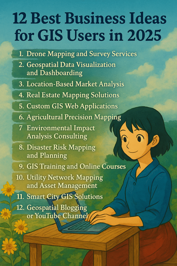
12 Best Business Ideas for GIS Users
1. Drone Mapping and Survey Services
As technology advances and the demand for accurate, high-resolution geospatial data increases, drone mapping and survey services have emerged as one of the most promising GIS-related business opportunities in 2025.
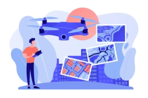
This field leverages unmanned aerial vehicles (UAVs) to collect aerial imagery and spatial data, which can be processed into valuable insights for various industries.
🌍 Why It’s a Great Business Idea
Industries such as agriculture, construction, mining, real estate, and environmental monitoring require up-to-date and precise geospatial information. Traditional surveying methods can be time-consuming, labor-intensive, and expensive. In contrast, drones offer a faster, safer, and more cost-effective solution with impressive accuracy—especially when equipped with RTK (Real-Time Kinematic) GPS systems.
✨ Services You Can Offer
-
Land Surveys
Provide boundary mapping and land assessment for landowners, developers, and government agencies. -
Topographic Mapping
Create detailed topographical maps showing elevation, terrain features, and surface models. Essential for construction, civil engineering, and urban planning. -
3D Modeling and Photogrammetry
Use drone imagery to create 3D point clouds and textured models of buildings, landscapes, and infrastructure. -
Infrastructure Inspections
Offer regular aerial inspections for solar panels, wind turbines, pipelines, power lines, roads, and bridges. Drones minimize human risk and reduce inspection costs. -
Precision Agriculture
Use drones with multispectral sensors to help farmers monitor crop health, irrigation levels, and pest infestations. -
Disaster Assessment and Monitoring
Provide rapid post-disaster surveys to aid in emergency response and insurance claims.
✅ What You Need to Get Started
-
Certification & Licensing:
Most countries require drone pilots to be certified (e.g., FAA Part 107 in the U.S.). Always check your local aviation authority’s requirements. -
High-Quality Drone with RTK GPS:
Invest in a professional drone like the DJI Phantom 4 RTK, Mavic 3 Enterprise, or DJI Matrice series, which provide precise georeferencing. -
GIS & Processing Software:
Use tools like Pix4D, DroneDeploy, Agisoft Metashape, or QGIS to process drone data into usable maps and 3D models. -
Insurance and Compliance:
Protect your business with drone liability insurance and comply with privacy laws regarding aerial data collection.
2. Geospatial Data Visualization and Dashboarding
In an era dominated by data-driven decisions, geospatial visualization has become a powerful tool to communicate complex spatial information quickly and clearly. In 2025, as organizations increasingly rely on location intelligence, there’s a booming demand for interactive dashboards and map-based analytics.
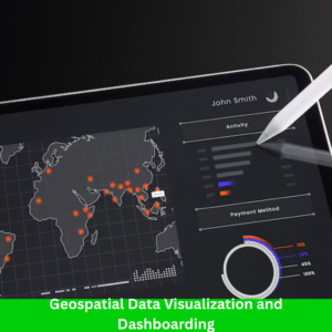
By starting a business in geospatial data visualization and dashboarding, you help clients make better decisions using real-time, location-based insights.
🌍 Why It’s a Great Business Idea
Modern organizations—whether public or private—are overwhelmed with data. But raw data doesn’t drive action—insights do. That’s where GIS professionals come in. By turning spatial data into interactive maps, charts, and dashboards, you create meaningful visuals that support smarter, faster decision-making.
Visual dashboards have become especially popular in sectors like urban development, supply chain management, climate monitoring, health surveillance, and emergency response.
✨ Services You Can Offer
-
Customized GIS Dashboards
Create interactive dashboards for web and mobile using ArcGIS Dashboards, Mapbox, or Leaflet. Help clients monitor key metrics in real time, like traffic congestion, population density, or emergency response. -
Data Storytelling & Reports
Turn complex spatial datasets into easy-to-understand story maps or Tableau visualizations for presentations, investors, or stakeholders. -
Real-time Data Integration
Integrate live feeds like weather, traffic, satellite imagery, IoT sensor data, etc., to enhance monitoring systems. -
Spatial Analysis Reports
Deliver clear, visual reports of your GIS analyses—such as heatmaps, clustering, site suitability, or proximity analysis—with infographics and dynamic content.
🎯 Ideal Client Sectors
-
Urban Planning Departments
Assist cities and municipalities in visualizing zoning, land use, green infrastructure, and smart city plans. -
Disaster Management Agencies
Create real-time dashboards for tracking floods, earthquakes, forest fires, or other emergencies—critical for decision-makers and public communication. -
Logistics and Supply Chain Companies
Help optimize delivery routes, track fleet movements, and visualize service areas using live location data. -
Environmental Organizations
Build dashboards that track deforestation, water quality, wildlife migration, or pollution in real time. -
Healthcare & Epidemiology
Support public health authorities in tracking outbreaks, vaccination coverage, or healthcare access through geospatial dashboards.
🛠️ What You Need to Get Started
-
Software Skills:
Get proficient with tools like:-
ArcGIS Online / ArcGIS Experience Builder
-
Tableau (with geospatial extensions)
-
Power BI (with GIS integrations)
-
Kepler.gl, Leaflet, or Mapbox
-
-
Data Sources:
Leverage public and private geospatial data sources—like OpenStreetMap, government open data portals, or remote sensing platforms. -
Design Skills:
Learn data storytelling, UX/UI design, and how to tailor visuals for non-technical stakeholders.
3. Location-Based Market Analysis
In today’s competitive world, “where” matters just as much as “what.” Whether a retail chain is planning a new store, a real estate developer is evaluating investment hotspots, or a city is zoning for future growth—location-based market analysis is key. As a GIS expert, you can turn spatial data into powerful business intelligence.

By offering location intelligence services, you help clients uncover geographic patterns, consumer behaviors, and strategic opportunities that would otherwise go unnoticed.
🌍 Why It’s a Great Business Idea
Every business needs to know:
-
Where their customers are
-
Where competitors are located
-
Which areas are growing
-
What neighborhoods are underserved
With your GIS skills, you can provide these insights using maps, spatial analysis, and demographic data. As industries become more data-centric in 2025, location-based market analysis will be essential for data-driven planning and growth.
✨ Services You Can Offer
-
Site Selection Analysis
Help businesses choose the best locations for their outlets or offices by analyzing:-
Customer density
-
Accessibility
-
Traffic flow
-
Nearby amenities
-
Zoning regulations
-
Proximity to competitors
-
-
Competitor Mapping
Use spatial data to visualize and analyze where competitors are located and how they influence market coverage. Identify underserved areas and expansion opportunities. -
Demographic Profiling
Combine GIS with census and consumer data to profile neighborhoods based on:-
Income levels
-
Age groups
-
Occupation & lifestyle patterns
-
Spending habits
-
Educational background
-
-
Heatmaps and Catchment Analysis
Create visual representations of customer density, delivery zones, or service reach to optimize logistics, marketing, and sales efforts. -
Retail Gap & Market Potential Analysis
Identify gaps in the market where demand exceeds supply—ideal for retail and franchise growth.
🎯 Ideal Client Sectors
-
Retail Chains & Franchises
Support location planning, expansion strategy, and customer reach optimization. -
Real Estate Developers & Brokers
Provide location analysis to guide investments in residential, commercial, or mixed-use properties. -
Local Governments & Urban Planners
Help cities understand community needs, plan zoning updates, or attract new businesses. -
Hospitality & Food Services
Assist in selecting new locations for restaurants, hotels, or delivery hubs based on foot traffic, demographics, and competition.
🛠️ What You Need to Get Started
-
GIS Tools:
Use software like ArcGIS, QGIS, MapInfo, or Tableau with geospatial plugins. -
Data Access:
Source demographic and business data from:-
Census bureaus
-
Local government portals
-
OpenStreetMap
-
Private data vendors (like ESRI or Nielsen)
-
-
Business Knowledge:
Understand how businesses operate and what drives location-based decisions. Learn the basics of marketing, real estate trends, and consumer behavior.
Related Content:
Top 16 FREE Sources of GIS Vector Data (Updated 2025)
7 Powerful GIS Applications in Climate Science
Top 10 Best QGIS Plugins for Remote Sensing in 2025 (Free & Powerful Tools)
8 GIS Services That Make You Rich in 2025
4. Real Estate Mapping Solutions
The real estate industry is increasingly embracing location intelligence to empower smarter decisions for buyers, sellers, investors, and agents. In 2025, a GIS professional can capitalize on this trend by offering interactive real estate mapping solutions that visualize properties along with key spatial factors.
From zoning overlays to school zones, your custom-built maps can dramatically improve how real estate agencies showcase properties, analyze markets, and provide value to clients.
🌍 Why It’s a Great Business Idea
Real estate is all about location, location, location—and GIS brings that concept to life.
Traditional property listings only show photos and descriptions, but with interactive maps, you can help users:
-
Discover nearby amenities
-
Visualize price trends
-
Compare neighborhoods
-
Understand commute times and more
Whether it’s a first-time homebuyer or a commercial investor, map-based tools give clients the insights they need to make confident decisions—making your service incredibly valuable in 2025’s tech-savvy market.
✨ Services You Can Offer
-
Interactive Property Maps
Build custom web maps that display available properties with filters for:-
Price range
-
Property type (residential, commercial, land)
-
For sale / rent / lease
-
Listing age
-
-
Zoning & Land Use Overlays
Integrate official zoning data to help clients know what type of development is allowed on a parcel—critical for investors and developers. -
Proximity Analysis Tools
Show distance to important amenities like:-
Schools & colleges
-
Hospitals & clinics
-
Parks, shopping centers, gyms
-
Public transport stations
-
-
Heatmaps for Market Trends
Use spatial data to visualize:-
Price per sq ft by neighborhood
-
Sales/rent activity density
-
Investment growth areas
-
-
Custom Layers & Insights
Add helpful context with layers like:-
School zones and ratings
-
Crime rate maps
-
Flood zones or risk areas
-
Public transit lines and access times
-
🎯 Ideal Client Sectors
-
Residential and Commercial Real Estate Agencies
Offer mapping solutions to showcase their property listings in a modern, user-friendly format. -
Real Estate Portals & Marketplaces
Help platforms like Zillow, Housing.com, or local equivalents enhance their map interfaces. -
Property Developers & Builders
Provide planning maps and market analysis tools to guide project decisions. -
Urban Planners & Local Authorities
Assist with visualizing future zoning plans and land use regulations.
🛠️ What You Need to Get Started
-
Technical Skills:
Learn to use:-
ArcGIS Online or Experience Builder
-
Leaflet.js or Mapbox GL JS (for custom web apps)
-
QGIS for spatial analysis
-
Google Maps API for integrations
-
-
Web Development Knowledge:
Know basic HTML, CSS, and JavaScript to create interactive property search tools and dashboards. -
Access to Reliable Data:
-
Property listings (via agencies or open APIs)
-
Zoning maps (from municipal GIS portals)
-
Crime, school, and transport data (from government or third-party providers)
-
5. Custom GIS Web Applications
In the digital-first world of 2025, many organizations need custom, interactive, and scalable GIS solutions that fit their specific workflows. If you have a background in GIS and basic to advanced web development skills, creating custom GIS web applications can be a profitable niche with recurring clients and long-term contracts.
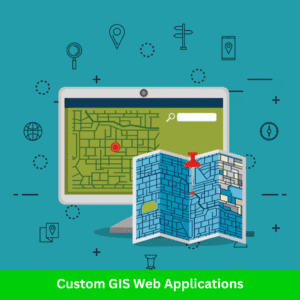
These apps can power everything from real-time asset tracking to environmental monitoring dashboards, and are especially valuable for clients who don’t want to depend on expensive third-party software.
🌐 Why It’s a Great Business Idea
Off-the-shelf GIS software often doesn’t meet all the unique needs of businesses, especially when it comes to:
-
Specialized workflows
-
Real-time data inputs
-
Integration with IoT, sensors, or mobile apps
-
Custom visualizations and reports
By building tailor-made GIS web apps, you provide exactly what clients need—no more, no less. That’s why companies are ready to pay a premium for your service.
🔧 What Kind of GIS Web Apps You Can Build
-
Asset Tracking Systems
Help businesses and local governments track movable and fixed assets in real time:-
Vehicles (fleet management)
-
Equipment and machinery
-
Public infrastructure (lights, roads, hydrants)
-
Parcel tracking
-
-
Utility Management Platforms
Build web apps for managing utilities like:-
Water pipelines
-
Electric grids
-
Telecom towers
-
Sewer networks
Provide features like outage reports, maintenance logs, or GIS-based alert systems.
-
-
Environmental Monitoring Dashboards
Enable organizations to visualize:-
Air/water quality
-
Deforestation patterns
-
Flood-prone zones
-
Climate risk maps
-
Biodiversity zones
Ideal for NGOs, government departments, and environmental consultants.
-
-
Custom Field Data Collection Interfaces
Integrate with mobile apps and GPS to let users capture data on the go (e.g., surveyors, field engineers, inspectors). -
Land Use & Urban Planning Tools
Provide zoning overlays, building permit layers, and planning features for urban development teams or municipalities.
🧠 Who Needs These Apps?
-
Government agencies (municipalities, disaster response units, utilities)
-
Construction and engineering firms
-
Logistics & transport companies
-
Environmental NGOs
-
Real estate developers
-
Agricultural businesses
-
Telecom companies
🛠️ Tools & Platforms to Use
Here are some tools that make custom GIS app development smoother and more powerful:
-
Leaflet.js – Lightweight and highly customizable open-source JS library for maps
-
Mapbox GL JS – Beautiful vector tiles, high performance, and customization
-
Google Maps API – Reliable and widely used with a rich feature set
-
OpenLayers – Good for handling complex GIS tasks
-
ArcGIS API for JavaScript – Ideal if clients already use the ESRI ecosystem
-
GeoServer – To publish and serve spatial data
-
PostGIS – Spatial database support for PostgreSQL
Also consider:
-
React or Vue.js – For building user-friendly, component-based UI
-
Node.js, Python Flask, or Django – For backend APIs and data management
-
Firebase or AWS – For hosting and real-time sync features
6. Agricultural Precision Mapping
In 2025, agriculture is becoming smarter, data-driven, and increasingly dependent on geospatial technology. Precision agriculture, also known as smart farming, uses GIS, remote sensing, drones, and field sensors to help farmers optimize crop yields, reduce costs, and sustain resources.

Starting a Precision Mapping service allows you to support the agriculture industry by providing actionable insights that directly impact productivity and profitability.
🌱 Why It’s a Great Business Opportunity
Agriculture contributes significantly to the economy, especially in developing countries — but farmers often lack access to modern tools. Your GIS-based service can:
-
Improve harvest quality
-
Reduce water and fertilizer usage
-
Help monitor crop health and growth
-
Predict pest or disease outbreaks
-
Support government and NGO agricultural projects
With more farmers adopting tech and governments supporting agritech innovations, this space is ripe for growth.
🛰️ What Services You Can Offer
-
Soil Health Analysis
Use satellite imagery, drone NDVI scans, or field sampling to:-
Analyze soil moisture, pH, and nutrient levels
-
Map fertility zones
-
Recommend where to apply fertilizer (and how much)
-
-
Crop Yield Prediction
Combine historical yield data with current growth patterns to:-
Predict yield before harvest
-
Identify low-performance zones
-
Adjust inputs (seeds, irrigation, pesticides) to maximize output
-
-
Irrigation Planning & Water Management
-
Create irrigation maps based on topography, soil type, and crop water demand
-
Optimize water use through GIS-based layout planning
-
Recommend drip or sprinkler systems tailored to field characteristics
-
-
Pest & Disease Forecasting
-
Use weather data, vegetation indices, and historical records to forecast disease-prone periods
-
Help farmers take preventive action, saving crops and reducing chemical use
-
-
Land Suitability Analysis
-
Identify the best crops to grow in specific locations based on terrain, soil, and weather
-
Help with crop rotation planning and sustainable farming practices
-
-
Farm Mapping & Geo-fencing
-
Digitize land parcels and boundaries
-
Monitor field activities using GPS
-
Set alerts for trespassing, livestock, or drone zones
-
👨🌾 Who Can Be Your Clients?
-
Individual Farmers
-
Large Agro-farms and Cooperatives
-
Agricultural Extension Offices
-
Government Agriculture Departments
-
NGOs focused on food security
-
Agri-input Companies (fertilizer, seeds)
-
Insurance companies (for crop damage assessments)
🛠️ Tools & Technologies You Can Use
-
QGIS / ArcGIS – For land analysis, layer overlays, and map creation
-
Google Earth Engine – For accessing free satellite data (Sentinel, Landsat)
-
Pix4D / DroneDeploy – For drone image processing and NDVI analysis
-
AgLeader / Trimble / John Deere Ops Center – Industry-leading platforms for farm data
-
Soil sensors & weather stations – For field-level real-time data
-
AI models – For predictive analytics and crop yield estimation
💡 Monetization Ideas
-
Offer consulting services per farm or project
-
Sell subscription-based reports (monthly or seasonal)
-
Provide custom farm dashboards with real-time monitoring
-
Conduct training workshops for local farmers or agri-officers
-
Partner with drone operators or agricultural software firms
📈 Future Growth & Trends
-
Government push for modernized farming under smart agriculture schemes
-
Rise of AgriTech startups and venture capital interest
-
Increasing use of IoT and AI in agriculture
-
Climate change awareness pushing data-informed farming
7. Environmental Impact Analysis Consulting
As the world becomes more aware of climate change, sustainability, and the importance of ecological balance, Environmental Impact Assessments (EIA) are now mandatory for most development projects. This creates a growing demand for professionals who can assess and visualize environmental data effectively.

GIS users are uniquely positioned to fill this role, using spatial data and mapping tools to evaluate how infrastructure and industrial projects affect the environment — both short-term and long-term.
🌍 Why It’s a Great Business in 2025
From highways and hydropower plants to mining and real estate, nearly every development project requires an Environmental Impact Assessment (EIA). Governments, private firms, NGOs, and even international funding agencies (like the World Bank or ADB) rely on scientific and visual evidence to decide whether a project is environmentally viable.
By offering GIS-based environmental consulting, you can:
-
Play a critical role in protecting nature
-
Earn by offering specialized technical services
-
Work with multi-sector clients like urban planning, construction, energy, etc.
🧰 Services You Can Offer
-
Land Use / Land Cover (LULC) Analysis
-
Classify and map different land types (forest, agriculture, water bodies, urban areas)
-
Identify land usage trends before and after development
-
Use supervised classification, NDVI, and other indices
-
-
Change Detection
-
Compare satellite imagery over time (e.g., 2000 vs. 2025) to assess human impact
-
Highlight deforestation, wetland loss, or urban sprawl
-
Use tools like Google Earth Engine, QGIS plugins, or ArcGIS Pro
-
-
EIA Reporting Maps
-
Create thematic maps required for official Environmental Impact Assessments:
-
Project boundary map
-
Sensitive ecological zones (wetlands, forests, heritage sites)
-
Environmental sensitivity buffers (distance to rivers, hills, etc.)
-
Drainage and watershed maps
-
-
Provide maps in formats required by environmental ministries
-
-
Air & Water Quality Mapping (if data is available)
-
Map pollutants or emission zones using point data from field sensors
-
Create heatmaps of high-risk environmental zones
-
-
Biodiversity and Wildlife Corridor Mapping
-
Identify animal migration paths or protected areas
-
Help projects avoid disruption to natural habitats
-
-
Hazard Risk Assessment
-
Overlay environmental data with hazard-prone zones (flood, landslide, earthquake)
-
Support disaster risk reduction planning
-
🧑💼 Who Needs This Service?
-
Environmental consulting firms
-
Urban planning and infrastructure developers
-
Government planning and environmental departments
-
Construction and mining companies
-
Renewable energy companies (wind, solar, hydro)
-
NGOs working in sustainability or conservation
-
Academic researchers and think tanks
🛠️ Tools You Can Use
-
QGIS / ArcGIS Pro – For map creation, spatial analysis, and layout design
-
Google Earth Engine – For large-scale satellite image processing and temporal analysis
-
Sentinel Hub / USGS EarthExplorer – For free remote sensing data
-
Global Forest Watch / NASA FIRMS – For deforestation and fire monitoring
-
InVEST by Natural Capital Project – For ecosystem service modeling
💼 Monetization Models
-
Offer project-based consulting (EIA reports for a new highway, dam, or factory)
-
Build long-term contracts with infrastructure firms or environmental agencies
-
Create template packages (ready-to-use mapping layers for consultants)
-
Provide training or workshops on environmental GIS tools
8. Disaster Risk Mapping and Planning
With climate change intensifying the frequency and severity of natural disasters, governments, NGOs, and communities are seeking proactive solutions. This opens the door for GIS professionals to step in as experts in disaster risk mapping and spatial planning — one of the most impactful and in-demand fields today.
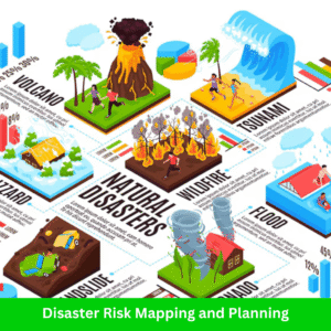
By launching a GIS-based disaster risk business in 2025, you can help save lives, reduce losses, and empower communities to prepare for natural hazards.
⚠️ Why It’s a Powerful Business Idea
From floods and landslides to earthquakes and wildfires, spatial data can help predict where disasters are most likely to occur, who will be affected, and how to respond effectively. Governments and humanitarian organizations need high-quality maps and planning tools to develop early warning systems, evacuation strategies, and post-disaster response plans.
By offering disaster-focused GIS services, you can position yourself as a critical partner in resilience planning and emergency management.
🧰 Services You Can Offer
-
Flood Risk Mapping
-
Use terrain models (DEMs), rainfall data, and historical flood records
-
Simulate flood-prone zones under various scenarios
-
Classify areas by flood vulnerability (low, medium, high risk)
-
-
Earthquake Vulnerability Assessment
-
Overlay fault lines, seismic zones, and building infrastructure
-
Map building density and construction types to assess vulnerability
-
Combine socio-economic data to highlight at-risk populations
-
-
Landslide Susceptibility Mapping
-
Analyze slope, soil type, land use, and rainfall data
-
Use models like the Analytical Hierarchy Process (AHP) or logistic regression
-
Create hazard maps for mountainous or hilly regions
-
-
Evacuation Planning Using GIS
-
Design optimal evacuation routes using road network analysis
-
Identify nearest shelters, hospitals, and relief centers
-
Model travel time analysis and accessibility maps
-
-
Multi-Hazard Risk Mapping
-
Integrate multiple hazard layers (flood, fire, quake) into one platform
-
Prioritize regions needing urgent attention and resource allocation
-
-
Early Warning System Mapping
-
Map communication towers, sirens, sensors, and community alert points
-
Help set up real-time dashboards to monitor and notify residents
-
🧑💼 Who Will Hire You?
-
Disaster management agencies and authorities (local and national)
-
Municipal and urban planning departments
-
NGOs and humanitarian organizations (e.g., Red Cross, UNDP)
-
Environmental ministries and research institutes
-
Schools and hospitals for safety audits
-
Smart city planners
🛠️ Tools and Technologies to Use
-
QGIS / ArcGIS Pro – For hazard and vulnerability mapping
-
Google Earth Engine – For rainfall and satellite data analysis
-
HEC-RAS / HEC-HMS – For hydrological modeling and flood simulation
-
InaSAFE – Open-source plugin for disaster impact modeling
-
OpenStreetMap / OSMnx – For road and infrastructure data
-
Drone mapping – For real-time post-disaster damage assessments
💡 Example Projects
-
Mapping flood zones in coastal cities for climate adaptation
-
Developing earthquake risk dashboards for municipal planning
-
Designing safe school maps in hilly or landslide-prone areas
-
Creating interactive web maps showing real-time disaster alerts
9. GIS Training and Online Courses
As the demand for geospatial skills skyrockets in 2025, GIS training is becoming one of the most scalable and profitable business ideas for GIS professionals. Whether you’re an expert in QGIS, ArcGIS, remote sensing, or spatial data analysis — your knowledge is valuable and people are willing to pay to learn from you.

If you love teaching, enjoy breaking down complex topics, or want to build passive income streams, starting a GIS training business is a smart move.
🎯 Why This Business Works
GIS tools are being used in everything from urban planning and environmental monitoring to business analytics and agriculture. However, there’s a learning gap. Many professionals, students, and even government employees want to learn GIS but lack structured, industry-relevant courses.
By offering accessible, niche-focused, and beginner-friendly training, you can build a loyal following while monetizing your expertise.
📚 Services You Can Offer
-
Online Courses
-
Platforms: Udemy, Teachable, Skillshare, or your own website
-
Popular topics:
-
“GIS for Beginners”
-
“Mastering QGIS in 30 Days”
-
“Remote Sensing with Google Earth Engine”
-
“Python for Geospatial Data Analysis”
-
-
-
Live Corporate Workshops & Training
-
Teach government departments, NGOs, or private firms
-
Tailor content to their specific use case (e.g., utilities, disaster response)
-
Offer certificates of completion
-
-
One-on-One Mentoring / Coaching
-
Help students, job seekers, or professionals with career transitions
-
Provide resume feedback, portfolio reviews, and project guidance
-
Charge hourly or monthly rates
-
-
YouTube Channel / Free Tutorials
-
Build an audience by offering free valuable content
-
Monetize via ads, affiliate links, and course promotion
-
Establish authority in the GIS training space
-
-
Niche Training Courses
Create specialized courses that address real-world problems:-
“GIS for Forestry and Wildlife Conservation”
-
“Geospatial Analysis for Urban Planning”
-
“Drone Data Processing with Pix4D & ArcGIS”
-
“Geospatial AI & Machine Learning for Beginners”
-
🛠️ Tools and Platforms to Use
-
LMS Platforms: Teachable, Thinkific, LearnWorlds
-
Screen Recording: OBS Studio, Camtasia, Loom
-
Video Editing: DaVinci Resolve, Filmora
-
Slide Design: Canva, PowerPoint
-
Course Promotion: LinkedIn, YouTube, Blogging, Email Marketing
-
Community Building: Discord, Facebook Groups, Telegram Channels
💼 Who’s Your Target Audience?
-
University students in geography, urban studies, or environmental science
-
Working professionals wanting to upskill
-
NGOs and government staff working with GIS-based projects
-
Data analysts expanding into location intelligence
-
Freelancers exploring GIS as a new career path
💰 Monetization Tips
-
Offer a free mini-course to attract leads
-
Create a bundled course package for upselling
-
Provide PDF certificates for completion (great for LinkedIn resumes)
-
Run seasonal promotions or live webinars to boost enrollments
-
Add consulting services or live Q&A sessions for premium learners
10. Utility Network Mapping and Asset Management
As cities grow and infrastructure ages, the need for efficient utility network mapping and asset management continues to rise. With advancements in GIS technology, utility companies and municipalities can now better track, manage, and maintain their assets in real time.
This creates an immense business opportunity for GIS professionals with expertise in mapping and asset management.

If you’re proficient in GIS, field data collection, and asset management systems, this is a highly profitable niche that you can tap into.
🎯 Why This Business Works
The utility sector relies heavily on precise asset management for everything from water pipelines to electrical grids and telecom networks. However, many utilities still struggle with outdated maps and systems that can lead to inefficiencies, costly repairs, and even public safety risks.
By providing detailed, accurate mapping services and helping municipalities and utility providers transition to modern GIS solutions, you can tap into a growing market with high demand for these services.
📚 Services You Can Offer
Utility Network Mapping
-
Offer 2D and 3D mapping of utility networks using GIS, GPS, and remote sensing data
-
Focus on water, power, gas, and telecom infrastructure
-
Ensure accurate data collection and analysis for better maintenance and planning
Asset Management Systems
-
Develop and implement GIS-based asset management platforms
-
Help utility providers track assets like pipelines, transformers, and switches
-
Integrate IoT data for real-time monitoring and reporting
Field Survey Services
-
Provide GPS-enabled field surveys to collect real-time data on utility networks
-
Offer cloud-based platforms for quick, collaborative fieldwork
-
Ensure accurate asset location, condition, and ownership details
Utility Network Analysis
-
Analyze existing utility systems for efficiency and potential upgrades
-
Provide data on network capacity, flow, and coverage
-
Offer GIS-based predictive analysis for better decision-making
Training & Support
-
Train utility companies’ staff on using GIS tools for asset management
-
Offer consulting services to improve current mapping and asset management systems
-
Provide ongoing technical support for maintenance and troubleshooting
🛠️ Tools and Platforms to Use
-
GIS Platforms: ArcGIS, QGIS, AutoCAD Map 3D
-
Field Survey Tools: Trimble, Leica, Esri Collector for ArcGIS
-
Asset Management Software: Cityworks, ArcGIS Utility Network Management, Maximo
-
Data Analysis: Python, R, ArcGIS ModelBuilder
-
Cloud Integration: ArcGIS Online, Google Cloud, AWS
-
Mapping Tools: Google Earth Engine, ArcGIS Pro, AutoCAD Civil 3D
💼 Who’s Your Target Audience?
-
Municipalities and local governments managing public utilities
-
Water, energy, and telecom providers looking to improve asset tracking
-
Construction and infrastructure firms needing detailed utility maps
-
Engineering consultants working on large-scale urban projects
-
Facility managers overseeing commercial or industrial utility networks
💰 Monetization Tips
-
Offer subscription-based services for ongoing asset management updates
-
Develop customizable mapping packages based on client needs (e.g., single network vs. full city coverage)
-
Charge for advanced analytics or predictive maintenance services
-
Provide consulting services for implementing GIS-based systems and tools
-
Bundle mapping services with field survey data for a comprehensive solution
11. Smart City GIS Solutions
As urban areas continue to grow and evolve, the concept of “smart cities” is rapidly gaining traction worldwide. A smart city integrates technology and data to improve the quality of life for its residents, enhance sustainability, and streamline city management.
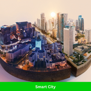
Geographic Information Systems (GIS) play a pivotal role in these transformations by providing real-time data, advanced spatial analysis, and insights to help cities function more efficiently. This opens a wealth of opportunities for GIS professionals to offer tailored solutions that support smart city initiatives.
With the demand for smart city solutions expected to soar in the coming years, establishing a GIS-based consultancy focused on smart cities is a lucrative and forward-thinking business opportunity. Whether it’s traffic management, urban planning, or environmental monitoring, the integration of GIS tools into smart city projects is essential for creating more livable, efficient, and sustainable urban environments.
🎯 Why This Business Works
The rapid urbanization of the world’s population and the increasing adoption of IoT (Internet of Things) technologies in cities has led to the need for more sophisticated urban management systems. GIS provides the essential spatial data and analysis that can be used to optimize resources, reduce waste, and improve urban infrastructure.
For example, GIS can help cities manage traffic flow, monitor environmental conditions, or optimize waste collection routes. With the rise of smart city technologies, local governments, tech firms, and urban planners are increasingly seeking GIS professionals who can deliver data-driven solutions to address the challenges posed by rapidly growing cities.
📚 Services You Can Offer
Traffic Flow Analysis
-
Use GIS tools to monitor and analyze traffic patterns in real time
-
Implement smart traffic management systems to reduce congestion
-
Provide route optimization solutions for public transportation
-
Offer predictive modeling to foresee traffic bottlenecks and suggest improvements
-
Develop systems that use data from sensors, cameras, and GPS devices to improve traffic flow
Urban Heat Island Mapping
-
Analyze and map the impact of urban heat islands (UHI) using remote sensing and GIS
-
Use temperature data, satellite imagery, and ground-level measurements to assess UHI effects
-
Provide recommendations for reducing UHI impacts, such as increasing green spaces or using cool roofing materials
-
Work with municipalities to plan urban greening initiatives and better manage heat exposure
Waste Collection Route Optimization
-
Use GIS to create more efficient waste collection routes and schedules
-
Optimize collection routes by integrating traffic data and real-time updates from GPS-enabled waste collection vehicles
-
Reduce fuel consumption, labor costs, and carbon emissions by identifying the most efficient paths
-
Work with local governments to implement smart waste systems with real-time tracking and monitoring
Environmental Monitoring and Management
-
Monitor air quality, water quality, noise pollution, and other environmental factors using GIS
-
Develop GIS-based systems that integrate IoT sensors for real-time environmental monitoring
-
Analyze spatial data to identify pollution hotspots and suggest mitigation measures
-
Provide actionable insights to help cities improve sustainability and meet environmental targets
Urban Planning and Development
-
Offer GIS-based solutions for planning new neighborhoods, infrastructure projects, or green spaces
-
Use spatial data to evaluate land use, zoning regulations, and development suitability
-
Create 3D city models to visualize urban development and its potential impacts
-
Collaborate with urban planners and architects to design sustainable, smart urban spaces
Smart Utilities and Infrastructure Management
-
Help cities optimize the management of utilities like water, electricity, and telecommunications using GIS
-
Implement GIS-based asset management solutions for tracking utility networks, pipelines, and infrastructure
-
Use real-time data from sensors and IoT devices to monitor system performance and prevent outages
🛠️ Tools and Platforms to Use
-
GIS Software: ArcGIS, QGIS, AutoCAD Map 3D, ArcGIS Urban
-
Smart City Platforms: Esri’s Smart City Solutions, Cityzenith, UrbanFootprint
-
Remote Sensing: Google Earth Engine, Landsat, Sentinel Data
-
IoT Integration: AWS IoT, Microsoft Azure IoT, Esri GeoEvent Server
-
Data Visualization: Tableau, Power BI, Esri StoryMaps
-
Cloud Platforms: AWS, Microsoft Azure, Google Cloud
-
Mobile Apps: Esri Collector for ArcGIS, Field Maps, Survey123 for data collection in the field
💼 Who’s Your Target Audience?
-
Local Governments and Municipalities looking to develop smart city initiatives
-
Tech Firms creating smart city solutions and infrastructure
-
Urban Planners and architects working on sustainable city development projects
-
Construction Companies implementing smart infrastructure in new developments
-
Transportation Agencies seeking to optimize traffic flow and public transportation
-
Environmental Consultants working to reduce urban environmental footprints
-
Waste Management Firms focusing on optimizing collection and disposal operations
💰 Monetization Tips
-
Offer Subscription-Based Services for ongoing GIS data analysis and traffic management updates
-
Sell Custom GIS Solutions for specific smart city needs (e.g., waste management or environmental monitoring)
-
Provide Consultancy Services for the planning and implementation of GIS-driven smart city projects
-
Develop Workshops and Training Programs for government employees and tech companies
-
License Your Software or GIS models to smart city tech firms or local governments
-
Create Data Products such as GIS layers, reports, and dashboards that can be sold on demand
12. Geospatial Blogging or YouTube Channel
In today’s digital age, one of the most rewarding and scalable ways to share your GIS expertise is by creating a blog or YouTube channel. Whether you’re passionate about teaching others, staying updated with GIS trends, or reviewing the latest tools, there is a large audience of professionals, students, and enthusiasts who are eager for quality GIS content.
By leveraging your knowledge, you can create valuable, evergreen content that provides passive income over time.
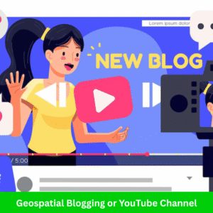
Starting a blog or YouTube channel focused on GIS allows you to reach a wide audience while also building a personal brand. As more people turn to online platforms for learning and industry updates, this is an ideal way to establish yourself as an authority in the GIS space while generating income from your content.
🎯 Why This Business Works
The GIS industry is growing, and so is the demand for educational content. Professionals and students alike are constantly looking for resources to help them better understand GIS concepts, tools, and techniques. Blogging or creating video content offers you a chance to tap into this demand while giving back to the community.
Additionally, creating online content has the potential for passive income, meaning you can earn money continuously as your content reaches new viewers or readers, even long after it’s published. If you’re passionate about teaching or sharing insights, this is a great opportunity to do so while earning.
📚 Content Ideas for Your Blog or YouTube Channel
Tutorials
-
Step-by-step guides on GIS software (e.g., how to use QGIS, ArcGIS, or Google Earth Engine)
-
Explaining GIS techniques and workflows (e.g., spatial analysis, georeferencing, raster processing)
-
GIS programming tutorials for beginners (e.g., Python for GIS, scripting in ArcPy)
-
Showcasing real-life GIS applications (e.g., urban planning, disaster management, environmental monitoring)
Tool Reviews
-
Reviewing GIS software and tools (e.g., QGIS, ArcGIS, ERDAS Imagine, AutoCAD Map 3D)
-
Comparing different GIS tools for specific use cases (e.g., which GIS tool is best for remote sensing analysis?)
-
Reviewing hardware used in GIS, such as GPS units, drones, and mobile devices for fieldwork
-
Covering new software updates and new GIS tools entering the market
Industry News and Trends
-
Reporting on new developments in the GIS industry, such as the introduction of AI-powered GIS tools, trends in spatial data collection, or emerging technology (e.g., LiDAR, drones)
-
Discussing recent case studies and the application of GIS in various sectors (e.g., smart cities, climate change, agriculture)
-
Covering GIS conferences, webinars, and events
-
Analyzing the impact of GIS on other industries (e.g., the role of GIS in healthcare, transportation, or business intelligence)
GIS Career Guidance
-
Offering advice on how to build a successful GIS career (e.g., what skills are in demand, which certifications are useful, and how to land your first GIS job)
-
Interviewing industry professionals and GIS experts to provide career insights
-
Creating job guides (e.g., “Top 10 GIS Careers to Pursue in 2025”)
-
Discussing networking opportunities and online communities for GIS professionals
Selling GIS Products
-
Selling GIS templates, shapefiles, or map designs (e.g., ready-to-use base maps for specific regions, analysis templates, cartographic layouts)
-
Offering premium content, such as detailed courses or eBooks on GIS topics
-
Selling GIS data (e.g., offering processed satellite data, environmental datasets, or urban planning datasets for a fee)
🛠️ Tools and Platforms to Use
-
Blog Platforms: WordPress (ideal for customization), Medium (easy to get started), Substack (great for newsletters)
-
YouTube Platforms: YouTube (for video tutorials, reviews, and vlogs), Vimeo (if you need more control over video monetization)
-
Screen Recording & Editing: OBS Studio, Camtasia, ScreenFlow, DaVinci Resolve
-
Video Editing: Adobe Premiere Pro, Final Cut Pro, Filmora
-
Content Planning: Google Calendar, Trello, Notion (to plan and organize content ideas)
-
SEO and Analytics: Google Analytics (to track blog or channel performance), Yoast SEO (for WordPress), TubeBuddy (for YouTube SEO)
-
Monetization: Google AdSense (for blogs and YouTube), Patreon (for premium content), Amazon Associates (affiliate marketing)
💼 Who’s Your Target Audience?
-
GIS Students looking for tutorials and career advice
-
GIS Professionals seeking to learn new skills, discover new tools, or stay updated on industry trends
-
Tech Enthusiasts interested in GIS technologies, including drone users, environmentalists, and urban planners
-
Companies and Agencies looking for tool recommendations, case studies, and industry insights
-
Government Agencies involved in GIS for urban planning, emergency management, and infrastructure
-
NGOs and Research Institutions seeking GIS-related information on environmental or social projects
💰 Monetization Tips
-
Ad Revenue: Use Google AdSense for blogs or YouTube ads to earn revenue based on views and clicks
-
Affiliate Marketing: Promote GIS software, tools, and courses and earn commissions when people purchase through your affiliate links (e.g., affiliate programs with Esri, QGIS training platforms)
-
Sponsorships: Work with GIS companies to create sponsored content, such as product reviews or tutorials featuring their tools
-
Selling Your Own Products: Create and sell GIS resources like shapefiles, templates, or tutorials, and offer paid membership for exclusive content
-
Crowdfunding: Platforms like Patreon or Buy Me a Coffee allow you to earn direct support from your audience for creating high-quality, educational content
-
Online Courses: Once you’ve built an audience, consider creating in-depth GIS courses that can be sold to your viewers or readers
-
Consulting and Freelancing: Use your platform to offer consulting services to companies or municipalities needing GIS expertise
Final Thoughts
In 2025, the geospatial industry is more dynamic than ever. With a little creativity, GIS professionals can build impactful, tech-savvy businesses that solve real-world problems. Whether you prefer field work, app development, teaching, or consulting—there’s a GIS business idea waiting for you.
Which idea inspired you the most? Let us know in the comments!
🧭 Frequently Asked Questions (FAQs)
1. What is GIS and how can it be used for business?
Answer:
GIS (Geographic Information System) is a technology used to capture, analyze, and visualize spatial data. Businesses use GIS for market analysis, location planning, asset management, environmental studies, and more. With the rise of location intelligence, GIS has become a powerful tool for decision-making across many industries.
2. Which GIS business idea is most profitable in 2025?
Answer:
In 2025, drone mapping and survey services are among the most profitable GIS business ideas due to their applications in construction, agriculture, and real estate. However, location-based market analysis and custom GIS web applications also have high earning potential depending on your skill set and target market.
3. Do I need programming skills to start a GIS business?
Answer:
Not always. While programming can help you build custom GIS tools or apps (e.g., using Python, JavaScript, or Leaflet), many services like training, consulting, or field surveying require minimal to no coding. You can choose your business idea based on your strengths.
4. Is drone mapping legal and do I need a license?
Answer:
Yes, drone mapping is legal in many countries, but it typically requires certification and registration from aviation authorities (e.g., FAA in the U.S., CAAN in Nepal). Make sure to follow local drone laws and invest in a commercial-grade drone for professional work.
5. Can I start a GIS business as a freelancer?
Answer:
Absolutely! Many GIS professionals start as freelancers offering services like data visualization, GIS analysis, or web mapping on platforms like Upwork, Fiverr, or through direct client outreach. It’s a great way to build a client base before expanding into a full business.
6. What industries need GIS services the most?
Answer:
Key industries include:
-
Agriculture
-
Urban planning
-
Environmental consulting
-
Utilities and infrastructure
-
Transportation and logistics
-
Real estate and construction
-
Government and defense
7. How much can I earn from a GIS business?
Answer:
Earnings vary based on your niche, expertise, and location. For example:
-
Drone mapping services can charge $300–$2,000 per project
-
GIS consultants earn $30–$100/hour
-
GIS trainers or course creators can make $1,000+/month through online platforms
With the right strategy, your GIS business can become a full-time income source or more.
8. Which software tools should I learn to start a GIS business?
Answer:
Essential tools include:
-
QGIS (Free and open-source)
-
ArcGIS (Industry standard)
-
Google Earth Engine
-
Mapbox, Leaflet (for web mapping)
-
Pix4D, DroneDeploy (for drone mapping)
-
Python, R, JavaScript (for automation and customization)
Choose tools based on your business idea and target clients.
9. How can I market my GIS business online?
Answer:
You can market your GIS business through:
-
A professional website with service pages and case studies
-
SEO blog content targeting GIS-related keywords
-
Social media (LinkedIn, YouTube, Instagram)
-
Online marketplaces like Upwork, Freelancer
-
Email outreach and networking with local businesses and government bodies
10. Can I start a GIS business with limited investment?
Answer:
Yes! Some GIS businesses like freelance GIS analysis, consulting, or online training require minimal investment. All you need is a good laptop, GIS software (like QGIS), and internet access to start offering services or building digital products.
1 thought on “12 Best Business Ideas for GIS Users in 2025”