Are you looking for the best 3D map generators to create stunning, interactive, and custom 3D maps in 2025? Whether you’re a designer, developer, geographer, educator, or just a map enthusiast, the ability to visualize terrain and landscapes in 3D has never been easier or more powerful.
Here’s a carefully curated list of the top 10 3D map generator tools in 2025 that help you generate, customize, and even 3D print realistic maps—all with just a few clicks.
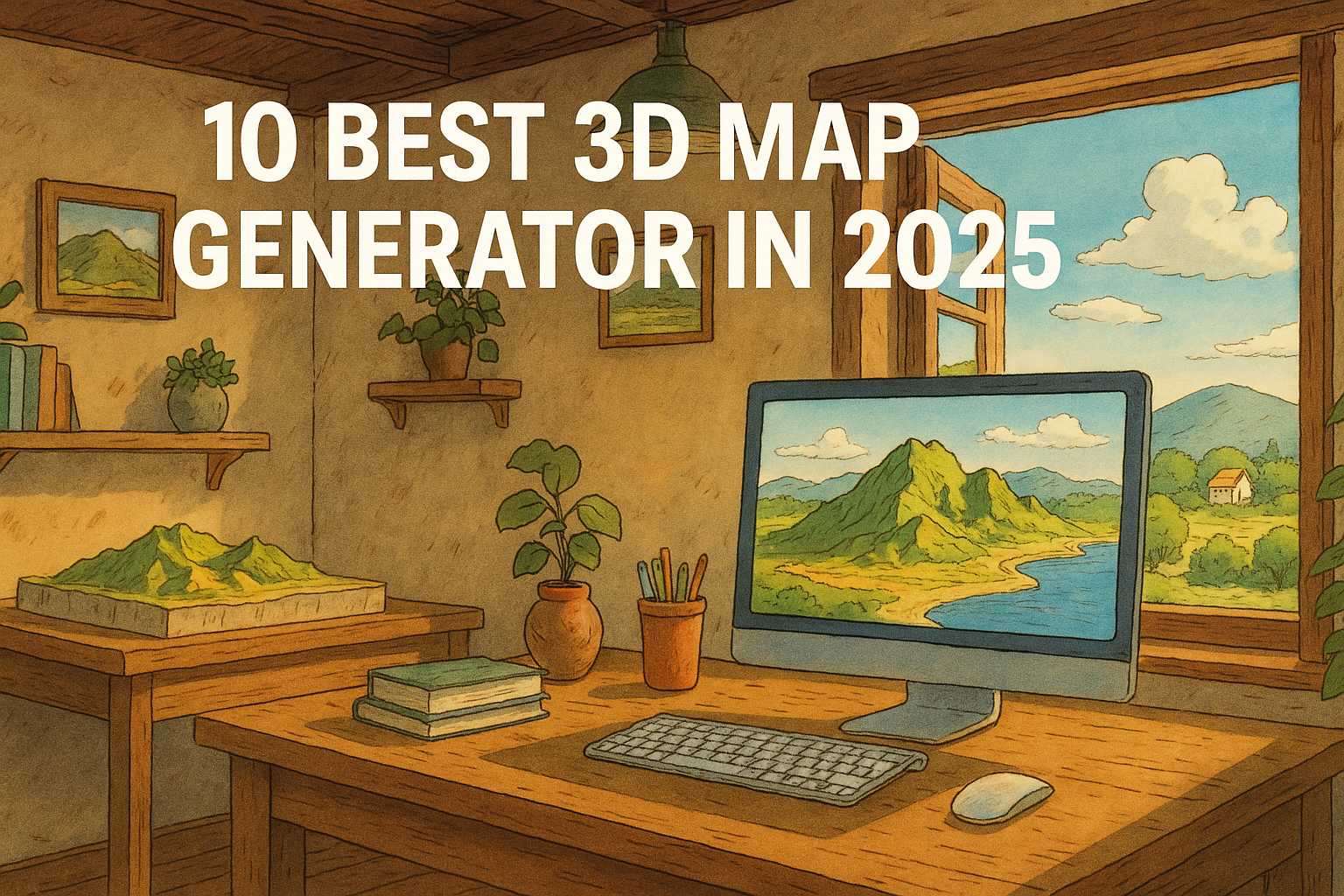
Best 3D Map Generators

🔟 3D-Mapper.com – Dead-Easy 3D Map Creation in the Browser
3D-Mapper.com stands out in 2025 as one of the most user-friendly and accessible online 3D map generators. Designed for both beginners and professionals, this browser-based tool allows users to create highly detailed 3D maps in just a few minutes — no software installation required. Whether you’re working on a school project, architectural presentation, or creative design, 3D-Mapper.com lets you customize terrain, colors, lighting, and more with ease.

One of its key strengths is the ability to export maps for 3D printing or embed them directly into your website, making it an excellent choice for educators, developers, and content creators. It also offers a free snapshot tool that lets you capture high-quality images of your customized 3D maps, including options for sky view or transparent backgrounds. With a sleek interface, real-time map rendering, and hassle-free export features, 3D-Mapper.com is a top pick for anyone looking to bring terrain to life in 2025.
9️⃣ 3D Map Generator (by Orange Box)
The 3D Map Generator by Orange Box is a powerful tool designed specifically for Photoshop users and creative designers who want to build stunning, realistic 3D maps directly within the Adobe environment. Unlike online-only platforms, this generator functions as a Photoshop plugin, giving designers the flexibility to work with familiar tools and layers while generating highly detailed topographic maps.

One of its standout features is the ability to generate 3D maps from Google Maps data or import your own GPX files, making it an excellent choice for mapping real-world locations or planning custom visual projects. The tool supports multiple map modes, including satellite view, terrain, and elevation, allowing creators to match the style and tone of their design needs.
This plugin is especially popular among professionals in graphic design, architecture, game development, and presentations, as it allows for full creative control using Photoshop’s native capabilities. You can easily adjust textures, apply lighting effects, add custom icons, or blend the map into larger compositions — all without leaving the Photoshop workspace.
With regular updates, detailed tutorials, and advanced control over visual styling, the 3D Map Generator by Orange Box is a top-tier option in 2025 for those who want to merge creativity with topographical accuracy. If you’re a designer looking for precision and style in your 3D map projects, this tool delivers exactly that.
8️⃣ Maps3D.io – Professional 3D Maps for Print or Web
Maps3D.io is a powerful and versatile online platform that enables users to create professional-quality 3D maps that can be either printed or embedded online. Tailored for both personal and commercial use, this tool is especially useful for individuals and organizations that need to visualize geographic data with accuracy and style.

One of the most notable features of Maps3D.io is its ability to generate 3D maps from GPS data, making it ideal for hikers, outdoor explorers, educators, and professionals who want to bring their routes and locations to life in 3D. Whether you’re uploading a GPS track or manually choosing a location, Maps3D’s smart rendering engine transforms the terrain into a beautiful 3D model within minutes.
What truly sets Maps3D apart is its built-in editor, which allows users to tweak and customize their maps directly in the browser. From adjusting elevation and perspective to adding markers or modifying colors, the editor offers creative control over every aspect of your map. The platform also includes geolocation tools, enabling users to search and pinpoint specific locations effortlessly.
Once your map is ready, you can either embed it directly into your website — perfect for blogs, travel sites, and portfolio pages — or export it for 3D printing, allowing for physical representations of landscapes, trails, or cityscapes. This makes it a favorite among educators, architects, geographers, and even gift creators who want to bring real-world locations into the tangible world.
Related Content:
Top 25 GIS Research Ideas for 2025
Top 30 GIS File Formats Every Mapping Professional Should Know
10 Best Mileage Tracker Apps in 2025
7️⃣ Icograms Designer – Infographic-Style Isometric 3D Maps
Icograms Designer is a unique 3D map creation tool that combines the power of isometric design with the simplicity of a drag-and-drop interface, making it perfect for users who prioritize visual storytelling and artistic presentation. Unlike traditional terrain-based 3D maps, Icograms focuses on isometric, infographic-style maps, which are widely used in urban planning, educational content, presentations, and storytelling.

With Icograms, users can design cityscapes, diagrams, and layouts using a vast library of pre-made isometric icons. These include buildings, roads, vehicles, people, trees, and more — all rendered in a clean, stylized isometric perspective that’s ideal for conveying complex ideas in a simple, visually engaging format. Whether you’re illustrating a traffic plan, creating an emergency response layout, or designing a futuristic city, Icograms gives you the creative tools to bring your vision to life.
One of the standout features is its intuitive editor, which makes use of a simple drag-and-drop system, allowing even beginners to create detailed isometric maps without any design experience. The platform is entirely browser-based, so there’s no need to download or install software. Users can customize every element, including colors, labels, and layout, which makes it incredibly versatile for presentations, reports, explainer videos, or marketing materials.
In 2025, Icograms Designer continues to be one of the top choices for professionals and educators looking to combine creativity, clarity, and functionality in their 3D maps. It’s not just about representing geographic data — it’s about telling a compelling visual story through organized, attractive, and easy-to-understand layouts.
6️⃣ MapTiler 3D – Realistic 3D Maps of the World
MapTiler 3D is a premium 3D mapping solution designed for professionals who need high-quality, realistic visualizations of the Earth. Ideal for developers, GIS experts, and cartographers, MapTiler 3D provides a powerful set of tools to create, customize, and integrate 3D tile maps into applications, dashboards, and websites. Whether you’re building an interactive map for the web or embedding geographic data into a professional project, MapTiler delivers performance and precision.

One of its major strengths lies in the realistic satellite and hybrid layers, which give users a lifelike view of terrains and urban landscapes. The platform supports the addition of roads, terrain details, and place names, enabling the creation of informative and aesthetically pleasing maps. These features make it perfect for applications such as urban planning, tourism guides, environmental analysis, and location-based services.
MapTiler 3D operates seamlessly with the MapTiler Cloud API, allowing for easy integration into web apps and GIS platforms. Developers can use the API to fetch dynamic map tiles, customize styling, and layer additional data on top of the 3D map canvas. This flexibility ensures that the tool can be adapted to a wide range of industries and projects, from smart cities to real estate and logistics.
In 2025, MapTiler 3D stands out for its professional-grade quality, developer-friendly API, and wide use across sectors that demand accuracy, interactivity, and global coverage. If you’re looking to embed 3D geographic data into digital products or want a reliable base for your next mapping application, MapTiler 3D is a top-tier choice.
5️⃣ Equator 3D Map Maker – High-Precision Mapping for Professionals
Equator 3D Map Maker is a specialized tool tailored for civil engineers, surveyors, architects, and urban planners who require accurate and detailed terrain visualization. Designed with a focus on precision and collaboration, Equator leverages high-resolution elevation data to generate realistic 3D figures and maps instantly — a must-have for infrastructure projects, site analysis, and environmental studies.

What sets Equator apart is its professional-grade elevation datasets, which allow users to map out terrain with exceptional accuracy. Whether you’re designing a road network, analyzing landform changes, or planning a development site, Equator provides the geospatial tools needed to visualize complex data in a clear, interactive format.
The platform’s user-friendly interface makes it easy to build, modify, and share 3D maps with stakeholders, colleagues, or clients. Teams can collaborate in real-time, making decisions based on shared visual data, which streamlines workflows and enhances project communication. The tool also supports instant export and sharing, meaning your 3D visuals can be integrated into presentations, reports, or GIS platforms without extra effort.
In 2025, Equator Studios continues to be a go-to platform for professionals in the AEC (Architecture, Engineering, and Construction) industry, providing a balance of advanced features and ease of use. If your work involves precise terrain modeling, infrastructure planning, or topographic visualization, Equator 3D Map Maker is a robust and reliable choice.
4️⃣ CesiumJS – Advanced Open-Source 3D Geospatial Platform
CesiumJS is an open-source, JavaScript-based geospatial 3D mapping library designed for developers, researchers, and enterprises who need to build high-performance, real-time, and large-scale 3D applications. Known for powering some of the most advanced geospatial visualizations and simulations around the globe, CesiumJS is trusted by organizations in defense, urban planning, aviation, and smart city development.

At its core, CesiumJS allows you to stream real-time terrain and imagery data, rendering detailed 3D maps and scenes directly in the browser without any plugins. This streaming capability ensures that vast datasets — including photorealistic terrains, BIM models, satellite imagery, and point clouds — can be efficiently visualized even in large-scale applications like digital twins of entire cities.
Developers appreciate Cesium for its extensive API and interoperability, allowing seamless integration with other mapping services and libraries, including Mapbox, OSM, and custom GIS datasets. Its modular architecture and WebGL engine ensure smooth performance across devices, while offering deep customization for building apps tailored to specific industries or use cases.
In 2025, CesiumJS remains the industry standard for next-generation 3D geospatial visualization. From visualizing drone data to simulating global logistics, it’s the platform of choice for those building complex, scalable, and interactive 3D environments. If you’re an advanced developer or enterprise needing cutting-edge geospatial visualization tools, CesiumJS is unmatched in power and flexibility.
3️⃣ Google Earth Studio – Cinematic 3D Map Animation Tool
Google Earth Studio is a powerful, web-based animation platform designed for creating stunning 3D map-based videos. Perfect for storytelling, education, journalism, and creative presentations, this free tool allows users to harness the visual richness of Google Earth’s 3D satellite imagery and transform it into cinematic video sequences.

Whether you’re crafting a news segment, educational video, or travel content, Earth Studio provides a user-friendly timeline-based editor to animate camera movements, zooms, pans, and flyovers. Its real strength lies in the ability to simulate aerial shots, dynamic transitions, and smooth path animations over detailed 3D terrain and cityscapes — all within your browser.
This tool is especially favored by journalists and educators, as it simplifies the process of visual storytelling while adding high production value to any project. Users can export their animations as video files and integrate them into documentaries, YouTube videos, or classroom materials.
In 2025, Google Earth Studio remains a top choice for anyone needing to combine the accuracy of maps with the emotion of motion. With no need for specialized software or complex coding, it enables creators to bring maps to life through visually engaging animations. If you’re looking to animate places and journeys in a professional-looking format, Google Earth Studio is the tool to try.
2️⃣ Terrain.party – Simple Terrain Heightmap Downloader
Terrain.party is a beloved and now community-revived tool used by game developers, 3D artists, and simulation designers to download terrain elevation data in the form of heightmaps. Though the original platform went offline, dedicated users have brought it back in 2025 through community forks, ensuring it remains accessible for creative and development projects.
The concept is simple yet powerful: you can select any location on Earth, and the tool will generate a PNG grayscale heightmap representing elevation data. This file can be easily imported into popular engines and software like Unity, Blender, Unreal Engine, and World Machine — making it perfect for creating realistic 3D terrains for games, architectural visualizations, and simulations.
Even with its minimal interface, Terrain.party provides a quick and reliable way to acquire accurate elevation data. The export package often includes multiple versions of the same heightmap derived from different data sources (like SRTM and USGS), giving users flexibility in choosing the best one for their project.
In 2025, Terrain.party continues to be an essential tool for terrain modeling, especially among indie developers and hobbyists. If you’re looking to turn real-world landscapes into game-ready or simulation-ready 3D environments, Terrain.party is a lightweight, no-fuss solution that still gets the job done.
1️⃣ BlenderGIS – Advanced 3D Mapping with Blender and Real GIS Data
BlenderGIS is a powerful, open-source add-on for Blender that enables users to import and visualize GIS (Geographic Information System) data directly into the 3D modeling environment. Designed for users who want full control over terrain modeling, texturing, and 3D visualization, BlenderGIS bridges the gap between professional geospatial data and artistic 3D design.

With BlenderGIS, you can import a wide range of geospatial formats, including Shapefiles, GeoTIFFs, and Digital Elevation Models (DEMs), and transform them into stunning, high-resolution 3D maps. This makes it incredibly useful for urban planning, environmental modeling, architectural visualization, and even game design, where realistic terrains and landscapes are required.
What sets BlenderGIS apart is the complete creative freedom it offers. Users can go beyond basic visualization and apply Blender’s full suite of tools—like sculpting, texturing, lighting, and animation—to create cinematic and hyper-detailed 3D scenes using real-world geographic data.
In 2025, BlenderGIS remains a top choice for professionals and advanced users who are comfortable with Blender and want to push the boundaries of 3D mapping. It’s open-source, endlessly customizable, and backed by a strong community, making it one of the most versatile tools for GIS-based 3D modeling available today. If you’re serious about combining geospatial accuracy with creative power, BlenderGIS is simply unmatched.
🗺️ 3D Map Generators Comparison Chart – 2025
| Rank | Tool Name | Platform | Best For | Key Features | Free Version | 3D Print Export | Embed Option |
|---|---|---|---|---|---|---|---|
| 1 | 3D-Mapper.com | Online (Web) | Beginners & quick generation | Custom styling, fast browser use, PNG snapshot | ✅ Yes | ✅ Yes | ✅ Yes |
| 2 | 3D Map Generator | Photoshop Add-on | Designers & creatives | Map from GPS/Google, multiple modes, terrain styling | ❌ Limited | ✅ Yes | ❌ No |
| 3 | Maps3D.io | Online (Web) | Commercial printing & GPS maps | Editor, 3D printing, GPS import/export | ✅ Yes | ✅ Yes | ✅ Yes |
| 4 | Icograms Designer | Online (Web) | Infographics & isometric maps | Icon-based design, city planning, drag & drop | ✅ Yes | ❌ No | ✅ Yes |
| 5 | MapTiler 3D | Online (Web/API) | Realistic terrain & developers | Satellite & hybrid layers, full world coverage | ✅ Yes | ❌ No | ✅ Yes |
| 6 | Equator Studios | Online Platform | Engineers, surveyors, GIS pros | High-res elevation data, share maps, civil tools | ✅ Limited | ✅ Yes | ✅ Yes |
| 7 | CesiumJS | JS Library | Developers & simulations | Open-source, stream terrain, massive scale | ✅ Yes | ✅ Yes (export) | ✅ Yes |
| 8 | Google Earth Studio | Web (Beta) | Animations & presentations | Cinematic videos, storytelling, map flyovers | ✅ Yes | ❌ No | ✅ Yes (via video) |
| 9 | Terrain.party | Web/Offline | Game devs & simulation creators | DEM downloads, terrain heightmaps, Unity/Blender integration | ✅ Yes | ✅ Yes | ❌ No |
| 10 | BlenderGIS | Blender Add-on | Advanced modeling & customization | Import GIS data into Blender, full 3D modeling | ✅ Yes | ✅ Yes | ❌ No |
🏁 Final Thoughts
The world of 3D map generation has come a long way. Whether you’re looking to create an interactive online 3D map, export to a 3D printer, or build a high-end animation, these tools offer something for everyone in 2025.
🧭 Bonus Tip:
If you’re just starting, try 3D-Mapper.com for its ease of use and Maps3D.io for quick commercial-ready exports.
🔍 Frequently Asked Questions
Q: What is the best free 3D map generator?
A: 3D-Mapper.com offers free map snapshots and is user-friendly for beginners.
Q: Can I 3D print maps generated with these tools?
A: Yes, most tools like Maps3D and 3D Map Generator offer export options for 3D printing.
Q: Which tool is best for educational use?
A: Tools like Google Earth Studio and Icograms are excellent for visual and interactive learning.
2 thoughts on “10 Best 3D Map Generators in 2025”