
Geographic Information Systems (GIS) are evolving rapidly, thanks to the integration of Artificial Intelligence (AI). AI-powered GIS apps are transforming geospatial analysis, enhancing decision-making, and automating complex spatial tasks. From real-time mapping to predictive analytics, AI in GIS is revolutionizing various industries, including urban planning, environmental monitoring, and transportation.
In this article, we will explore the top 10 GIS apps powered by AI that are leading the way in geospatial data analysis and visualization.
What Are GIS Apps Powered by AI?
GIS (Geographic Information Systems) apps powered by AI are advanced mapping and spatial analysis applications that integrate artificial intelligence to automate, analyze, and enhance geospatial data processing. These apps utilize machine learning (ML), deep learning, and AI-driven algorithms to improve accuracy, automate workflows, and provide predictive insights.
Top 10 GIS Apps Powered by AI
Here’re listed these 10 GIS Apps Powered by AI that make you GIS related Work Easy:
1. ArcGIS AI (Esri)
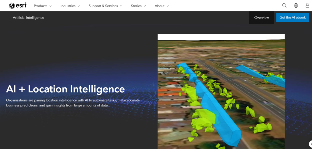
📌 Key Features:
- AI-driven predictive modeling for land use and environmental analysis.
- Automated feature extraction from satellite imagery.
- Integration with deep learning frameworks like TensorFlow.
🌍 Why It Stands Out: ArcGIS AI seamlessly blends AI-driven geospatial intelligence with robust GIS tools, making it a go-to choice for professionals.
2. Google Earth Engine AI
📌 Key Features:
- AI-based land classification and change detection.
- Cloud computing for large-scale geospatial analysis.
- Advanced deep learning integration for satellite imagery.
🌍 Why It Stands Out: It leverages Google’s AI capabilities to process and analyze vast amounts of satellite data in real-time.
3. QGIS with AI Plugins
📌 Key Features:
- Open-source AI-powered geospatial data processing.
- Supports AI plugins for object detection and classification.
- Works with Python-based AI models for automation.
🌍 Why It Stands Out: Being open-source and community-driven, QGIS offers customizable AI functionalities for GIS professionals and researchers.
See Also: How DeepSeek AI is Revolutionizing GIS Automation [2025]
4. Hexagon Smart M.Apps
📌 Key Features:
- AI-driven dynamic geospatial analytics.
- Real-time data visualization using AI-powered models.
- Cloud-based interactive GIS mapping solutions.
🌍 Why It Stands Out: It provides AI-powered location intelligence for business insights and smart city planning.
5. GeoAI by Microsoft
📌 Key Features:
- AI-driven geospatial predictions and trend analysis.
- Machine learning integration for land-use planning.
- Supports Azure AI services for spatial data analytics.
🌍 Why It Stands Out: Microsoft’s cloud-based AI GIS solutions enable advanced geospatial decision-making across industries.
See Also: DeepSeek AI in GIS: A New Era of Geospatial Intelligence [2025]
6. ENVI Deep Learning (L3Harris)
📌 Key Features:
- AI-based image classification and feature detection.
- Automates remote sensing analysis.
- Works with multispectral and hyperspectral satellite images.
🌍 Why It Stands Out: It’s widely used in defense, agriculture, and environmental monitoring for AI-driven geospatial intelligence.
7. TensorFlow GIS
📌 Key Features:
- AI-powered spatial modeling and predictive analytics.
- Custom deep learning models for GIS applications.
- Supports automated geospatial data classification.
🌍 Why It Stands Out: This integration allows GIS professionals to leverage deep learning for advanced spatial data analysis.
8. IBM PAIRS Geoscope
📌 Key Features:
- AI-powered real-time geospatial data analytics.
- Works with big data and IoT for GIS applications.
- Machine learning-based risk assessment models.
🌍 Why It Stands Out: IBM’s AI-driven GIS solution is highly scalable and integrates seamlessly with enterprise applications.
See Also: How GIS Users Use DeepSeek AI: Transforming Spatial Analysis with AI-Powered Insights
9. GeoAI Platform by NVIDIA
📌 Key Features:
- Uses deep learning for geospatial data processing.
- High-performance AI-driven geospatial visualization.
- Supports real-time remote sensing applications.
🌍 Why It Stands Out: NVIDIA’s GPU-powered AI models accelerate GIS analytics, making it one of the fastest AI GIS platforms.
10. Ordnance Survey AI GIS
📌 Key Features:
- AI-based topographic data mapping.
- Smart geospatial data automation tools.
- AI-powered risk and disaster management modeling.
🌍 Why It Stands Out: This app is particularly useful for urban planning, land surveying, and national mapping agencies.
Future of AI in GIS
The fusion of Artificial Intelligence with GIS is unlocking new possibilities in spatial intelligence, predictive analytics, and automated mapping. With continuous advancements in machine learning, deep learning, and cloud computing, AI-powered GIS applications will become even more efficient and widely adopted.
Key Trends to Watch:
- 📡 AI-Driven Satellite Image Analysis for enhanced land monitoring.
- 🏙 Smart Cities Development using predictive geospatial analytics.
- 🚀 Autonomous GIS Systems for real-time environmental and disaster response.
Why Are AI-Powered GIS Apps Important?
🌍 Enhanced Accuracy – AI eliminates human errors in spatial analysis.
⏳ Faster Processing – Automates mapping and data classification, reducing processing time.
🔍 Better Decision-Making – AI-driven GIS insights help in urban planning, agriculture, transportation, and disaster management.
Conclusion
AI-powered GIS applications are revolutionizing spatial data analysis and geospatial decision-making. From real-time mapping to predictive analytics, these AI GIS apps are shaping the future of industries like urban planning, environmental monitoring, and disaster management.
By leveraging AI-driven geospatial intelligence, organizations can unlock new levels of efficiency, accuracy, and automation in their GIS workflows.
Frequently Asked Questions (FAQs)
Q1: What is the role of AI in GIS applications?
Ans: AI enhances GIS applications by automating spatial analysis, improving data accuracy, and enabling predictive geospatial modeling.
Q2: Which is the best AI-powered GIS app?
Ans: ArcGIS AI, Google Earth Engine AI, and QGIS AI plugins are among the most popular AI-integrated GIS applications.
Q3: How does AI improve remote sensing in GIS?
Ans: AI automates image classification, object detection, and change detection in satellite imagery, improving efficiency and accuracy.
Q4: What industries benefit the most from AI GIS applications?
Ans: Urban planning, agriculture, environmental monitoring, disaster management, and transportation benefit significantly from AI-powered GIS.
Q5: What is the future of AI in GIS?
Ans: The future of AI in GIS includes real-time geospatial intelligence, autonomous mapping, and AI-driven predictive spatial analysis.
6 thoughts on “Top 10 GIS Apps Powered by AI: A Future Perspective”