What is LiDAR? A Simple 2025 Guide to How It Works & Its Uses
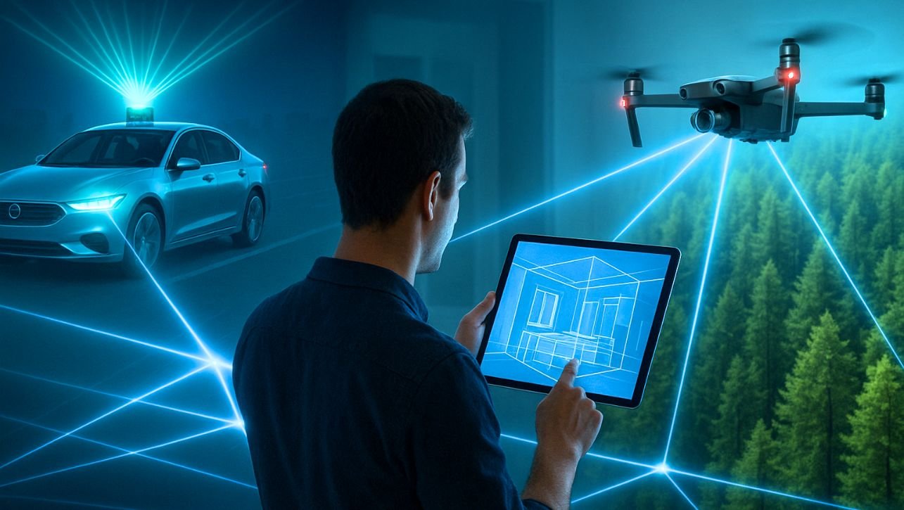
Look around you. In 2025, an invisible dance of light is happening all around us, shaping your daily life in ways you might not even notice. It’s guiding your new car, helping architects preserve historic sites, and even assisting doctors in complex surgeries. This invisible force is LiDAR. Once a bulky, expensive tool for scientists and surveyors, LiDAR has exploded into the mainstream. But what is LiDAR, and why has it become so fundamental to our technological future? This isn’t just a guide to what LiDAR is—it’s a look at how it’s actively building a smarter, safer, and more precisely mapped world. What is LiDAR? LiDAR, which stands for Light Detection and Ranging, is a remote sensing method that uses light in the form of a pulsed laser to measure variable distances to the Earth. Here’s the simplest analogy: Imagine millions of tiny, invisible laser tape measures firing every second, building a precise, three-dimensional map of everything they touch. These pulses of light—each one a single photon—bounce off objects like trees, cars, and buildings and return to the sensor. By measuring the time it takes for each pulse to return (Time of Flight) and using the known speed of light, the system calculates an exact distance. After firing billions of these pulses, a hyper-accurate “point cloud”—a massive collection of individual data points in 3D space—is created. How LiDAR Works in 2025: Smarter, Smaller, and Solid-State The core principle remains, but the technology has evolved dramatically. Here’s the 2025 breakdown: Emission: A laser emitter sends out a focused beam of light. In 2025, these are more efficient and eye-safe than ever. Scanning: The light hits a scanning mechanism. While mechanical spinners were once common, 2025 is the era of Solid-State LiDAR. No Moving Parts: Solid-state systems use microscopic antennas on a chip to steer the laser beam electronically. This makes them cheaper, more reliable, smaller, and perfect for mass-market applications like consumer vehicles and phones. Detection: The photodetector receives the reflected light. Processing: Advanced onboard AI and processors calculate the distance for each point and use the scanner’s position data to assemble the final 3D point cloud in real-time. The LiDAR Revolution: Why 2025 is a Tipping Point Three key trends have propelled LiDAR into the spotlight: The Mass-Market Automotive Push: With major automakers rolling out Level 3 automated driving systems, LiDAR has become a critical sensor for creating a fail-safe 3D view of the road, complementing cameras and radar. Consumer Electronics Integration: Apple embedding LiDAR in iPhones and iPads normalized the technology for millions, enabling everything from instant room measurements to next-level AR gaming. The “Democratization” of Data: Affordable, drone-mounted LiDAR systems and user-friendly processing software have put powerful mapping capabilities in the hands of small businesses, researchers, and farmers. Read Also: LiDAR vs. Photogrammetry: The Ultimate 2025 Showdown (Pros, Cons & Verdict) How Do Drones (UAVs) Collect GIS Data? ArcGIS Pro vs. QGIS: The Ultimate 2025 Showdown (Pros, Cons & Verdict) LiDAR in Action: The 2025 Use-Case Landscape 1. Autonomous Vehicles & Smart Transportation LiDAR is the high-fidelity eyes of self-driving cars. In 2025, it doesn’t just “see” an object; it precisely identifies its轮廓, calculates its velocity, and predicts its path, even in pitch darkness or blinding sun. It’s essential for differentiating a harmless plastic bag from a stray tire on the highway. 2. Environmental Monitoring & Climate Science Carbon Stock Assessment: Satellites and aircraft with LiDAR are precisely measuring forest biomass on a global scale, making carbon credit markets more accurate and fighting deforestation. Coastal Resilience: By regularly mapping coastlines, scientists can track erosion from sea-level rise with centimeter accuracy, informing vital protection strategies. 3. Digital Twins & the Metaverse Every major city and corporation is building a “digital twin”—a live, virtual replica of the real world. LiDAR is the primary tool for scanning physical assets—from entire factories to infrastructure networks—to create the foundational 3D model for simulation, planning, and the industrial metaverse. 4. Augmented Reality (AR) & Mobile Computing The LiDAR scanner in your phone or AR glasses does one thing incredibly well: it understands the geometry of your surroundings. This allows digital objects to interact realistically with your physical space—a virtual character hiding behind your real sofa, or an IKEA chair perfectly fitting in your living room. 5. Archaeology & Cultural Heritage Researchers are using drones with LiDAR to discover lost cities and ancient earthworks hidden beneath dense jungle canopies, revolutionizing our understanding of human history without ever breaking ground. LiDAR vs. The World: How It Stacks Up in 2025 No sensor is perfect. LiDAR’s role is best understood in a suite of technologies: LiDAR vs. Cameras (Photogrammetry): LiDAR provides its own light source and captures exact geometry and distance natively. Cameras provide rich texture and color but struggle with precise scale and low light. In 2025, the trend is Sensor Fusion—combining LiDAR’s 3D data with camera imagery for a complete picture. LiDAR vs. Radar: Radar is excellent at measuring speed and works in all weather conditions, but it has very low resolution. LiDAR provides the high-resolution 3D shape that radar cannot. The Future of LiDAR: What’s Next? (2025 and Beyond) The evolution is accelerating. Key trends to watch: Chip-Scale LiDAR: LiDAR sensors will shrink to the size of a postage stamp, becoming cheap and ubiquitous enough to be embedded in every robot, smart device, and traffic light. Quantum LiDAR: Emerging quantum technologies will lead to LiDAR systems with unprecedented sensitivity, capable of seeing further and through obscurants like fog and smoke more effectively. AI-Native LiDAR: Sensors will have AI built directly into the hardware, allowing them to not just collect raw data, but to identify and classify objects (e.g., “pedestrian,” “cyclist”) at the source, dramatically speeding up processing. Conclusion: What is LiDAR? LiDAR is no longer a niche technology. It has become a fundamental utility for perceiving and interacting with our world, as transformative as the GPS signal itself. It answers a simple but profound question with incredible precision: “Where are things, and what is their shape?” As we march toward a more automated and digitally integrated future, LiDAR provides the essential spatial context … Read more