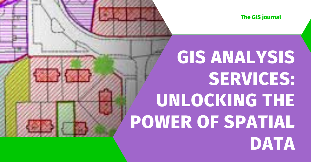
GIS Analysis Services: Unlocking the Power of Spatial Data

GIS Analysis Services

In today’s data-driven world, spatial data is a critical asset for businesses, governments, and organizations. Geographic Information System (GIS) analysis services transform complex spatial datasets into actionable insights, enabling smarter decision-making and optimized resource management. Whether it’s urban planning, environmental monitoring, or disaster risk assessment, GIS analysis empowers industries to address challenges with precision and efficiency. What Are GIS Analysis Services? GIS analysis services encompass a range of techniques and tools designed to analyze, interpret, and visualize spatial data. These services help uncover patterns, trends, and relationships that are otherwise invisible in traditional datasets. From creating interactive maps to performing advanced geostatistical analyses, GIS tools enable organizations to harness the full potential of geographic information. Core GIS Analysis Services 1. Spatial Data Analysis GIS experts analyze spatial relationships and patterns to provide solutions for site suitability, resource allocation, and infrastructure development. Buffer and proximity analysis. Density mapping for population or resources. 2. Thematic Mapping Creating maps that represent specific themes, such as land use, transportation, or demographics, to support decision-making and visualization. 3. Remote Sensing and Image Processing Using satellite and aerial imagery to detect changes in land cover, monitor environmental impacts, and support agricultural planning. 4. Network Analysis Analyzing transportation and utility networks to identify optimal routes, improve logistics, and ensure efficient service delivery. 5. Environmental Impact Assessment (EIA) GIS supports EIA by analyzing spatial data related to biodiversity, land use, and environmental changes for sustainable development projects. 6. Disaster Management and Risk Assessment GIS helps in identifying hazard-prone areas, mapping evacuation routes, and analyzing risk factors to prepare for and mitigate disasters. 7. Land and Property Management From cadastral mapping to zoning and urban development, GIS is vital for effective land-use planning. Read Also: Geomatics Engineering: Career, Job, & Salary in 2025 Industries Utilizing GIS Analysis Services 1. Government and Urban Planning Governments use GIS to plan smart cities, design infrastructure, and manage public resources efficiently. 2. Agriculture GIS aids in precision farming, crop health monitoring, and water resource management. 3. Transportation and Logistics GIS tools optimize delivery routes, analyze traffic patterns, and plan transportation systems. 4. Environmental Conservation GIS plays a key role in monitoring deforestation, wildlife habitats, and climate change impacts. 5. Real Estate and Property Management GIS provides insights into property valuation, zoning regulations, and land-use trends. Read Also: AutoCAD Map 3D – GIS and CAD Fusion Industries Benefiting from GIS Analysis Services Government and Urban Planning Agriculture and Forestry Transportation and Logistics Utilities and Energy Environmental Conservation Real Estate Disaster Management Read Also: Top 15 Map Maker Interview Questions & Answers How to Become a GIS Analysis Professional? A career as a GIS analyst is exciting, offering opportunities to work with cutting-edge technology and solve real-world problems. Whether you’re passionate about urban planning, environmental management, or disaster response, GIS analysis is a versatile and rewarding field. Here’s a step-by-step guide to becoming a GIS analysis professional. 1. Understand the Role of a GIS Analyst Before diving into the field, it’s essential to understand what a GIS analyst does. Collects, processes, and interprets spatial data. Creates maps and visualizations for decision-making. Performs geospatial analysis to uncover patterns and insights. Collaborates with professionals in fields like engineering, urban planning, and environmental science. 2. Gain the Required Educational Background Undergraduate Degree Pursue a degree in Geography, Geoinformatics, Environmental Science, Urban Planning, or a related field. Some technical fields like Computer Science or Civil Engineering can also be a good foundation. Postgraduate Degree (Optional) A master’s in GIS, Remote Sensing, or Geoinformatics can provide specialized skills and improve job prospects. Short-Term Certification Programs If formal degrees aren’t an option, certification programs in GIS and spatial analysis can provide the required knowledge. 3. Develop Technical Skills GIS analysis professionals rely on software and tools to perform their tasks. Learn the following: GIS Software ArcGIS (by Esri) QGIS (open-source) GRASS GIS Remote Sensing Tools ENVI ERDAS IMAGINE Programming and Data Analysis Python: Libraries like GeoPandas, Shapely, and Rasterio for geospatial analysis. SQL: For geospatial databases. R: For statistical analysis in spatial data. Web Mapping Tools Leaflet.js Mapbox 4. Gain Practical Experience Practical experience is crucial for developing real-world GIS skills. Internships: Many companies and government organizations offer GIS internships. Freelancing: Platforms like Upwork or Fiverr often have GIS-related projects. Personal Projects: Work on mapping and analysis projects to build a portfolio. 5. Earn Certifications Certifications validate your skills and improve employability. Some popular certifications include: Esri Technical Certification: For ArcGIS users. GISP Certification: Offered by the GIS Certification Institute. Remote Sensing Certifications: Offered by organizations like NASA or ISRO. 6. Build a Portfolio A strong portfolio showcasing your GIS projects is essential. Include: Examples of maps and spatial analyses you’ve done. Case studies or project summaries of your work. Details on the tools and techniques you used. 7. Network and Stay Updated The GIS field evolves rapidly, so staying connected with industry professionals and trends is essential. Attend GIS conferences and webinars. Join professional organizations like URISA (Urban and Regional Information Systems Association). Subscribe to GIS-related journals and blogs. 8. Apply for Jobs in GIS Analysis Once you’ve built your skills and portfolio, look for job opportunities in: Government agencies (urban planning, environmental management). Private companies (logistics, real estate, or consulting firms). Nonprofit organizations (environmental conservation, disaster relief). Read Also: ArcGIS Pro Review: Transforming the Way We Map and Analyze Why Invest in GIS Analysis Services? GIS analysis services provide a competitive edge by turning complex spatial data into meaningful insights. Whether it’s optimizing operations, planning infrastructure, or conserving the environment, GIS tools and techniques empower businesses and organizations to make informed, data-driven decisions. For tailored GIS solutions, partnering with experienced GIS professionals ensures accurate and impactful results. Read Also: Top 15 Data Mapper Interview Questions & Answers Benefits of GIS Analysis Services Enhanced Decision-Making: Spatial insights improve planning and strategy development. Cost and Time Efficiency: Optimize resource allocation and streamline operations. Improved Risk Management: Predict and mitigate potential hazards. Better Visualization: Interactive maps and 3D models for better … Read more
Geoinformatics – Shaping the Future of Spatial Sciences

Geoinformatics

Geoinformatics is a cutting-edge field that combines data science, geography, and advanced technologies like GIS (Geographic Information Systems), remote sensing, and spatial analytics. In an era where data drives decision-making, Geoinformatics is revolutionizing industries such as urban planning, environmental management, disaster response, and even business strategy. As we approach 2025, the demand for skilled Geoinformatics professionals is skyrocketing, offering diverse career opportunities and impressive earning potential. This blog explores the exciting prospects of a career in Geoinformatics, detailing job roles, salary trends, and the skills needed to thrive in this dynamic field. Whether you’re a student, a professional looking to pivot, or simply curious, Geoinformatics promises a rewarding and impactful career path in the digital age. What is Geoinformatics? Geoinformatics is an interdisciplinary field that integrates geography, computer science, and data analytics to collect, analyze, and visualize spatial data. It focuses on using advanced tools like Geographic Information Systems (GIS), remote sensing, GPS, and spatial databases to solve complex problems across various industries. At its core, Geoinformatics enables the understanding and management of spatial information—data tied to specific locations on Earth. This information is vital for tasks such as mapping, monitoring environmental changes, planning infrastructure, and optimizing logistics. Software For Geoinformatics Ebooks Why Choose Geoinformatics? Geoinformatics is not just a field of study—it’s a gateway to solving some of the world’s most pressing challenges through innovative technology and data-driven insights. Here’s why Geoinformatics is becoming an essential discipline in today’s rapidly changing world: 1. High Demand Across Multiple Industries Geoinformatics professionals are in demand across sectors like urban planning, environmental conservation, disaster management, agriculture, transportation, and even business analytics. The ability to interpret and manage spatial data makes Geoinformatics experts indispensable in both public and private sectors. 2. Diverse Career Opportunities From GIS analysts and remote sensing specialists to spatial data scientists and urban planners, Geoinformatics offers a wide array of career paths. You can work with government agencies, multinational corporations, NGOs, or research institutions. 3. Contribution to Sustainable Development Geoinformatics plays a pivotal role in addressing global challenges such as climate change, urbanization, resource management, and disaster mitigation. It empowers professionals to make data-driven decisions that promote sustainable growth and environmental conservation. 4. Cutting-Edge Technology and Innovation As a Geoinformatics professional, you’ll work with advanced tools like GIS software, remote sensing satellites, AI, and big data analytics. This makes the field exciting for tech enthusiasts who love to innovate and solve complex problems. 5. Competitive Salaries and Growth Potential Geoinformatics is a rapidly growing field with competitive salaries and excellent growth prospects. Professionals with expertise in this area are highly valued in the job market, both locally and globally. 6. Global Relevance With the increasing emphasis on spatial data across the globe, Geoinformatics offers opportunities to work on international projects and collaborate with experts worldwide. 7. Interdisciplinary Learning Geoinformatics combines geography, computer science, and data analysis, providing a holistic learning experience. This interdisciplinary approach makes it ideal for individuals with diverse interests and skill sets. Read Also: Geomatics Engineering: Career, Job, & Salary in 2025 Why Study Geoinformatics? Studying Geoinformatics opens up a world of opportunities for those passionate about technology, geography, and solving real-world problems. Here’s why Geoinformatics is a field worth exploring: 1. Address Global Challenges Geoinformatics equips you with the tools to tackle critical global issues like climate change, urban sprawl, deforestation, and natural disasters. Your expertise can contribute to creating sustainable solutions for these pressing problems. 2. Be at the Forefront of Technology Geoinformatics combines advanced technologies such as Geographic Information Systems (GIS), remote sensing, GPS, and spatial data analysis. Studying this field allows you to work with cutting-edge tools and stay ahead in the era of technological innovation. 3. Diverse Career Pathways A degree in Geoinformatics opens doors to various career opportunities in fields like urban planning, environmental management, disaster response, agriculture, and even business strategy. The demand for geospatial expertise spans multiple industries. 4. Interdisciplinary Learning Geoinformatics blends geography, computer science, data analytics, and environmental science, making it an exciting and versatile field for individuals with diverse academic interests. 5. High Earning Potential With the growing importance of spatial data, professionals in Geoinformatics are in high demand, earning competitive salaries and enjoying excellent job stability. 6. Make a Global Impact Geoinformatics professionals play a vital role in international projects, contributing to global initiatives like sustainable development, disaster resilience, and environmental conservation. 7. Opportunities for Innovation and Research The field offers immense potential for innovation, allowing you to explore emerging areas such as AI in geospatial analysis, 3D mapping, and big data analytics. Geoinformatics also provides a strong foundation for advanced research and higher studies. 8. Work on Real-World Applications Geoinformatics is a highly practical discipline where you can see the tangible results of your work, whether it’s mapping disaster-prone areas, planning smart cities, or optimizing transportation networks. Read Also: What is a GIS Technician and What Does a GIS Technician Do Objectives of Geoinformatics The field of Geoinformatics is designed to develop a blend of technical, analytical, and innovative skills to address spatial and environmental challenges. Here are the primary objectives of Geoinformatics education and practice: 1. Impart Fundamental Knowledge Provide a solid foundation in core concepts of geospatial science, including Geographic Information Systems (GIS), remote sensing, and cartography. Equip students with the ability to collect, analyze, and interpret spatial data. 2. Develop Technical Competence Train individuals in advanced tools and technologies like GIS software, remote sensing applications, GPS, and geospatial analytics. Enable students to solve real-world problems in sectors such as urban planning, natural resource management, disaster response, and infrastructure development. 3. Encourage Interdisciplinary Learning Integrate geography, computer science, and data analytics to create a multidisciplinary approach to problem-solving. Promote the application of geospatial technology across diverse industries. 4. Foster Problem-Solving and Analytical Skills Develop the ability to design and implement geospatial solutions for global challenges such as climate change, disaster mitigation, and urbanization. Encourage creative thinking to address complex spatial problems efficiently. 5. Promote Research and Innovation Encourage students and … Read more

GRASS GIS Reviews 2025 & Product Details – GIS Software

Grass GIS

In the ever-evolving world of Geographic Information Systems (GIS), GRASS GIS stands out as a powerful open-source tool designed for advanced spatial modeling and analysis. As we move into 2025, GRASS GIS continues to gain popularity for its versatility, extensive toolset, and robust capabilities in both academic and professional GIS environments. Whether you’re working with raster data, vector layers, or performing geospatial analysis, GRASS GIS provides the resources needed to handle complex tasks. In this review, we’ll explore the latest product details, features, and updates for GRASS GIS in 2025, along with insights on how this software stands against its competition in the GIS software market. If you’re looking for a comprehensive GIS solution, read on to discover what makes GRASS GIS an indispensable tool for your geospatial needs. GRASS GIS Review GRASS GIS (Geographic Resources Analysis Support System) has earned its reputation as a versatile and powerful open-source Geographic Information System (GIS) tool. Whether you’re a researcher, environmental analyst, or GIS enthusiast, GRASS GIS offers a comprehensive suite of capabilities for spatial data management, analysis, and visualization. Over the years, this software has grown into one of the most reliable tools in the geospatial industry, combining flexibility with an ever-expanding range of features. GO TO GRASS GIS Rating: 4.0/5 Key Features of GRASS GIS Comprehensive Geospatial Analysis: GRASS GIS excels in spatial data analysis, offering tools for raster and vector manipulation, hydrological modeling, terrain analysis, and geostatistics. Its extensive library allows users to perform complex operations that can support a range of environmental, engineering, and scientific applications. Raster and Vector Data Handling: GRASS GIS provides robust support for both raster and vector data, making it ideal for various GIS workflows. It allows users to integrate different types of geospatial data and perform sophisticated analyses, such as creating digital elevation models (DEMs), land use analysis, and terrain modeling. Advanced Geospatial Modeling and Simulations: One of the standout features of GRASS GIS is its ability to model geospatial processes. From environmental simulations like soil erosion to complex hydrological modeling, GRASS GIS has the power to help researchers and professionals understand and predict spatial phenomena with high accuracy. Open-Source Flexibility: As an open-source software, GRASS GIS is free to download, modify, and use. Its open-source nature also means that users have the freedom to adapt the software to their specific needs, create custom tools, and contribute to the development of the platform. This flexibility makes it a favorite among developers and academic users. Cross-Platform Compatibility: GRASS GIS is available on multiple operating systems, including Windows, macOS, and Linux. This cross-platform compatibility ensures that users can access the software regardless of their preferred computing environment. 3D Visualization: With the rise of 3D GIS, GRASS GIS has integrated capabilities for 3D visualization, helping users interpret spatial data in more interactive and meaningful ways. Whether it’s visualizing terrain, urban planning models, or hydrological networks, 3D capabilities allow for a more detailed analysis of data. Integration with Other GIS Software: GRASS GIS integrates well with other GIS platforms, such as QGIS and MapServer. This integration allows users to work with different tools simultaneously, taking advantage of the unique capabilities each one offers. Read Also: ArcGIS Desktop Reviews 2025: Details, Pricing, & Features GRASS GIS History GRASS GIS (Geographic Resources Analysis Support System) is one of the oldest and most robust open-source geographic information system (GIS) software platforms. Developed initially as a research project, its history reflects its evolution into a powerful and versatile tool used globally for spatial data analysis and geospatial modeling. Here’s a look at the key milestones in the history of GRASS GIS: Early Development (1980s – 1990s): GRASS GIS was developed in the early 1980s by the U.S. Army Corps of Engineers Construction Engineering Research Laboratory (CERL) as part of a project to create a comprehensive GIS software package for land management and environmental analysis. The initial focus was on supporting military needs, but the project soon gained interest in the academic and scientific communities for its spatial analysis and mapping capabilities. Open-Source Transition (1990s): In 1992, GRASS GIS transitioned from a proprietary software developed by the U.S. Army Corps to an open-source project, making the software freely available to the public. This move was instrumental in the growth of the open-source GIS community. By opening up the code, GRASS GIS allowed users to modify, improve, and extend its functionality, leading to contributions from a growing community of developers worldwide. Release of Version 4.x (1990s): In 1995, GRASS GIS version 4.x was released, and it began to gain wider acceptance. The software provided a user-friendly interface for spatial data analysis and was recognized for its advanced raster and vector data management capabilities. This period marked a significant advancement, as GRASS GIS introduced a suite of geospatial modeling and analysis tools that would become standard features in future versions. Increasing Popularity (2000s): As GIS technology evolved, GRASS GIS became a popular tool among researchers, environmental scientists, and GIS professionals due to its powerful analytical tools and ability to handle complex spatial datasets. During the 2000s, GRASS GIS continued to improve, adding support for new data formats, advanced geospatial analysis functions, and more sophisticated modeling tools. The software began to see greater adoption in academia and government agencies, particularly in fields like environmental management, hydrology, and land-use planning. Integration with Other GIS Software (2000s – Present): One of the key developments in GRASS GIS’s history was its growing interoperability with other GIS tools. In particular, the software began to integrate with QGIS (Quantum GIS), another open-source GIS platform, providing users with a more seamless experience. This integration allowed users to access the strengths of both platforms, offering enhanced data analysis and visualization capabilities. Recent Advancements and Continuous Development (2010s – Present): Over the past decade, GRASS GIS has continued to evolve with regular updates and improvements, including better user interfaces, enhanced tools for 3D visualization, and increased performance for handling large datasets. The active development community ensures that the software remains relevant in … Read more

QGIS Reviews 2024: Details, Pricing, & Features

QGIS

QGIS (Quantum GIS) is an open-source Geographic Information System (GIS) software widely used by GIS professionals and enthusiasts around the world. It offers a powerful, free alternative to commercial GIS software like ArcGIS. QGIS provides excellent tools for data visualization, spatial analysis, and map creation. In this blog, we will discuss QGIS’s features, advantages, drawbacks, pricing, and other key aspects. Key Features of QGIS QGIS offers several features that make it a great GIS tool. Here are some of the main features: Open-Source Software: QGIS is completely open-source, making it free and accessible to everyone. Anyone can download, install, and modify it. Data Compatibility: QGIS supports almost every type of geospatial data format, including shapefiles, GeoJSON, KML, and more. It also works with spatial databases like PostGIS and SpatiaLite. Advanced Spatial Analysis: QGIS includes tools that can handle advanced spatial analysis, interpolation, and proximity analysis. Customizable Interface: The interface of QGIS is fully customizable. You can arrange toolbars, menus, and panels according to your needs. Plugins: QGIS has many plugins available to add new features and functionalities. You can install them from the QGIS plugin repository. Pros of QGIS Free and Open-Source: The biggest advantage of QGIS is that it’s completely free. Anyone can download and use it without any licensing fees. User-Friendly Interface: QGIS has a user-friendly interface that makes it easy for even new users to learn and get started. Extensive Community Support: QGIS has a large and active community, with plenty of forums, tutorials, and documentation available to help users. Cross-Platform Compatibility: QGIS works on Windows, macOS, and Linux, making it accessible to users on different platforms. Scalability: QGIS can handle both large and small datasets efficiently. It works well with large datasets, which is important for many GIS applications. Cons of QGIS Performance with Large Datasets: QGIS can sometimes be slow when dealing with very large datasets, especially when performing complex analyses. Learning Curve: While QGIS is user-friendly, there can still be a learning curve for some of its more advanced features. Limited Advanced Geospatial Tools: QGIS may not offer the same level of advanced tools as ArcGIS, although plugins can add some of these features. Pricing of QGIS QGIS is completely free. It is open-source software that you can download and use without any cost. There are no subscription fees or licensing fees involved. Additionally, the tutorials and guides available on the QGIS community website are also free. User Experience with QGIS QGIS is relatively easy to use, especially for those who are looking to perform basic GIS tasks. If you are a beginner, there are plenty of online tutorials and learning resources that will help you understand the features of QGIS. For more advanced users, QGIS is a powerful tool capable of performing complex spatial analysis and map design. Performance and Speed of QGIS QGIS’s performance largely depends on your system configuration and dataset size. It works very fast and efficiently with smaller datasets, but it can become slow with larger datasets (such as millions of features). However, there are performance optimization techniques and configurations available for handling large data more effectively. Qgis Vs ArcGIS The main difference between QGIS and other GIS tools like ArcGIS is that QGIS is open-source and free, while ArcGIS is a licensed software. While ArcGIS offers some advanced tools and official support, QGIS has a strong community and plenty of plugins that make it highly versatile. Plus, QGIS does not require a subscription or license, which is a major advantage for users on a budget. System Requirements for QGIS Minimum system requirements to run QGIS: Operating System: Windows 7 or later, macOS 10.10 or later, Linux Processor: Intel i3 or equivalent RAM: 4GB minimum (8GB recommended) Hard Drive Space: 1GB of free space Graphics: Any GPU with OpenGL 2.0 support Conclusion: Should You Use QGIS? QGIS is an excellent open-source GIS tool that is suitable for GIS professionals, researchers, and beginners alike. Its biggest advantage is that it’s completely free and highly customizable. While some advanced features in ArcGIS may not be available in QGIS, it is still an excellent choice for those who need powerful spatial analysis tools on a budget. Rating: 4.5/5 You can download QGIS from the official website and try it out for free. If you’re a GIS professional, this software can enhance your workflow and make your GIS tasks more efficient and powerful. Frequently Asked Questions (FAQs) Q: Does QGIS work on Windows, macOS, and Linux? A: Yes, QGIS works on all major platforms, including Windows, macOS, and Linux. Q: Is QGIS free to use? A: Yes, QGIS is open-source and completely free to use. Q: Does QGIS have a learning curve? A: While QGIS is user-friendly, there is a slight learning curve for some of its advanced features.