30 Best GIS LinkedIn Accounts to Follow in 2025

GIS LinkedIn accounts

Are you a GIS (Geographic Information Systems) professional or student looking to grow your career in 2025? One of the best ways to stay updated with industry trends, tools, and opportunities is by following the right people on LinkedIn. We’ve compiled a list of the top 30 GIS LinkedIn accounts you should follow this year. These individuals and organizations consistently share valuable content that can help you learn, grow, and succeed in the geospatial world. Why Follow GIS Experts on LinkedIn? LinkedIn isn’t just for job hunting. It’s a powerful platform where GIS professionals share: Tutorials and how-tos on GIS tools like QGIS, ArcGIS, and Google Earth Engine Real-world case studies and mapping projects Career advice and job postings Industry news, trends, and technology updates Insights into remote sensing, cartography, spatial analysis, and more If you’re serious about leveling up your GIS career, these profiles are must-follows! 30 GIS LinkedIn Accounts You Should Follow Here’s the full list of top GIS influencers and accounts worth adding to your LinkedIn feed: 1. Milos Popovic, PhD If you’re passionate about cartography and beautiful data storytelling, Milos Popovic, PhD is a must-follow on LinkedIn. He’s a geospatial data scientist and mapping expert known for his stunning map visualizations that go far beyond the traditional GIS aesthetic. His work often combines social, economic, and historical datasets to produce rich, engaging narratives through maps. Milos champions the use of open-source tools like QGIS, R, and Python, making geospatial data accessible and powerful for both beginners and experts. He frequently posts thought-provoking visualizations, insightful articles, and tutorials that demonstrate how to turn raw data into impactful stories. Whether you’re into thematic mapping, spatial data science, or just appreciate the art of maps, his content is both inspiring and educational. 👉 Follow Milos Popovic to enhance your visual storytelling skills and stay connected to the evolving world of open-source GIS in 2025. 2. Qiusheng Wu Qiusheng Wu is a highly respected figure in the GIS and remote sensing community, especially known for his expertise in Google Earth Engine (GEE), Python scripting, and geospatial analytics. As an associate professor and creator of several open-source geospatial tools, Qiusheng is passionate about empowering GIS professionals and researchers with powerful and accessible geospatial workflows. On LinkedIn, he regularly shares high-value content including tutorials, code snippets, YouTube videos, and updates on tools like geemap, leafmap, and other Python-based libraries for Earth observation. His teaching style is clear, practical, and beginner-friendly—making complex topics like remote sensing and big geospatial data processing easy to grasp. For anyone looking to level up their skills in automation, cloud-based geospatial computing, and open-source GIS, following Qiusheng Wu is a game-changer. 👉 Follow Qiusheng Wu for hands-on geospatial learning, Python tricks, and the latest in Google Earth Engine. 3. Matt Forrest Matt Forrest is a leading voice in the geospatial community, blending his deep expertise in GIS, data science, and spatial analysis to provide valuable insights on the future of geospatial tech. With a career rooted in innovative spatial problem-solving, Matt consistently shares thoughtful content that bridges the gap between geospatial theory and real-world application. On LinkedIn, Matt posts about cutting-edge technologies like AI-driven mapping, data engineering in GIS, spatial databases, and the evolving role of location intelligence in business and society. His posts often highlight practical applications of spatial thinking—helping professionals understand not just how GIS works, but why it matters. Whether you’re a GIS analyst, data scientist, or simply passionate about spatial innovation, Matt’s content offers a unique perspective on how location data is transforming industries. 👉 Follow Matt Forrest to explore the intersection of geospatial thinking, advanced analytics, and modern tech solutions. 4. John Nelson John Nelson is widely recognized as a true cartography wizard and a passionate advocate for creative GIS mapping. As a key figure at Esri, John is known for pushing the boundaries of what’s possible in map design, regularly transforming complex geospatial data into visually stunning, story-driven maps. On LinkedIn, John shares hands-on tutorials, map-making techniques, and inspirational cartographic experiments using ArcGIS Pro and other Esri tools. His approachable, design-first mindset encourages GIS professionals to think beyond basic mapping and to craft maps that communicate, inspire, and engage. From terrain shading tricks to historical map recreations, his content is both educational and fun to explore. If you’re looking to upgrade your cartographic skills and develop an artistic edge in your GIS projects, following John Nelson will spark endless creativity. 👉 Follow John Nelson for innovative map ideas, Esri-based tips, and a fresh take on visual storytelling in GIS. Related Content: 12 Best Business Ideas for GIS Users in 2025 Top 16 FREE Sources of GIS Vector Data (Updated 2025) 25 Best QGIS Plugins Every QGIS User Must Know 8 GIS Services That Make You Rich in 2025 5. Milan Janosov Milan Janosov is a rising thought leader at the intersection of GIS, data science, and urban analytics. With a background in network science and urban data, Milan’s work explores how spatial data can reveal patterns in human behavior, city dynamics, and social systems. His passion lies in turning raw location data into actionable insights that help make cities smarter and more sustainable. On LinkedIn, Milan frequently shares research-backed posts, data visualizations, and real-world projects that leverage geospatial tools to analyze topics like mobility, population distribution, urban growth, and infrastructure planning. His content is especially valuable for those interested in smart cities, urban data science, and the future of location-based intelligence. 👉 Follow Milan Janosov to dive into cutting-edge GIS applications in urban environments and learn how spatial thinking shapes modern cities. 6. Brendan Ashworth Brendan Ashworth is a leading geospatial innovator who consistently shares insights on GIS development, spatial data engineering, and the latest in geospatial technology. With a strong focus on coding, automation, and tech-forward GIS solutions, Brendan’s content is especially valuable for developers, analysts, and GIS professionals who want to stay ahead of the curve. On LinkedIn, he dives into topics like web mapping, cloud-native GIS, APIs, and … Read more

10 Best 3D Map Generators in 2025

3D Map Generators

Are you looking for the best 3D map generators to create stunning, interactive, and custom 3D maps in 2025? Whether you’re a designer, developer, geographer, educator, or just a map enthusiast, the ability to visualize terrain and landscapes in 3D has never been easier or more powerful. Here’s a carefully curated list of the top 10 3D map generator tools in 2025 that help you generate, customize, and even 3D print realistic maps—all with just a few clicks. Best 3D Map Generators 🔟 3D-Mapper.com – Dead-Easy 3D Map Creation in the Browser 3D-Mapper.com stands out in 2025 as one of the most user-friendly and accessible online 3D map generators. Designed for both beginners and professionals, this browser-based tool allows users to create highly detailed 3D maps in just a few minutes — no software installation required. Whether you’re working on a school project, architectural presentation, or creative design, 3D-Mapper.com lets you customize terrain, colors, lighting, and more with ease. One of its key strengths is the ability to export maps for 3D printing or embed them directly into your website, making it an excellent choice for educators, developers, and content creators. It also offers a free snapshot tool that lets you capture high-quality images of your customized 3D maps, including options for sky view or transparent backgrounds. With a sleek interface, real-time map rendering, and hassle-free export features, 3D-Mapper.com is a top pick for anyone looking to bring terrain to life in 2025. 9️⃣ 3D Map Generator (by Orange Box) The 3D Map Generator by Orange Box is a powerful tool designed specifically for Photoshop users and creative designers who want to build stunning, realistic 3D maps directly within the Adobe environment. Unlike online-only platforms, this generator functions as a Photoshop plugin, giving designers the flexibility to work with familiar tools and layers while generating highly detailed topographic maps. One of its standout features is the ability to generate 3D maps from Google Maps data or import your own GPX files, making it an excellent choice for mapping real-world locations or planning custom visual projects. The tool supports multiple map modes, including satellite view, terrain, and elevation, allowing creators to match the style and tone of their design needs. This plugin is especially popular among professionals in graphic design, architecture, game development, and presentations, as it allows for full creative control using Photoshop’s native capabilities. You can easily adjust textures, apply lighting effects, add custom icons, or blend the map into larger compositions — all without leaving the Photoshop workspace. With regular updates, detailed tutorials, and advanced control over visual styling, the 3D Map Generator by Orange Box is a top-tier option in 2025 for those who want to merge creativity with topographical accuracy. If you’re a designer looking for precision and style in your 3D map projects, this tool delivers exactly that. 8️⃣ Maps3D.io – Professional 3D Maps for Print or Web Maps3D.io is a powerful and versatile online platform that enables users to create professional-quality 3D maps that can be either printed or embedded online. Tailored for both personal and commercial use, this tool is especially useful for individuals and organizations that need to visualize geographic data with accuracy and style. One of the most notable features of Maps3D.io is its ability to generate 3D maps from GPS data, making it ideal for hikers, outdoor explorers, educators, and professionals who want to bring their routes and locations to life in 3D. Whether you’re uploading a GPS track or manually choosing a location, Maps3D’s smart rendering engine transforms the terrain into a beautiful 3D model within minutes. What truly sets Maps3D apart is its built-in editor, which allows users to tweak and customize their maps directly in the browser. From adjusting elevation and perspective to adding markers or modifying colors, the editor offers creative control over every aspect of your map. The platform also includes geolocation tools, enabling users to search and pinpoint specific locations effortlessly. Once your map is ready, you can either embed it directly into your website — perfect for blogs, travel sites, and portfolio pages — or export it for 3D printing, allowing for physical representations of landscapes, trails, or cityscapes. This makes it a favorite among educators, architects, geographers, and even gift creators who want to bring real-world locations into the tangible world. Related Content:  25 Best Map Apps 2025 Top 25 GIS Research Ideas for 2025 Top 30 GIS File Formats Every Mapping Professional Should Know 10 Best Mileage Tracker Apps in 2025 7️⃣ Icograms Designer – Infographic-Style Isometric 3D Maps Icograms Designer is a unique 3D map creation tool that combines the power of isometric design with the simplicity of a drag-and-drop interface, making it perfect for users who prioritize visual storytelling and artistic presentation. Unlike traditional terrain-based 3D maps, Icograms focuses on isometric, infographic-style maps, which are widely used in urban planning, educational content, presentations, and storytelling. With Icograms, users can design cityscapes, diagrams, and layouts using a vast library of pre-made isometric icons. These include buildings, roads, vehicles, people, trees, and more — all rendered in a clean, stylized isometric perspective that’s ideal for conveying complex ideas in a simple, visually engaging format. Whether you’re illustrating a traffic plan, creating an emergency response layout, or designing a futuristic city, Icograms gives you the creative tools to bring your vision to life. One of the standout features is its intuitive editor, which makes use of a simple drag-and-drop system, allowing even beginners to create detailed isometric maps without any design experience. The platform is entirely browser-based, so there’s no need to download or install software. Users can customize every element, including colors, labels, and layout, which makes it incredibly versatile for presentations, reports, explainer videos, or marketing materials. In 2025, Icograms Designer continues to be one of the top choices for professionals and educators looking to combine creativity, clarity, and functionality in their 3D maps. It’s not just about representing geographic data — it’s about telling a compelling visual story … Read more

16 Best GIS YouTube Channels to Learn and Stay Updated

GIS YouTube Channels

GIS (Geographic Information System) is a rapidly evolving field, and keeping up with the latest tools, techniques, and trends is essential for professionals and enthusiasts alike. YouTube has become a valuable platform for learning GIS, offering free tutorials, technical insights, and expert discussions. In this post, we highlight 16 Top GIS YouTube channels that provide high-quality educational content on GIS software, remote sensing, cartography, and geospatial analysis. Whether you’re a beginner or an advanced GIS user, these channels will help you enhance your skills. 16 Best GIS YouTube Channels GIS (Geographic Information System) is a rapidly evolving field, and keeping up with the latest tools, techniques, and trends is essential for professionals and enthusiasts alike. YouTube has become a valuable platform for learning GIS, offering free tutorials, technical insights, and expert discussions. In this post, we highlight 16 Top GIS YouTube channels that provide high-quality educational content on GIS software, remote sensing, cartography, and geospatial analysis. Whether you’re a beginner or an advanced GIS user, these channels will help you enhance your skills. 1. GeoDelta Labs 📌 Topics: QGIS, ArcMap, ArcGIS Pro, Google Earth, Python, Excel🌍 Country: United Kingdom📅 Created: – Joined Oct 16, 2018🎥 Videos: – 179 videos👀 Total Views: – 50M+🔗 Visit Channel This channel provides tutorials on QGIS, ArcMap, ArcGIS Pro, Google Earth, Python, Excel, and more, making it a great resource for GIS learners. GeoDelta Labs provides detailed GIS tutorials on various tools, including QGIS, ArcMap, and ArcGIS Pro. Whether you’re a beginner or an expert, this channel has something valuable for everyone. 2. Open Geospatial Solutions 📌 Topics: Open-source GIS, geemap, leafmap, segment geospatial🌍 Country: – United States📅 Created: – Joined Feb 11, 2009🎥 Videos: – 827 videos👀 Total Views: – 2,159,131 views🔗 Visit Channel Focused on open-source GIS, this channel covers tools like geemap, leafmap, and segment geospatial to help users work with geospatial data efficiently. This channel focuses on open-source GIS tools such as geemap and leafmap, making it a great resource for Python-based spatial analysis. 3. Milos Makes Maps 📌 Topics: R programming, GIS, cartography🌍 Country: – Netherlands📅 Created: – Joined Aug 6, 2011🎥 Videos: – 86 videos👀 Total Views: – 357,884 views🔗 Visit Channel Milos blends GIS with R programming and offers creative cartography tutorials to help users unleash their inner map artist. Milos specializes in R-based GIS mapping and cartography. His tutorials help GIS enthusiasts become skilled in creative map design. Related Content: The Best 15 Google Maps Scrapers 20 Best Remote Sensing Software for Professionals 10 Best Free LiDAR Software Tools and Viewers 4. Klas Karlsson 📌 Topics: QGIS, Blender🌍 Country: – Sweden📅 Created: – Joined Dec 30, 2007🎥 Videos: – 128 videos👀 Total Views: – 3,423,379 views🔗 Visit Channel If you’re looking for QGIS and Blender tutorials, this channel is a must-follow for learning advanced GIS visualization techniques. This channel combines GIS with 3D modeling, offering QGIS and Blender tutorials. 5. ArcGIS 📌 Topics: ESRI GIS software, demos, case studies🌍 Country: – United States📅 Created: – Joined Nov 26, 2015🎥 Videos: – 1,298 videos👀 Total Views: – 11,213,541 views🔗 Visit Channel The official Esri ArcGIS channel provides demos, technical sessions, case studies, and software updates to keep professionals informed. The official ArcGIS channel from Esri provides software tutorials, industry case studies, and technical demonstrations. 6. John Nelson Maps 📌 Topics: QGIS, ArcMap, Google Earth tutorials🌍 Country: – United States📅 Created: – Joined Sep 30, 2011🎥 Videos: – 285 videos👀 Total Views: – 1,907,334 views🔗 Visit Channel This channel shares tutorials on QGIS, ArcMap, ArcGIS Pro, Google Earth, and Python, focusing on mapping techniques and storytelling. 7. Made 4 Geek 📌 Topics: AutoCAD, Google Maps, ArcGIS🌍 Country: – Not Specified📅 Created: – Joined Oct 7, 2011🎥 Videos: – 733 videos👀 Total Views: – 21,771,292 views🔗 Visit Channel A fantastic resource for learning multiple GIS tools, including AutoCAD, Google Maps, ArcGIS, ERDAS IMAGINE, QGIS, and Excel. 8. GIS Simplified 📌 Topics: Enterprise GIS, Python, QGIS🌍 Country: – India📅 Created: – Joined Apr 30, 2020🎥 Videos: – 100 videos👀 Total Views: – 927,419 views🔗 Visit Channel This channel covers a variety of GIS topics, including ArcGIS Pro, Enterprise GIS, QGIS, Python, and GIS concepts. 9. ESRI 📌 Topics: ArcGIS software, webinars🌍 Country: – United States📅 Created: – Joined Jun 21, 2008🎥 Videos: – 776 videos👀 Total Views: – 8,060,669 views🔗 Visit Channel The official Esri channel shares software tutorials, webinars, conferences, and industry news, making it essential for ArcGIS users. 10. Matt Forest 📌 Topics: GIS profession, ChatGPT in GIS🌍 Country: – Not Specified📅 Created: – Joined Aug 3, 2006🎥 Videos: – 84 videos👀 Total Views: – 1,051,813 views🔗 Visit Channel Matt Forest shares insights on the GIS profession, with tutorials on QGIS, Python, ChatGPT, SQL, and PostGIS. 11. Spatial Thoughts 📌 Topics: Courses, lectures on geospatial tech🌍 Country: – India📅 Created: – Joined Jan 2, 2020🎥 Videos: – 413 videos👀 Total Views: – 804,736 views🔗 Visit Channel A channel dedicated to GIS courses, tutorials, expert interviews, and geospatial technology lectures. 12. Geospatial World 📌 Topics: GIS, AI, IoT, LiDAR🌍 Country: – India📅 Created: – Joined Jan 17, 2013🎥 Videos: – 2,259 videos👀 Total Views: – 19,796,924 views🔗 Visit Channel Covering a broad range of topics, including GIS, GPS, LiDAR, UAVs, BIM, Smart Cities, AI, and IoT, this channel is great for staying updated on modern geospatial trends. 13. Geospatial School 📌 Topics: QGIS, Python for GIS🌍 Country: – United States📅 Created: – Joined Oct 12, 2011🎥 Videos: – 275 videos👀 Total Views: – 4,873,365 views🔗 Visit Channel This channel specializes in QGIS, PyQGIS scripts, QGIS plugins, Python, and R for data science applications in GIS. 14. Terra Spatial 📌 Topics: GIS education and technology🌍 Country: – India📅 Created: – Joined Nov 7, 2016🎥 Videos: – 665 videos👀 Total Views: – 5,649,857 views🔗 Visit Channel A great platform for learning about GIS education and remote sensing technologies. 15. GIS & RS Solution 📌 Topics: ArcGIS, QGIS, ENVI tutorials🌍 Country: – Bangladesh📅 Created: – Joined Jul 11, 2020🎥 Videos: – 172 … Read more

GIS for Pets: Mapping Your Dog’s Favorite Walking Routes and Hangout Spots

GIS for Pets

GIS for Pets: Have you ever wondered where your dog goes during their daily walks or which spots they love the most? What if you could map your furry friend’s favorite routes and hangout spots using Geographic Information Systems (GIS)? In this lighthearted guide, we’ll show you how to use GIS to track your pet’s movements and habits—turning your dog’s adventures into a fun, data-driven project! Why Map Your Dog’s Movements with GIS for Pets? GIS isn’t just for urban planning or disaster management—it can also be a playful tool for pet owners! By mapping your dog’s walking routes and favorite spots, you can: Understand their preferences: Discover which parks, trails, or streets your dog loves the most. Improve their routine: Optimize walking routes for exercise and mental stimulation. Create a pet memory map: Preserve your dog’s favorite places as a unique keepsake. Share fun insights: Impress fellow pet owners with your tech-savvy approach to pet care. How to Use GIS to Map Your Dog’s Adventures 1. Gather the Right Tools To get started, you’ll need: A GPS tracker (attached to your dog’s collar) or a smartphone app that records location data. GIS software like QGIS (free and open-source) or ArcGIS (for more advanced users). A spreadsheet to organize your data (e.g., Excel or Google Sheets). 2. Collect Location Data Take your dog on their usual walks and let the GPS tracker record their movements. Make sure to: Note the starting and ending points of each walk. Mark spots where your dog stops to sniff, play, or relax. Repeat this process over several days to gather enough data. 3. Organize and Input Data into GIS Software Once you’ve collected the data, organize it into a spreadsheet with columns for: Latitude and longitude coordinates. Timestamps (date and time of each location). Notes (e.g., “stopped to play with another dog”). Import the data into your GIS software to create a visual map of your dog’s routes and favorite spots. 4. Visualize Your Dog’s Adventures with GIS for Pets Use GIS tools to: Plot walking routes: Create lines connecting the GPS points to show your dog’s path. Highlight favorite spots: Use markers or heatmaps to identify areas your dog visits frequently. Add context: Overlay your map with local landmarks, parks, or trails for a richer story. 5. Analyze and Share Your Findings Now that you’ve mapped your dog’s movements, you can: Identify patterns (e.g., does your dog prefer shady spots or open fields?). Share the map with friends or on social media—because who doesn’t love a tech-savvy pet owner? Use the data to plan new walking routes that keep your dog happy and engaged. Fun Ideas to Take Your Pet Mapping to the Next Level Create a “Paw Print Map”: Print your dog’s favorite routes and frame it as a unique piece of art. Compare with Other Pets: Collaborate with fellow pet owners to create a community pet map. Track Seasonal Changes: See how your dog’s habits change with the weather or seasons. Why This Matters (Even If It’s Just for Fun) While mapping your dog’s movements might seem like a quirky project, it’s also a great way to: Learn the basics of GIS in a fun, approachable way. Bond with your pet by understanding their preferences and habits. Showcase the versatility of GIS technology in everyday life. Final Thoughts Who knew GIS could be so paws-itively fun? By mapping your dog’s favorite walking routes and hangout spots, you’re not only creating a unique keepsake but also exploring the creative potential of geospatial technology. So grab a GPS tracker, fire up your GIS software, and start mapping your furry friend’s adventures today!

Top 10 GIS Software: Features, Benefits, and Comparisons

GIS Software

Geographic Information System (GIS) software plays a crucial role in mapping, spatial analysis, and data visualization across various industries. From urban planning to environmental management, the right GIS software can make a significant difference in decision-making. In this article, we will explore the top 10 GIS software, their features, benefits, and comparisons to help you choose the best one for your needs. Top 10 GIS Software 1. ArcGIS by Esri Features: Advanced spatial analysis and geoprocessing tools. Cloud-based mapping with ArcGIS Online. 3D mapping and visualization capabilities. Large dataset handling and remote sensing analysis. Benefits: Industry leader with robust customer support. Highly customizable with plugins and APIs. Integrates with various third-party applications. Best For: Government agencies, enterprises, and research institutions. 2. QGIS (Quantum GIS) Features: Open-source and free to use. Supports multiple file formats including shapefiles, GeoJSON, and raster data. Strong community support and regular updates. Integration with GRASS GIS and PostGIS for extended functionality. Benefits: No licensing cost. User-friendly with a wide range of plugins. Ideal for both beginners and professionals. Best For: Students, small businesses, and research projects. 3. Google Earth Pro Features: High-resolution satellite imagery. Historical imagery to track changes over time. GIS data import for analysis. Free for personal and commercial use. Benefits: Easy-to-use interface with powerful visualization tools. Excellent for geographical research and presentations. Supports 3D terrain and structures. Best For: Educators, journalists, and environmental researchers. 4. GRASS GIS Features: Advanced geospatial modeling and raster data analysis. Open-source with extensive GIS and remote sensing tools. Supports scripting with Python and shell scripts. Multi-platform support (Windows, macOS, Linux). Benefits: Highly flexible and customizable. Excellent for scientific research and academic use. Free with no licensing restrictions. Best For: GIS researchers, academics, and professionals in environmental science. 5. MapInfo Pro Features: Strong spatial analysis and visualization tools. Seamless integration with databases like SQL Server and Oracle. Customizable with MapBasic programming language. High-quality cartographic output. Benefits: Great for businesses needing location intelligence. User-friendly with drag-and-drop functionalities. Strong support for demographic and economic analysis. Best For: Business analysts, real estate firms, and logistics companies. 6. Global Mapper Features: Supports over 300 file formats. Powerful terrain analysis and LiDAR data processing. 3D visualization and fly-through tools. Affordable pricing compared to premium GIS software. Benefits: Easy learning curve with intuitive UI. Great for processing large geospatial datasets. Ideal for non-GIS professionals. Best For: Surveyors, forestry management, and engineers. 7. SuperMap GIS Features: Cloud, desktop, and mobile GIS solutions. AI-powered spatial data analysis. 3D GIS and BIM integration. Supports big data processing. Benefits: Cutting-edge technology with AI support. Excellent performance with large datasets. Great for smart city planning and urban development. Best For: Urban planners, engineers, and government projects. 8. Manifold GIS Features: High-speed GIS processing. Full SQL integration for data management. Parallel processing for enhanced performance. Works well with big data and cloud computing. Benefits: Extremely fast with multi-core support. Affordable with a one-time license fee. Good alternative to expensive GIS software. Best For: Data scientists, developers, and GIS professionals. 9. SAGA GIS Features: Free and open-source software. Advanced geostatistics and terrain analysis tools. Strong hydrological modeling capabilities. Cross-platform support. Benefits: Specialized for geospatial analysis and research. Lightweight with powerful tools. Excellent for academic and research purposes. Best For: Hydrologists, environmental scientists, and geospatial researchers. 10. GeoDa Features: Specializes in spatial data analysis. Free and open-source. Interactive data visualization tools. Statistical and econometric modeling. Benefits: Ideal for socio-economic and demographic studies. User-friendly interface for quick data exploration. Great for GIS beginners in data science. Best For: Economists, data scientists, and public policy analysts. Comparison Table of Top GIS Software GIS Software Price Best For Key Features ArcGIS Paid Enterprises, Research 3D Mapping, Cloud GIS QGIS Free Students, Small Projects Open-Source, Plugins Google Earth Pro Free Educators, Research High-Resolution Imagery GRASS GIS Free Scientific Research Advanced Raster Analysis MapInfo Pro Paid Business Analysis Demographic Data Integration Global Mapper Paid Surveying, Forestry LiDAR, 3D Visualization SuperMap GIS Paid Smart Cities, AI GIS Cloud, Big Data Support Manifold GIS Paid Data Science SQL, High-Speed Processing SAGA GIS Free Hydrology, Terrain Analysis Geostatistics, Open-Source GeoDa Free Social Science, Statistics Econometric Modeling Conclusion Choosing the best GIS software depends on your specific needs. If you are looking for an industry-standard GIS, ArcGIS is the best choice. If you prefer an open-source alternative, QGIS and GRASS GIS are excellent options. For those interested in business applications, MapInfo Pro is a strong candidate. Meanwhile, researchers and scientists might find SAGA GIS and GeoDa more suitable. Regardless of your choice, GIS software is an invaluable tool for spatial analysis, mapping, and decision-making. Which GIS software do you use? Let us know in the comments!

Integrating Deep Learning With GIS | GeoAI [2025]

Featured Image (Top of the Blog) Image Type: A futuristic AI-powered GIS visualization. Suggested Image: A digital rendering of a world map with data overlays, neural network connections, and satellite imagery.

In recent years, Geographic Information Systems (GIS) have revolutionized how we analyze spatial data. With the rapid advancements in artificial intelligence (AI) and deep learning, the integration of these technologies has paved the way for GeoAI—a powerful combination that enhances spatial analytics and decision-making. This blog post explores how deep learning is transforming GIS and how to Integrating Deep Learning With GIS, its applications, benefits, and career opportunities for job seekers and students aiming to enter this growing field. Understanding GeoAI: The Fusion of GIS and Deep Learning GeoAI refers to the integration of geospatial data with artificial intelligence techniques, particularly deep learning models, to analyze, predict, and visualize spatial patterns. GIS, which traditionally relied on manual interpretation and rule-based models, now benefits from AI’s ability to process vast datasets efficiently. Deep learning, a subset of machine learning, enables GIS to handle complex geospatial challenges by recognizing patterns and extracting insights that were previously difficult to detect. Why Is Deep Learning Important for GIS? Enhanced Image Processing – AI-powered GIS applications can analyze satellite imagery, detect changes, and classify objects with higher accuracy. Automated Feature Extraction – Deep learning helps in identifying features like roads, buildings, and land cover automatically. Improved Prediction Models – AI enhances GIS applications in climate change modeling, disaster management, and urban planning. Real-Time Decision Making – AI-driven GIS systems enable faster decision-making for environmental monitoring, agriculture, and infrastructure development. Applications of Deep Learning in GIS GeoAI has transformed various industries by leveraging GIS and AI technologies. Here are some of its major applications: 1. Land Use and Land Cover Classification Deep learning models can process high-resolution satellite imagery to classify land use patterns such as urban areas, forests, water bodies, and agricultural land. This application is essential for urban planning, deforestation monitoring, and resource management. 2. Disaster Prediction and Management GeoAI plays a crucial role in predicting natural disasters like hurricanes, wildfires, and floods. Convolutional Neural Networks (CNNs) analyze historical disaster data, identify patterns, and provide early warnings to minimize damage. See Also: How DeepSeek AI is Revolutionizing GIS Automation 3. Smart Cities and Infrastructure Development Deep learning models integrated with GIS help in designing smart cities by analyzing traffic patterns, optimizing public transportation, and managing utilities. AI-powered GIS applications can detect urban heat islands, plan sustainable housing, and optimize waste management systems. 4. Precision Agriculture GeoAI helps farmers make data-driven decisions by analyzing crop health, soil moisture, and weather conditions using satellite imagery. AI algorithms can detect early signs of crop diseases and suggest remedial actions, leading to higher yields and sustainable farming practices. See Also: DeepSeek AI in GIS: A New Era of Geospatial Intelligence 5. Autonomous Navigation and Transportation GIS-powered deep learning models enable autonomous vehicles to navigate accurately by processing real-time geospatial data. Self-driving cars rely on AI-based lidar mapping, object detection, and road condition analysis. 6. Climate Change Monitoring GeoAI helps researchers analyze climate patterns, monitor changes in glaciers, and predict rising sea levels. AI-driven remote sensing techniques assist in tracking global temperature changes and their impact on biodiversity. Key Deep Learning Techniques Used in GIS Deep learning models have significantly enhanced GIS capabilities. Some of the commonly used AI techniques in GeoAI include: 1. Convolutional Neural Networks (CNNs) CNNs are widely used for image classification, segmentation, and object detection in GIS applications. They play a crucial role in analyzing aerial and satellite imagery for land cover mapping, urban development, and environmental monitoring. See Also: How GIS Users Use DeepSeek AI: Transforming Spatial Analysis with AI-Powered Insights 2. Recurrent Neural Networks (RNNs) RNNs are used for analyzing time-series data in GIS, such as predicting weather patterns, traffic congestion, and flood forecasting. 3. Generative Adversarial Networks (GANs) GANs help in enhancing and generating high-resolution geospatial images, which improves the accuracy of urban planning, forestry management, and disaster simulations. 4. Transformers in GIS Recent advancements in AI have introduced transformer-based models, such as Vision Transformers (ViTs), that provide better spatial feature extraction and enhance the interpretation of geospatial data. See Also: GeoAI: The New Era of Artificial Intelligence in Geography Career Opportunities in GeoAI The demand for professionals skilled in GIS and AI is growing rapidly. Here are some of the top job roles in this field: 1. GeoAI Data Scientist Analyzes large-scale geospatial datasets using AI techniques. Develops predictive models for urban planning and disaster management. Skills Required: Python, TensorFlow, GIS software (ArcGIS, QGIS), Remote Sensing. See Also: Top 10 GIS Apps Powered by AI: A Future Perspective 2. Remote Sensing Analyst Works with satellite and drone imagery to monitor environmental changes. Uses deep learning models for image classification and object detection. Skills Required: Deep Learning, Image Processing, Python, Google Earth Engine. 3. GIS Developer Builds web and mobile applications integrating AI-powered GIS solutions. Develops machine learning models for spatial analysis. Skills Required: JavaScript, Python, Open Source GIS Tools, AI/ML Frameworks. 4. Urban and Regional Planner (AI-GIS Focused) Utilizes AI-driven GIS tools for smart city planning and infrastructure development. Helps governments optimize public services using GeoAI models. Skills Required: GIS, AI Algorithms, Spatial Statistics, Remote Sensing. See Also: Using DeepSeek AI for Predictive Spatial Analytics in GIS 5. Environmental Data Analyst Analyzes climate data and predicts environmental changes. Works with AI models to monitor deforestation, wildlife migration, and carbon emissions. Skills Required: GIS, AI, Remote Sensing, Climate Modeling. How Students Can Start a Career in GeoAI For students and job seekers interested in GeoAI, here’s a roadmap to get started: Learn the Basics of GIS – Get familiar with GIS software like ArcGIS, QGIS, and Google Earth Engine. Master Programming Languages – Learn Python, R, or JavaScript for GIS-based AI applications. Understand AI and Machine Learning – Take online courses on deep learning frameworks like TensorFlow and PyTorch. Gain Hands-On Experience – Work on projects involving satellite imagery analysis, predictive modeling, and spatial AI applications. Earn Certifications – Obtain certifications in GIS, AI, and remote sensing from recognized institutions. Participate in Competitions – Join Kaggle challenges, hackathons, and GIS-focused AI … Read more

DeepSeek AI in GIS: A New Era of Geospatial Intelligence [2025]

DeepSeek AI in GIS

Geospatial Information Systems (GIS) have long been crucial in mapping, spatial analysis, and location-based decision-making. However, traditional GIS tools often struggle with handling large datasets, real-time analysis, and predictive modeling. With the advent of DeepSeek AI, a powerful AI-driven tool, the GIS landscape is undergoing a transformation. This article explores how DeepSeek AI enhances GIS data processing, spatial analysis, and automation, revolutionizing the geospatial industry. Understanding DeepSeek AI in GIS DeepSeek AI is an artificial intelligence framework that integrates with GIS applications to streamline spatial data processing, automate complex analyses, and generate accurate insights. AI-powered GIS applications enhance efficiency, reduce manual effort, and improve decision-making in various domains, including urban planning, environmental monitoring, and disaster management. Key Capabilities of DeepSeek AI in GIS Advanced Spatial Data Processing – Handles massive geospatial datasets efficiently. AI-Powered Spatial Analysis – Enables predictive modeling and real-time insights. Automation in GIS Workflows – Reduces manual efforts and speeds up processes. Improved Data Accuracy – Uses AI-driven data correction techniques. Real-Time Monitoring and Forecasting – Helps in disaster prediction and response. 1. Enhancing GIS Data Processing with DeepSeek AI Big Data Handling & Management GIS applications generate vast amounts of spatial data, which are difficult to process using conventional methods. DeepSeek AI enables: Efficient Data Cleaning & Preprocessing – Identifying and correcting errors in geospatial datasets. Faster Data Processing – AI-based algorithms reduce computational time. Seamless Integration with Cloud Computing – Supports large-scale GIS projects with cloud-based AI solutions. Automating Geospatial Data Classification DeepSeek AI leverages machine learning techniques such as: Image Classification for Remote Sensing – Automatically classifies satellite images for land-use analysis. Object Detection in GIS – Identifies buildings, water bodies, and vegetation from aerial imagery. Spatial Data Labeling – Improves the accuracy of geospatial datasets using AI-driven annotation. See Also: How GIS Users Use DeepSeek AI: Transforming Spatial Analysis with AI-Powered Insights 2. AI-Powered Spatial Analysis: The Future of GIS Predictive Modeling for Environmental Monitoring DeepSeek AI allows GIS professionals to predict environmental changes with high accuracy: Climate Change Impact Analysis – AI models forecast temperature changes and sea-level rise. Air Pollution Prediction – AI-based GIS tools analyze air quality trends using geospatial data. Flood and Disaster Risk Assessment – Deep learning models simulate flood-prone areas for better disaster preparedness. AI in Urban Planning and Smart Cities AI-driven GIS is transforming urban development with: Traffic Flow Prediction – AI models analyze and optimize urban traffic patterns. Smart Infrastructure Planning – DeepSeek AI assists in designing energy-efficient buildings and road networks. Land Use Optimization – AI-enhanced GIS tools help city planners allocate land for residential, commercial, and industrial use. See Also: GeoAI: The New Era of Artificial Intelligence in Geography 3. GIS Workflow Automation Using DeepSeek AI Reducing Manual Effort with AI   GIS workflows require intensive manual effort for mapping, analysis, and report generation. DeepSeek AI automates: Map Digitization – AI converts scanned maps into geospatial vector data. Automated Feature Extraction – Identifies land cover features from satellite images without human intervention. Change Detection in Remote Sensing – AI detects changes in land use over time. Real-Time Geospatial Decision-Making By integrating AI with GIS platforms, organizations can achieve: Live Monitoring of Geographic Events – Tracks weather patterns, urban expansions, and natural disasters. AI-Powered Risk Assessment – Provides automated risk evaluations for infrastructure projects. Automated Reporting and Visualization – Generates geospatial reports in real-time for informed decision-making. 4. DeepSeek AI in Action: Real-World Applications Disaster Management and Emergency Response AI-driven GIS helps predict and mitigate natural disasters. Rapid response mapping allows authorities to plan rescue operations efficiently. Agriculture and Precision Farming Crop Health Monitoring using satellite imagery. AI-based soil analysis for optimal farming practices. Wildlife Conservation and Forest Monitoring AI detects illegal deforestation and poaching activities. AI-powered GIS maps help track animal migration patterns. See Also: Top 10 Industries That Can Benefit from DeepSeek AI Challenges of Implementing AI in GIS Despite its advantages, integrating DeepSeek AI into GIS comes with challenges: High Computational Requirements – AI processing requires robust hardware and cloud infrastructure. Data Privacy and Security Issues – Large-scale GIS-AI integration must comply with data protection regulations. Skill Gap in AI and GIS – Professionals need training to leverage AI in GIS effectively. However, ongoing advancements in AI and cloud computing are addressing these challenges, making AI-driven GIS solutions more accessible. Conclusion The fusion of DeepSeek AI and GIS is revolutionizing geospatial intelligence. From automating GIS workflows to enhancing spatial analysis and predictive modeling, AI is unlocking new possibilities in geospatial applications. As AI continues to evolve, the potential for GIS to drive smarter cities, improved environmental monitoring, and better disaster response is limitless. Organizations that embrace AI-powered GIS solutions will gain a competitive advantage in the rapidly evolving geospatial industry. Frequently Asked Questions (FAQs) Q1: How does DeepSeek AI improve GIS analysis? DeepSeek AI enhances GIS by automating data processing, improving accuracy, and enabling predictive spatial analytics for better decision-making. Q2: Can AI automate GIS mapping and spatial data classification? Yes, AI automates map digitization, feature extraction, and change detection, reducing manual efforts and improving efficiency. See Also: DeepSeek Empowers Top 10 Companies with Game-Changing Benefits Q3: What industries benefit from AI-powered GIS applications? Industries such as urban planning, agriculture, disaster management, environmental monitoring, and transportation benefit greatly from AI-enhanced GIS. Q4: What challenges exist in integrating AI with GIS? Challenges include high computational needs, data privacy concerns, and the requirement for specialized AI-GIS expertise. Q5: How can businesses adopt DeepSeek AI for GIS applications? Businesses can integrate AI into GIS workflows by leveraging cloud-based AI solutions, investing in AI-powered GIS tools, and training professionals in AI applications.

AutoCAD Map 3D – GIS and CAD Fusion

AutoCAD Map 3D

AutoCAD Map 3D seamlessly combines the power of GIS and CAD, offering a unique solution for professionals who need to work with both geospatial and design data. This tool integrates mapping and spatial analysis with traditional CAD features, enabling users to visualize, analyze, and edit spatial data within the familiar AutoCAD environment. Whether you’re in urban planning, infrastructure design, or asset management, AutoCAD Map 3D offers the tools to streamline workflows and enhance collaboration. In this review, we’ll dive into its key features, pricing, pros and cons, and help you determine if it’s the right solution for your projects. AutoCAD Map 3D Review AutoCAD Map 3D is a powerful GIS and CAD software solution that blends the technical capabilities of AutoCAD with advanced mapping and geospatial analysis tools. Aimed at professionals in various industries, including urban planning, civil engineering, and infrastructure development, AutoCAD Map 3D provides a unified platform for creating, managing, and analyzing geospatial data. AutoCAD Map 3D 30-Day Free Trial Rating: 4.6/5 Pros and Cons of AutoCAD Map 3D Pros All-in-One Solution: The combination of GIS and CAD tools in one software makes AutoCAD Map 3D a versatile choice for professionals who need to work with both types of data. Intuitive Interface: The software retains AutoCAD’s familiar user interface, which helps users transition to AutoCAD Map 3D with ease, reducing the learning curve. Customization: AutoCAD Map 3D is highly customizable, allowing users to tailor the software to their specific needs through custom tools and scripts. Strong Data Management Capabilities: AutoCAD Map 3D excels in managing large datasets, ensuring users can handle complex projects without performance issues. Cons Cost: AutoCAD Map 3D can be expensive, especially for small businesses or individuals. The pricing may be a barrier for those on tight budgets. Complexity for Beginners: While the software is powerful, its many features and capabilities can be overwhelming for new users, especially those without a strong GIS or CAD background. Limited 3D Visualization Tools: Compared to other 3D modeling software, AutoCAD Map 3D’s 3D visualization capabilities are somewhat limited, which may be a drawback for users who require more advanced 3D features. Read Also: SAGA GIS Reviews 2025: Details, Pricing, & Features Key Features of AutoCAD Map 3D Seamless GIS and CAD Integration: AutoCAD Map 3D allows users to work with both CAD designs and GIS data in one environment. This integration helps users visualize spatial data and incorporate geographic context into their CAD projects. Geospatial Data Management: Users can connect to various geospatial data sources, such as shapefiles, rasters, and databases, to manage and analyze large volumes of spatial data efficiently. Advanced Mapping Tools: AutoCAD Map 3D includes a wide range of tools for map creation, spatial analysis, and data management, allowing users to generate detailed, customized maps with ease. Data Connectivity: The software allows users to connect to external databases and geospatial sources, ensuring that all project data remains up-to-date and integrated across platforms. Infrastructure and Asset Management: With built-in tools for asset management, users can track, manage, and maintain infrastructure projects more effectively by tying spatial data to CAD models. Read Also: Global Mapper Reviews 2025: Details, Pricing, & Features CAD and GIS Fusion AutoCAD Map 3D effectively combines the functionalities of both CAD and GIS, offering powerful tools for mapping, spatial analysis, and data management. The software provides a ribbon-based interface with dedicated tabs for tasks like map layout design, GIS analysis, and feature editing, making it easier for users to navigate between different functions. While AutoCAD Map 3D provides capabilities for both CAD and GIS workflows, it doesn’t specialize in either field exclusively. Instead, it serves as a bridge, offering essential features from both disciplines. For users looking to enhance its GIS capabilities, the ArcGIS for AutoCAD plugin can be used to improve interoperability, allowing seamless integration of GIS data and image services for enhanced editing and spatial analysis. Read Also: MapInfo Pro Reviews 2025: Details, Pricing, & Features History of AutoCAD Map 3D AutoCAD Map 3D, developed by Autodesk, has evolved significantly since its inception to become one of the leading tools for integrating GIS (Geographic Information Systems) and CAD (Computer-Aided Design) in a single platform. Here is a brief history of how AutoCAD Map 3D came to be: Early Beginnings – 2000s: AutoCAD Map 3D was first introduced in the early 2000s, initially as a standalone GIS product designed to complement Autodesk’s core AutoCAD software. Its purpose was to provide users with tools to integrate geospatial data into their AutoCAD drawings. The initial versions focused on enhancing map production, spatial analysis, and providing access to geographic data from a variety of sources, such as shapefiles and databases. 2004 – First Major Version: In 2004, AutoCAD Map 3D saw its first significant upgrade. This version allowed for the creation of more sophisticated maps, leveraging AutoCAD’s existing drafting tools while adding GIS-specific functionalities. Users could now directly manipulate and manage geospatial data, allowing for smoother integration of maps into the design process. The integration of Map 3D into AutoCAD’s existing ecosystem made it a practical choice for industries where both CAD and GIS tools were essential. 2007 – Integration with Autodesk Infrastructure Solutions: AutoCAD Map 3D began to integrate more tightly with other Autodesk solutions, such as AutoCAD Civil 3D, for infrastructure design and management. This enabled better coordination between mapping, design, and project management teams. The software also expanded its capabilities to include geospatial database connectivity, which allowed users to interact with spatial data stored in databases such as Oracle Spatial or Microsoft SQL Server. 2010 – Expanded GIS Capabilities: By 2010, AutoCAD Map 3D had grown to include advanced GIS capabilities, such as the ability to perform spatial analysis, manage large datasets, and perform geospatial data processing tasks. These updates were crucial for users in the utilities, transportation, and urban planning sectors, where the need for combining GIS data with engineering designs was more critical than ever. 2013 – Continued Enhancements: In subsequent releases, Autodesk continued to add functionality and improve … Read more

Top 15 LIDAR Technician Interview Questions & Answers

LIDAR Technician

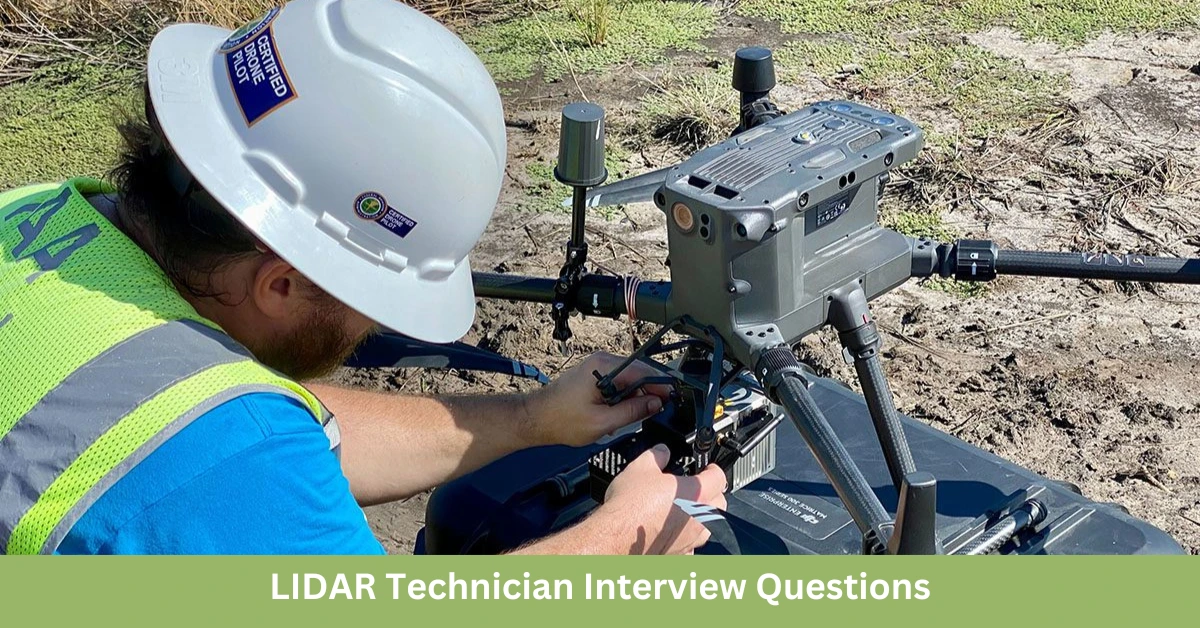
A LIDAR Technician is responsible for collecting, processing, and analyzing LIDAR (Light Detection and Ranging) data to create precise 3D maps and models. LIDAR is used in various industries, including forestry, environmental monitoring, and urban planning, for creating high-resolution topographical maps. If you’re preparing for a LIDAR Technician interview, these top 15 LIDAR Technician interview questions and answers will help you highlight your technical skills and experience. LIDAR Technician Interview Questions & Answers Here’s a comprehensive list of 15 LIDAR Technician Interview Questions & Answers along with detailed answers to help you prepare and impress your interviewers. 1. What is the role of a LIDAR Technician? Answer: A LIDAR Technician operates LIDAR systems to collect data from laser sensors, processes this data to create detailed 3D maps or models, and ensures the data’s accuracy and completeness for various applications, such as topography, forestry, and urban planning. 2. What types of LIDAR systems have you worked with? Answer: I have experience with several LIDAR systems, including: Terrestrial LIDAR for ground-based scanning. Aerial LIDAR mounted on drones or aircraft for large-scale mapping. Mobile LIDAR integrated into vehicles for road and infrastructure surveying. 3. What is the principle behind LIDAR technology? Answer: LIDAR works by emitting laser pulses from a sensor and measuring the time it takes for the pulses to bounce back from objects. This time-of-flight data is used to calculate distances and create precise 3D models of the scanned area. 4. How do you process and analyze LIDAR data? Answer: To process and analyze LIDAR data, I: Use software such as LIDAR360, CloudCompare, and ArcGIS to process raw point clouds. Clean and filter the data to remove noise and irrelevant information. Classify the point cloud into different categories like ground, vegetation, and buildings. Create digital elevation models (DEMs) or 3D models for further analysis. Read Also: Top 15 Cartography Technician Interview Questions and Answers 5. What is point cloud data, and how do you work with it? Answer: Point cloud data consists of a collection of data points in 3D space, each with an XYZ coordinate, representing the surface of an object or environment. I work with point clouds by: Importing them into specialized software. Applying classification algorithms to identify different features. Visualizing and converting point clouds into usable data formats like DEMs or 3D models. 6. What challenges do you face when working with LIDAR data, and how do you overcome them? Answer: Challenges include: Noise in data: I use filtering techniques to clean the data. Large data volumes: I use efficient processing software and break data into manageable chunks. Environmental factors: I ensure optimal scanning conditions and use multiple data sources for accuracy. Read Also: 15 Cartographic Drafter Interview Questions and Answers 7. What software tools are you proficient in for processing LIDAR data? Answer: I am proficient in several LIDAR processing tools, including: LAStools: For efficient LIDAR data processing and manipulation. ArcGIS: For creating maps and analyzing geospatial data. FUSION: A specialized tool for LIDAR data analysis. Global Mapper: For processing and visualizing point cloud data. 8. How do you ensure the accuracy of LIDAR data? Answer: To ensure data accuracy, I: Calibrate LIDAR sensors before each survey. Conduct ground truthing by comparing LIDAR data with physical measurements. Use control points or reference data to validate the results. Read Also: 15 Cartographic Designer Interview Questions 9. Can you explain the difference between airborne and terrestrial LIDAR? Answer: Airborne LIDAR is mounted on an aircraft or drone and is used for large-area surveys, such as mapping forests or topography. Terrestrial LIDAR is ground-based and used for detailed scanning of smaller areas, such as buildings or infrastructure. 10. How do you handle large datasets generated from LIDAR surveys? Answer: I handle large datasets by: Using high-performance computers and cloud storage for data management. Breaking down large datasets into smaller, manageable sections. Employing software that can handle big data efficiently, such as LAStools and CloudCompare. Read Also: Top 15 Cadastral Mapper Interview Questions 11. What are some common applications of LIDAR technology? Answer: LIDAR is used in a variety of fields, including: Topography and mapping: Creating precise 3D models and elevation maps. Forestry: Analyzing vegetation and forest structure. Archaeology: Mapping ancient structures and landscapes. Urban planning: Mapping infrastructure and planning for development. 12. How do you ensure that LIDAR data is compatible with other geospatial data? Answer: I ensure compatibility by: Standardizing coordinate systems across all datasets. Converting LIDAR data into widely accepted formats like LAS or LAZ. Integrating LIDAR data with GIS software for further analysis and visualization. Read Also: Top 17 Cartographer Interview Questions 13. How do you perform quality control during LIDAR data collection? Answer: I perform quality control by: Checking for calibration issues with the LIDAR system. Monitoring data collection conditions (e.g., weather, altitude). Verifying data completeness and accuracy during field surveys. 14. How do you work with field crews during LIDAR data collection? Answer: I coordinate with field crews to ensure that: Proper GPS equipment is used for ground control points. The LIDAR system is properly mounted and calibrated. Field data is accurately recorded and aligned with the LIDAR data collected. Read Also: 15 Must-Ask Interview Questions for Cartographer 15. Can you share a successful LIDAR project you’ve worked on? Answer: I worked on a project mapping coastal erosion, where we used airborne LIDAR to create detailed elevation models of the shoreline. The high-resolution data allowed for accurate assessments of erosion rates and helped inform conservation strategies. Conclusion A LIDAR Technician plays a critical role in collecting and processing LIDAR data for creating precise 3D models and maps. These top 15 LIDAR Technician interview questions and answers will help you prepare for an interview and demonstrate your expertise in LIDAR technology, data processing, and field operations. Stay connected for more career tips and insights into the world of geospatial technology!