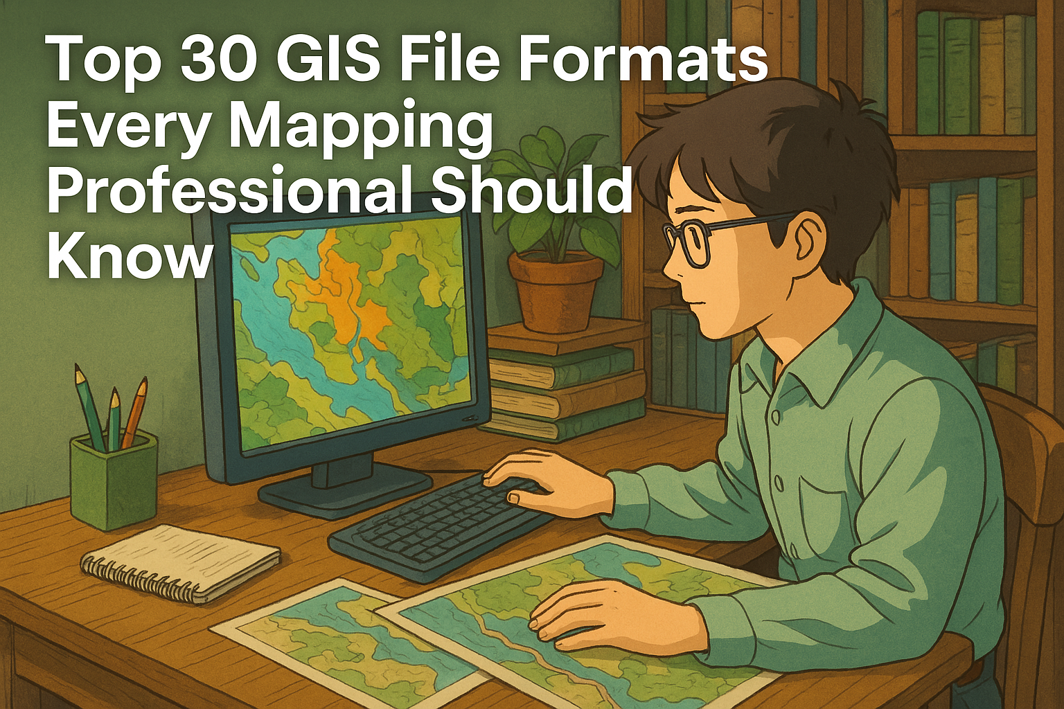
Top 30 GIS File Formats Every Mapping Professional Should Know

ChatGPT Image Apr 6 2025 06 49 02 PM

Whether you’re a GIS (Geographic Information System) professional, developer, or student, navigating the world of GIS file formats can feel overwhelming. With countless file types for vector, raster, spatial databases, and metadata, understanding which file format to use—and when—can drastically boost your productivity. In this comprehensive guide, we’ll break down 30 of the most commonly used GIS file formats, helping you decode their purpose, compatibility, and usage in modern mapping and spatial analysis workflows. 30 GIS File Formats 🔷 Vector File Formats Vector files store geographic features as points, lines, and polygons. These formats are perfect for boundaries, roads, rivers, and more. When working with spatial data, choosing the right vector file format is crucial. Vector formats represent geographic features using points, lines, and polygons, making them ideal for storing roads, boundaries, buildings, and other precise features. Let’s explore some of the most commonly used vector GIS file types, including their structure, use cases, and compatibility. 1. Shapefile (.shp, .shx, .dbf) The Shapefile is a widely used vector file format developed by Esri, and despite being introduced in the early 1990s, it’s still very popular. 🔍 Key Components: .shp – Stores geometry (points, lines, polygons) .shx – Shape index format for fast access .dbf – DBase file containing attribute data ✅ Advantages: Supported by nearly every GIS software (ArcGIS, QGIS, MapInfo, etc.) Simple and reliable for sharing vector data ⚠️ Limitations: No support for topology Attribute table has a 10-character field name limit Maximum file size ~2 GB 2. GeoJSON (.geojson) GeoJSON is an open-standard format based on JavaScript Object Notation (JSON). It represents geographic features and their attributes in a lightweight, human-readable structure. 🌍 Best For: Web mapping applications (Leaflet, Mapbox, OpenLayers) API data exchange and web-based visualizations ✅ Advantages: Easy to read and write Excellent for browser-based GIS applications Supports properties (attributes) along with geometry ⚠️ Limitations: Larger files may impact performance Doesn’t support complex topology 3. KML/KMZ (.kml, .kmz) KML (Keyhole Markup Language) and KMZ (its compressed version) were developed by Google for Google Earth. These are XML-based formats used to display geographic data in 3D. 🌍 Use Cases: Creating interactive maps Visualizing spatial features in 3D viewers Sharing geographic data in presentations ✅ Advantages: Easy to view in Google Earth/Maps Supports styling, pop-ups, and 3D visualizations ⚠️ Limitations: Not ideal for advanced GIS analysis Slower performance with large datasets 4. GeoPackage (.gpkg) GeoPackage (GPKG) is a modern, open-source format based on SQLite that can store vector, raster, and tile data in a single file. 🔧 Ideal For: Mobile GIS applications Offline mapping and data portability ✅ Advantages: All-in-one container (vector + raster) Fully OGC-compliant and platform-independent Faster performance and better scalability than shapefiles ⚠️ Limitations: Slightly larger learning curve for beginners Not supported by some legacy systems 5. CSV (.csv) Comma-Separated Values (CSV) files are not GIS-specific but are frequently used for storing tabular spatial data, especially when paired with coordinate columns (e.g., latitude/longitude). 🧭 Typical Use: Simple geocoding (e.g., plotting store locations) Joining tabular data with spatial datasets ✅ Advantages: Easy to create/edit in Excel, Notepad, Google Sheets Widely supported for quick imports ⚠️ Limitations: Cannot store complex geometry Needs coordinate columns for spatial use 6. GPX (.gpx) GPS Exchange Format (GPX) is an XML format designed specifically for sharing GPS data such as waypoints, tracks, and routes. 🚴 Use Cases: Outdoor recreation (hiking, cycling) GPS logging and route tracking Import/export from GPS devices ✅ Advantages: Supported by many fitness/GPS apps Easy to view and share track data ⚠️ Limitations: Limited attribute support Not suitable for complex GIS analysis 7. DWG (.dwg) DWG is the native file format for AutoCAD, primarily used in architectural and engineering design. It stores 2D and 3D vector data. 🛠️ Commonly Used By: Engineers, architects, and surveyors Infrastructure planning and CAD-GIS workflows ✅ Advantages: High precision Extensive CAD support ⚠️ Limitations: Limited GIS-specific functionality Requires conversion to use in most GIS tools 8. DXF (.dxf) Drawing Exchange Format (DXF) is a more open version of DWG, used to share AutoCAD data with other software, including GIS platforms. 🌐 Use Cases: CAD-to-GIS data exchange Importing building layouts or blueprints into GIS ✅ Advantages: Open format with wide support Easier to integrate into GIS than DWG ⚠️ Limitations: Still CAD-focused, not ideal for spatial analysis 9. GML (.gml) Geography Markup Language (GML) is an XML-based format developed by the OGC (Open Geospatial Consortium) for storing geographic data. 🔄 Best For: Interoperability and data sharing between different GIS platforms Web Feature Services (WFS) ✅ Advantages: Highly customizable Supports rich attribute data and geometry ⚠️ Limitations: Verbose and large file sizes Complex structure can be overwhelming for beginners 10. WKT/WKB (.wkt, .wkb) Well-Known Text (WKT) and Well-Known Binary (WKB) are formats used to represent geometry in a standard, database-friendly way. 📊 Ideal For: Spatial databases like PostGIS Storing geometry in tabular formats ✅ Advantages: Simple to parse and store Great for database integration ⚠️ Limitations: No styling or attribute metadata Not standalone GIS data formats 11. XLS/XLSX (Excel) Excel files are not traditional GIS formats, but they’re often used to store coordinates and attribute data before being imported into GIS software. 🧮 Use Cases: Storing survey data Mapping address or point data ✅ Advantages: Familiar interface for non-GIS users Supports advanced formatting and formulas ⚠️ Limitations: Needs conversion to proper GIS formats for spatial analysis Cannot natively store spatial geometry Related Content: Top 25 GIS Research Ideas for 2025 16 Best GIS YouTube Channels to Learn and Stay Updated 20 Best Remote Sensing Software for Professionals 10 Best Free LiDAR Software Tools and Viewers 🟩 Raster File Formats Raster formats store data in pixel-based grids. Best used for satellite images, elevation models, and environmental data. Raster GIS data represents the world in a grid of pixels, where each cell holds a value—commonly used for elevation, imagery, land cover, and environmental modeling. Below are six powerful raster file formats used in geospatial analysis, remote sensing, and scientific research. 1. Esri Grid (.adf) Type: Proprietary … Read more
Top 25 GIS Research Ideas for 2025

GIS Research Ideas

Geographic Information Systems (GIS) continue to revolutionize various industries, from environmental conservation to urban planning. As technology advances, researchers are exploring new ways to leverage GIS for data analysis, predictive modeling, and sustainability. If you are looking for innovative GIS research topics for 2025, here are the top 10 ideas that can make a significant impact: Top 25 GIS Research Ideas Here are listed top 25+ GIS Research Idea for 2025: 1. GIS for Climate Change Analysis Climate change is a pressing global issue, and GIS plays a crucial role in assessing its impacts on different ecosystems. Researchers can use GIS to analyze temperature variations, predict extreme weather patterns, and develop mitigation strategies for climate resilience. 2. Urban Heat Island Mapping With rapid urbanization, cities are experiencing increased temperatures due to the heat island effect. Using GIS, researchers can map and analyze urban heat islands (UHIs), identify high-risk zones, and propose green infrastructure solutions to reduce heat stress. 3. Flood Risk Assessment Using GIS Flooding remains a major threat to many regions worldwide. GIS and remote sensing can help researchers predict flood-prone areas, analyze historical flood data, and develop disaster mitigation strategies for better preparedness. 4. GIS in Sustainable Urban Planning Smart city development relies on data-driven urban planning. GIS can optimize land use, enhance transportation networks, and ensure sustainable infrastructure development while minimizing environmental degradation. Related Content: 16 Best GIS YouTube Channels to Learn and Stay Updated 20 Best Remote Sensing Software for Professionals 10 Best Free LiDAR Software Tools and Viewers 5. Spatio-Temporal Analysis of Population Growth Demographic shifts significantly impact urban development and resource allocation. GIS-based spatio-temporal analysis can help researchers track population growth, migration trends, and urban expansion, leading to better policy decisions. 6. Groundwater Mapping Using GIS Water scarcity is a growing concern worldwide. GIS tools can be used to analyze groundwater availability, predict water distribution, and identify suitable locations for water conservation projects. 7. Soil Erosion Mapping with GIS Soil erosion affects agriculture, water quality, and land stability. Using GIS, researchers can predict soil erosion-prone areas, assess land degradation, and implement soil conservation measures to protect agricultural productivity. 8. Remote Sensing for Forest Monitoring Deforestation and forest degradation are major environmental threats. GIS and remote sensing technologies can be used to monitor forest cover changes, track illegal logging activities, and support reforestation efforts. 9. GIS in Crime Pattern Analysis Law enforcement agencies are increasingly relying on GIS for crime mapping and predictive analysis. Researchers can study crime trends, identify high-crime areas, and propose data-driven strategies for improving public safety. 10. GIS in Oil Spill Detection and Management Oil spills have devastating effects on marine ecosystems. GIS can assist in detecting oil spills, tracking their movement, and developing effective response strategies to minimize environmental damage. 11. Geospatial Analysis of Renewable Energy Sites As the world shifts towards sustainable energy, GIS plays a crucial role in identifying optimal locations for wind farms and solar power plants. Researchers can analyze terrain, climate conditions, and land suitability to maximize energy production while minimizing environmental impact. 12. GIS for Coastal Zone Management Coastal areas are highly vulnerable to erosion, flooding, and climate change. GIS can help researchers assess coastal changes, monitor shoreline dynamics, and develop conservation strategies to protect marine ecosystems and coastal communities. 13. GIS and Green Infrastructure Green infrastructure, such as parks, green roofs, and urban forests, is essential for sustainable urban development. GIS can be used to design and optimize these spaces, enhancing environmental benefits like air quality improvement and stormwater management. 14. 3D GIS and Urban Modeling The integration of 3D GIS is transforming city planning and disaster risk assessment. Researchers can use 3D models to simulate urban expansion, analyze infrastructure resilience, and plan for smart cities. 15. Land Use/Land Cover Change Detection Monitoring land use and land cover (LULC) changes is crucial for environmental sustainability. GIS and remote sensing can track deforestation, urban sprawl, and agricultural expansion, providing insights for land management policies. 16. GIS and Archaeological Mapping Archaeologists are increasingly using GIS to map and analyze ancient sites. GIS can help in identifying potential excavation locations, studying historical landscapes, and preserving cultural heritage sites. 17. Mapping Socio-Economic Inequality GIS can be a powerful tool for visualizing economic disparities across different regions. Researchers can analyze income distribution, access to healthcare, and education levels, leading to more effective policymaking and resource allocation. 18. GIS for Cultural Heritage Preservation Many historical sites face threats from urbanization, natural disasters, and climate change. GIS can assist in mapping and documenting cultural heritage locations, enabling better conservation and restoration efforts. 19. GIS in Agricultural Productivity Precision agriculture relies heavily on GIS for analyzing soil health, crop yields, and irrigation patterns. Researchers can use GIS to optimize farming practices, improve food security, and promote sustainable agriculture. 20. GIS in Water Resource Management With increasing water scarcity, GIS is essential for tracking water availability, mapping watersheds, and planning efficient water management strategies. This research can help ensure sustainable water use for agriculture, industry, and households. 21. Spatial Analysis of Air Quality Air pollution is a major health and environmental concern globally. By integrating GIS with remote sensing data, researchers can monitor pollution sources, analyze air quality trends, and identify high-risk zones. This helps policymakers implement effective mitigation strategies and improve public health outcomes. Research Tip: Combine satellite data (like Sentinel-5P) with local sensor readings for high-resolution mapping. 22. GIS in Environmental Impact Assessment (EIA) Environmental Impact Assessments are crucial for sustainable development. GIS can streamline the EIA process by modeling how proposed projects (like highways, dams, or industries) may affect ecosystems. Researchers can visualize potential impacts, compare scenarios, and support decision-makers in choosing the least harmful development path. Why It Matters: With rapid infrastructure growth, EIAs using GIS can ensure responsible development. 23. Forest Fire Risk Mapping As climate change intensifies, forest fires are becoming more frequent and destructive. GIS can model fire-prone zones by analyzing historical data, vegetation type, slope, and weather patterns. This research is vital for early … Read more

Global Mapper Reviews 2025: Details, Pricing, & Features

Global Mapper

Looking for powerful GIS software that combines simplicity and versatility? Global Mapper has earned its reputation as a go-to tool for spatial data professionals and enthusiasts alike. Known for its user-friendly interface and comprehensive features, it supports a wide range of GIS applications, from map creation and analysis to data management. Whether you’re managing large datasets or exploring advanced 3D visualization, Global Mapper offers a cost-effective solution for all your geospatial needs. In this review, we’ll dive into the features, pricing, and overall performance of Global Mapper in 2025, helping you decide if it’s the right choice for your GIS projects. Global Mapper Review Global Mapper is a robust and versatile GIS software designed for both novice users and seasoned professionals. Developed by Blue Marble Geographics, it is widely recognized for its ease of use, affordability, and powerful geospatial data processing capabilities. Whether you’re working on basic map creation, advanced spatial analysis, or 3D visualization, Global Mapper delivers a range of tools that meet diverse GIS needs. From its ability to handle massive datasets to its compatibility with various file formats, Global Mapper simplifies geospatial workflows without compromising on functionality. Additionally, its intuitive interface makes it accessible for users at all levels, while its rich set of features appeals to those tackling complex geospatial challenges. Get Global Mapper 30-day Free Trial Rating: 4.6/5 Pros and Cons of Global Mapper Pros User-Friendly Interface: Designed with simplicity in mind, Global Mapper caters to both beginners and professionals, offering intuitive navigation and streamlined workflows. Extensive File Format Support: The software supports over 300 file formats, enabling seamless data integration from various sources without compatibility concerns. Powerful Data Visualization: With 2D and 3D mapping capabilities, users can create stunning visualizations for terrain modeling, analysis, and presentations. Affordable Pricing: Compared to other GIS solutions, Global Mapper provides a cost-effective option without compromising on essential features. Advanced Terrain Analysis: Tools for contour generation, watershed analysis, and volume calculations make it ideal for topographic and geospatial studies. Flexible Licensing Options: Offers perpetual licenses and subscription models to suit different budget and usage needs. Cons Limited Advanced GIS Features: While robust for general use, it may lack some advanced tools found in higher-end GIS platforms like ArcGIS Pro. Steeper Learning Curve for Complex Tasks: Beginners might find it challenging to perform advanced geospatial analyses without prior GIS knowledge. Lacks Integrated Cloud Capabilities: Unlike competitors, Global Mapper doesn’t offer seamless cloud integration for data storage and collaboration. Custom Script Support: Though functional, its scripting capabilities may not be as advanced or versatile as other GIS platforms for automation. Less Community Support: While Global Mapper has a loyal user base, it doesn’t have the same extensive community forums or third-party resources as larger GIS software. Read Also: GRASS GIS Reviews 2025 & Product Details – GIS Software Key Features of Global Mapper 1. Wide File Format Support Supports over 300 geospatial file formats, ensuring compatibility with diverse datasets and easy integration into workflows. 2. 3D Data Visualization and Analysis Offers powerful tools for rendering, analyzing, and editing 3D data, such as terrain models, point clouds, and LiDAR data. 3. Terrain and Topographic Analysis Features contour generation, slope analysis, watershed delineation, and cut-and-fill calculations for detailed terrain studies. 4. Raster and Vector Data Processing Provides robust tools for editing, analyzing, and converting raster and vector datasets. 5. Advanced LiDAR Processing Includes classification, feature extraction, and visualization tools for working with LiDAR and other point cloud datasets. 6. GIS Data Creation and Editing Enables users to create custom maps, edit shapefiles, and manage geospatial data with precision and ease. 7. Thematic Mapping Tools for creating compelling thematic maps using data-driven symbology and customizable layouts. 8. Powerful Analysis Tools Conducts spatial analysis, including buffer zones, line-of-sight, and viewshed analysis, for a wide range of applications. 9. Image Rectification and Georeferencing Allows users to georeference and rectify raster images to align with geographic coordinates for accurate mapping. 10. GPS and Mobile Data Integration Supports real-time GPS tracking and importing data from mobile devices, enhancing field-to-office workflows. 11. Batch Processing Automates repetitive tasks, such as data conversion or analysis, for improved efficiency and time savings. 12. Affordable Licensing Options Offers flexible licensing models, including perpetual and subscription-based options, tailored to different needs. 13. Customizable Scripting Provides scripting tools to automate processes and streamline workflows using the Global Mapper scripting language. Read Also: ArcGIS Enterprise Review: Unleashing the Power of GIS for Organizations History of Global Mapper Early Beginnings (1990s): Global Mapper started as a mapping tool developed by USGS (U.S. Geological Survey) to visualize terrain data. Originally named DLG Viewer, it was designed for viewing Digital Line Graph (DLG) data formats. Transformation into Global Mapper (2001): Mike Childs, a software engineer, acquired the source code and rebranded it as Global Mapper. The software was enhanced to support multiple file formats, making it more versatile and appealing to GIS professionals. Early Development (2001–2010): Rapidly gained popularity due to its ability to handle over 300 geospatial formats. Known for being user-friendly and affordable compared to competitors like ArcGIS. Introduced advanced features such as terrain visualization, raster manipulation, and basic GIS analysis. Acquisition by Blue Marble Geographics (2011): Global Mapper was acquired by Blue Marble Geographics, a leader in GIS and geodetic software. This marked a significant milestone, with Blue Marble focusing on integrating cutting-edge geospatial technologies into the software. Advancements and Innovations (2011–2015): Integrated LiDAR processing and 3D visualization tools, catering to industries requiring high-precision mapping. Added tools for georeferencing, watershed analysis, and thematic mapping. Transitioned to 64-bit architecture for improved performance. Wider Adoption (2016–2020): Global Mapper became a go-to solution for industries like forestry, mining, agriculture, and urban planning. Introduced batch processing and scripting capabilities to enhance automation and efficiency. Continued support for cutting-edge formats like UAV (drone) imagery and real-time GPS integration. Recent Developments (2021–2024): Focused on improving the user interface and adding advanced spatial analysis tools. Enhanced capabilities for mobile data integration and cloud compatibility for seamless field-to-office workflows. Released regular updates to … Read more

ArcMap Review: A Comprehensive Overview of a GIS Classic

ArcMap

ArcMap, the desktop component of Esri’s ArcGIS suite, has been a cornerstone of geographic information systems (GIS) for years. Widely praised for its powerful data analysis, mapping, and spatial analysis capabilities, ArcMap has been the go-to tool for professionals across various industries, from environmental science to urban planning. While newer software like ArcGIS Pro is gaining traction, ArcMap continues to hold significant value for those who require robust GIS tools and a user-friendly interface. In this review, we’ll dive into its features, strengths, limitations, and best use cases, helping you understand whether ArcMap still fits your GIS needs in the modern world of geospatial technology. ArcMap Review ArcMap, a core application within the ArcGIS suite by Esri, has long been a leading choice for geospatial professionals. Known for its robust mapping, spatial analysis, and data management capabilities, ArcMap has been a staple in the GIS industry for years. Despite the emergence of newer software like ArcGIS Pro, ArcMap remains a powerful tool for professionals working with geographic data across various sectors such as urban planning, environmental research, and natural resource management.   GO TO ArcMAP Rating: 4.7/5 ArcMap Overview ArcMap is a desktop-based GIS application that enables users to create, view, analyze, and manage geographic data through maps. It offers a comprehensive set of tools for visualizing spatial information, conducting spatial analysis, and generating high-quality cartographic outputs. With its robust capabilities, ArcMap allows users to manipulate and process both vector and raster data, making it an essential tool for professionals working in various fields of geospatial analysis and mapping. Some of the key features and capabilities of ArcMap include: Mapping and Visualization ArcMap provides robust tools for creating detailed and customized maps. It supports both vector and raster data, allowing you to visualize geographic features with clarity and precision. Users can create high-quality cartographic outputs for print and digital media, customizing every aspect of map design. Spatial Analysis and Geoprocessing One of ArcMap’s standout features is its powerful spatial analysis capabilities. It offers an extensive suite of tools for performing complex spatial operations, such as overlay analysis, proximity analysis, buffering, and statistical modeling. These tools help users make informed decisions based on geographic data. Georeferencing ArcMap makes it easy to align maps or aerial imagery with a known coordinate system. The georeferencing tools allow users to map images with known geographic coordinates and integrate them into a GIS project for further analysis. Data Management and Editing ArcMap provides comprehensive tools for managing, editing, and processing geospatial data. Whether working with vector data (such as shapefiles) or raster data (such as satellite images), users can easily manipulate and update datasets to ensure their maps are accurate and up-to-date. Geodatabase Integration ArcMap is tightly integrated with Esri’s geodatabase model, allowing for efficient data management. It supports both personal and enterprise geodatabases, enabling multi-user environments for collaborative projects and complex data management tasks. ModelBuilder and Automation ArcMap includes ModelBuilder, a tool that lets users automate complex workflows by building custom models using a visual interface. This is particularly useful for performing repetitive tasks, creating batch processes, and automating spatial analysis. Customizable Symbology and Labeling ArcMap offers advanced symbology and labeling features that allow users to visually represent geographic data in a way that is both functional and aesthetically pleasing. Custom symbols, color ramps, and label styles help create maps that convey the desired information clearly and effectively. Support for Raster Data ArcMap excels at working with raster data, including satellite imagery, aerial photography, and digital elevation models (DEMs). The software provides tools for raster analysis, including classification, reclassification, and surface analysis, among others. Print Layouts and Map Production ArcMap has robust capabilities for map production, offering detailed print layouts with options for adding legends, north arrows, scale bars, and other map elements. This makes it ideal for producing professional-quality maps for reports, presentations, or fieldwork. Advanced Cartographic Design Users can fine-tune their map design with advanced cartographic tools in ArcMap, including options for map projections, coordinate systems, and layout elements. This ensures that the final map product meets high standards for both visual appeal and accuracy. Read Also: ERDAS Imagine – Revolutionizing Geospatial Imaging and Analysis ArcMap History 1999: ArcMap was first introduced as part of the ArcGIS software suite by Esri, aimed at providing a powerful desktop GIS platform. Early 2000s: Quickly became a widely used tool for mapping, spatial analysis, and geospatial data management across industries such as urban planning, environmental science, and government. 2003: ArcMap started to integrate advanced geoprocessing and spatial analysis tools, allowing users to perform complex operations on both raster and vector data. 2007: Introduced the ability to automate workflows using ModelBuilder, enhancing efficiency and usability for complex GIS tasks. 2010s: ArcMap’s tools evolved to support high-quality cartographic outputs, enabling professionals to create visually appealing and precise maps for print and digital use. 2015: Esri launched ArcGIS Pro, a new 64-bit, multi-threaded application with modern features, marking the beginning of a gradual shift towards the new platform. Late 2010s: Despite the release of ArcGIS Pro, ArcMap remained widely used, especially in legacy workflows and by organizations that were accustomed to its interface. 2020s: Esri continued to support ArcMap while encouraging users to transition to ArcGIS Pro, which offers more advanced capabilities, better performance, and enhanced integration with cloud-based tools. Strengths of ArcMap Comprehensive GIS Tools: ArcMap provides a wide range of tools for spatial analysis, data visualization, geospatial data management, and cartography, making it a versatile platform for GIS professionals. Advanced Spatial Analysis: It offers powerful geoprocessing tools for analyzing spatial data, from basic overlays to complex operations like buffering, interpolation, and surface analysis. High-Quality Cartography: ArcMap excels in creating high-quality, detailed maps with advanced symbology options, customizable map layouts, and printing capabilities, making it a go-to tool for producing professional cartographic outputs. Compatibility with Various Data Formats: ArcMap supports a wide variety of data formats, including both raster and vector data, and integrates seamlessly with Esri’s file formats like shapefiles, geodatabases, and raster datasets. Customizability: … Read more