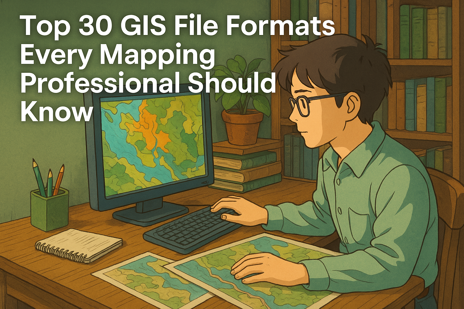
Top 30 GIS File Formats Every Mapping Professional Should Know

ChatGPT Image Apr 6 2025 06 49 02 PM

Whether you’re a GIS (Geographic Information System) professional, developer, or student, navigating the world of GIS file formats can feel overwhelming. With countless file types for vector, raster, spatial databases, and metadata, understanding which file format to use—and when—can drastically boost your productivity. In this comprehensive guide, we’ll break down 30 of the most commonly used GIS file formats, helping you decode their purpose, compatibility, and usage in modern mapping and spatial analysis workflows. 30 GIS File Formats 🔷 Vector File Formats Vector files store geographic features as points, lines, and polygons. These formats are perfect for boundaries, roads, rivers, and more. When working with spatial data, choosing the right vector file format is crucial. Vector formats represent geographic features using points, lines, and polygons, making them ideal for storing roads, boundaries, buildings, and other precise features. Let’s explore some of the most commonly used vector GIS file types, including their structure, use cases, and compatibility. 1. Shapefile (.shp, .shx, .dbf) The Shapefile is a widely used vector file format developed by Esri, and despite being introduced in the early 1990s, it’s still very popular. 🔍 Key Components: .shp – Stores geometry (points, lines, polygons) .shx – Shape index format for fast access .dbf – DBase file containing attribute data ✅ Advantages: Supported by nearly every GIS software (ArcGIS, QGIS, MapInfo, etc.) Simple and reliable for sharing vector data ⚠️ Limitations: No support for topology Attribute table has a 10-character field name limit Maximum file size ~2 GB 2. GeoJSON (.geojson) GeoJSON is an open-standard format based on JavaScript Object Notation (JSON). It represents geographic features and their attributes in a lightweight, human-readable structure. 🌍 Best For: Web mapping applications (Leaflet, Mapbox, OpenLayers) API data exchange and web-based visualizations ✅ Advantages: Easy to read and write Excellent for browser-based GIS applications Supports properties (attributes) along with geometry ⚠️ Limitations: Larger files may impact performance Doesn’t support complex topology 3. KML/KMZ (.kml, .kmz) KML (Keyhole Markup Language) and KMZ (its compressed version) were developed by Google for Google Earth. These are XML-based formats used to display geographic data in 3D. 🌍 Use Cases: Creating interactive maps Visualizing spatial features in 3D viewers Sharing geographic data in presentations ✅ Advantages: Easy to view in Google Earth/Maps Supports styling, pop-ups, and 3D visualizations ⚠️ Limitations: Not ideal for advanced GIS analysis Slower performance with large datasets 4. GeoPackage (.gpkg) GeoPackage (GPKG) is a modern, open-source format based on SQLite that can store vector, raster, and tile data in a single file. 🔧 Ideal For: Mobile GIS applications Offline mapping and data portability ✅ Advantages: All-in-one container (vector + raster) Fully OGC-compliant and platform-independent Faster performance and better scalability than shapefiles ⚠️ Limitations: Slightly larger learning curve for beginners Not supported by some legacy systems 5. CSV (.csv) Comma-Separated Values (CSV) files are not GIS-specific but are frequently used for storing tabular spatial data, especially when paired with coordinate columns (e.g., latitude/longitude). 🧭 Typical Use: Simple geocoding (e.g., plotting store locations) Joining tabular data with spatial datasets ✅ Advantages: Easy to create/edit in Excel, Notepad, Google Sheets Widely supported for quick imports ⚠️ Limitations: Cannot store complex geometry Needs coordinate columns for spatial use 6. GPX (.gpx) GPS Exchange Format (GPX) is an XML format designed specifically for sharing GPS data such as waypoints, tracks, and routes. 🚴 Use Cases: Outdoor recreation (hiking, cycling) GPS logging and route tracking Import/export from GPS devices ✅ Advantages: Supported by many fitness/GPS apps Easy to view and share track data ⚠️ Limitations: Limited attribute support Not suitable for complex GIS analysis 7. DWG (.dwg) DWG is the native file format for AutoCAD, primarily used in architectural and engineering design. It stores 2D and 3D vector data. 🛠️ Commonly Used By: Engineers, architects, and surveyors Infrastructure planning and CAD-GIS workflows ✅ Advantages: High precision Extensive CAD support ⚠️ Limitations: Limited GIS-specific functionality Requires conversion to use in most GIS tools 8. DXF (.dxf) Drawing Exchange Format (DXF) is a more open version of DWG, used to share AutoCAD data with other software, including GIS platforms. 🌐 Use Cases: CAD-to-GIS data exchange Importing building layouts or blueprints into GIS ✅ Advantages: Open format with wide support Easier to integrate into GIS than DWG ⚠️ Limitations: Still CAD-focused, not ideal for spatial analysis 9. GML (.gml) Geography Markup Language (GML) is an XML-based format developed by the OGC (Open Geospatial Consortium) for storing geographic data. 🔄 Best For: Interoperability and data sharing between different GIS platforms Web Feature Services (WFS) ✅ Advantages: Highly customizable Supports rich attribute data and geometry ⚠️ Limitations: Verbose and large file sizes Complex structure can be overwhelming for beginners 10. WKT/WKB (.wkt, .wkb) Well-Known Text (WKT) and Well-Known Binary (WKB) are formats used to represent geometry in a standard, database-friendly way. 📊 Ideal For: Spatial databases like PostGIS Storing geometry in tabular formats ✅ Advantages: Simple to parse and store Great for database integration ⚠️ Limitations: No styling or attribute metadata Not standalone GIS data formats 11. XLS/XLSX (Excel) Excel files are not traditional GIS formats, but they’re often used to store coordinates and attribute data before being imported into GIS software. 🧮 Use Cases: Storing survey data Mapping address or point data ✅ Advantages: Familiar interface for non-GIS users Supports advanced formatting and formulas ⚠️ Limitations: Needs conversion to proper GIS formats for spatial analysis Cannot natively store spatial geometry Related Content: Top 25 GIS Research Ideas for 2025 16 Best GIS YouTube Channels to Learn and Stay Updated 20 Best Remote Sensing Software for Professionals 10 Best Free LiDAR Software Tools and Viewers 🟩 Raster File Formats Raster formats store data in pixel-based grids. Best used for satellite images, elevation models, and environmental data. Raster GIS data represents the world in a grid of pixels, where each cell holds a value—commonly used for elevation, imagery, land cover, and environmental modeling. Below are six powerful raster file formats used in geospatial analysis, remote sensing, and scientific research. 1. Esri Grid (.adf) Type: Proprietary … Read more
AutoCAD Map 3D – GIS and CAD Fusion

AutoCAD Map 3D

AutoCAD Map 3D seamlessly combines the power of GIS and CAD, offering a unique solution for professionals who need to work with both geospatial and design data. This tool integrates mapping and spatial analysis with traditional CAD features, enabling users to visualize, analyze, and edit spatial data within the familiar AutoCAD environment. Whether you’re in urban planning, infrastructure design, or asset management, AutoCAD Map 3D offers the tools to streamline workflows and enhance collaboration. In this review, we’ll dive into its key features, pricing, pros and cons, and help you determine if it’s the right solution for your projects. AutoCAD Map 3D Review AutoCAD Map 3D is a powerful GIS and CAD software solution that blends the technical capabilities of AutoCAD with advanced mapping and geospatial analysis tools. Aimed at professionals in various industries, including urban planning, civil engineering, and infrastructure development, AutoCAD Map 3D provides a unified platform for creating, managing, and analyzing geospatial data. AutoCAD Map 3D 30-Day Free Trial Rating: 4.6/5 Pros and Cons of AutoCAD Map 3D Pros All-in-One Solution: The combination of GIS and CAD tools in one software makes AutoCAD Map 3D a versatile choice for professionals who need to work with both types of data. Intuitive Interface: The software retains AutoCAD’s familiar user interface, which helps users transition to AutoCAD Map 3D with ease, reducing the learning curve. Customization: AutoCAD Map 3D is highly customizable, allowing users to tailor the software to their specific needs through custom tools and scripts. Strong Data Management Capabilities: AutoCAD Map 3D excels in managing large datasets, ensuring users can handle complex projects without performance issues. Cons Cost: AutoCAD Map 3D can be expensive, especially for small businesses or individuals. The pricing may be a barrier for those on tight budgets. Complexity for Beginners: While the software is powerful, its many features and capabilities can be overwhelming for new users, especially those without a strong GIS or CAD background. Limited 3D Visualization Tools: Compared to other 3D modeling software, AutoCAD Map 3D’s 3D visualization capabilities are somewhat limited, which may be a drawback for users who require more advanced 3D features. Read Also: SAGA GIS Reviews 2025: Details, Pricing, & Features Key Features of AutoCAD Map 3D Seamless GIS and CAD Integration: AutoCAD Map 3D allows users to work with both CAD designs and GIS data in one environment. This integration helps users visualize spatial data and incorporate geographic context into their CAD projects. Geospatial Data Management: Users can connect to various geospatial data sources, such as shapefiles, rasters, and databases, to manage and analyze large volumes of spatial data efficiently. Advanced Mapping Tools: AutoCAD Map 3D includes a wide range of tools for map creation, spatial analysis, and data management, allowing users to generate detailed, customized maps with ease. Data Connectivity: The software allows users to connect to external databases and geospatial sources, ensuring that all project data remains up-to-date and integrated across platforms. Infrastructure and Asset Management: With built-in tools for asset management, users can track, manage, and maintain infrastructure projects more effectively by tying spatial data to CAD models. Read Also: Global Mapper Reviews 2025: Details, Pricing, & Features CAD and GIS Fusion AutoCAD Map 3D effectively combines the functionalities of both CAD and GIS, offering powerful tools for mapping, spatial analysis, and data management. The software provides a ribbon-based interface with dedicated tabs for tasks like map layout design, GIS analysis, and feature editing, making it easier for users to navigate between different functions. While AutoCAD Map 3D provides capabilities for both CAD and GIS workflows, it doesn’t specialize in either field exclusively. Instead, it serves as a bridge, offering essential features from both disciplines. For users looking to enhance its GIS capabilities, the ArcGIS for AutoCAD plugin can be used to improve interoperability, allowing seamless integration of GIS data and image services for enhanced editing and spatial analysis. Read Also: MapInfo Pro Reviews 2025: Details, Pricing, & Features History of AutoCAD Map 3D AutoCAD Map 3D, developed by Autodesk, has evolved significantly since its inception to become one of the leading tools for integrating GIS (Geographic Information Systems) and CAD (Computer-Aided Design) in a single platform. Here is a brief history of how AutoCAD Map 3D came to be: Early Beginnings – 2000s: AutoCAD Map 3D was first introduced in the early 2000s, initially as a standalone GIS product designed to complement Autodesk’s core AutoCAD software. Its purpose was to provide users with tools to integrate geospatial data into their AutoCAD drawings. The initial versions focused on enhancing map production, spatial analysis, and providing access to geographic data from a variety of sources, such as shapefiles and databases. 2004 – First Major Version: In 2004, AutoCAD Map 3D saw its first significant upgrade. This version allowed for the creation of more sophisticated maps, leveraging AutoCAD’s existing drafting tools while adding GIS-specific functionalities. Users could now directly manipulate and manage geospatial data, allowing for smoother integration of maps into the design process. The integration of Map 3D into AutoCAD’s existing ecosystem made it a practical choice for industries where both CAD and GIS tools were essential. 2007 – Integration with Autodesk Infrastructure Solutions: AutoCAD Map 3D began to integrate more tightly with other Autodesk solutions, such as AutoCAD Civil 3D, for infrastructure design and management. This enabled better coordination between mapping, design, and project management teams. The software also expanded its capabilities to include geospatial database connectivity, which allowed users to interact with spatial data stored in databases such as Oracle Spatial or Microsoft SQL Server. 2010 – Expanded GIS Capabilities: By 2010, AutoCAD Map 3D had grown to include advanced GIS capabilities, such as the ability to perform spatial analysis, manage large datasets, and perform geospatial data processing tasks. These updates were crucial for users in the utilities, transportation, and urban planning sectors, where the need for combining GIS data with engineering designs was more critical than ever. 2013 – Continued Enhancements: In subsequent releases, Autodesk continued to add functionality and improve … Read more

ArcGIS Enterprise Review: Unleashing the Power of GIS for Organizations

ArcGIS Enterprise

In today’s data-driven world, organizations need robust and scalable solutions to manage, analyze, and share geospatial data effectively. ArcGIS Enterprise from Esri offers a comprehensive platform designed to help organizations unlock the full potential of geographic information systems (GIS). Whether you’re in government, business, education, or non-profit sectors, ArcGIS Enterprise empowers you to create, analyze, and manage maps and spatial data at scale. In this review, we’ll dive into the core features of ArcGIS Enterprise, explore its capabilities for managing complex GIS workflows, and discuss how it can benefit organizations of all sizes. From data storage and sharing to advanced spatial analysis and cloud-based integration, ArcGIS Enterprise is a powerful tool that enables collaborative decision-making and enhances operational efficiency. Let’s explore how this enterprise GIS solution can elevate your organization’s GIS capabilities. ArcGIS Enterprise Review ArcGIS Enterprise is a robust GIS platform developed by Esri, designed for organizations that need to deploy, manage, and share geospatial data at scale. This enterprise-level solution enables users to perform advanced mapping, spatial analysis, and real-time data integration, all within a collaborative environment. Whether you’re managing large datasets, creating web maps and apps, or empowering decision-makers with spatial intelligence, ArcGIS Enterprise offers the tools and flexibility needed to leverage geographic data across various industries. GO TO ArcGIS Enterprise Rating: 4.6/5 Key Features of ArcGIS Enterprise Centralized GIS Management ArcGIS Enterprise allows you to centralize your GIS workflows, data storage, and applications in one secure environment. It provides an integrated solution for managing data, users, and permissions, ensuring seamless collaboration across teams and departments. Advanced Spatial Analysis and Mapping With ArcGIS Enterprise, users can create detailed and dynamic maps and perform complex spatial analysis to inform decision-making. The platform supports a range of geospatial data formats and provides tools for creating sophisticated geospatial models and visualizations. Web and Mobile Integration ArcGIS Enterprise enables users to deploy GIS apps for the web and mobile devices. With easy integration into cloud-based platforms, users can access spatial data anytime, anywhere, making it ideal for field operations and remote access. Real-Time Data and Dashboards ArcGIS Enterprise supports real-time data integration, allowing organizations to monitor and analyze live data streams, track assets, and visualize real-time insights through dashboards. This is particularly useful for industries that require up-to-the-minute data, such as transportation, utilities, and emergency services. Security and Customization With enterprise-level security features, ArcGIS Enterprise ensures that sensitive data is protected. The platform also offers customization options, allowing users to tailor applications, data workflows, and user experiences to suit their specific needs. Read Also: ArcMap Review: A Comprehensive Overview of a GIS Classic ArcGIS Enterprise History ArcGIS Enterprise, a core component of Esri’s suite of geographic information system (GIS) solutions, has evolved over several decades to become a comprehensive platform for spatial data management, analysis, and sharing. Here is a brief history of ArcGIS Enterprise: Early Beginnings: ArcView and ArcGIS Desktop (1990s-2000s) Esri’s journey into enterprise GIS began with the release of ArcView in the 1990s, a desktop application that allowed users to view and analyze spatial data. During this time, Esri was also developing ArcGIS Desktop (introduced in 2000), which became the foundation for future developments. ArcGIS Desktop consisted of multiple applications like ArcMap, ArcCatalog, and ArcScene, providing users with powerful tools for spatial analysis, mapping, and data management. The Rise of ArcGIS Server (2004) As GIS needs expanded, organizations required more robust, server-based solutions to handle large datasets and facilitate web-based access. In 2004, Esri introduced ArcGIS Server, a server-based platform that allowed organizations to deploy GIS services over the web. ArcGIS Server allowed users to share maps, spatial data, and GIS functionality across the enterprise, marking the early steps toward what would eventually become ArcGIS Enterprise. Launch of ArcGIS Enterprise (2015) In 2015, Esri officially launched ArcGIS Enterprise, integrating the capabilities of ArcGIS Server, Portal for ArcGIS, and ArcGIS Data Store into a single, unified platform. ArcGIS Enterprise allowed organizations to deploy, manage, and share GIS data in both cloud and on-premise environments. The addition of Portal for ArcGIS provided web-based mapping and collaboration tools, while ArcGIS Data Store ensured that data storage and management were optimized for enterprise workflows. Integration with Cloud and Web Services (2016-2017) As cloud computing became more widespread, Esri adapted ArcGIS Enterprise to support both on-premise and cloud environments. In 2016, Esri began offering ArcGIS Enterprise as part of the Esri Cloud platform, giving users the flexibility to host their GIS data and services on their own infrastructure or in the cloud. The introduction of ArcGIS Online integration enabled users to leverage cloud-based services and apps alongside their ArcGIS Enterprise systems. Continuous Enhancements and Innovations (2018-Present) Since its launch, Esri has continuously enhanced ArcGIS Enterprise by adding features like real-time data streaming, advanced analytics, and improved user interfaces. The integration of tools such as ArcGIS Pro for advanced desktop GIS and ArcGIS Insights for business intelligence analysis has solidified ArcGIS Enterprise as a comprehensive GIS platform for managing and sharing spatial data. Esri has also continued to focus on streamlining data management, improving security features, and providing greater scalability to support larger datasets and user bases. ArcGIS Enterprise 10.8 and Beyond (2020s) The release of ArcGIS Enterprise 10.8 brought new capabilities for advanced analytics, cloud deployment, and more sophisticated mapping features. With the growing demand for real-time data and big data analytics, ArcGIS Enterprise has adapted to support these emerging technologies. As of the 2020s, Esri continues to evolve ArcGIS Enterprise, adding tools for machine learning, AI-powered analysis, and better integration with cloud platforms like AWS and Azure, positioning it as a future-proof solution for GIS needs. Read Also: ArcGIS Online Review: Empowering Cloud-Based GIS Mapping and Collaboration 3 Reasons for Using ArcGIS Enterprise 1. Visualize ArcGIS Enterprise enables users to create dynamic and interactive maps that allow for effective visualization of geographic data. Whether it’s presenting spatial data, overlaying multiple layers, or creating 3D visualizations, ArcGIS Enterprise provides the tools to transform complex data into easy-to-understand visual formats. This helps organizations … Read more