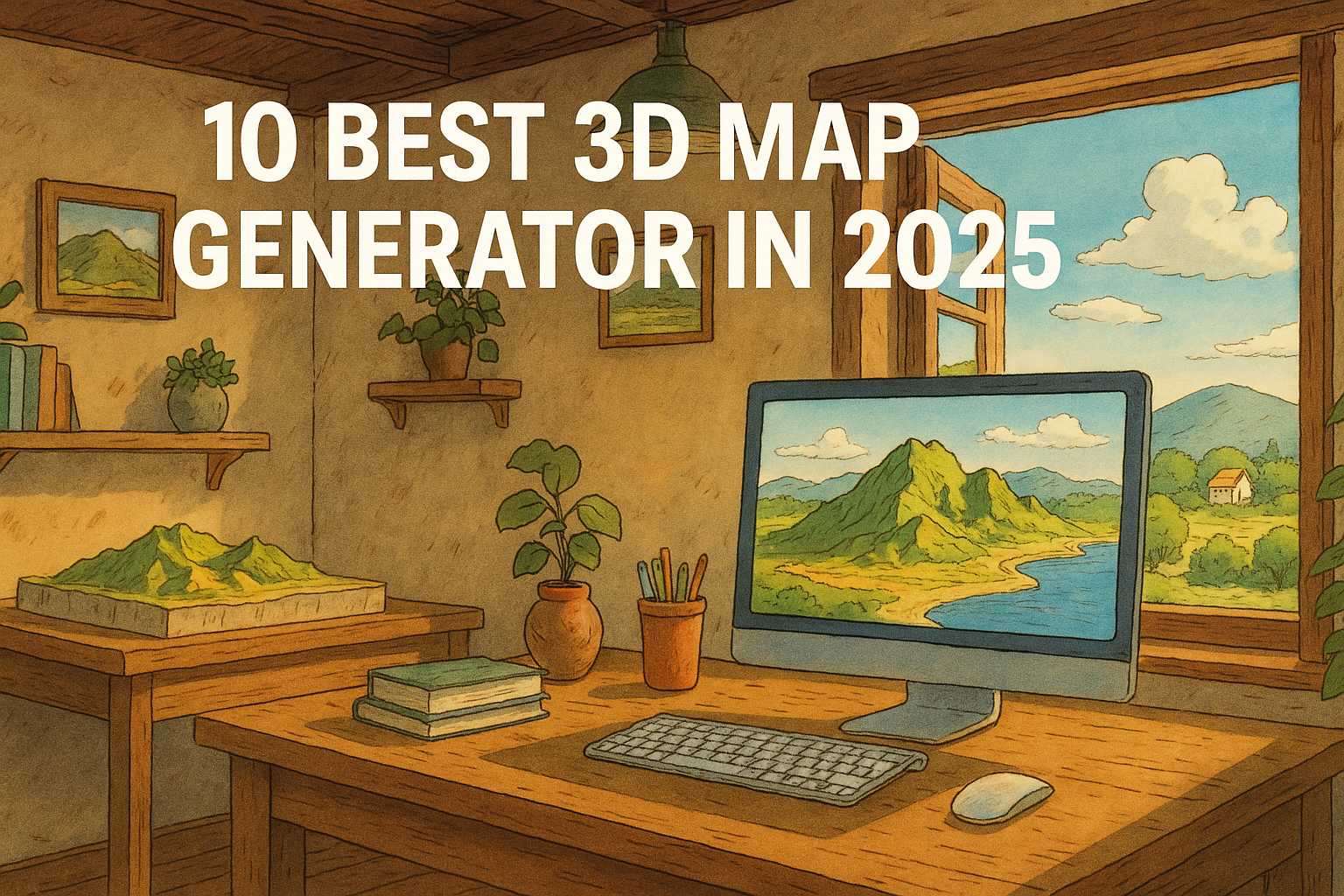
10 Best 3D Map Generators in 2025

3D Map Generators

Are you looking for the best 3D map generators to create stunning, interactive, and custom 3D maps in 2025? Whether you’re a designer, developer, geographer, educator, or just a map enthusiast, the ability to visualize terrain and landscapes in 3D has never been easier or more powerful. Here’s a carefully curated list of the top 10 3D map generator tools in 2025 that help you generate, customize, and even 3D print realistic maps—all with just a few clicks. Best 3D Map Generators 🔟 3D-Mapper.com – Dead-Easy 3D Map Creation in the Browser 3D-Mapper.com stands out in 2025 as one of the most user-friendly and accessible online 3D map generators. Designed for both beginners and professionals, this browser-based tool allows users to create highly detailed 3D maps in just a few minutes — no software installation required. Whether you’re working on a school project, architectural presentation, or creative design, 3D-Mapper.com lets you customize terrain, colors, lighting, and more with ease. One of its key strengths is the ability to export maps for 3D printing or embed them directly into your website, making it an excellent choice for educators, developers, and content creators. It also offers a free snapshot tool that lets you capture high-quality images of your customized 3D maps, including options for sky view or transparent backgrounds. With a sleek interface, real-time map rendering, and hassle-free export features, 3D-Mapper.com is a top pick for anyone looking to bring terrain to life in 2025. 9️⃣ 3D Map Generator (by Orange Box) The 3D Map Generator by Orange Box is a powerful tool designed specifically for Photoshop users and creative designers who want to build stunning, realistic 3D maps directly within the Adobe environment. Unlike online-only platforms, this generator functions as a Photoshop plugin, giving designers the flexibility to work with familiar tools and layers while generating highly detailed topographic maps. One of its standout features is the ability to generate 3D maps from Google Maps data or import your own GPX files, making it an excellent choice for mapping real-world locations or planning custom visual projects. The tool supports multiple map modes, including satellite view, terrain, and elevation, allowing creators to match the style and tone of their design needs. This plugin is especially popular among professionals in graphic design, architecture, game development, and presentations, as it allows for full creative control using Photoshop’s native capabilities. You can easily adjust textures, apply lighting effects, add custom icons, or blend the map into larger compositions — all without leaving the Photoshop workspace. With regular updates, detailed tutorials, and advanced control over visual styling, the 3D Map Generator by Orange Box is a top-tier option in 2025 for those who want to merge creativity with topographical accuracy. If you’re a designer looking for precision and style in your 3D map projects, this tool delivers exactly that. 8️⃣ Maps3D.io – Professional 3D Maps for Print or Web Maps3D.io is a powerful and versatile online platform that enables users to create professional-quality 3D maps that can be either printed or embedded online. Tailored for both personal and commercial use, this tool is especially useful for individuals and organizations that need to visualize geographic data with accuracy and style. One of the most notable features of Maps3D.io is its ability to generate 3D maps from GPS data, making it ideal for hikers, outdoor explorers, educators, and professionals who want to bring their routes and locations to life in 3D. Whether you’re uploading a GPS track or manually choosing a location, Maps3D’s smart rendering engine transforms the terrain into a beautiful 3D model within minutes. What truly sets Maps3D apart is its built-in editor, which allows users to tweak and customize their maps directly in the browser. From adjusting elevation and perspective to adding markers or modifying colors, the editor offers creative control over every aspect of your map. The platform also includes geolocation tools, enabling users to search and pinpoint specific locations effortlessly. Once your map is ready, you can either embed it directly into your website — perfect for blogs, travel sites, and portfolio pages — or export it for 3D printing, allowing for physical representations of landscapes, trails, or cityscapes. This makes it a favorite among educators, architects, geographers, and even gift creators who want to bring real-world locations into the tangible world. Related Content:  25 Best Map Apps 2025 Top 25 GIS Research Ideas for 2025 Top 30 GIS File Formats Every Mapping Professional Should Know 10 Best Mileage Tracker Apps in 2025 7️⃣ Icograms Designer – Infographic-Style Isometric 3D Maps Icograms Designer is a unique 3D map creation tool that combines the power of isometric design with the simplicity of a drag-and-drop interface, making it perfect for users who prioritize visual storytelling and artistic presentation. Unlike traditional terrain-based 3D maps, Icograms focuses on isometric, infographic-style maps, which are widely used in urban planning, educational content, presentations, and storytelling. With Icograms, users can design cityscapes, diagrams, and layouts using a vast library of pre-made isometric icons. These include buildings, roads, vehicles, people, trees, and more — all rendered in a clean, stylized isometric perspective that’s ideal for conveying complex ideas in a simple, visually engaging format. Whether you’re illustrating a traffic plan, creating an emergency response layout, or designing a futuristic city, Icograms gives you the creative tools to bring your vision to life. One of the standout features is its intuitive editor, which makes use of a simple drag-and-drop system, allowing even beginners to create detailed isometric maps without any design experience. The platform is entirely browser-based, so there’s no need to download or install software. Users can customize every element, including colors, labels, and layout, which makes it incredibly versatile for presentations, reports, explainer videos, or marketing materials. In 2025, Icograms Designer continues to be one of the top choices for professionals and educators looking to combine creativity, clarity, and functionality in their 3D maps. It’s not just about representing geographic data — it’s about telling a compelling visual story … Read more
16 Best GIS YouTube Channels to Learn and Stay Updated

GIS YouTube Channels

GIS (Geographic Information System) is a rapidly evolving field, and keeping up with the latest tools, techniques, and trends is essential for professionals and enthusiasts alike. YouTube has become a valuable platform for learning GIS, offering free tutorials, technical insights, and expert discussions. In this post, we highlight 16 Top GIS YouTube channels that provide high-quality educational content on GIS software, remote sensing, cartography, and geospatial analysis. Whether you’re a beginner or an advanced GIS user, these channels will help you enhance your skills. 16 Best GIS YouTube Channels GIS (Geographic Information System) is a rapidly evolving field, and keeping up with the latest tools, techniques, and trends is essential for professionals and enthusiasts alike. YouTube has become a valuable platform for learning GIS, offering free tutorials, technical insights, and expert discussions. In this post, we highlight 16 Top GIS YouTube channels that provide high-quality educational content on GIS software, remote sensing, cartography, and geospatial analysis. Whether you’re a beginner or an advanced GIS user, these channels will help you enhance your skills. 1. GeoDelta Labs 📌 Topics: QGIS, ArcMap, ArcGIS Pro, Google Earth, Python, Excel🌍 Country: United Kingdom📅 Created: – Joined Oct 16, 2018🎥 Videos: – 179 videos👀 Total Views: – 50M+🔗 Visit Channel This channel provides tutorials on QGIS, ArcMap, ArcGIS Pro, Google Earth, Python, Excel, and more, making it a great resource for GIS learners. GeoDelta Labs provides detailed GIS tutorials on various tools, including QGIS, ArcMap, and ArcGIS Pro. Whether you’re a beginner or an expert, this channel has something valuable for everyone. 2. Open Geospatial Solutions 📌 Topics: Open-source GIS, geemap, leafmap, segment geospatial🌍 Country: – United States📅 Created: – Joined Feb 11, 2009🎥 Videos: – 827 videos👀 Total Views: – 2,159,131 views🔗 Visit Channel Focused on open-source GIS, this channel covers tools like geemap, leafmap, and segment geospatial to help users work with geospatial data efficiently. This channel focuses on open-source GIS tools such as geemap and leafmap, making it a great resource for Python-based spatial analysis. 3. Milos Makes Maps 📌 Topics: R programming, GIS, cartography🌍 Country: – Netherlands📅 Created: – Joined Aug 6, 2011🎥 Videos: – 86 videos👀 Total Views: – 357,884 views🔗 Visit Channel Milos blends GIS with R programming and offers creative cartography tutorials to help users unleash their inner map artist. Milos specializes in R-based GIS mapping and cartography. His tutorials help GIS enthusiasts become skilled in creative map design. Related Content: The Best 15 Google Maps Scrapers 20 Best Remote Sensing Software for Professionals 10 Best Free LiDAR Software Tools and Viewers 4. Klas Karlsson 📌 Topics: QGIS, Blender🌍 Country: – Sweden📅 Created: – Joined Dec 30, 2007🎥 Videos: – 128 videos👀 Total Views: – 3,423,379 views🔗 Visit Channel If you’re looking for QGIS and Blender tutorials, this channel is a must-follow for learning advanced GIS visualization techniques. This channel combines GIS with 3D modeling, offering QGIS and Blender tutorials. 5. ArcGIS 📌 Topics: ESRI GIS software, demos, case studies🌍 Country: – United States📅 Created: – Joined Nov 26, 2015🎥 Videos: – 1,298 videos👀 Total Views: – 11,213,541 views🔗 Visit Channel The official Esri ArcGIS channel provides demos, technical sessions, case studies, and software updates to keep professionals informed. The official ArcGIS channel from Esri provides software tutorials, industry case studies, and technical demonstrations. 6. John Nelson Maps 📌 Topics: QGIS, ArcMap, Google Earth tutorials🌍 Country: – United States📅 Created: – Joined Sep 30, 2011🎥 Videos: – 285 videos👀 Total Views: – 1,907,334 views🔗 Visit Channel This channel shares tutorials on QGIS, ArcMap, ArcGIS Pro, Google Earth, and Python, focusing on mapping techniques and storytelling. 7. Made 4 Geek 📌 Topics: AutoCAD, Google Maps, ArcGIS🌍 Country: – Not Specified📅 Created: – Joined Oct 7, 2011🎥 Videos: – 733 videos👀 Total Views: – 21,771,292 views🔗 Visit Channel A fantastic resource for learning multiple GIS tools, including AutoCAD, Google Maps, ArcGIS, ERDAS IMAGINE, QGIS, and Excel. 8. GIS Simplified 📌 Topics: Enterprise GIS, Python, QGIS🌍 Country: – India📅 Created: – Joined Apr 30, 2020🎥 Videos: – 100 videos👀 Total Views: – 927,419 views🔗 Visit Channel This channel covers a variety of GIS topics, including ArcGIS Pro, Enterprise GIS, QGIS, Python, and GIS concepts. 9. ESRI 📌 Topics: ArcGIS software, webinars🌍 Country: – United States📅 Created: – Joined Jun 21, 2008🎥 Videos: – 776 videos👀 Total Views: – 8,060,669 views🔗 Visit Channel The official Esri channel shares software tutorials, webinars, conferences, and industry news, making it essential for ArcGIS users. 10. Matt Forest 📌 Topics: GIS profession, ChatGPT in GIS🌍 Country: – Not Specified📅 Created: – Joined Aug 3, 2006🎥 Videos: – 84 videos👀 Total Views: – 1,051,813 views🔗 Visit Channel Matt Forest shares insights on the GIS profession, with tutorials on QGIS, Python, ChatGPT, SQL, and PostGIS. 11. Spatial Thoughts 📌 Topics: Courses, lectures on geospatial tech🌍 Country: – India📅 Created: – Joined Jan 2, 2020🎥 Videos: – 413 videos👀 Total Views: – 804,736 views🔗 Visit Channel A channel dedicated to GIS courses, tutorials, expert interviews, and geospatial technology lectures. 12. Geospatial World 📌 Topics: GIS, AI, IoT, LiDAR🌍 Country: – India📅 Created: – Joined Jan 17, 2013🎥 Videos: – 2,259 videos👀 Total Views: – 19,796,924 views🔗 Visit Channel Covering a broad range of topics, including GIS, GPS, LiDAR, UAVs, BIM, Smart Cities, AI, and IoT, this channel is great for staying updated on modern geospatial trends. 13. Geospatial School 📌 Topics: QGIS, Python for GIS🌍 Country: – United States📅 Created: – Joined Oct 12, 2011🎥 Videos: – 275 videos👀 Total Views: – 4,873,365 views🔗 Visit Channel This channel specializes in QGIS, PyQGIS scripts, QGIS plugins, Python, and R for data science applications in GIS. 14. Terra Spatial 📌 Topics: GIS education and technology🌍 Country: – India📅 Created: – Joined Nov 7, 2016🎥 Videos: – 665 videos👀 Total Views: – 5,649,857 views🔗 Visit Channel A great platform for learning about GIS education and remote sensing technologies. 15. GIS & RS Solution 📌 Topics: ArcGIS, QGIS, ENVI tutorials🌍 Country: – Bangladesh📅 Created: – Joined Jul 11, 2020🎥 Videos: – 172 … Read more

ArcMap Review: A Comprehensive Overview of a GIS Classic

ArcMap

ArcMap, the desktop component of Esri’s ArcGIS suite, has been a cornerstone of geographic information systems (GIS) for years. Widely praised for its powerful data analysis, mapping, and spatial analysis capabilities, ArcMap has been the go-to tool for professionals across various industries, from environmental science to urban planning. While newer software like ArcGIS Pro is gaining traction, ArcMap continues to hold significant value for those who require robust GIS tools and a user-friendly interface. In this review, we’ll dive into its features, strengths, limitations, and best use cases, helping you understand whether ArcMap still fits your GIS needs in the modern world of geospatial technology. ArcMap Review ArcMap, a core application within the ArcGIS suite by Esri, has long been a leading choice for geospatial professionals. Known for its robust mapping, spatial analysis, and data management capabilities, ArcMap has been a staple in the GIS industry for years. Despite the emergence of newer software like ArcGIS Pro, ArcMap remains a powerful tool for professionals working with geographic data across various sectors such as urban planning, environmental research, and natural resource management.   GO TO ArcMAP Rating: 4.7/5 ArcMap Overview ArcMap is a desktop-based GIS application that enables users to create, view, analyze, and manage geographic data through maps. It offers a comprehensive set of tools for visualizing spatial information, conducting spatial analysis, and generating high-quality cartographic outputs. With its robust capabilities, ArcMap allows users to manipulate and process both vector and raster data, making it an essential tool for professionals working in various fields of geospatial analysis and mapping. Some of the key features and capabilities of ArcMap include: Mapping and Visualization ArcMap provides robust tools for creating detailed and customized maps. It supports both vector and raster data, allowing you to visualize geographic features with clarity and precision. Users can create high-quality cartographic outputs for print and digital media, customizing every aspect of map design. Spatial Analysis and Geoprocessing One of ArcMap’s standout features is its powerful spatial analysis capabilities. It offers an extensive suite of tools for performing complex spatial operations, such as overlay analysis, proximity analysis, buffering, and statistical modeling. These tools help users make informed decisions based on geographic data. Georeferencing ArcMap makes it easy to align maps or aerial imagery with a known coordinate system. The georeferencing tools allow users to map images with known geographic coordinates and integrate them into a GIS project for further analysis. Data Management and Editing ArcMap provides comprehensive tools for managing, editing, and processing geospatial data. Whether working with vector data (such as shapefiles) or raster data (such as satellite images), users can easily manipulate and update datasets to ensure their maps are accurate and up-to-date. Geodatabase Integration ArcMap is tightly integrated with Esri’s geodatabase model, allowing for efficient data management. It supports both personal and enterprise geodatabases, enabling multi-user environments for collaborative projects and complex data management tasks. ModelBuilder and Automation ArcMap includes ModelBuilder, a tool that lets users automate complex workflows by building custom models using a visual interface. This is particularly useful for performing repetitive tasks, creating batch processes, and automating spatial analysis. Customizable Symbology and Labeling ArcMap offers advanced symbology and labeling features that allow users to visually represent geographic data in a way that is both functional and aesthetically pleasing. Custom symbols, color ramps, and label styles help create maps that convey the desired information clearly and effectively. Support for Raster Data ArcMap excels at working with raster data, including satellite imagery, aerial photography, and digital elevation models (DEMs). The software provides tools for raster analysis, including classification, reclassification, and surface analysis, among others. Print Layouts and Map Production ArcMap has robust capabilities for map production, offering detailed print layouts with options for adding legends, north arrows, scale bars, and other map elements. This makes it ideal for producing professional-quality maps for reports, presentations, or fieldwork. Advanced Cartographic Design Users can fine-tune their map design with advanced cartographic tools in ArcMap, including options for map projections, coordinate systems, and layout elements. This ensures that the final map product meets high standards for both visual appeal and accuracy. Read Also: ERDAS Imagine – Revolutionizing Geospatial Imaging and Analysis ArcMap History 1999: ArcMap was first introduced as part of the ArcGIS software suite by Esri, aimed at providing a powerful desktop GIS platform. Early 2000s: Quickly became a widely used tool for mapping, spatial analysis, and geospatial data management across industries such as urban planning, environmental science, and government. 2003: ArcMap started to integrate advanced geoprocessing and spatial analysis tools, allowing users to perform complex operations on both raster and vector data. 2007: Introduced the ability to automate workflows using ModelBuilder, enhancing efficiency and usability for complex GIS tasks. 2010s: ArcMap’s tools evolved to support high-quality cartographic outputs, enabling professionals to create visually appealing and precise maps for print and digital use. 2015: Esri launched ArcGIS Pro, a new 64-bit, multi-threaded application with modern features, marking the beginning of a gradual shift towards the new platform. Late 2010s: Despite the release of ArcGIS Pro, ArcMap remained widely used, especially in legacy workflows and by organizations that were accustomed to its interface. 2020s: Esri continued to support ArcMap while encouraging users to transition to ArcGIS Pro, which offers more advanced capabilities, better performance, and enhanced integration with cloud-based tools. Strengths of ArcMap Comprehensive GIS Tools: ArcMap provides a wide range of tools for spatial analysis, data visualization, geospatial data management, and cartography, making it a versatile platform for GIS professionals. Advanced Spatial Analysis: It offers powerful geoprocessing tools for analyzing spatial data, from basic overlays to complex operations like buffering, interpolation, and surface analysis. High-Quality Cartography: ArcMap excels in creating high-quality, detailed maps with advanced symbology options, customizable map layouts, and printing capabilities, making it a go-to tool for producing professional cartographic outputs. Compatibility with Various Data Formats: ArcMap supports a wide variety of data formats, including both raster and vector data, and integrates seamlessly with Esri’s file formats like shapefiles, geodatabases, and raster datasets. Customizability: … Read more

QGIS Reviews 2024: Details, Pricing, & Features

QGIS

QGIS (Quantum GIS) is an open-source Geographic Information System (GIS) software widely used by GIS professionals and enthusiasts around the world. It offers a powerful, free alternative to commercial GIS software like ArcGIS. QGIS provides excellent tools for data visualization, spatial analysis, and map creation. In this blog, we will discuss QGIS’s features, advantages, drawbacks, pricing, and other key aspects. Key Features of QGIS QGIS offers several features that make it a great GIS tool. Here are some of the main features: Open-Source Software: QGIS is completely open-source, making it free and accessible to everyone. Anyone can download, install, and modify it. Data Compatibility: QGIS supports almost every type of geospatial data format, including shapefiles, GeoJSON, KML, and more. It also works with spatial databases like PostGIS and SpatiaLite. Advanced Spatial Analysis: QGIS includes tools that can handle advanced spatial analysis, interpolation, and proximity analysis. Customizable Interface: The interface of QGIS is fully customizable. You can arrange toolbars, menus, and panels according to your needs. Plugins: QGIS has many plugins available to add new features and functionalities. You can install them from the QGIS plugin repository. Pros of QGIS Free and Open-Source: The biggest advantage of QGIS is that it’s completely free. Anyone can download and use it without any licensing fees. User-Friendly Interface: QGIS has a user-friendly interface that makes it easy for even new users to learn and get started. Extensive Community Support: QGIS has a large and active community, with plenty of forums, tutorials, and documentation available to help users. Cross-Platform Compatibility: QGIS works on Windows, macOS, and Linux, making it accessible to users on different platforms. Scalability: QGIS can handle both large and small datasets efficiently. It works well with large datasets, which is important for many GIS applications. Cons of QGIS Performance with Large Datasets: QGIS can sometimes be slow when dealing with very large datasets, especially when performing complex analyses. Learning Curve: While QGIS is user-friendly, there can still be a learning curve for some of its more advanced features. Limited Advanced Geospatial Tools: QGIS may not offer the same level of advanced tools as ArcGIS, although plugins can add some of these features. Pricing of QGIS QGIS is completely free. It is open-source software that you can download and use without any cost. There are no subscription fees or licensing fees involved. Additionally, the tutorials and guides available on the QGIS community website are also free. User Experience with QGIS QGIS is relatively easy to use, especially for those who are looking to perform basic GIS tasks. If you are a beginner, there are plenty of online tutorials and learning resources that will help you understand the features of QGIS. For more advanced users, QGIS is a powerful tool capable of performing complex spatial analysis and map design. Performance and Speed of QGIS QGIS’s performance largely depends on your system configuration and dataset size. It works very fast and efficiently with smaller datasets, but it can become slow with larger datasets (such as millions of features). However, there are performance optimization techniques and configurations available for handling large data more effectively. Qgis Vs ArcGIS The main difference between QGIS and other GIS tools like ArcGIS is that QGIS is open-source and free, while ArcGIS is a licensed software. While ArcGIS offers some advanced tools and official support, QGIS has a strong community and plenty of plugins that make it highly versatile. Plus, QGIS does not require a subscription or license, which is a major advantage for users on a budget. System Requirements for QGIS Minimum system requirements to run QGIS: Operating System: Windows 7 or later, macOS 10.10 or later, Linux Processor: Intel i3 or equivalent RAM: 4GB minimum (8GB recommended) Hard Drive Space: 1GB of free space Graphics: Any GPU with OpenGL 2.0 support Conclusion: Should You Use QGIS? QGIS is an excellent open-source GIS tool that is suitable for GIS professionals, researchers, and beginners alike. Its biggest advantage is that it’s completely free and highly customizable. While some advanced features in ArcGIS may not be available in QGIS, it is still an excellent choice for those who need powerful spatial analysis tools on a budget. Rating: 4.5/5 You can download QGIS from the official website and try it out for free. If you’re a GIS professional, this software can enhance your workflow and make your GIS tasks more efficient and powerful. Frequently Asked Questions (FAQs) Q: Does QGIS work on Windows, macOS, and Linux? A: Yes, QGIS works on all major platforms, including Windows, macOS, and Linux. Q: Is QGIS free to use? A: Yes, QGIS is open-source and completely free to use. Q: Does QGIS have a learning curve? A: While QGIS is user-friendly, there is a slight learning curve for some of its advanced features.