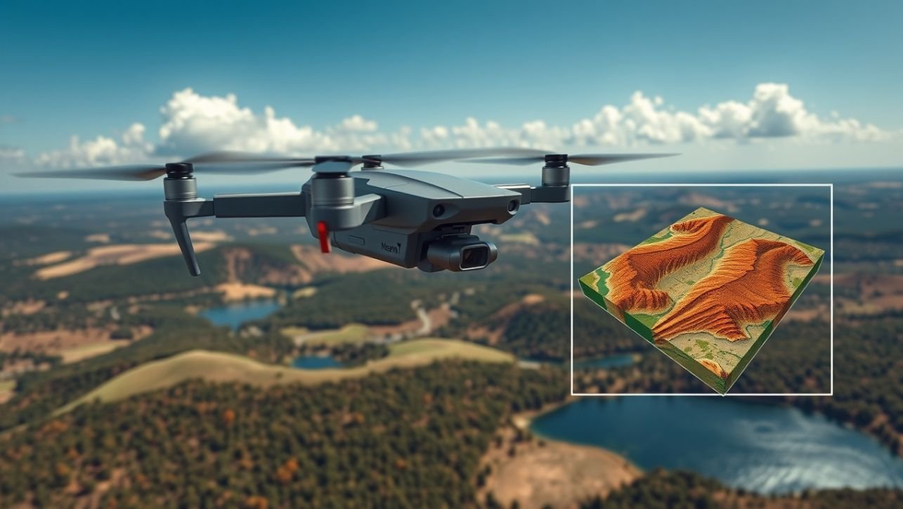
Imagine needing a highly detailed map of a construction site, a precise volume calculation of a stockpile, or an assessment of crop health across hundreds of acres. A decade ago, this meant hiring a plane for aerial photography, deploying a ground survey crew for weeks, or relying on outdated satellite imagery. Today, the solution takes off from the back of a truck.
Drones, or Unmanned Aerial Vehicles (UAVs), are revolutionizing GIS data collection. By acting as low-flying, highly adaptable sensor platforms, they bridge the critical gap between coarse satellite imagery and slow, ground-level surveys. They deliver data with centimeter-level accuracy, on-demand, and at a fraction of the traditional cost.
But how does a flying robot transform into a powerful geospatial data collection tool? This guide will demystify the process, from pre-flight planning to the final, actionable map.
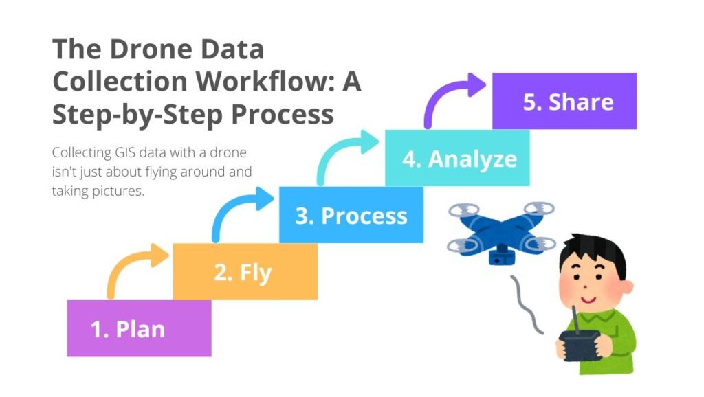
The Drone Data Collection Workflow: A Step-by-Step Process
Collecting GIS data with a drone isn’t just about flying around and taking pictures. It’s a meticulous process that ensures accuracy, completeness, and efficiency.
Step 1: Mission Planning (The Blueprint)
Before the drone even leaves the ground, careful planning is essential.
-
Define the Objective: What is the final deliverable? A 2D map, a 3D model, a digital surface model (DSM), or a vegetation index? The goal dictates every other parameter.
-
Set the Flight Parameters: Using specialized mobile apps (e.g., DJI Pilot, Pix4Dcapture), the operator defines:
-
Flight Area: The exact polygon of the area to be mapped.
-
Altitude: Determines ground sampling distance (GSD)—the actual size of each pixel on the ground. Lower altitude = higher resolution.
-
Image Overlap: Crucial for quality. Frontlap (or overlap) is typically 70-80%, and sidelap is 60-70%. High overlap ensures every part of the ground is captured from multiple angles, which is critical for 3D model generation.
-
-
Ground Control Points (GCPs): For survey-grade accuracy, GCPs are essential. These are visible markers placed throughout the survey area whose precise coordinates (X, Y, Z) are collected with a GNSS receiver. The processing software uses these to “geo-reference” the model, tying it to a real-world coordinate system.
Step 2: The Data Capture Flight (The Execution)
The pilot launches the drone, and it autonomously executes the pre-planned mission.
-
Autonomous Navigation: The drone follows a precise “lawnmower” pattern, automatically capturing images at predetermined intervals.
-
Data Logging: The drone doesn’t just capture images; it also logs the precise location (from its onboard GPS) and orientation (from its Inertial Measurement Unit – IMU) for every single photo. This data is stored in the image’s EXIF metadata.
Read Also:
ArcGIS Pro vs. QGIS: The Ultimate 2025 Showdown (Pros, Cons & Verdict)
What is a Digital Elevation Model (DEM)? The Complete Guide 2025
What is a TIN (Triangulated Irregular Network)?
Step 3: Data Processing (The Magic)
This is where the raw images are transformed into geospatial products. The thousands of overlapping images are uploaded to specialized software.
-
Photogrammetry: This is the most common technique. The software uses a process called Structure from Motion (SfM). It identifies common points in multiple overlapping images and triangulates their positions in 3D space, creating a dense point cloud.
-
Output Generation: This point cloud is the foundation for all other products:
-
Orthomosaic Map: A geometrically corrected (“orthorectified”) 2D map where every pixel is scaled uniformly, eliminating distortion from terrain and lens tilt. It’s a seamless, highly accurate image map.
-
Digital Surface Model (DSM): A 3D representation of the earth’s surface, including all objects on it like buildings and trees.
-
Digital Terrain Model (DTM): A 3D representation of the bare earth, with all vegetation and buildings removed.
-
3D Textured Mesh: A photorealistic, navigable 3D model of the survey area.
-
Step 4: Analysis & Application (The Insight)
The final maps and models are imported into GIS software (like ArcGIS Pro or QGIS) where they become powerful layers for spatial analysis.
The Sensors: The Eyes of the Drone
The type of data collected depends entirely on the sensor mounted on the drone.
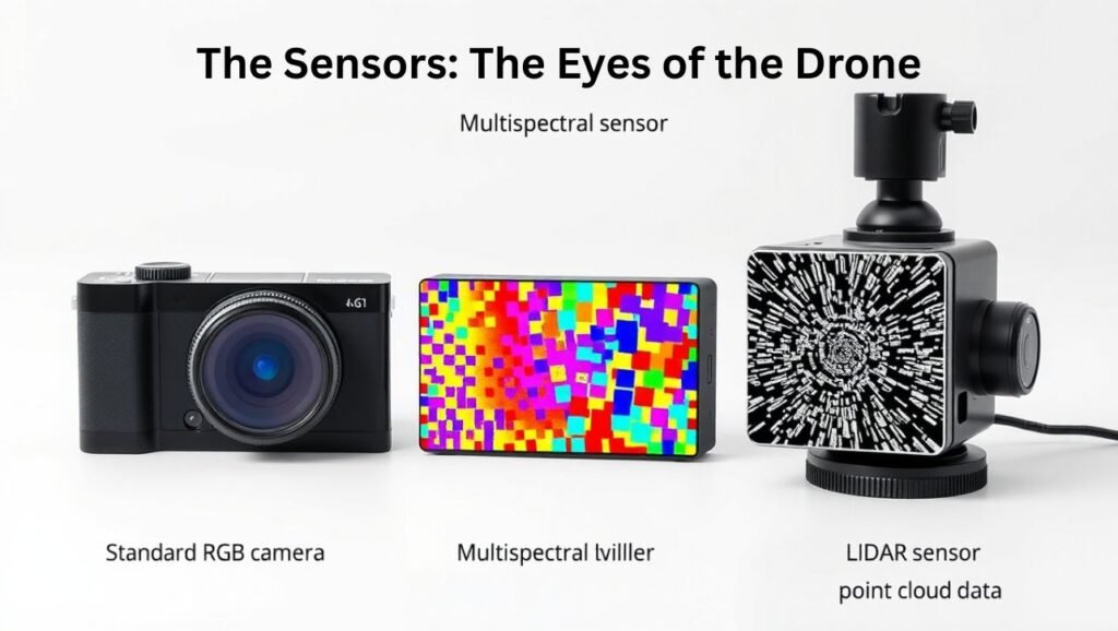
1. RGB (Red, Green, Blue) Cameras
-
What they do: Capture standard visible-light photographs.
-
Primary Outputs: High-resolution orthomosaics and 3D models.
-
Applications:
-
Construction progress monitoring
-
General mapping and base layer creation
-
Erosion monitoring
-
2. Multispectral Sensors
-
What they do: Capture data in specific wavelengths of light, including both visible and non-visible bands (e.g., Near-Infrared – NIR, Red Edge).
-
Primary Outputs: Vegetation indices like NDVI (Normalized Difference Vegetation Index), which is a key measure of plant health.
-
Applications:
-
Precision Agriculture: Identifying crop stress, optimizing water and fertilizer use.
-
Environmental Monitoring: Assessing the health of forests and wetlands.
-
Land Management: Detecting invasive species.
-
3. LiDAR (Light Detection and Ranging)
-
What they do: Emits rapid laser pulses and measures the time it takes for them to return to the sensor, creating a highly accurate “point cloud” of the environment.
-
Primary Outputs: Dense 3D point clouds, highly accurate DTMs.
-
Applications:
-
Forestry: Measuring tree height and canopy structure.
-
Infrastructure & Transmission Line Mapping: Seeing through vegetation to map the ground below.
-
Flood Modeling: Creating accurate terrain models for hydrological analysis.
-
-
LiDAR vs. Photogrammetry: LiDAR is superior for penetrating vegetation and capturing fine details like power lines, but it is more expensive and doesn’t capture true-color imagery natively.
4. Thermal Sensors
-
What they do: Detect heat signatures (infrared radiation).
-
Primary Outputs: Heat maps and temperature readings.
-
Applications:
-
Solar Farm Inspection: Identifying faulty panels.
-
Search and Rescue: Locating people at night or in dense foliage.
-
Building Inspection: Detecting heat leaks and faulty insulation.
-
Key Advantages of Drone-Collected GIS Data
Why has this technology been so disruptive?
-
Unprecedented Resolution & Accuracy: Capture data at a centimeter-level GSD, revealing details invisible to satellites or manned aircraft.
-
Rapid Deployment and On-Demand Data: Map hundreds of acres in a single flight and get the data the same day. This is critical for time-sensitive projects and rapid response in disasters.
-
Enhanced Safety: Drones can access hazardous or difficult-to-reach areas without risking human lives—inspecting unstable slopes, cell towers, or disaster zones.
-
Cost-Effectiveness: Drone surveys are significantly cheaper than traditional manned aerial surveys or large, ground-based survey crews.
-
Rich, Comprehensive Datasets: A single flight can generate a suite of interrelated products (2D map, 3D model, elevation model) from one data source.
Real-World Applications: Drones in Action
-
Construction: Tracking earthwork volumes, monitoring site progress against BIM models, and conducting safety inspections.
-
Agriculture: Creating prescription maps for variable rate application of water and fertilizer, saving inputs and increasing yields.
-
Mining & Aggregates: Calculating stockpile volumes with high accuracy for inventory management and operational planning.
-
Public Safety: Creating up-to-date maps for disaster response, wildfire management, and crime scene reconstruction.
-
Environmental Science: Monitoring coastal erosion, tracking wildlife populations, and mapping wetland boundaries.
Conclusion: Collect GIS Data
Drone technology has democratized high-precision geospatial data, putting powerful mapping capabilities in the hands of surveyors, engineers, farmers, and conservationists alike. The workflow—from automated flight planning to sophisticated photogrammetric processing—has become streamlined and accessible.
As sensors become smaller, batteries last longer, and AI-driven analytics become more sophisticated, the role of drones in GIS will only expand. They are no longer just a cool gadget; they are an indispensable tool for understanding and managing our world with a clarity and speed that was once unimaginable.
By understanding how drones collect GIS data, you can unlock new levels of efficiency, insight, and accuracy in your projects, truly seeing the big picture from a brand new perspective.
FAQ: Collect GIS Data
Q: What is the difference between a drone map and a satellite image?
A: Drone maps offer much higher resolution (centimeters vs. meters), can be captured on-demand regardless of cloud cover, and are used to create accurate 3D models. Satellite imagery covers a much larger area consistently but at a lower resolution.
Q: How accurate is drone mapping?
A: With proper planning and the use of Ground Control Points (GCPs), drone maps can achieve 1-3 times the GSD in horizontal (X,Y) accuracy and 2-5 times the GSD in vertical (Z) accuracy. This means with a 2 cm GSD, you can expect ~2-4 cm horizontal and ~4-10 cm vertical accuracy.
Q: Do I need a license to fly a drone for mapping?
A: In most countries, yes. In the U.S., commercial drone operations require a Part 107 license from the FAA. Always check and comply with your local aviation regulations.
Q: Can drones fly in all weather conditions?
A: No. Rain, high winds (>15-20 mph), and poor visibility can ground drones. Ideal conditions are calm, clear days with minimal cloud cover for consistent lighting.
1 thought on “How Do Drones (UAVs) Collect GIS Data? The Complete 2025 Guide”