25 Best Map Apps 2025

Best Map Apps

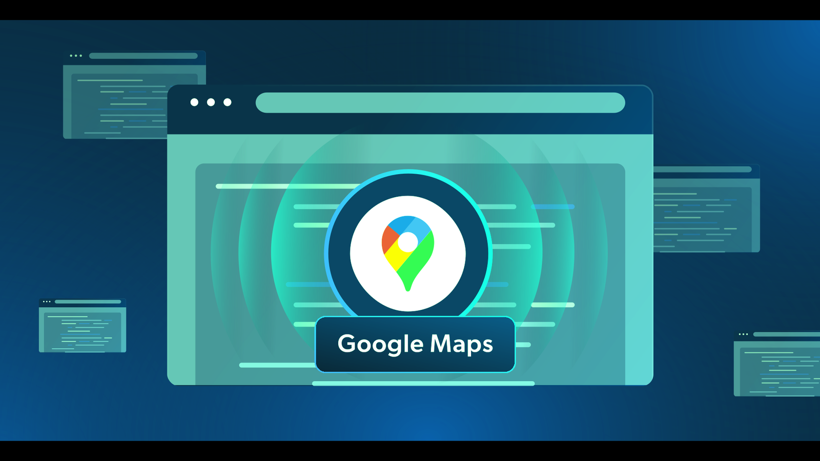
Maps have always been an important aspect of our lives. For centuries, humans have relied on maps to help them get around, find new places to explore, and learn more about their surroundings. With the advent of technology, we now have access to countless mapping applications that can help us with all of these things and more. As smartphone usage continues to increase, so does the demand for innovative and useful mapping apps. Whether you’re looking for an app that can help you navigate your way around town or one that provides detailed information about specific locations, we’ve got you covered. The next time you need directions to your next destination or want to explore an unfamiliar area, these apps are sure to meet your needs. Read on for a comprehensive list of the 25 best map apps to download in 2025. Best Map Apps 1. Google Maps Google Maps is still the gold standard when it comes to navigation apps. With precise and reliable data on roads, public transportation, local businesses, and landmarks, this app helps you find your way with ease. What sets Google Maps apart is its feature-rich experience — from real-time traffic updates and voice-guided turn-by-turn navigation to offline map access and detailed Street View imagery. It even offers indoor maps for large locations like airports and shopping malls. Whether you’re driving, walking, biking, or taking transit, Google Maps has you covered with accurate directions and estimated travel times. Best of all, it’s completely free to use and available on Android, iOS, iPad, and web browsers. If you’re looking for a powerful and reliable map app, Google Maps remains a top choice. Read More: The Best 15 Google Maps Scrapers  2. TomTom GO TomTom GO is a solid contender in the navigation app space, offering a sleek interface and reliable guidance for your travels. With features like real-time traffic updates, crystal-clear 3D maps, and advanced lane guidance, it’s designed to make your journey as smooth as possible. One standout feature is its augmented reality navigation, which adds a modern twist to finding your way. TomTom GO also works offline, making it a great companion even when you’re out of range or trying to save data. Ideal for both drivers and pedestrians, the app ensures you stay on the right path whether you’re commuting or exploring a new city. While it comes with a free 30-day trial, continued access starts at just $4.99/month. It’s available on both Android and iOS platforms, and definitely worth checking out if you want a premium navigation experience. 3. Waze Waze is a driver’s best friend when it comes to beating traffic and staying ahead of road delays. What makes Waze unique is its real-time, user-generated updates — fellow drivers share info about accidents, traffic jams, speed traps, and other road hazards, helping you choose the fastest route. It’s more than just a GPS app — Waze adds a social twist with fun icons, voice options, and the ability to see and interact with other users on the road. Perfect for daily commutes or long drives, Waze keeps you informed and entertained while making sure you get to your destination quickly and safely. The app is free to use and available on Android and iOS, making it a must-try for drivers who want smart, community-powered navigation. 4. Apple Maps Apple Maps has evolved into a powerful navigation tool, especially for iOS users. With beautifully detailed 3D visuals, real-time traffic updates, and accurate transit directions, it’s now a serious competitor in the map app world. One of its standout features is AR walking directions, which overlay digital arrows on the real world to guide you step by step. It’s also tightly integrated with Siri, allowing for hands-free navigation and voice commands that feel seamless on Apple devices. Exclusively available on iOS, iPadOS, and macOS, Apple Maps is a visually stunning and highly functional app that fits perfectly into the Apple ecosystem. And of course, it’s completely free to use. Related Content: Top 25 GIS Research Ideas 16 Best GIS YouTube Channels to Learn and Stay Updated 20 Best Remote Sensing Software for Professionals 5. Citymapper Citymapper is the ultimate app for urban commuters, especially in large cities around the world. Designed to simplify public transportation, it combines routes for buses, trains, subways, bikes, and walking into one cohesive, easy-to-follow journey. Whether you’re navigating complex transit systems or exploring a new city, Citymapper makes it easy to find the fastest and most efficient routes. It offers real-time updates on delays and disruptions, helping you stay on track. Ideal for city dwellers and travelers alike, Citymapper is available for free on both Android and iOS, making it a must-have app for anyone who relies on public transportation. 6. HERE WeGo HERE WeGo is a user-friendly navigation app with a sleek interface and the added bonus of downloadable offline maps. It supports a variety of routes, including public transport, walking, biking, and driving, making it a versatile tool for any kind of journey. One of its standout features is the ability to compare ride-sharing services, helping you choose the most cost-effective or convenient option for your travels. Whether you’re navigating through a city or heading off the beaten path, HERE WeGo has you covered. Perfect for travelers who need reliable maps without an internet connection, HERE WeGo is available for free on both Android and iOS. It’s an excellent choice for those who want to stay connected even when going off the grid. 7. MapQuest As one of the original digital map services, MapQuest continues to be a reliable option for navigation. Offering turn-by-turn voice guidance, real-time traffic updates, and the ability to compare fuel prices nearby, it provides all the essentials for a smooth journey. Whether you’re driving across town or on a road trip, MapQuest helps you navigate with ease and efficiency. Its simple interface and useful features make it a trusted choice for both seasoned travelers and casual commuters. Available for free … Read more

Top 30 GIS File Formats Every Mapping Professional Should Know

ChatGPT Image Apr 6 2025 06 49 02 PM

Whether you’re a GIS (Geographic Information System) professional, developer, or student, navigating the world of GIS file formats can feel overwhelming. With countless file types for vector, raster, spatial databases, and metadata, understanding which file format to use—and when—can drastically boost your productivity. In this comprehensive guide, we’ll break down 30 of the most commonly used GIS file formats, helping you decode their purpose, compatibility, and usage in modern mapping and spatial analysis workflows. 30 GIS File Formats 🔷 Vector File Formats Vector files store geographic features as points, lines, and polygons. These formats are perfect for boundaries, roads, rivers, and more. When working with spatial data, choosing the right vector file format is crucial. Vector formats represent geographic features using points, lines, and polygons, making them ideal for storing roads, boundaries, buildings, and other precise features. Let’s explore some of the most commonly used vector GIS file types, including their structure, use cases, and compatibility. 1. Shapefile (.shp, .shx, .dbf) The Shapefile is a widely used vector file format developed by Esri, and despite being introduced in the early 1990s, it’s still very popular. 🔍 Key Components: .shp – Stores geometry (points, lines, polygons) .shx – Shape index format for fast access .dbf – DBase file containing attribute data ✅ Advantages: Supported by nearly every GIS software (ArcGIS, QGIS, MapInfo, etc.) Simple and reliable for sharing vector data ⚠️ Limitations: No support for topology Attribute table has a 10-character field name limit Maximum file size ~2 GB 2. GeoJSON (.geojson) GeoJSON is an open-standard format based on JavaScript Object Notation (JSON). It represents geographic features and their attributes in a lightweight, human-readable structure. 🌍 Best For: Web mapping applications (Leaflet, Mapbox, OpenLayers) API data exchange and web-based visualizations ✅ Advantages: Easy to read and write Excellent for browser-based GIS applications Supports properties (attributes) along with geometry ⚠️ Limitations: Larger files may impact performance Doesn’t support complex topology 3. KML/KMZ (.kml, .kmz) KML (Keyhole Markup Language) and KMZ (its compressed version) were developed by Google for Google Earth. These are XML-based formats used to display geographic data in 3D. 🌍 Use Cases: Creating interactive maps Visualizing spatial features in 3D viewers Sharing geographic data in presentations ✅ Advantages: Easy to view in Google Earth/Maps Supports styling, pop-ups, and 3D visualizations ⚠️ Limitations: Not ideal for advanced GIS analysis Slower performance with large datasets 4. GeoPackage (.gpkg) GeoPackage (GPKG) is a modern, open-source format based on SQLite that can store vector, raster, and tile data in a single file. 🔧 Ideal For: Mobile GIS applications Offline mapping and data portability ✅ Advantages: All-in-one container (vector + raster) Fully OGC-compliant and platform-independent Faster performance and better scalability than shapefiles ⚠️ Limitations: Slightly larger learning curve for beginners Not supported by some legacy systems 5. CSV (.csv) Comma-Separated Values (CSV) files are not GIS-specific but are frequently used for storing tabular spatial data, especially when paired with coordinate columns (e.g., latitude/longitude). 🧭 Typical Use: Simple geocoding (e.g., plotting store locations) Joining tabular data with spatial datasets ✅ Advantages: Easy to create/edit in Excel, Notepad, Google Sheets Widely supported for quick imports ⚠️ Limitations: Cannot store complex geometry Needs coordinate columns for spatial use 6. GPX (.gpx) GPS Exchange Format (GPX) is an XML format designed specifically for sharing GPS data such as waypoints, tracks, and routes. 🚴 Use Cases: Outdoor recreation (hiking, cycling) GPS logging and route tracking Import/export from GPS devices ✅ Advantages: Supported by many fitness/GPS apps Easy to view and share track data ⚠️ Limitations: Limited attribute support Not suitable for complex GIS analysis 7. DWG (.dwg) DWG is the native file format for AutoCAD, primarily used in architectural and engineering design. It stores 2D and 3D vector data. 🛠️ Commonly Used By: Engineers, architects, and surveyors Infrastructure planning and CAD-GIS workflows ✅ Advantages: High precision Extensive CAD support ⚠️ Limitations: Limited GIS-specific functionality Requires conversion to use in most GIS tools 8. DXF (.dxf) Drawing Exchange Format (DXF) is a more open version of DWG, used to share AutoCAD data with other software, including GIS platforms. 🌐 Use Cases: CAD-to-GIS data exchange Importing building layouts or blueprints into GIS ✅ Advantages: Open format with wide support Easier to integrate into GIS than DWG ⚠️ Limitations: Still CAD-focused, not ideal for spatial analysis 9. GML (.gml) Geography Markup Language (GML) is an XML-based format developed by the OGC (Open Geospatial Consortium) for storing geographic data. 🔄 Best For: Interoperability and data sharing between different GIS platforms Web Feature Services (WFS) ✅ Advantages: Highly customizable Supports rich attribute data and geometry ⚠️ Limitations: Verbose and large file sizes Complex structure can be overwhelming for beginners 10. WKT/WKB (.wkt, .wkb) Well-Known Text (WKT) and Well-Known Binary (WKB) are formats used to represent geometry in a standard, database-friendly way. 📊 Ideal For: Spatial databases like PostGIS Storing geometry in tabular formats ✅ Advantages: Simple to parse and store Great for database integration ⚠️ Limitations: No styling or attribute metadata Not standalone GIS data formats 11. XLS/XLSX (Excel) Excel files are not traditional GIS formats, but they’re often used to store coordinates and attribute data before being imported into GIS software. 🧮 Use Cases: Storing survey data Mapping address or point data ✅ Advantages: Familiar interface for non-GIS users Supports advanced formatting and formulas ⚠️ Limitations: Needs conversion to proper GIS formats for spatial analysis Cannot natively store spatial geometry Related Content: Top 25 GIS Research Ideas for 2025 16 Best GIS YouTube Channels to Learn and Stay Updated 20 Best Remote Sensing Software for Professionals 10 Best Free LiDAR Software Tools and Viewers 🟩 Raster File Formats Raster formats store data in pixel-based grids. Best used for satellite images, elevation models, and environmental data. Raster GIS data represents the world in a grid of pixels, where each cell holds a value—commonly used for elevation, imagery, land cover, and environmental modeling. Below are six powerful raster file formats used in geospatial analysis, remote sensing, and scientific research. 1. Esri Grid (.adf) Type: Proprietary … Read more

Top 25 GIS Research Ideas for 2025

GIS Research Ideas

Geographic Information Systems (GIS) continue to revolutionize various industries, from environmental conservation to urban planning. As technology advances, researchers are exploring new ways to leverage GIS for data analysis, predictive modeling, and sustainability. If you are looking for innovative GIS research topics for 2025, here are the top 10 ideas that can make a significant impact: Top 25 GIS Research Ideas Here are listed top 25+ GIS Research Idea for 2025: 1. GIS for Climate Change Analysis Climate change is a pressing global issue, and GIS plays a crucial role in assessing its impacts on different ecosystems. Researchers can use GIS to analyze temperature variations, predict extreme weather patterns, and develop mitigation strategies for climate resilience. 2. Urban Heat Island Mapping With rapid urbanization, cities are experiencing increased temperatures due to the heat island effect. Using GIS, researchers can map and analyze urban heat islands (UHIs), identify high-risk zones, and propose green infrastructure solutions to reduce heat stress. 3. Flood Risk Assessment Using GIS Flooding remains a major threat to many regions worldwide. GIS and remote sensing can help researchers predict flood-prone areas, analyze historical flood data, and develop disaster mitigation strategies for better preparedness. 4. GIS in Sustainable Urban Planning Smart city development relies on data-driven urban planning. GIS can optimize land use, enhance transportation networks, and ensure sustainable infrastructure development while minimizing environmental degradation. Related Content: 16 Best GIS YouTube Channels to Learn and Stay Updated 20 Best Remote Sensing Software for Professionals 10 Best Free LiDAR Software Tools and Viewers 5. Spatio-Temporal Analysis of Population Growth Demographic shifts significantly impact urban development and resource allocation. GIS-based spatio-temporal analysis can help researchers track population growth, migration trends, and urban expansion, leading to better policy decisions. 6. Groundwater Mapping Using GIS Water scarcity is a growing concern worldwide. GIS tools can be used to analyze groundwater availability, predict water distribution, and identify suitable locations for water conservation projects. 7. Soil Erosion Mapping with GIS Soil erosion affects agriculture, water quality, and land stability. Using GIS, researchers can predict soil erosion-prone areas, assess land degradation, and implement soil conservation measures to protect agricultural productivity. 8. Remote Sensing for Forest Monitoring Deforestation and forest degradation are major environmental threats. GIS and remote sensing technologies can be used to monitor forest cover changes, track illegal logging activities, and support reforestation efforts. 9. GIS in Crime Pattern Analysis Law enforcement agencies are increasingly relying on GIS for crime mapping and predictive analysis. Researchers can study crime trends, identify high-crime areas, and propose data-driven strategies for improving public safety. 10. GIS in Oil Spill Detection and Management Oil spills have devastating effects on marine ecosystems. GIS can assist in detecting oil spills, tracking their movement, and developing effective response strategies to minimize environmental damage. 11. Geospatial Analysis of Renewable Energy Sites As the world shifts towards sustainable energy, GIS plays a crucial role in identifying optimal locations for wind farms and solar power plants. Researchers can analyze terrain, climate conditions, and land suitability to maximize energy production while minimizing environmental impact. 12. GIS for Coastal Zone Management Coastal areas are highly vulnerable to erosion, flooding, and climate change. GIS can help researchers assess coastal changes, monitor shoreline dynamics, and develop conservation strategies to protect marine ecosystems and coastal communities. 13. GIS and Green Infrastructure Green infrastructure, such as parks, green roofs, and urban forests, is essential for sustainable urban development. GIS can be used to design and optimize these spaces, enhancing environmental benefits like air quality improvement and stormwater management. 14. 3D GIS and Urban Modeling The integration of 3D GIS is transforming city planning and disaster risk assessment. Researchers can use 3D models to simulate urban expansion, analyze infrastructure resilience, and plan for smart cities. 15. Land Use/Land Cover Change Detection Monitoring land use and land cover (LULC) changes is crucial for environmental sustainability. GIS and remote sensing can track deforestation, urban sprawl, and agricultural expansion, providing insights for land management policies. 16. GIS and Archaeological Mapping Archaeologists are increasingly using GIS to map and analyze ancient sites. GIS can help in identifying potential excavation locations, studying historical landscapes, and preserving cultural heritage sites. 17. Mapping Socio-Economic Inequality GIS can be a powerful tool for visualizing economic disparities across different regions. Researchers can analyze income distribution, access to healthcare, and education levels, leading to more effective policymaking and resource allocation. 18. GIS for Cultural Heritage Preservation Many historical sites face threats from urbanization, natural disasters, and climate change. GIS can assist in mapping and documenting cultural heritage locations, enabling better conservation and restoration efforts. 19. GIS in Agricultural Productivity Precision agriculture relies heavily on GIS for analyzing soil health, crop yields, and irrigation patterns. Researchers can use GIS to optimize farming practices, improve food security, and promote sustainable agriculture. 20. GIS in Water Resource Management With increasing water scarcity, GIS is essential for tracking water availability, mapping watersheds, and planning efficient water management strategies. This research can help ensure sustainable water use for agriculture, industry, and households. 21. Spatial Analysis of Air Quality Air pollution is a major health and environmental concern globally. By integrating GIS with remote sensing data, researchers can monitor pollution sources, analyze air quality trends, and identify high-risk zones. This helps policymakers implement effective mitigation strategies and improve public health outcomes. Research Tip: Combine satellite data (like Sentinel-5P) with local sensor readings for high-resolution mapping. 22. GIS in Environmental Impact Assessment (EIA) Environmental Impact Assessments are crucial for sustainable development. GIS can streamline the EIA process by modeling how proposed projects (like highways, dams, or industries) may affect ecosystems. Researchers can visualize potential impacts, compare scenarios, and support decision-makers in choosing the least harmful development path. Why It Matters: With rapid infrastructure growth, EIAs using GIS can ensure responsible development. 23. Forest Fire Risk Mapping As climate change intensifies, forest fires are becoming more frequent and destructive. GIS can model fire-prone zones by analyzing historical data, vegetation type, slope, and weather patterns. This research is vital for early … Read more

16 Best GIS YouTube Channels to Learn and Stay Updated

GIS YouTube Channels

GIS (Geographic Information System) is a rapidly evolving field, and keeping up with the latest tools, techniques, and trends is essential for professionals and enthusiasts alike. YouTube has become a valuable platform for learning GIS, offering free tutorials, technical insights, and expert discussions. In this post, we highlight 16 Top GIS YouTube channels that provide high-quality educational content on GIS software, remote sensing, cartography, and geospatial analysis. Whether you’re a beginner or an advanced GIS user, these channels will help you enhance your skills. 16 Best GIS YouTube Channels GIS (Geographic Information System) is a rapidly evolving field, and keeping up with the latest tools, techniques, and trends is essential for professionals and enthusiasts alike. YouTube has become a valuable platform for learning GIS, offering free tutorials, technical insights, and expert discussions. In this post, we highlight 16 Top GIS YouTube channels that provide high-quality educational content on GIS software, remote sensing, cartography, and geospatial analysis. Whether you’re a beginner or an advanced GIS user, these channels will help you enhance your skills. 1. GeoDelta Labs 📌 Topics: QGIS, ArcMap, ArcGIS Pro, Google Earth, Python, Excel🌍 Country: United Kingdom📅 Created: – Joined Oct 16, 2018🎥 Videos: – 179 videos👀 Total Views: – 50M+🔗 Visit Channel This channel provides tutorials on QGIS, ArcMap, ArcGIS Pro, Google Earth, Python, Excel, and more, making it a great resource for GIS learners. GeoDelta Labs provides detailed GIS tutorials on various tools, including QGIS, ArcMap, and ArcGIS Pro. Whether you’re a beginner or an expert, this channel has something valuable for everyone. 2. Open Geospatial Solutions 📌 Topics: Open-source GIS, geemap, leafmap, segment geospatial🌍 Country: – United States📅 Created: – Joined Feb 11, 2009🎥 Videos: – 827 videos👀 Total Views: – 2,159,131 views🔗 Visit Channel Focused on open-source GIS, this channel covers tools like geemap, leafmap, and segment geospatial to help users work with geospatial data efficiently. This channel focuses on open-source GIS tools such as geemap and leafmap, making it a great resource for Python-based spatial analysis. 3. Milos Makes Maps 📌 Topics: R programming, GIS, cartography🌍 Country: – Netherlands📅 Created: – Joined Aug 6, 2011🎥 Videos: – 86 videos👀 Total Views: – 357,884 views🔗 Visit Channel Milos blends GIS with R programming and offers creative cartography tutorials to help users unleash their inner map artist. Milos specializes in R-based GIS mapping and cartography. His tutorials help GIS enthusiasts become skilled in creative map design. Related Content: The Best 15 Google Maps Scrapers 20 Best Remote Sensing Software for Professionals 10 Best Free LiDAR Software Tools and Viewers 4. Klas Karlsson 📌 Topics: QGIS, Blender🌍 Country: – Sweden📅 Created: – Joined Dec 30, 2007🎥 Videos: – 128 videos👀 Total Views: – 3,423,379 views🔗 Visit Channel If you’re looking for QGIS and Blender tutorials, this channel is a must-follow for learning advanced GIS visualization techniques. This channel combines GIS with 3D modeling, offering QGIS and Blender tutorials. 5. ArcGIS 📌 Topics: ESRI GIS software, demos, case studies🌍 Country: – United States📅 Created: – Joined Nov 26, 2015🎥 Videos: – 1,298 videos👀 Total Views: – 11,213,541 views🔗 Visit Channel The official Esri ArcGIS channel provides demos, technical sessions, case studies, and software updates to keep professionals informed. The official ArcGIS channel from Esri provides software tutorials, industry case studies, and technical demonstrations. 6. John Nelson Maps 📌 Topics: QGIS, ArcMap, Google Earth tutorials🌍 Country: – United States📅 Created: – Joined Sep 30, 2011🎥 Videos: – 285 videos👀 Total Views: – 1,907,334 views🔗 Visit Channel This channel shares tutorials on QGIS, ArcMap, ArcGIS Pro, Google Earth, and Python, focusing on mapping techniques and storytelling. 7. Made 4 Geek 📌 Topics: AutoCAD, Google Maps, ArcGIS🌍 Country: – Not Specified📅 Created: – Joined Oct 7, 2011🎥 Videos: – 733 videos👀 Total Views: – 21,771,292 views🔗 Visit Channel A fantastic resource for learning multiple GIS tools, including AutoCAD, Google Maps, ArcGIS, ERDAS IMAGINE, QGIS, and Excel. 8. GIS Simplified 📌 Topics: Enterprise GIS, Python, QGIS🌍 Country: – India📅 Created: – Joined Apr 30, 2020🎥 Videos: – 100 videos👀 Total Views: – 927,419 views🔗 Visit Channel This channel covers a variety of GIS topics, including ArcGIS Pro, Enterprise GIS, QGIS, Python, and GIS concepts. 9. ESRI 📌 Topics: ArcGIS software, webinars🌍 Country: – United States📅 Created: – Joined Jun 21, 2008🎥 Videos: – 776 videos👀 Total Views: – 8,060,669 views🔗 Visit Channel The official Esri channel shares software tutorials, webinars, conferences, and industry news, making it essential for ArcGIS users. 10. Matt Forest 📌 Topics: GIS profession, ChatGPT in GIS🌍 Country: – Not Specified📅 Created: – Joined Aug 3, 2006🎥 Videos: – 84 videos👀 Total Views: – 1,051,813 views🔗 Visit Channel Matt Forest shares insights on the GIS profession, with tutorials on QGIS, Python, ChatGPT, SQL, and PostGIS. 11. Spatial Thoughts 📌 Topics: Courses, lectures on geospatial tech🌍 Country: – India📅 Created: – Joined Jan 2, 2020🎥 Videos: – 413 videos👀 Total Views: – 804,736 views🔗 Visit Channel A channel dedicated to GIS courses, tutorials, expert interviews, and geospatial technology lectures. 12. Geospatial World 📌 Topics: GIS, AI, IoT, LiDAR🌍 Country: – India📅 Created: – Joined Jan 17, 2013🎥 Videos: – 2,259 videos👀 Total Views: – 19,796,924 views🔗 Visit Channel Covering a broad range of topics, including GIS, GPS, LiDAR, UAVs, BIM, Smart Cities, AI, and IoT, this channel is great for staying updated on modern geospatial trends. 13. Geospatial School 📌 Topics: QGIS, Python for GIS🌍 Country: – United States📅 Created: – Joined Oct 12, 2011🎥 Videos: – 275 videos👀 Total Views: – 4,873,365 views🔗 Visit Channel This channel specializes in QGIS, PyQGIS scripts, QGIS plugins, Python, and R for data science applications in GIS. 14. Terra Spatial 📌 Topics: GIS education and technology🌍 Country: – India📅 Created: – Joined Nov 7, 2016🎥 Videos: – 665 videos👀 Total Views: – 5,649,857 views🔗 Visit Channel A great platform for learning about GIS education and remote sensing technologies. 15. GIS & RS Solution 📌 Topics: ArcGIS, QGIS, ENVI tutorials🌍 Country: – Bangladesh📅 Created: – Joined Jul 11, 2020🎥 Videos: – 172 … Read more

20 Best Remote Sensing Software for Professionals

Remote Sensing Software

Remote sensing has become a critical tool in various industries, including environmental monitoring, agriculture, urban planning, and disaster management. With advancements in technology, numerous remote sensing software solutions are available to process, analyze, and visualize satellite and aerial imagery. This article lists the 20 best remote sensing software tools that professionals can use for their geospatial and earth observation needs. 20 Best Remote Sensing Software Here’s a list of 20 Best Remote Sensing Software for Professionals you can start using today: 1. Google Earth Engine Platform: Web-based Key Features: Cloud computing, vast data catalog, AI/ML integration Google Earth Engine (GEE) is a cloud-based platform that provides access to a vast repository of geospatial datasets and remote sensing tools. It supports advanced analytics, machine learning, and data visualization. Users can leverage its computational power to analyze massive amounts of satellite imagery, making it ideal for large-scale environmental and climate studies. 2. ArcGIS Pro Platform: Windows Key Features: Advanced spatial analysis, 3D visualization, deep integration with GIS ArcGIS Pro by Esri is one of the most powerful remote sensing software tools. It supports raster analysis, geostatistics, and integration with AI models for enhanced imagery interpretation. The software enables users to conduct high-precision spatial analysis, overlay multiple datasets, and integrate real-time data streams. 3. QGIS Platform: Windows, macOS, Linux Key Features: Open-source, plugin support, raster and vector analysis QGIS is a widely used open-source GIS software that supports remote sensing tasks through plugins like the Semi-Automatic Classification Plugin (SCP) for image classification. It allows for extensive customization and scripting using Python, making it a versatile tool for research and academic purposes. 4. ERDAS IMAGINE Platform: Windows Key Features: AI-driven classification, photogrammetry, LiDAR analysis ERDAS IMAGINE is a leading software for raster-based remote sensing, supporting high-level geospatial analytics and machine learning. It excels in photogrammetry, 3D terrain modeling, and satellite image analysis, making it a preferred choice for professionals in urban planning and land-use management. 5. ENVI Platform: Windows Key Features: Hyperspectral analysis, SAR processing, AI integration ENVI is a premier tool for remote sensing professionals, particularly for analyzing hyperspectral and synthetic aperture radar (SAR) data. It includes robust tools for automated feature extraction, atmospheric correction, and multi-temporal analysis, helping researchers derive meaningful insights from satellite and aerial imagery. 6. SNAP (Sentinel Application Platform) Platform: Windows, macOS, Linux Key Features: Multi-mission support, free Sentinel data processing Developed by ESA, SNAP provides advanced processing capabilities for Sentinel satellite data, making it essential for earth observation applications. The software offers pre-processing tools for SAR and optical imagery, allowing users to conduct sophisticated atmospheric corrections and vegetation indices analysis. 7. GRASS GIS Platform: Windows, macOS, Linux Key Features: Open-source, raster processing, hydrology tools GRASS GIS is an open-source powerhouse for geospatial and remote sensing analysis, offering extensive raster processing and statistical analysis tools. It supports topographic modeling, spatial interpolation, and change detection analysis, making it a favorite among environmental scientists and hydrologists. 8. PCI Geomatica Platform: Windows Key Features: AI-based object recognition, photogrammetry, atmospheric correction PCI Geomatica is a feature-rich remote sensing software that supports multi-sensor image processing and AI-based classification. It includes tools for advanced radar analysis, mosaicking, and automated feature detection, making it invaluable for mapping and disaster response planning. 9. Global Mapper Platform: Windows Key Features: LiDAR processing, terrain analysis, 3D visualization Global Mapper is a cost-effective tool for remote sensing applications, supporting LiDAR and terrain modeling. It includes powerful tools for contour generation, watershed analysis, and volumetric calculations, catering to professionals in forestry and mining. 10. Orfeo ToolBox (OTB) Platform: Windows, macOS, Linux Key Features: Open-source, large-scale processing, machine learning support OTB is a high-performance remote sensing toolbox known for its ability to handle large datasets efficiently. It features automated image classification, segmentation, and object recognition using AI algorithms. Related Content:  10 Best Free LiDAR Software Tools and Viewers The Best 15 Google Maps Scrapers of 2025 Top 10 GIS Software: Features, Benefits, and Comparisons 11. ILWIS (Integrated Land and Water Information System) Platform: Windows Key Features: Open-source, raster and vector processing, hydrological modeling ILWIS is a powerful remote sensing software known for its strong GIS and image processing capabilities. It is widely used in hydrology, agriculture, and land management applications. It supports various geospatial data formats and provides robust analytical tools for spatial modeling and map visualization. 12. eCognition Platform: Windows Key Features: Object-based image analysis, machine learning integration eCognition is a leading software for object-based image classification, supporting AI-driven analysis for land cover mapping and feature extraction. It is widely used in precision agriculture, forestry management, and urban planning, thanks to its ability to analyze complex imagery efficiently. 13. GEOimage Platform: Windows Key Features: SAR and optical data processing, AI-powered classification GEOimage is a specialized tool for satellite and drone imagery analysis, commonly used for defense and environmental monitoring applications. It provides advanced filtering and image enhancement techniques for improved feature recognition and land-use planning. 14. SAGA GIS Platform: Windows, macOS, Linux Key Features: Open-source, geostatistical analysis, terrain modeling SAGA GIS is known for its powerful geostatistical and topographic analysis tools, making it useful for climate modeling and hydrology. It includes extensive capabilities for terrain analysis, hydrological modeling, and landform classification. 15. GEOID Platform: Windows Key Features: 3D geospatial visualization, terrain analysis GEOID is an advanced remote sensing software for digital elevation modeling and geospatial visualization. It provides high-resolution 3D visualization tools, making it ideal for geological and environmental studies. 16. Whitebox GAT Platform: Windows, macOS, Linux Key Features: Open-source, LiDAR processing, hydrological tools Whitebox GAT is an emerging tool in remote sensing, focusing on terrain analysis and LiDAR data interpretation. It is commonly used for environmental modeling, landform analysis, and water resource management. 17. SuperGIS Platform: Windows Key Features: Spatial analysis, remote sensing, GIS integration SuperGIS provides an alternative to ArcGIS with strong remote sensing support. It includes real-time mapping, GPS integration, and spatial data analysis tools. 18. DIPEx Platform: Windows Key Features: AI-enhanced image processing, object recognition DIPEx is used for advanced image classification and feature extraction, supporting deep … Read more

10 Best Free LiDAR Software Tools and Viewers

LiDAR Software

LiDAR (Light Detection and Ranging) technology has revolutionized the way we capture and analyze geospatial data. From urban planning and forestry to flood modeling and archaeology, LiDAR data is incredibly powerful—but also huge and complex. That’s where specialized software tools come in. Whether you’re a seasoned GIS professional, a surveyor, or just diving into remote sensing, having access to reliable and free LiDAR tools can make all the difference. 10 Best Free LiDAR Software Tools and Viewers Here’s a list of 10 of the best free LiDAR software tools and viewers you can start using today: 1. LAStools (Partial Free Version) Platform: WindowsUse for: Fast processing, conversion, filtering, and compression of LiDAR data LAStools is practically a legend in the LiDAR community. While it offers a commercial license for full access, many of its core tools are freely available and extremely powerful. It supports operations like tiling, merging, filtering, classifying, and converting LAS/LAZ files with impressive speed. 🔍 Pro Tip: Use LAStools with QGIS for a powerful free geospatial workflow. 2. CloudCompare Platform: Windows, macOS, LinuxUse for: 3D point cloud and mesh editing, visualization, and comparison CloudCompare is open-source and one of the most flexible 3D point cloud viewers/editors out there. It can handle massive datasets and supports various point formats, including LAS and E57. It’s excellent for visual analysis, segmentation, and registration. ✨ Visualization is its strong suit—ideal for inspection and QA workflows. 3. PDAL (Point Data Abstraction Library) Platform: Cross-platform (CLI-based)Use for: Advanced LiDAR processing pipelines PDAL is the open-source equivalent of GDAL but for point cloud data. It supports scripting and pipeline-based workflows for things like filtering, transforming, and analyzing point clouds. Although it has a steeper learning curve, it’s incredibly powerful and is widely used in automation and large-scale processing. 💡 Best for users who are comfortable with command-line tools and scripting. Related Content:  The Best 15 Google Maps Scrapers of 2025 Top 10 GIS Software: Features, Benefits, and Comparisons How to Build AI-Powered GIS Applications Using DeepSeek AI [2025] 4. QGIS with LAStools or PDAL Plugin Platform: Cross-platformUse for: Visualizing and processing LiDAR within a full GIS environment QGIS isn’t LiDAR software per se, but with the right plugins (like LAStools, PDAL, or the native LAS/LAZ viewer), it becomes a powerful tool for managing LiDAR data alongside vector and raster GIS layers. 🌍 Perfect for GIS professionals who want everything in one platform. 5. Fusion (USFS LiDAR Toolkit) Platform: WindowsUse for: Forest structure analysis and canopy modeling Developed by the U.S. Forest Service, Fusion is specifically designed for forest-based LiDAR analysis. It supports canopy height modeling, density metrics, and visual analysis. While the interface feels a bit dated, it’s still a favorite among forestry professionals. 🌲 Tailored for vegetation and terrain studies. 6. Potree Platform: Web-based viewer (JavaScript)Use for: Web visualization of point clouds Potree is a WebGL-based viewer that allows you to publish massive point clouds online. It’s ideal for sharing LiDAR data with stakeholders or embedding interactive views into websites. 🌐 Great for presentations, client deliverables, or education. 7. OpenTopography Tools Platform: Web-basedUse for: Accessing, viewing, and analyzing LiDAR data OpenTopography offers a user-friendly portal to access open LiDAR datasets, process them on the cloud, and even download custom outputs. It’s especially useful if you don’t want to install heavy software but need quick results. 📡 Ideal for fast online workflows and data discovery. 8. FME (Free Viewer) Platform: Windows, macOSUse for: Viewing and inspecting point cloud data While FME’s full version is paid, Safe Software offers a free viewer that lets you visualize point clouds in multiple formats. It’s helpful for data QA, transformation previews, and interoperability checks. 🔄 A lightweight way to explore complex datasets. 9. Entwine + Potree Converter Platform: CLI/WebUse for: Converting large point clouds into web-ready formats Entwine is a powerful tool for organizing massive point clouds into streamable formats. It works beautifully with Potree and CesiumJS, letting you serve terabytes of LiDAR online with ease. 📁 Excellent for managing large public datasets or web-based platforms. 10. LASTools + ArcGIS (via LAS Dataset) Platform: WindowsUse for: Combining ArcGIS power with LAStools (limited in free version) If you’re an ArcGIS user, you can use the built-in LAS dataset capabilities for viewing and analyzing LiDAR data. While ArcGIS itself isn’t free, the LAS dataset support is robust, and pairing it with LAStools’ free components makes for a solid combo. 📊 Best for users already in the Esri ecosystem but looking for free extensions. Final Thoughts Free doesn’t mean limited—these tools prove that professionals can work efficiently with LiDAR data without spending a dime. Whether you’re building DEMs, analyzing forests, or developing web viewers, there’s a free solution waiting for you. 🔗 Bonus Tip: Mix and match! Use PDAL for heavy processing, CloudCompare for inspection, and Potree to share your results online. The combination can rival many premium solutions.

The Best 15 Google Maps Scrapers of 2025

Google Maps Scrapers

Learn about the top Google Maps scrapers available, their unique features, and how they can enhance your data collection efforts. In this guide, you’ll learn: What a Google Maps scraper is Why it outperforms the Google Places API Essential factors to consider when choosing a Google Maps scraping service The best Google Maps scrapers on the market Let’s dive in! What Is a Google Maps Scrapers? A Google Maps scraper is a specialized tool, service, or solution designed to retrieve information from Google Maps pages. It extracts specific geolocated data based on user-defined queries, enabling highly targeted data collection. To work effectively, a Google Maps scraping service must handle complex tasks such as bypassing anti-scraping measures, managing proxies, and implementing geo-targeting. Once the data is extracted, the scraper automatically parses it into user-friendly formats such as JSON or CSV. For more details, follow our tutorial on how to scrape Google Maps with Python. Why Do You Need It Instead of the Places API? Google features an official Places API to programmatically retrieve Maps data. While this API is widely used, it comes with limitations that make scraping a more appealing option. Here’s why choosing a Google Maps scraper over the Places API is beneficial: Cost Efficiency: The Places API follows a strict pay-as-you-go pricing model, whereas scraping providers generally offer more cost-effective plans. Freedom from API Rate Limits: The Places API imposes rate limits, restricting how much data you can fetch within a given timeframe. Scraping helps bypass these constraints. Access to All Data Points: The data returned by the Places API is limited and may change over time. Scrapers, however, can capture all available information on Google Maps pages with no restrictions. For further insights, read our guide on web scraping vs API. Aspects to Consider When Evaluating Google Maps Scrapers Below are essential factors to consider when choosing the best Google Maps scrapers: Features: Capabilities and functionalities offered by the scraping service. Type: The type of web scraping service (e.g., API, browser extension, no-code tool, etc.). Available Data: Information the scraper can extract. Free Option: Presence of a free plan or trial period to test the service before committing to a paid plan. Pricing: The pricing structure of available plans. Review Score: User ratings on platforms like G2, Capterra, Chrome Web Store, etc. Best Services to Scrape Google Maps Explore the top 15 Google Maps scraper services, ranked based on the criteria presented earlier. 1. Bright Data Type: Scraping API Available Data: Business names, addresses, contact details, reviews, open hours, images, and more Free Option: Yes, via a free trial Pricing: Pay-as-you-go model Review Score: 4.7/5 on G2 2. Map Lead Scraper Type: Chrome Extension Available Data: Name, phone, email, social media links, website URL, etc. Free Option: Yes, with limited features Pricing: Starts at $9.9/month Review Score: 4.8/5 on Chrome Web Store 3. NoDataNoBusiness Type: Google Sheets Integration Available Data: Contact details, phone numbers, ratings, etc. Free Option: Yes, with 200 free credits Pricing: Starts at $19/month Review Score: 4.5/5 on Google Workspace Marketplace 4. Scrapingdog Type: Scraping API Available Data: General Maps information, posts, photos, reviews Free Option: Yes, with 1,000 free credits Pricing: Starts at $40/month Review Score: 4.8/5 on Trustpilot 5. Octoparse Type: No-Code Desktop Tool Available Data: Title, review count, rating, address, etc. Free Option: Yes, with limited tasks Pricing: Starts at $119/month Review Score: 4.6/5 on G2 Read More: Top 10 GIS Software: Features, Benefits, and Comparisons 6. Outscraper Type: Scraping API Available Data: Name, phone, website, reviews, etc. Free Option: Yes, up to 500 records Pricing: Pay-as-you-go model Review Score: 4.7/5 on Trustpilot 7. Apify Type: Full-Stack Web Scraping Platform Available Data: Depends on selected Actor Free Option: Yes, with limited resources Pricing: Varies per Actor Review Score: 4.8/5 on G2 8. G Maps Extractor Type: Chrome Extension Available Data: Business names, phone numbers, emails, etc. Free Option: Yes, up to 1,000 leads per month Pricing: Starts at $49/month Review Score: N/A 9. PhantomBuster Type: Cloud Scraper Available Data: Place URL, title, rating, etc. Free Option: Yes, via a 14-day free trial Pricing: Starts at $56/month Review Score: 2.8/5 on Trustpilot Read More: Automating GIS Workflows With QGIS: A Complete Guide For 2025 10. MapsScraper Type: Chrome Extension Available Data: Business name, address, phone, reviews, etc. Free Option: Yes, via a 7-day free trial Pricing: Starts at $19/month Review Score: 3.7/5 on Trustpilot 11. Web Scraper.io Type: Chrome Extension Available Data: Business names, phone numbers, addresses Free Option: Yes Pricing: Free and premium versions available Review Score: 4.2/5 on Chrome Web Store 12. Data Miner Type: No-Code Scraper Available Data: Business details, emails, and more Free Option: Yes Pricing: Starts at $19/month Review Score: 4.3/5 on Chrome Web Store 13. ParseHub Type: No-Code Scraping Tool Available Data: Various Google Maps data points Free Option: Yes, with limited runs Pricing: Starts at $189/month Review Score: 4.4/5 on G2 Read More: 10 Best GIS-Related AI Automation Software in 2025 14. Scrapebox Type: Windows Software Available Data: Contact details, reviews, and more Free Option: No Pricing: One-time payment of $97 Review Score: 4.0/5 on SEO forums 15. WebHarvy Type: Point-and-Click Scraper Available Data: Google Maps business data Free Option: Yes, with limitations Pricing: One-time payment of $129 Review Score: 4.5/5 on Trustpilot Conclusion These 15 Google Maps scrapers offer powerful solutions for extracting location-based data. Among them, Bright Data’s Google Maps Scrapers API remains the top choice for its scalability and robust features. Choose the best scraper based on your specific needs and budget!

Top 10 Industries That Can Benefit from DeepSeek AI

DeepSeek

Artificial Intelligence (AI) has transformed multiple industries, enabling businesses to optimize operations, enhance customer experience, and drive innovation. Among the many AI models, DeepSeek AI stands out as a powerful tool that helps industries unlock new possibilities through data-driven decision-making and automation. In this article, we will explore ten industries that can benefit significantly from DeepSeek AI. 10 Industries That Can Benefit from DeepSeek AI Here are the list of 10 Industries that can take benefit from DeepSeek AI: 1. Healthcare The healthcare industry is one of the biggest beneficiaries of AI advancements. DeepSeek AI can revolutionize this field in multiple ways: Medical Diagnostics: AI-powered image recognition can detect diseases like cancer, pneumonia, and fractures more accurately and quickly. Personalized Treatment Plans: AI can analyze patient history and recommend the best treatments. Drug Discovery: AI speeds up the process of discovering new drugs by analyzing molecular structures. Administrative Automation: AI chatbots can handle appointment scheduling and patient inquiries, reducing workload on medical staff. 2. Finance and Banking DeepSeek AI is transforming the finance sector by providing better fraud detection, risk assessment, and customer service automation. Fraud Detection: AI can analyze transaction patterns to identify fraudulent activities in real-time. Algorithmic Trading: AI-driven trading bots make split-second trading decisions based on data analysis. Loan Risk Assessment: AI evaluates credit scores, financial history, and other factors to predict loan repayment risks. Customer Service: AI chatbots provide instant financial advice and support, improving customer satisfaction. See Also: DeepSeek Vs ChatGPT: The AI Battle Begins 3. Retail and E-Commerce AI has already disrupted the retail sector, and DeepSeek AI takes it to the next level with improved personalization and operational efficiency. Customer Behavior Analysis: AI tracks and predicts consumer preferences to offer personalized recommendations. Inventory Management: AI can predict demand and optimize inventory levels, reducing waste and increasing efficiency. Chatbots and Virtual Assistants: AI-powered bots handle customer inquiries 24/7, improving response times. Price Optimization: AI helps set competitive pricing based on real-time market analysis. 4. Manufacturing and Supply Chain DeepSeek AI is a game-changer in manufacturing, optimizing production and supply chain operations. Predictive Maintenance: AI detects potential equipment failures before they happen, reducing downtime. Quality Control: AI-powered image recognition detects product defects in real-time. Supply Chain Optimization: AI predicts demand, manages logistics, and reduces inefficiencies. Automation: AI-driven robots enhance manufacturing efficiency by performing repetitive tasks with precision. 5. Education and E-Learning Education is evolving with AI, making learning more interactive and personalized. Personalized Learning: AI tailors course content based on individual student progress. AI Tutors: Virtual tutors provide instant feedback and guidance to students. Automated Grading: AI can assess assignments and exams, reducing teacher workload. Enhanced Accessibility: AI-powered speech-to-text tools help students with disabilities. See Also: DeepSeek – The AI Shake Up the Tech World 6. Real Estate DeepSeek AI is revolutionizing real estate by making property valuation and customer engagement smarter. Smart Pricing Models: AI evaluates property values based on location, amenities, and market trends. Virtual Property Tours: AI-powered virtual tours enhance customer experience. Customer Matching: AI matches buyers with properties that fit their preferences. Fraud Prevention: AI detects suspicious transactions in real estate deals. 7. Marketing and Advertising AI is reshaping digital marketing, helping businesses reach the right audience more efficiently. Audience Targeting: AI analyzes user behavior and personalizes ad campaigns. Content Generation: AI creates blog posts, ad copies, and product descriptions. Social Media Analysis: AI monitors trends and optimizes social media strategies. SEO Optimization: AI suggests keywords, metadata, and link-building strategies to improve website rankings. 8. Automotive Industry AI plays a crucial role in the development of self-driving cars and smart transportation systems. Autonomous Vehicles: AI enables self-driving technology through real-time sensor data analysis. Traffic Management: AI predicts congestion patterns and optimizes traffic flow. Vehicle Diagnostics: AI detects issues in vehicles before they lead to breakdowns. Fleet Management: AI optimizes routes and fuel consumption for commercial vehicles. 9. Legal Industry DeepSeek AI is transforming legal services by automating document review and case research. Legal Document Analysis: AI scans and analyzes contracts, identifying key clauses and risks. Case Predictions: AI evaluates past case data to predict legal outcomes. Chatbots for Legal Assistance: AI-powered bots provide basic legal advice to clients. E-Discovery: AI helps law firms analyze massive amounts of data for case preparation. 10. Human Resources and Recruitment AI is improving hiring and employee management processes through automation and data insights. Resume Screening: AI filters job applications to find the most qualified candidates. Employee Engagement: AI analyzes workplace satisfaction and provides insights for improvement. Training and Development: AI customizes training programs based on employee skill gaps. Bias Reduction: AI-driven hiring ensures fair and unbiased recruitment. Conclusion DeepSeek AI is a powerful tool that is revolutionizing multiple industries by improving efficiency, reducing costs, and enhancing decision-making. Whether it’s healthcare, finance, retail, manufacturing, or any other sector, AI-driven solutions are paving the way for a smarter and more automated future. As AI continues to advance, businesses that integrate DeepSeek AI into their operations will gain a competitive edge, leading to increased profitability and customer satisfaction. Are you ready to leverage the power of DeepSeek AI for your business? The future of AI is here, and it’s transforming industries like never before! Frequently Asked Questions (FAQ) Q: What is DeepSeek AI? DeepSeek AI is an advanced artificial intelligence system designed to enhance various industries through automation, data analysis, and intelligent decision-making. Q: How does DeepSeek AI benefit businesses? DeepSeek AI improves efficiency, reduces costs, automates tasks, enhances customer service, and provides data-driven insights that help businesses make informed decisions. Q: Is DeepSeek AI useful for small businesses? Yes, small businesses can leverage DeepSeek AI for automation, customer support, marketing, and financial analysis, helping them compete with larger companies. Q: How does AI improve fraud detection in finance? DeepSeek AI analyzes transaction patterns in real-time to detect anomalies and prevent fraudulent activities, ensuring safer financial transactions. Q: Can AI replace human jobs in various industries? While AI automates repetitive tasks, it primarily enhances human productivity rather … Read more

DeepSeek Empowers Top 10 Companies with Game-Changing Benefits

DeepSeek

In today’s fast-paced digital world, businesses are constantly seeking innovative solutions to stay ahead of the competition. DeepSeek, a cutting-edge AI-driven analytics and decision-making platform, is revolutionizing how companies optimize their operations, improve efficiency, and maximize profits. From automating processes to providing deep insights into customer behavior, DeepSeek has emerged as a game-changer for enterprises worldwide. In this blog post, we’ll explore how DeepSeek is empowering the top 10 companies with game-changing benefits, helping them achieve unparalleled success in their respective industries. Top 10 Companies with Game-Changing Benefits Using DeepSeek 1. Google: Enhancing Search Algorithms and Ad Targeting Google, the tech giant, leverages DeepSeek’s AI-driven analytics to refine its search algorithms, making search results more relevant and precise. Additionally, Google Ads benefits from DeepSeek’s data analysis capabilities, ensuring better targeting and higher conversion rates for advertisers. Benefits: Improved search relevance and ranking factors Enhanced ad targeting and higher ROI Predictive analytics for user behavior 2. Amazon: Optimizing E-Commerce and Supply Chain Efficiency Amazon uses DeepSeek to streamline its massive supply chain, ensuring seamless inventory management, demand forecasting, and personalized product recommendations. Benefits: Efficient inventory management and reduced operational costs Enhanced customer experience with personalized recommendations Faster and smarter logistics operations 3. Tesla: AI-Powered Autonomous Driving and Manufacturing Tesla incorporates DeepSeek’s advanced AI models to improve self-driving technology and optimize manufacturing processes, reducing waste and increasing efficiency. Benefits: Improved AI-driven autonomous vehicle performance Optimized energy efficiency in electric vehicles Predictive maintenance for car parts and battery performance See Also: DeepSeek Vs ChatGPT – The AI Battle Begins 4. Microsoft: Revolutionizing Cloud Computing and AI Services Microsoft utilizes DeepSeek to power its Azure AI services, enhancing cloud security, automation, and enterprise solutions. Benefits: Faster data processing and AI model deployment Strengthened cybersecurity measures with predictive analytics Improved cloud storage optimization for businesses 5. Apple: Enhancing User Experience and App Store Analytics Apple integrates DeepSeek to analyze user behavior, optimize App Store recommendations, and enhance Siri’s AI capabilities. Benefits: Smarter and more intuitive virtual assistant (Siri) Personalized App Store and Apple Music recommendations Improved security with AI-driven threat detection 6. Facebook (Meta): AI-Powered Social Media Insights Meta leverages DeepSeek’s data analytics to improve ad targeting, detect fake news, and enhance user engagement on platforms like Facebook, Instagram, and WhatsApp. Benefits: Advanced AI-driven content moderation More precise advertising and audience targeting Improved user experience and engagement See Also: DeepSeek – The AI Shaking Up The Tech World 7. Netflix: Revolutionizing Content Recommendations Netflix uses DeepSeek’s deep learning algorithms to analyze viewing habits and deliver highly accurate recommendations, ensuring users stay engaged for longer durations. Benefits: Enhanced content personalization Improved customer retention and reduced churn rate Optimized video streaming quality 8. IBM: Advancing AI-Powered Business Solutions IBM incorporates DeepSeek into Watson AI to drive business automation, improve customer support chatbots, and provide data-driven insights. Benefits: AI-powered chatbots for superior customer service Advanced cybersecurity solutions for enterprises Predictive analytics for business decision-making 9. Salesforce: AI-Driven CRM Enhancements Salesforce utilizes DeepSeek to enhance its CRM (Customer Relationship Management) tools, allowing businesses to better understand their clients and predict sales trends. Benefits: Improved lead generation and conversion rates AI-driven customer insights for better decision-making Enhanced sales forecasting accuracy 10. Spotify: Elevating Music Personalization with AI Spotify harnesses DeepSeek’s machine learning capabilities to refine its Discover Weekly playlists, ensuring that users receive highly personalized music recommendations. Benefits: Enhanced AI-powered song and playlist recommendations Improved user engagement and longer session durations Better ad targeting for free-tier users Conclusion DeepSeek is redefining how businesses leverage AI to optimize processes, improve customer experiences, and increase revenue. By integrating DeepSeek’s game-changing AI capabilities, these top 10 companies have set new benchmarks in their industries, staying ahead in the competitive landscape. As AI and machine learning continue to evolve, DeepSeek is poised to unlock even greater possibilities, making it an indispensable tool for businesses worldwide. Frequently Asked Questions (FAQ) 1. What is DeepSeek and how does it benefit businesses? DeepSeek is an AI-powered analytics and decision-making platform that helps businesses optimize operations, improve efficiency, and enhance customer experiences through data-driven insights and automation. 2. How does DeepSeek improve search algorithms for Google? DeepSeek refines Google’s search algorithms by analyzing user behavior and optimizing search ranking factors, leading to more relevant search results and better ad targeting. 3. How does DeepSeek help e-commerce companies like Amazon? DeepSeek enables Amazon to streamline its supply chain, improve demand forecasting, and provide personalized product recommendations, resulting in improved operational efficiency and customer satisfaction. 4. Can DeepSeek enhance customer experiences in the entertainment industry? Yes, companies like Netflix and Spotify use DeepSeek to personalize content recommendations, ensuring users receive highly relevant suggestions that enhance engagement and retention. 5. Is DeepSeek beneficial for cybersecurity and fraud detection? Yes, businesses like Microsoft and IBM leverage DeepSeek for advanced cybersecurity measures, predictive threat detection, and AI-powered automation to prevent fraud and secure sensitive data. 6. How does DeepSeek help with CRM and customer relationship management? Salesforce integrates DeepSeek to analyze customer data, predict sales trends, and enhance lead generation, improving overall customer relationship management. 7. What industries can benefit from DeepSeek? DeepSeek is beneficial across multiple industries, including tech, e-commerce, entertainment, social media, cloud computing, and cybersecurity, helping businesses improve decision-making and customer experiences.

10 Best Hospitals in the USA for 2025

Hospitals

Choosing the right hospital is a critical decision for your health and well-being. The United States is home to some of the most advanced healthcare facilities in the world, offering state-of-the-art technology, renowned specialists, and comprehensive patient care. Here’s a curated list of the 10 best hospitals in the USA for 2025, based on their specialties, patient outcomes, and overall reputation. Best Hospitals in The USA 1. Mayo Clinic, Rochester, MN The Mayo Clinic continues to set the benchmark for healthcare worldwide. Known for its exceptional patient care and groundbreaking research, it excels in specialties such as oncology, cardiology, and endocrinology. The Mayo Clinic is particularly recognized for: Advanced diagnostic procedures: Utilizing state-of-the-art equipment for accurate and timely diagnoses. Comprehensive cancer treatments: Offering personalized therapies including immunotherapy and proton beam therapy. Expert care in diabetes and endocrine disorders: Providing cutting-edge treatments and comprehensive management plans. Best for These Conditions: The Mayo Clinic is a global leader in treating rare and complex conditions such as: Cancer (all types) Heart diseases, including coronary artery disease and heart failure Neurological disorders like Parkinson’s disease and ALS Fees: The cost of treatment varies depending on the complexity of the condition. Initial consultations typically range from $500 to $1,000, with specialized treatments costing significantly more. Financial counseling is available for patients. Appointment and Ticket Booking: Appointments can be scheduled online through the Mayo Clinic’s official website. International patients can access a dedicated portal that provides: Medical record review Personalized care plans Visa assistance and travel support Read Also: 10 Best Universities in the USA for 2025 2. Cleveland Clinic, Cleveland, OH Renowned for its expertise in cardiology and heart surgery, the Cleveland Clinic is a global leader in healthcare. Patients from around the world seek its innovative treatments and minimally invasive procedures. Highlights include: Leading cardiovascular care: Pioneering treatments for heart failure, arrhythmias, and heart valve diseases. Orthopedic surgery excellence: Advanced joint replacement and spine surgery techniques. State-of-the-art transplant programs: Leading liver, kidney, and heart transplant services. Best for These Conditions: The Cleveland Clinic is best known for treating: Heart diseases such as arrhythmias and coronary artery disease Complex orthopedic conditions, including spinal deformities End-stage organ failure requiring transplants Fees: Consultation fees range from $400 to $1,200, depending on the specialty. Surgical and advanced treatment costs vary based on the complexity of the procedure. Appointment and Ticket Booking: Patients can book appointments through the Cleveland Clinic’s official website or by calling their international patient center. Services offered include: Remote medical consultations Travel and lodging assistance Interpreter services for international patients. Read Also: 10 Best Universities in Canada for 2025 3. Johns Hopkins Hospital, Baltimore, MD A name synonymous with medical excellence, Johns Hopkins is renowned for its pioneering research and world-class patient care. Its specialties include neurology, psychiatry, and ophthalmology. Key features are: Innovative brain and spine treatments: Expert care for conditions like epilepsy, brain tumors, and spinal cord injuries. Advanced mental health care: Comprehensive programs for depression, anxiety, and other psychiatric conditions. Cutting-edge ophthalmic surgery: Specialized treatments for retinal diseases and glaucoma. Best for These Conditions: Johns Hopkins is globally recognized for: Neurological disorders such as epilepsy and multiple sclerosis Complex psychiatric conditions Advanced eye diseases like macular degeneration Fees: Initial consultations range from $350 to $1,000. Treatment costs vary based on the level of care and procedures required. Appointment and Ticket Booking: Appointments can be scheduled online via the Johns Hopkins official website. International patients can benefit from: Pre-arrival medical evaluations Visa and travel assistance Dedicated care coordinators. Read Also: 10 Best Universities in the UK for International Students in 2025 4. Massachusetts General Hospital, Boston, MA Affiliated with Harvard Medical School, Massachusetts General Hospital consistently ranks among the top hospitals in the country. It excels in specialties such as oncology, orthopedics, and cardiology. Why patients choose Mass General: World-class cancer care: Comprehensive treatments including immunotherapy and precision medicine. Advanced orthopedic treatments: Expert care for joint replacements and sports injuries. Top-tier cardiology programs: State-of-the-art procedures for heart valve disease and arrhythmias. Best for These Conditions: Mass General is renowned for treating: Complex cancer cases Severe orthopedic injuries Advanced cardiac conditions Fees: Consultation fees range from $500 to $1,500. Cancer treatments and surgeries are priced according to individual patient needs and treatment plans. Appointment and Ticket Booking: Patients can book online via the hospital’s website or through its international patient center. Additional services include: Second opinion consultations Travel planning and accommodations Multilingual support. Read Also: 10 Best Universities in Australia For 2025 5. NewYork-Presbyterian Hospital, New York, NY One of the largest and most comprehensive healthcare systems in the nation, NewYork-Presbyterian offers exceptional care across multiple specialties. Highlights include: Renowned neurology and neurosurgery teams: Expertise in treating stroke, brain tumors, and spinal cord injuries. Pediatric care through its partnership with Columbia and Cornell: Specialized care for congenital disorders and critical illnesses in children. Advanced rehabilitation programs: Comprehensive physical and occupational therapy services. Best for These Conditions: NewYork-Presbyterian is known for excellence in: Neurological disorders like stroke and brain injuries Pediatric heart and lung conditions Post-surgical rehabilitation Fees: Initial consultation fees range from $450 to $1,200. Specialized treatments and surgeries are priced based on complexity and length of stay. Appointment and Ticket Booking: Appointments can be booked via their official website or by contacting the international patient services. Offerings include: Telemedicine consultations Travel and accommodation coordination Interpreter services for non-English speakers. Read Also: 10 Best Universities in the USA for International Students in 2025 6. UCLA Medical Center, Los Angeles, CA The UCLA Medical Center is celebrated for its focus on innovation and patient-centered care. It’s a leader in geriatrics, psychiatry, and organ transplantation. Top features are: Comprehensive transplant services: Expert care for liver, kidney, and heart transplants. Excellence in geriatric medicine: Specialized programs for older adults with complex medical needs. Leading psychiatric treatments: Advanced therapies for depression, anxiety, and bipolar disorder. Best for These Conditions: Organ transplantation (liver, kidney, and heart) Geriatric care for chronic conditions and aging-related issues Complex psychiatric disorders Fees: … Read more