GIS MCQ

1. Which of the following is NOT a core component of GIS? A. Hardware B. Software C. Data  D. Internet Answer D. InternetExplanation: The five core components of GIS are Hardware, Software, Data, People, and Methods. Internet is not a core component of GIS. 2. Who is credited with developing the first operational GIS ( CGIS) in 1963? A. Roger Tomlinson  B. Michael Goodchild  C. Howard fisher  D. Jack Dangermond  Answer A. Roger Tomlinson Explanation: Roger Tomlinson created the Canada Geographic Information System (CGIS), the first computerized GIS. 3. Which data format is a vector-based GIS file type? A) GeoTIFFB) JPEG2000C) ShapefileD) NetCDF Answer C. Shapefile Explanation: A Shapefile is a vector-based format used in GIS to store geometric data (points, lines, polygons) along with attribute information. The other options are not vector-based: GeoTIFF (A) and JPEG2000 (B) are raster formats for grid or image data. NetCDF (D) is used for multidimensional scientific datasets (e.g., climate models) and is not a vector format. 4. What is the primary purpose of georeferencing? A) To compress raster dataB) To align spatial data to real-world coordinatesC) To improve data visualizationD) To create 3D models Answer C. Shapefile Explanation: A Shapefile is a vector-based format used in GIS to store geometric data (points, lines, polygons) along with attribute information. The other options are not vector-based: GeoTIFF (A) and JPEG2000 (B) are raster formats for grid or image data. NetCDF (D) is used for multidimensional scientific datasets (e.g., climate models) and is not a vector format. 5. Which topology rule ensures adjacent polygons share exact boundaries? A) Must Not OverlapB) Must Not Have GapsC) Must Be Covered ByD) Boundary Must Be Covered By Answer B) Must Not Have Gaps Explanation: (B) “Must Not Have Gaps”  Forces polygons to form a continuous surface with no empty spaces between them Adjacent polygons must share their boundaries completely (no gaps = boundaries coincide exactly) Primary rule for parcel datasets, land cover maps, etc. where seamless coverage is required 6. Which component of GIS includes GPS units and scanners? A) SoftwareB) DataC) HardwareD) Methods Answer C) Hardware Explanation: The correct answer is C) Hardware because GPS units and scanners are physical devices used to collect and input spatial data into a GIS. Here’s a breakdown of each option: A) Software refers to programs like ArcGIS or QGIS used to process and analyze data, not physical devices. B) Data represents the spatial and attribute information stored in a GIS, not the tools used to collect it. C) Hardware (Correct) includes physical equipment like GPS units, scanners, drones, and computers that capture, store, or display geospatial data. D) Methods are the techniques and workflows used in GIS analysis, not the physical tools.   7. The quantitative revolution in geography during the 1960s led to the development of: A) Topological databasesB) Web GISC) Automated map analysis toolsD) Cloud storage Answer C) Automated map analysis tools Explanation: The quantitative revolution (1950s-1960s) marked geography’s shift toward statistical methods, spatial modeling, and computer-assisted analysis. This era directly fostered: C) Automated map analysis tools (Correct): Early GIS precursors like SYMAP (1964) emerged, enabling quantitative spatial analysis. Why not the others? A) Topological databases: Developed later as GIS matured (1970s-1980s). B) Web GIS: Emerged with internet technology (1990s-2000s). D) Cloud storage: Became viable in the 21st century. 8. Which data quality element refers to missing features in a dataset? A) Logical consistencyB) CompletenessC) Temporal accuracyD) Thematic accuracy Answer B) Completeness Explanation: The correct answer is B) Completeness, as this quality element explicitly measures whether a dataset contains all the features, records, or attributes it should, without omissions. 9. Which spatial relationship describes a road passing through a park? A) AdjacencyB) ContainmentC) IntersectionD) Proximity Answer C) Intersection Explanation: The correct answer is B) Completeness, as this quality element explicitly measures whether a dataset contains all the features, records, or attributes it should, without omissions. 9. Which spatial relationship describes a road passing through a park? A) AdjacencyB) ContainmentC) IntersectionD) Proximity Answer C) Intersection Explanation: The correct answer is C) Intersection, as this relationship describes one feature (the road) physically crossing or overlapping another (the park).

20 Best Remote Sensing Software for Professionals

Remote Sensing Software

Remote sensing has become a critical tool in various industries, including environmental monitoring, agriculture, urban planning, and disaster management. With advancements in technology, numerous remote sensing software solutions are available to process, analyze, and visualize satellite and aerial imagery. This article lists the 20 best remote sensing software tools that professionals can use for their geospatial and earth observation needs. 20 Best Remote Sensing Software Here’s a list of 20 Best Remote Sensing Software for Professionals you can start using today: 1. Google Earth Engine Platform: Web-based Key Features: Cloud computing, vast data catalog, AI/ML integration Google Earth Engine (GEE) is a cloud-based platform that provides access to a vast repository of geospatial datasets and remote sensing tools. It supports advanced analytics, machine learning, and data visualization. Users can leverage its computational power to analyze massive amounts of satellite imagery, making it ideal for large-scale environmental and climate studies. 2. ArcGIS Pro Platform: Windows Key Features: Advanced spatial analysis, 3D visualization, deep integration with GIS ArcGIS Pro by Esri is one of the most powerful remote sensing software tools. It supports raster analysis, geostatistics, and integration with AI models for enhanced imagery interpretation. The software enables users to conduct high-precision spatial analysis, overlay multiple datasets, and integrate real-time data streams. 3. QGIS Platform: Windows, macOS, Linux Key Features: Open-source, plugin support, raster and vector analysis QGIS is a widely used open-source GIS software that supports remote sensing tasks through plugins like the Semi-Automatic Classification Plugin (SCP) for image classification. It allows for extensive customization and scripting using Python, making it a versatile tool for research and academic purposes. 4. ERDAS IMAGINE Platform: Windows Key Features: AI-driven classification, photogrammetry, LiDAR analysis ERDAS IMAGINE is a leading software for raster-based remote sensing, supporting high-level geospatial analytics and machine learning. It excels in photogrammetry, 3D terrain modeling, and satellite image analysis, making it a preferred choice for professionals in urban planning and land-use management. 5. ENVI Platform: Windows Key Features: Hyperspectral analysis, SAR processing, AI integration ENVI is a premier tool for remote sensing professionals, particularly for analyzing hyperspectral and synthetic aperture radar (SAR) data. It includes robust tools for automated feature extraction, atmospheric correction, and multi-temporal analysis, helping researchers derive meaningful insights from satellite and aerial imagery. 6. SNAP (Sentinel Application Platform) Platform: Windows, macOS, Linux Key Features: Multi-mission support, free Sentinel data processing Developed by ESA, SNAP provides advanced processing capabilities for Sentinel satellite data, making it essential for earth observation applications. The software offers pre-processing tools for SAR and optical imagery, allowing users to conduct sophisticated atmospheric corrections and vegetation indices analysis. 7. GRASS GIS Platform: Windows, macOS, Linux Key Features: Open-source, raster processing, hydrology tools GRASS GIS is an open-source powerhouse for geospatial and remote sensing analysis, offering extensive raster processing and statistical analysis tools. It supports topographic modeling, spatial interpolation, and change detection analysis, making it a favorite among environmental scientists and hydrologists. 8. PCI Geomatica Platform: Windows Key Features: AI-based object recognition, photogrammetry, atmospheric correction PCI Geomatica is a feature-rich remote sensing software that supports multi-sensor image processing and AI-based classification. It includes tools for advanced radar analysis, mosaicking, and automated feature detection, making it invaluable for mapping and disaster response planning. 9. Global Mapper Platform: Windows Key Features: LiDAR processing, terrain analysis, 3D visualization Global Mapper is a cost-effective tool for remote sensing applications, supporting LiDAR and terrain modeling. It includes powerful tools for contour generation, watershed analysis, and volumetric calculations, catering to professionals in forestry and mining. 10. Orfeo ToolBox (OTB) Platform: Windows, macOS, Linux Key Features: Open-source, large-scale processing, machine learning support OTB is a high-performance remote sensing toolbox known for its ability to handle large datasets efficiently. It features automated image classification, segmentation, and object recognition using AI algorithms. Related Content:  10 Best Free LiDAR Software Tools and Viewers The Best 15 Google Maps Scrapers of 2025 Top 10 GIS Software: Features, Benefits, and Comparisons 11. ILWIS (Integrated Land and Water Information System) Platform: Windows Key Features: Open-source, raster and vector processing, hydrological modeling ILWIS is a powerful remote sensing software known for its strong GIS and image processing capabilities. It is widely used in hydrology, agriculture, and land management applications. It supports various geospatial data formats and provides robust analytical tools for spatial modeling and map visualization. 12. eCognition Platform: Windows Key Features: Object-based image analysis, machine learning integration eCognition is a leading software for object-based image classification, supporting AI-driven analysis for land cover mapping and feature extraction. It is widely used in precision agriculture, forestry management, and urban planning, thanks to its ability to analyze complex imagery efficiently. 13. GEOimage Platform: Windows Key Features: SAR and optical data processing, AI-powered classification GEOimage is a specialized tool for satellite and drone imagery analysis, commonly used for defense and environmental monitoring applications. It provides advanced filtering and image enhancement techniques for improved feature recognition and land-use planning. 14. SAGA GIS Platform: Windows, macOS, Linux Key Features: Open-source, geostatistical analysis, terrain modeling SAGA GIS is known for its powerful geostatistical and topographic analysis tools, making it useful for climate modeling and hydrology. It includes extensive capabilities for terrain analysis, hydrological modeling, and landform classification. 15. GEOID Platform: Windows Key Features: 3D geospatial visualization, terrain analysis GEOID is an advanced remote sensing software for digital elevation modeling and geospatial visualization. It provides high-resolution 3D visualization tools, making it ideal for geological and environmental studies. 16. Whitebox GAT Platform: Windows, macOS, Linux Key Features: Open-source, LiDAR processing, hydrological tools Whitebox GAT is an emerging tool in remote sensing, focusing on terrain analysis and LiDAR data interpretation. It is commonly used for environmental modeling, landform analysis, and water resource management. 17. SuperGIS Platform: Windows Key Features: Spatial analysis, remote sensing, GIS integration SuperGIS provides an alternative to ArcGIS with strong remote sensing support. It includes real-time mapping, GPS integration, and spatial data analysis tools. 18. DIPEx Platform: Windows Key Features: AI-enhanced image processing, object recognition DIPEx is used for advanced image classification and feature extraction, supporting deep … Read more

10 Best Free LiDAR Software Tools and Viewers

LiDAR Software

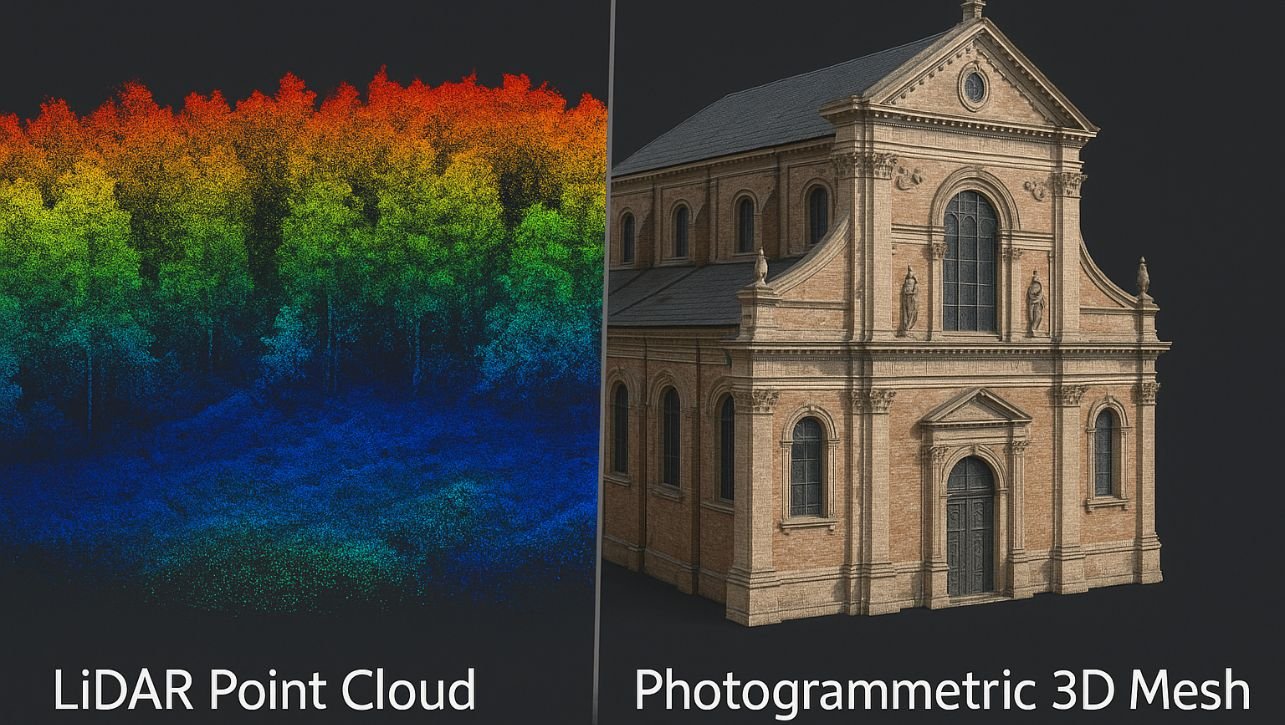
LiDAR (Light Detection and Ranging) technology has revolutionized the way we capture and analyze geospatial data. From urban planning and forestry to flood modeling and archaeology, LiDAR data is incredibly powerful—but also huge and complex. That’s where specialized software tools come in. Whether you’re a seasoned GIS professional, a surveyor, or just diving into remote sensing, having access to reliable and free LiDAR tools can make all the difference. 10 Best Free LiDAR Software Tools and Viewers Here’s a list of 10 of the best free LiDAR software tools and viewers you can start using today: 1. LAStools (Partial Free Version) Platform: WindowsUse for: Fast processing, conversion, filtering, and compression of LiDAR data LAStools is practically a legend in the LiDAR community. While it offers a commercial license for full access, many of its core tools are freely available and extremely powerful. It supports operations like tiling, merging, filtering, classifying, and converting LAS/LAZ files with impressive speed. 🔍 Pro Tip: Use LAStools with QGIS for a powerful free geospatial workflow. 2. CloudCompare Platform: Windows, macOS, LinuxUse for: 3D point cloud and mesh editing, visualization, and comparison CloudCompare is open-source and one of the most flexible 3D point cloud viewers/editors out there. It can handle massive datasets and supports various point formats, including LAS and E57. It’s excellent for visual analysis, segmentation, and registration. ✨ Visualization is its strong suit—ideal for inspection and QA workflows. 3. PDAL (Point Data Abstraction Library) Platform: Cross-platform (CLI-based)Use for: Advanced LiDAR processing pipelines PDAL is the open-source equivalent of GDAL but for point cloud data. It supports scripting and pipeline-based workflows for things like filtering, transforming, and analyzing point clouds. Although it has a steeper learning curve, it’s incredibly powerful and is widely used in automation and large-scale processing. 💡 Best for users who are comfortable with command-line tools and scripting. Related Content:  The Best 15 Google Maps Scrapers of 2025 Top 10 GIS Software: Features, Benefits, and Comparisons How to Build AI-Powered GIS Applications Using DeepSeek AI [2025] 4. QGIS with LAStools or PDAL Plugin Platform: Cross-platformUse for: Visualizing and processing LiDAR within a full GIS environment QGIS isn’t LiDAR software per se, but with the right plugins (like LAStools, PDAL, or the native LAS/LAZ viewer), it becomes a powerful tool for managing LiDAR data alongside vector and raster GIS layers. 🌍 Perfect for GIS professionals who want everything in one platform. 5. Fusion (USFS LiDAR Toolkit) Platform: WindowsUse for: Forest structure analysis and canopy modeling Developed by the U.S. Forest Service, Fusion is specifically designed for forest-based LiDAR analysis. It supports canopy height modeling, density metrics, and visual analysis. While the interface feels a bit dated, it’s still a favorite among forestry professionals. 🌲 Tailored for vegetation and terrain studies. 6. Potree Platform: Web-based viewer (JavaScript)Use for: Web visualization of point clouds Potree is a WebGL-based viewer that allows you to publish massive point clouds online. It’s ideal for sharing LiDAR data with stakeholders or embedding interactive views into websites. 🌐 Great for presentations, client deliverables, or education. 7. OpenTopography Tools Platform: Web-basedUse for: Accessing, viewing, and analyzing LiDAR data OpenTopography offers a user-friendly portal to access open LiDAR datasets, process them on the cloud, and even download custom outputs. It’s especially useful if you don’t want to install heavy software but need quick results. 📡 Ideal for fast online workflows and data discovery. 8. FME (Free Viewer) Platform: Windows, macOSUse for: Viewing and inspecting point cloud data While FME’s full version is paid, Safe Software offers a free viewer that lets you visualize point clouds in multiple formats. It’s helpful for data QA, transformation previews, and interoperability checks. 🔄 A lightweight way to explore complex datasets. 9. Entwine + Potree Converter Platform: CLI/WebUse for: Converting large point clouds into web-ready formats Entwine is a powerful tool for organizing massive point clouds into streamable formats. It works beautifully with Potree and CesiumJS, letting you serve terabytes of LiDAR online with ease. 📁 Excellent for managing large public datasets or web-based platforms. 10. LASTools + ArcGIS (via LAS Dataset) Platform: WindowsUse for: Combining ArcGIS power with LAStools (limited in free version) If you’re an ArcGIS user, you can use the built-in LAS dataset capabilities for viewing and analyzing LiDAR data. While ArcGIS itself isn’t free, the LAS dataset support is robust, and pairing it with LAStools’ free components makes for a solid combo. 📊 Best for users already in the Esri ecosystem but looking for free extensions. Final Thoughts Free doesn’t mean limited—these tools prove that professionals can work efficiently with LiDAR data without spending a dime. Whether you’re building DEMs, analyzing forests, or developing web viewers, there’s a free solution waiting for you. 🔗 Bonus Tip: Mix and match! Use PDAL for heavy processing, CloudCompare for inspection, and Potree to share your results online. The combination can rival many premium solutions.

Free Practice MCQs of Professional Practice For NEC | Mock Test 2025

MCQs of Professional Practice

📘 Free Practice MCQs of Professional Practice For NEC | Mock Test Prepare confidently for your NEC licensing exams with this free set of Multiple Choice Questions (MCQs) focused on Professional Practice. This quiz is designed to help engineers, surveyors, and professionals in Nepal familiarize themselves with the types of questions that may appear in the NEC (Nepal Engineering Council) exams. 🔹 Topics Covered: Engineering ethics & responsibilities NEC code of conduct Professional liability Contract management Legal aspects of engineering in Nepal 📝 Each attempt will sharpen your understanding of core concepts and boost your confidence. Whether you’re just starting your preparation or reviewing before the exam, this quiz is a great tool to test your knowledge. Start practicing now and move one step closer to becoming a licensed professional in Nepal! 📌 Why Practice MCQs for NEC? The Professional Practice section is one of the most important parts of the NEC exam. It evaluates your knowledge of: Engineering ethics Professional responsibilities Legal and contract issues Code of conduct NEC rules and regulations Practicing MCQs helps you: ✅ Understand question patterns✅ Improve time management✅ Identify weak areas✅ Gain exam confidence 📘 What’s Included in This Quiz? 🎯 20+ MCQs based on NEC syllabus 🕒 Time-based questions to simulate exam pressure 📊 Score & feedback at the end ✅ Correct answers and explanations 📱 Mobile & desktop friendly 🔗 Related Resources: Free Practice Quiz SET for NEC (Nepal Engineering Council) License Exam 50+ Astronomy MCQ Questions With Explanation Set-1  Astronomy MCQ Questions Free Practice Set-2 📥 Want to Download These Questions? We’re also working on a PDF version of these questions with answers so you can revise anytime, even offline. Stay tuned or [subscribe to our newsletter] to get it first! 🧠 Final Words: The NEC license exam is a major milestone for every engineer in Nepal. Don’t let the Professional Practice section hold you back. Take full advantage of our free MCQs, test yourself, and walk into your exam with confidence.

GIS for Pets: Mapping Your Dog’s Favorite Walking Routes and Hangout Spots

GIS for Pets

GIS for Pets: Have you ever wondered where your dog goes during their daily walks or which spots they love the most? What if you could map your furry friend’s favorite routes and hangout spots using Geographic Information Systems (GIS)? In this lighthearted guide, we’ll show you how to use GIS to track your pet’s movements and habits—turning your dog’s adventures into a fun, data-driven project! Why Map Your Dog’s Movements with GIS for Pets? GIS isn’t just for urban planning or disaster management—it can also be a playful tool for pet owners! By mapping your dog’s walking routes and favorite spots, you can: Understand their preferences: Discover which parks, trails, or streets your dog loves the most. Improve their routine: Optimize walking routes for exercise and mental stimulation. Create a pet memory map: Preserve your dog’s favorite places as a unique keepsake. Share fun insights: Impress fellow pet owners with your tech-savvy approach to pet care. How to Use GIS to Map Your Dog’s Adventures 1. Gather the Right Tools To get started, you’ll need: A GPS tracker (attached to your dog’s collar) or a smartphone app that records location data. GIS software like QGIS (free and open-source) or ArcGIS (for more advanced users). A spreadsheet to organize your data (e.g., Excel or Google Sheets). 2. Collect Location Data Take your dog on their usual walks and let the GPS tracker record their movements. Make sure to: Note the starting and ending points of each walk. Mark spots where your dog stops to sniff, play, or relax. Repeat this process over several days to gather enough data. 3. Organize and Input Data into GIS Software Once you’ve collected the data, organize it into a spreadsheet with columns for: Latitude and longitude coordinates. Timestamps (date and time of each location). Notes (e.g., “stopped to play with another dog”). Import the data into your GIS software to create a visual map of your dog’s routes and favorite spots. 4. Visualize Your Dog’s Adventures with GIS for Pets Use GIS tools to: Plot walking routes: Create lines connecting the GPS points to show your dog’s path. Highlight favorite spots: Use markers or heatmaps to identify areas your dog visits frequently. Add context: Overlay your map with local landmarks, parks, or trails for a richer story. 5. Analyze and Share Your Findings Now that you’ve mapped your dog’s movements, you can: Identify patterns (e.g., does your dog prefer shady spots or open fields?). Share the map with friends or on social media—because who doesn’t love a tech-savvy pet owner? Use the data to plan new walking routes that keep your dog happy and engaged. Fun Ideas to Take Your Pet Mapping to the Next Level Create a “Paw Print Map”: Print your dog’s favorite routes and frame it as a unique piece of art. Compare with Other Pets: Collaborate with fellow pet owners to create a community pet map. Track Seasonal Changes: See how your dog’s habits change with the weather or seasons. Why This Matters (Even If It’s Just for Fun) While mapping your dog’s movements might seem like a quirky project, it’s also a great way to: Learn the basics of GIS in a fun, approachable way. Bond with your pet by understanding their preferences and habits. Showcase the versatility of GIS technology in everyday life. Final Thoughts Who knew GIS could be so paws-itively fun? By mapping your dog’s favorite walking routes and hangout spots, you’re not only creating a unique keepsake but also exploring the creative potential of geospatial technology. So grab a GPS tracker, fire up your GIS software, and start mapping your furry friend’s adventures today!

The Best 15 Google Maps Scrapers of 2025

Google Maps Scrapers

Learn about the top Google Maps scrapers available, their unique features, and how they can enhance your data collection efforts. In this guide, you’ll learn: What a Google Maps scraper is Why it outperforms the Google Places API Essential factors to consider when choosing a Google Maps scraping service The best Google Maps scrapers on the market Let’s dive in! What Is a Google Maps Scrapers? A Google Maps scraper is a specialized tool, service, or solution designed to retrieve information from Google Maps pages. It extracts specific geolocated data based on user-defined queries, enabling highly targeted data collection. To work effectively, a Google Maps scraping service must handle complex tasks such as bypassing anti-scraping measures, managing proxies, and implementing geo-targeting. Once the data is extracted, the scraper automatically parses it into user-friendly formats such as JSON or CSV. For more details, follow our tutorial on how to scrape Google Maps with Python. Why Do You Need It Instead of the Places API? Google features an official Places API to programmatically retrieve Maps data. While this API is widely used, it comes with limitations that make scraping a more appealing option. Here’s why choosing a Google Maps scraper over the Places API is beneficial: Cost Efficiency: The Places API follows a strict pay-as-you-go pricing model, whereas scraping providers generally offer more cost-effective plans. Freedom from API Rate Limits: The Places API imposes rate limits, restricting how much data you can fetch within a given timeframe. Scraping helps bypass these constraints. Access to All Data Points: The data returned by the Places API is limited and may change over time. Scrapers, however, can capture all available information on Google Maps pages with no restrictions. For further insights, read our guide on web scraping vs API. Aspects to Consider When Evaluating Google Maps Scrapers Below are essential factors to consider when choosing the best Google Maps scrapers: Features: Capabilities and functionalities offered by the scraping service. Type: The type of web scraping service (e.g., API, browser extension, no-code tool, etc.). Available Data: Information the scraper can extract. Free Option: Presence of a free plan or trial period to test the service before committing to a paid plan. Pricing: The pricing structure of available plans. Review Score: User ratings on platforms like G2, Capterra, Chrome Web Store, etc. Best Services to Scrape Google Maps Explore the top 15 Google Maps scraper services, ranked based on the criteria presented earlier. 1. Bright Data Type: Scraping API Available Data: Business names, addresses, contact details, reviews, open hours, images, and more Free Option: Yes, via a free trial Pricing: Pay-as-you-go model Review Score: 4.7/5 on G2 2. Map Lead Scraper Type: Chrome Extension Available Data: Name, phone, email, social media links, website URL, etc. Free Option: Yes, with limited features Pricing: Starts at $9.9/month Review Score: 4.8/5 on Chrome Web Store 3. NoDataNoBusiness Type: Google Sheets Integration Available Data: Contact details, phone numbers, ratings, etc. Free Option: Yes, with 200 free credits Pricing: Starts at $19/month Review Score: 4.5/5 on Google Workspace Marketplace 4. Scrapingdog Type: Scraping API Available Data: General Maps information, posts, photos, reviews Free Option: Yes, with 1,000 free credits Pricing: Starts at $40/month Review Score: 4.8/5 on Trustpilot 5. Octoparse Type: No-Code Desktop Tool Available Data: Title, review count, rating, address, etc. Free Option: Yes, with limited tasks Pricing: Starts at $119/month Review Score: 4.6/5 on G2 Read More: Top 10 GIS Software: Features, Benefits, and Comparisons 6. Outscraper Type: Scraping API Available Data: Name, phone, website, reviews, etc. Free Option: Yes, up to 500 records Pricing: Pay-as-you-go model Review Score: 4.7/5 on Trustpilot 7. Apify Type: Full-Stack Web Scraping Platform Available Data: Depends on selected Actor Free Option: Yes, with limited resources Pricing: Varies per Actor Review Score: 4.8/5 on G2 8. G Maps Extractor Type: Chrome Extension Available Data: Business names, phone numbers, emails, etc. Free Option: Yes, up to 1,000 leads per month Pricing: Starts at $49/month Review Score: N/A 9. PhantomBuster Type: Cloud Scraper Available Data: Place URL, title, rating, etc. Free Option: Yes, via a 14-day free trial Pricing: Starts at $56/month Review Score: 2.8/5 on Trustpilot Read More: Automating GIS Workflows With QGIS: A Complete Guide For 2025 10. MapsScraper Type: Chrome Extension Available Data: Business name, address, phone, reviews, etc. Free Option: Yes, via a 7-day free trial Pricing: Starts at $19/month Review Score: 3.7/5 on Trustpilot 11. Web Scraper.io Type: Chrome Extension Available Data: Business names, phone numbers, addresses Free Option: Yes Pricing: Free and premium versions available Review Score: 4.2/5 on Chrome Web Store 12. Data Miner Type: No-Code Scraper Available Data: Business details, emails, and more Free Option: Yes Pricing: Starts at $19/month Review Score: 4.3/5 on Chrome Web Store 13. ParseHub Type: No-Code Scraping Tool Available Data: Various Google Maps data points Free Option: Yes, with limited runs Pricing: Starts at $189/month Review Score: 4.4/5 on G2 Read More: 10 Best GIS-Related AI Automation Software in 2025 14. Scrapebox Type: Windows Software Available Data: Contact details, reviews, and more Free Option: No Pricing: One-time payment of $97 Review Score: 4.0/5 on SEO forums 15. WebHarvy Type: Point-and-Click Scraper Available Data: Google Maps business data Free Option: Yes, with limitations Pricing: One-time payment of $129 Review Score: 4.5/5 on Trustpilot Conclusion These 15 Google Maps scrapers offer powerful solutions for extracting location-based data. Among them, Bright Data’s Google Maps Scrapers API remains the top choice for its scalability and robust features. Choose the best scraper based on your specific needs and budget!

Advanced Diploma in Geographic Information Systems (GIS): Master Spatial Analysis & Boost Your Career in 2025 Free!

GIS

In today’s data-driven world, possessing technical skills in spatial analysis and mapping is essential for career growth. Geographic Information Systems (GIS) have revolutionized industries such as urban planning, environmental management, disaster response, and business intelligence. Whether you’re a beginner, a college student, or a working professional, enrolling in an Advanced Diploma in GIS can be your gateway to mastering spatial technologies and significantly boosting your career prospects in 2025 and beyond. Why Choose GIS? GIS is not just about maps; it’s a powerful analytical tool that integrates geography with data science, remote sensing, and artificial intelligence. GIS professionals are in high demand across multiple sectors, including government, real estate, transportation, and public health. Whether you want to start your GIS career or enhance your technical expertise, an advanced diploma in GIS offers valuable insights and hands-on experience.   Read More: Top 10 GIS Software: Features, Benefits, and Comparisons Read More: Automating GIS Workflows With QGIS: A Complete Guide For 2025 Who Can Apply? Advanced Diploma in GIS is suitable for: College students interested in geospatial technologies. Graduates from geography, engineering, or environmental sciences. Professionals looking to upskill in GIS applications. Researchers and analysts working with spatial data. Benefits of an Advanced Diploma in GIS Career Advancement: GIS expertise can open doors to well-paying roles in government agencies, private firms, and international organizations. Cost-Effective Learning: Many institutions offer affordable programs with financial aid and scholarships. Hands-On Training: Gain real-world experience with GIS software like ArcGIS, QGIS, and Google Earth Engine. Global Career Opportunities: GIS professionals work in diverse industries, including urban planning, climate science, and logistics. Continuous Learning: GIS is evolving with AI, Big Data, and Machine Learning—staying updated ensures long-term career growth. Tips for Maximizing Your Learning Experience Set Goals: Define what GIS applications interest you the most—urban planning, environmental management, or business intelligence. Practice Regularly: Engage in projects using GIS tools to reinforce your learning. Read More: 10 Best GIS-Related AI Automation Software in 2025 Read More: Automating GIS Workflows with DeepSeek AI: A Step-by-Step Guide [2025] Explore Real-World Applications: Apply GIS skills to solve real-world problems in your community. Network: Join online GIS forums, attend webinars, and connect with GIS professionals to expand your knowledge. Top 4 GIS Courses in an Advanced Diploma 1. Advanced Diploma in Geographic Information Systems This course provides fundamental training in GIS software, spatial data management, and visualization techniques. You will learn how to create interactive maps, analyze spatial patterns, and generate data-driven insights for decision-making. Topics include: Introduction to GIS tools (ArcGIS, QGIS) Geospatial data collection and processing Cartography and data visualization techniques Course Link: Click Here 2. Remote Sensing and Image Interpretation This course covers remote sensing techniques, including satellite imagery analysis, aerial photography, and LiDAR technology. Learn how to extract meaningful information from remotely sensed data to monitor land use, environmental changes, and disaster management. Topics include: Basics of satellite and drone imagery Image classification techniques Applications in environmental monitoring and agriculture Course Link: Click Here 3. GIS for Urban and Regional Planning This module focuses on using GIS for smart city planning, transportation networks, and land-use management. Understand how GIS tools help in infrastructure development, population studies, and environmental impact assessment. Topics include: Spatial planning for urban growth GIS applications in transportation and smart cities Environmental impact and sustainability assessment Course Link: Click Here Read More: Top 10 GIS Apps Powered by AI: A Future Perspective Read More: How DeepSeek AI is Revolutionizing GIS Automation [2025] 4. Geospatial Big Data and Machine Learning in GIS This advanced course integrates GIS with machine learning and big data analytics. Learn how artificial intelligence enhances spatial predictions, automates mapping tasks, and optimizes decision-making processes. Topics include: Machine learning algorithms for spatial analysis Handling big geospatial data with Python and R Predictive modeling for climate change and disaster response Course Link: Click Here Conclusion An Advanced Diploma in GIS offers a transformative learning experience, equipping you with cutting-edge skills in spatial analysis and mapping. Whether you’re a student, a professional, or a researcher, mastering GIS will unlock new career opportunities and keep you ahead in the competitive job market. Enroll today and take the first step towards becoming a GIS expert!

Top 10 GIS Software: Features, Benefits, and Comparisons

GIS Software

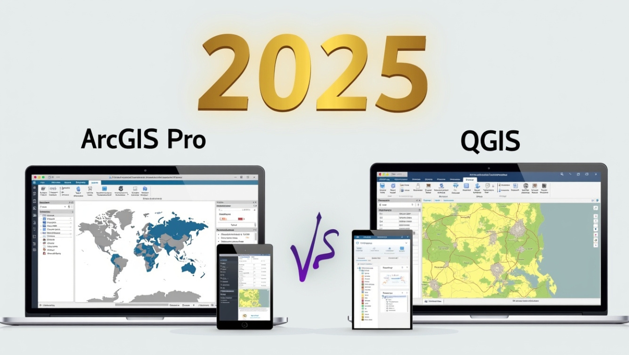
Geographic Information System (GIS) software plays a crucial role in mapping, spatial analysis, and data visualization across various industries. From urban planning to environmental management, the right GIS software can make a significant difference in decision-making. In this article, we will explore the top 10 GIS software, their features, benefits, and comparisons to help you choose the best one for your needs. Top 10 GIS Software 1. ArcGIS by Esri Features: Advanced spatial analysis and geoprocessing tools. Cloud-based mapping with ArcGIS Online. 3D mapping and visualization capabilities. Large dataset handling and remote sensing analysis. Benefits: Industry leader with robust customer support. Highly customizable with plugins and APIs. Integrates with various third-party applications. Best For: Government agencies, enterprises, and research institutions. 2. QGIS (Quantum GIS) Features: Open-source and free to use. Supports multiple file formats including shapefiles, GeoJSON, and raster data. Strong community support and regular updates. Integration with GRASS GIS and PostGIS for extended functionality. Benefits: No licensing cost. User-friendly with a wide range of plugins. Ideal for both beginners and professionals. Best For: Students, small businesses, and research projects. 3. Google Earth Pro Features: High-resolution satellite imagery. Historical imagery to track changes over time. GIS data import for analysis. Free for personal and commercial use. Benefits: Easy-to-use interface with powerful visualization tools. Excellent for geographical research and presentations. Supports 3D terrain and structures. Best For: Educators, journalists, and environmental researchers. 4. GRASS GIS Features: Advanced geospatial modeling and raster data analysis. Open-source with extensive GIS and remote sensing tools. Supports scripting with Python and shell scripts. Multi-platform support (Windows, macOS, Linux). Benefits: Highly flexible and customizable. Excellent for scientific research and academic use. Free with no licensing restrictions. Best For: GIS researchers, academics, and professionals in environmental science. 5. MapInfo Pro Features: Strong spatial analysis and visualization tools. Seamless integration with databases like SQL Server and Oracle. Customizable with MapBasic programming language. High-quality cartographic output. Benefits: Great for businesses needing location intelligence. User-friendly with drag-and-drop functionalities. Strong support for demographic and economic analysis. Best For: Business analysts, real estate firms, and logistics companies. 6. Global Mapper Features: Supports over 300 file formats. Powerful terrain analysis and LiDAR data processing. 3D visualization and fly-through tools. Affordable pricing compared to premium GIS software. Benefits: Easy learning curve with intuitive UI. Great for processing large geospatial datasets. Ideal for non-GIS professionals. Best For: Surveyors, forestry management, and engineers. 7. SuperMap GIS Features: Cloud, desktop, and mobile GIS solutions. AI-powered spatial data analysis. 3D GIS and BIM integration. Supports big data processing. Benefits: Cutting-edge technology with AI support. Excellent performance with large datasets. Great for smart city planning and urban development. Best For: Urban planners, engineers, and government projects. 8. Manifold GIS Features: High-speed GIS processing. Full SQL integration for data management. Parallel processing for enhanced performance. Works well with big data and cloud computing. Benefits: Extremely fast with multi-core support. Affordable with a one-time license fee. Good alternative to expensive GIS software. Best For: Data scientists, developers, and GIS professionals. 9. SAGA GIS Features: Free and open-source software. Advanced geostatistics and terrain analysis tools. Strong hydrological modeling capabilities. Cross-platform support. Benefits: Specialized for geospatial analysis and research. Lightweight with powerful tools. Excellent for academic and research purposes. Best For: Hydrologists, environmental scientists, and geospatial researchers. 10. GeoDa Features: Specializes in spatial data analysis. Free and open-source. Interactive data visualization tools. Statistical and econometric modeling. Benefits: Ideal for socio-economic and demographic studies. User-friendly interface for quick data exploration. Great for GIS beginners in data science. Best For: Economists, data scientists, and public policy analysts. Comparison Table of Top GIS Software GIS Software Price Best For Key Features ArcGIS Paid Enterprises, Research 3D Mapping, Cloud GIS QGIS Free Students, Small Projects Open-Source, Plugins Google Earth Pro Free Educators, Research High-Resolution Imagery GRASS GIS Free Scientific Research Advanced Raster Analysis MapInfo Pro Paid Business Analysis Demographic Data Integration Global Mapper Paid Surveying, Forestry LiDAR, 3D Visualization SuperMap GIS Paid Smart Cities, AI GIS Cloud, Big Data Support Manifold GIS Paid Data Science SQL, High-Speed Processing SAGA GIS Free Hydrology, Terrain Analysis Geostatistics, Open-Source GeoDa Free Social Science, Statistics Econometric Modeling Conclusion Choosing the best GIS software depends on your specific needs. If you are looking for an industry-standard GIS, ArcGIS is the best choice. If you prefer an open-source alternative, QGIS and GRASS GIS are excellent options. For those interested in business applications, MapInfo Pro is a strong candidate. Meanwhile, researchers and scientists might find SAGA GIS and GeoDa more suitable. Regardless of your choice, GIS software is an invaluable tool for spatial analysis, mapping, and decision-making. Which GIS software do you use? Let us know in the comments!

Automating GIS Workflows With QGIS: A Complete Guide For 2025

Automating GIS Workflows With QGIS

Geographic Information Systems (GIS) have become an essential tool for spatial analysis, mapping, and decision-making across various industries. QGIS, an open-source GIS software, offers powerful automation capabilities that save time, reduce errors, and enhance productivity. Whether you are a GIS analyst, a researcher, or a developer, automating GIS workflows in QGIS can significantly streamline your tasks. This guide will walk you through different methods and tools to automating GIS workflows with QGIS in 2025. Why Automate GIS Workflows? Manual GIS tasks can be time-consuming and prone to human errors. Automation provides several benefits, including: Efficiency: Processing large datasets in a fraction of the time. Accuracy: Reducing human error by following a consistent workflow. Scalability: Handling complex tasks effortlessly. Reproducibility: Ensuring repeatability of GIS tasks for future use. Methods to Automate GIS Workflows in QGIS QGIS offers multiple automation techniques ranging from built-in tools to scripting. Below are the most effective methods for automating GIS tasks: 1. Processing Toolbox and Model Builder QGIS has a built-in Processing Toolbox that provides an extensive collection of geoprocessing tools. The Model Builder allows users to chain multiple processes together into a single workflow. Steps to Automate Using Model Builder: Open QGIS and go to Processing Toolbox. Select Model Designer under the Processing menu. Drag and drop the necessary geoprocessing tools. Connect them logically to create a workflow. Save and run the model to automate your GIS task. 2. Automating with PyQGIS (Python in QGIS) For advanced GIS automation, PyQGIS (QGIS’s Python API) allows scripting to automate repetitive GIS tasks. Example: Automating Data Import and Processing from qgis.core import * from qgis.utils import iface # Load vector layer layer = QgsVectorLayer(“C:/data/shapefile.shp”, “My Layer”, “ogr”) if not layer.isValid(): print(“Layer failed to load!”) else: QgsProject.instance().addMapLayer(layer) Advantages of PyQGIS: Can be used to automate complex workflows. Enables batch processing of multiple datasets. Provides flexibility to integrate with other tools. See Also: Using DeepSeek AI for Predictive Spatial Analytics in GIS 3. Using QGIS Processing Scripts Processing scripts can be created within QGIS to automate a series of geoprocessing steps. These scripts can be written in Python and executed within the QGIS Processing Toolbox. Example: Creating a Simple Processing Script from qgis.processing import run params = { ‘INPUT’: ‘C:/data/input.shp’, ‘OUTPUT’: ‘C:/data/output.shp’ } run(“native:buffer”, params) 4. Batch Processing in QGIS Batch processing allows users to run the same GIS task on multiple datasets simultaneously. Many geoprocessing tools in QGIS support batch mode. Steps to Use Batch Processing: Open any processing tool (e.g., Buffer). Click Run as Batch Process. Add multiple input datasets. Specify output locations. Execute the process. See Also: Top 10 GIS Apps Powered by AI: A Future Perspective 5. Automating GIS Workflows with Plugins QGIS has a vast plugin ecosystem that extends its automation capabilities. Some useful plugins include: Processing R: Integrates QGIS with R for statistical and spatial analysis. QGIS2Web: Automates web map creation. DB Manager: Automates database tasks within QGIS. Case Study: Automating Land Use Classification Let’s consider an example where we need to classify land use data for a city using automation techniques in QGIS. Workflow Steps: Data Import: Use PyQGIS to load satellite imagery. Preprocessing: Apply filtering and smoothing using QGIS Processing Scripts. Classification: Automate land use classification using ML models via the Processing R plugin. Export Results: Save classified maps automatically to a directory. This automation reduces manual intervention and ensures a reproducible classification workflow. See Also: How GIS Users Use DeepSeek AI: Transforming Spatial Analysis with AI-Powered Insights Best Practices for GIS Automation in QGIS To make the most out of GIS automation in QGIS, follow these best practices: Use Relative Paths: Ensure scripts work across different machines. Document Your Workflow: Maintain clear documentation of automated processes. Test on Small Datasets: Before scaling up, test your scripts/models on smaller datasets. Regularly Update Plugins: Ensure compatibility with new QGIS versions. Utilize QGIS Logs: Check logs for debugging automation issues. Future of GIS Automation in QGIS (2025 & Beyond) With advancements in AI and cloud computing, GIS automation in QGIS is evolving. Some future trends include: AI-Powered GIS Automation: Machine learning models will enhance automated feature extraction and classification. Cloud-Based GIS Automation: Integration with cloud platforms like Google Earth Engine. No-Code GIS Automation: Enhanced Model Builder for users with no coding experience. See Also: GeoAI: The New Era of Artificial Intelligence in Geography Conclusion Automating GIS workflows in QGIS is essential for improving efficiency, accuracy, and scalability. Whether using Model Builder, PyQGIS, Processing Scripts, or Plugins, QGIS provides diverse automation options. As technology advances, automation in GIS will become even more seamless, empowering users to handle complex spatial analysis with ease. If you found this guide helpful, consider subscribing to our newsletter for more GIS tips and tutorials! Frequently Asked Questions (FAQs) Q1: Can I automate GIS workflows in QGIS without coding? Ans: Yes, using Model Builder and Batch Processing, you can automate tasks without writing code. Q2: What programming language does QGIS use for automation? Ans: QGIS uses Python (PyQGIS) for scripting and automation. Q3: How can I schedule GIS tasks to run automatically? Ans: You can use external schedulers like Windows Task Scheduler or cron jobs (Linux) to run QGIS scripts periodically. Q4: Can I integrate QGIS automation with other GIS software? Ans: Yes, QGIS supports interoperability with ArcGIS, PostGIS, and cloud-based GIS platforms. Q5: Where can I learn more about PyQGIS? Ans: The official QGIS documentation and online courses are great resources to master PyQGIS.

Integrating Deep Learning With GIS | GeoAI [2025]

Featured Image (Top of the Blog) Image Type: A futuristic AI-powered GIS visualization. Suggested Image: A digital rendering of a world map with data overlays, neural network connections, and satellite imagery.

In recent years, Geographic Information Systems (GIS) have revolutionized how we analyze spatial data. With the rapid advancements in artificial intelligence (AI) and deep learning, the integration of these technologies has paved the way for GeoAI—a powerful combination that enhances spatial analytics and decision-making. This blog post explores how deep learning is transforming GIS and how to Integrating Deep Learning With GIS, its applications, benefits, and career opportunities for job seekers and students aiming to enter this growing field. Understanding GeoAI: The Fusion of GIS and Deep Learning GeoAI refers to the integration of geospatial data with artificial intelligence techniques, particularly deep learning models, to analyze, predict, and visualize spatial patterns. GIS, which traditionally relied on manual interpretation and rule-based models, now benefits from AI’s ability to process vast datasets efficiently. Deep learning, a subset of machine learning, enables GIS to handle complex geospatial challenges by recognizing patterns and extracting insights that were previously difficult to detect. Why Is Deep Learning Important for GIS? Enhanced Image Processing – AI-powered GIS applications can analyze satellite imagery, detect changes, and classify objects with higher accuracy. Automated Feature Extraction – Deep learning helps in identifying features like roads, buildings, and land cover automatically. Improved Prediction Models – AI enhances GIS applications in climate change modeling, disaster management, and urban planning. Real-Time Decision Making – AI-driven GIS systems enable faster decision-making for environmental monitoring, agriculture, and infrastructure development. Applications of Deep Learning in GIS GeoAI has transformed various industries by leveraging GIS and AI technologies. Here are some of its major applications: 1. Land Use and Land Cover Classification Deep learning models can process high-resolution satellite imagery to classify land use patterns such as urban areas, forests, water bodies, and agricultural land. This application is essential for urban planning, deforestation monitoring, and resource management. 2. Disaster Prediction and Management GeoAI plays a crucial role in predicting natural disasters like hurricanes, wildfires, and floods. Convolutional Neural Networks (CNNs) analyze historical disaster data, identify patterns, and provide early warnings to minimize damage. See Also: How DeepSeek AI is Revolutionizing GIS Automation 3. Smart Cities and Infrastructure Development Deep learning models integrated with GIS help in designing smart cities by analyzing traffic patterns, optimizing public transportation, and managing utilities. AI-powered GIS applications can detect urban heat islands, plan sustainable housing, and optimize waste management systems. 4. Precision Agriculture GeoAI helps farmers make data-driven decisions by analyzing crop health, soil moisture, and weather conditions using satellite imagery. AI algorithms can detect early signs of crop diseases and suggest remedial actions, leading to higher yields and sustainable farming practices. See Also: DeepSeek AI in GIS: A New Era of Geospatial Intelligence 5. Autonomous Navigation and Transportation GIS-powered deep learning models enable autonomous vehicles to navigate accurately by processing real-time geospatial data. Self-driving cars rely on AI-based lidar mapping, object detection, and road condition analysis. 6. Climate Change Monitoring GeoAI helps researchers analyze climate patterns, monitor changes in glaciers, and predict rising sea levels. AI-driven remote sensing techniques assist in tracking global temperature changes and their impact on biodiversity. Key Deep Learning Techniques Used in GIS Deep learning models have significantly enhanced GIS capabilities. Some of the commonly used AI techniques in GeoAI include: 1. Convolutional Neural Networks (CNNs) CNNs are widely used for image classification, segmentation, and object detection in GIS applications. They play a crucial role in analyzing aerial and satellite imagery for land cover mapping, urban development, and environmental monitoring. See Also: How GIS Users Use DeepSeek AI: Transforming Spatial Analysis with AI-Powered Insights 2. Recurrent Neural Networks (RNNs) RNNs are used for analyzing time-series data in GIS, such as predicting weather patterns, traffic congestion, and flood forecasting. 3. Generative Adversarial Networks (GANs) GANs help in enhancing and generating high-resolution geospatial images, which improves the accuracy of urban planning, forestry management, and disaster simulations. 4. Transformers in GIS Recent advancements in AI have introduced transformer-based models, such as Vision Transformers (ViTs), that provide better spatial feature extraction and enhance the interpretation of geospatial data. See Also: GeoAI: The New Era of Artificial Intelligence in Geography Career Opportunities in GeoAI The demand for professionals skilled in GIS and AI is growing rapidly. Here are some of the top job roles in this field: 1. GeoAI Data Scientist Analyzes large-scale geospatial datasets using AI techniques. Develops predictive models for urban planning and disaster management. Skills Required: Python, TensorFlow, GIS software (ArcGIS, QGIS), Remote Sensing. See Also: Top 10 GIS Apps Powered by AI: A Future Perspective 2. Remote Sensing Analyst Works with satellite and drone imagery to monitor environmental changes. Uses deep learning models for image classification and object detection. Skills Required: Deep Learning, Image Processing, Python, Google Earth Engine. 3. GIS Developer Builds web and mobile applications integrating AI-powered GIS solutions. Develops machine learning models for spatial analysis. Skills Required: JavaScript, Python, Open Source GIS Tools, AI/ML Frameworks. 4. Urban and Regional Planner (AI-GIS Focused) Utilizes AI-driven GIS tools for smart city planning and infrastructure development. Helps governments optimize public services using GeoAI models. Skills Required: GIS, AI Algorithms, Spatial Statistics, Remote Sensing. See Also: Using DeepSeek AI for Predictive Spatial Analytics in GIS 5. Environmental Data Analyst Analyzes climate data and predicts environmental changes. Works with AI models to monitor deforestation, wildlife migration, and carbon emissions. Skills Required: GIS, AI, Remote Sensing, Climate Modeling. How Students Can Start a Career in GeoAI For students and job seekers interested in GeoAI, here’s a roadmap to get started: Learn the Basics of GIS – Get familiar with GIS software like ArcGIS, QGIS, and Google Earth Engine. Master Programming Languages – Learn Python, R, or JavaScript for GIS-based AI applications. Understand AI and Machine Learning – Take online courses on deep learning frameworks like TensorFlow and PyTorch. Gain Hands-On Experience – Work on projects involving satellite imagery analysis, predictive modeling, and spatial AI applications. Earn Certifications – Obtain certifications in GIS, AI, and remote sensing from recognized institutions. Participate in Competitions – Join Kaggle challenges, hackathons, and GIS-focused AI … Read more