In the world of GIS (Geographic Information Systems), ArcGIS Pro stands out as a revolutionary tool designed to enhance mapping, spatial analysis, and data visualization. Developed by Esri, this advanced desktop application has become the go-to solution for professionals and students alike, offering cutting-edge tools for 2D and 3D mapping, geoprocessing, and real-time data integration.
With its intuitive ribbon interface, seamless integration with ArcGIS Online, and support for Python scripting, ArcGIS Pro is tailored for both beginners and seasoned GIS experts. Whether you’re managing urban planning projects, analyzing environmental data, or building sophisticated geospatial models, this software provides the flexibility and power you need.
Join us as we dive into this comprehensive review of ArcGIS Pro, exploring its features, performance, and how it is reshaping the future of GIS workflows.
ArcGIS Pro Software Review
ArcGIS Pro, Esri’s flagship desktop GIS software, is a game-changer in the field of geospatial technology. With its modern design, advanced functionalities, and powerful analytical capabilities, it has become the preferred tool for professionals, educators, and GIS enthusiasts worldwide.
This cutting-edge platform seamlessly integrates 2D and 3D mapping, enabling users to create visually stunning and highly detailed maps. Whether you’re conducting environmental research, managing urban development, or analyzing demographic trends, ArcGIS Pro delivers robust tools to meet your needs.
Here’s an in-depth review of ArcGIS Pro, covering its key strengths, weaknesses, and overall usability.
Rating 4.9/5
1. True 3D Integration with Local and Global Scenes in ArcGIS Pro
Gone are the days when working with 3D data required switching between ArcScene or ArcGlobe. With ArcGIS Pro, 2D and 3D workflows are seamlessly unified, revolutionizing how GIS professionals approach geospatial analysis. Now, users can easily convert 2D data to 3D or synchronize both formats without breaking a sweat.
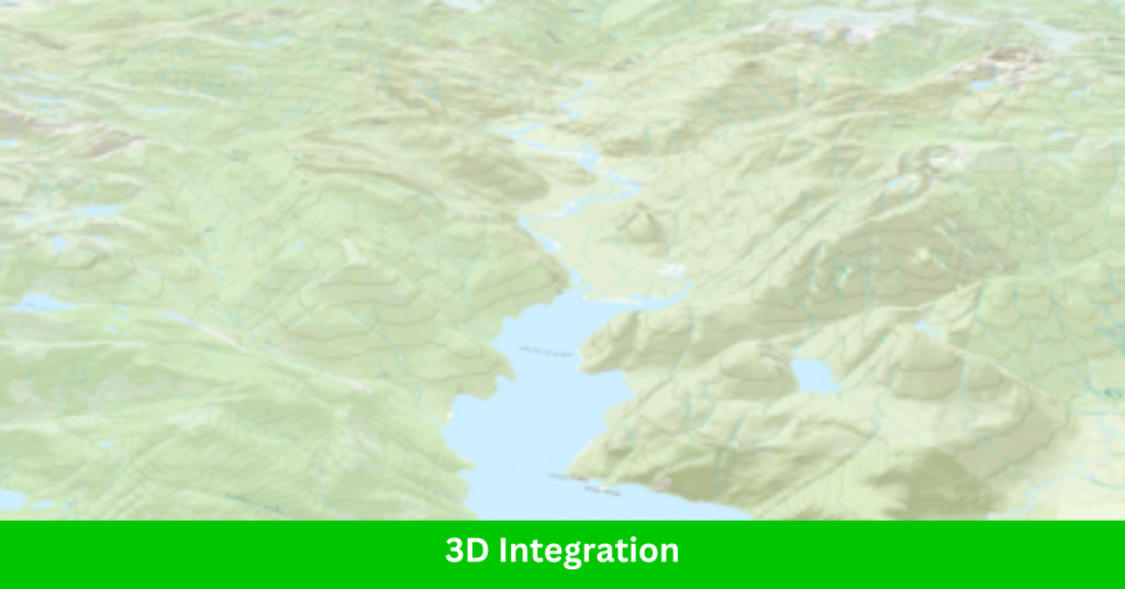
ArcGIS Pro brings 3D mapping to everyone’s fingertips with tools for editing, creating movie timelines, and designing interactive web scenes. From visualizing underground pipelines to managing utilities and countless other GIS applications, this software elevates industries into the third dimension with ease and efficiency.
Switching between platforms used to be a hassle—drag-and-drop functionality between ArcScene and ArcMap was nonexistent. But with ArcGIS Pro, all your 3D data integrates effortlessly within local and global scenes, streamlining the entire process.
This advanced 3D integration not only saves time but also enhances productivity, making ArcGIS Pro the ultimate tool for modern GIS professionals. Whether you’re mapping terrain, analyzing elevation, or creating stunning visuals, ArcGIS Pro ensures that working in 3D has never been this smooth—or this powerful.
2. Build Realistic Rooftops in 3D with ArcGIS Pro
Unleash your inner adventurer with ArcGIS Pro and its powerful 3D building tools. Whether you’re visualizing urban landscapes or designing complex structures, ArcGIS Pro makes creating realistic rooftops in 3D an effortless experience.
With its sleek rendering capabilities, ArcGIS Pro allows you to define roof types and other structural details with precision. All it takes is a normalized Digital Surface Model (nDSM), and the software takes care of the rest, transforming your data into stunning 3D rooftops.
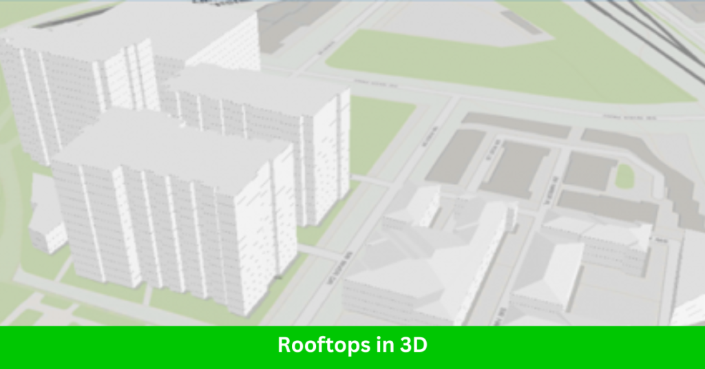
This tool isn’t just about aesthetics—it’s about functionality. From measuring distances between buildings to planning intricate designs, ArcGIS Pro brings realism to your projects. Imagine a 13-meter rooftop jump—can you make it? With the accuracy and detail provided by ArcGIS Pro, you can calculate and visualize every detail of your project.
For GIS professionals working in urban planning, architecture, or 3D modeling, ArcGIS Pro’s 3D rooftop capabilities are an invaluable asset. Say goodbye to tedious manual calculations and hello to automated, realistic 3D visualizations.
3. Access to ArcGIS Online with ArcGIS Pro
Working with ArcGIS Pro means instant access to the robust features of ArcGIS Online, Esri’s cloud-based platform for creating maps and apps. While signing in to your ArcGIS Online account is a required first step, it’s a small trade-off for the powerful capabilities it unlocks.
With ArcGIS Online, creating web maps and apps is remarkably simple. Whether you’re designing tools for field teams, office staff, or community projects, ArcGIS Online provides intuitive apps tailored to your needs. Publish 2D views or stunning 3D web scenes, and customize every detail using Esri’s JavaScript API or the powerful Arcade language for defining symbols and behaviors.
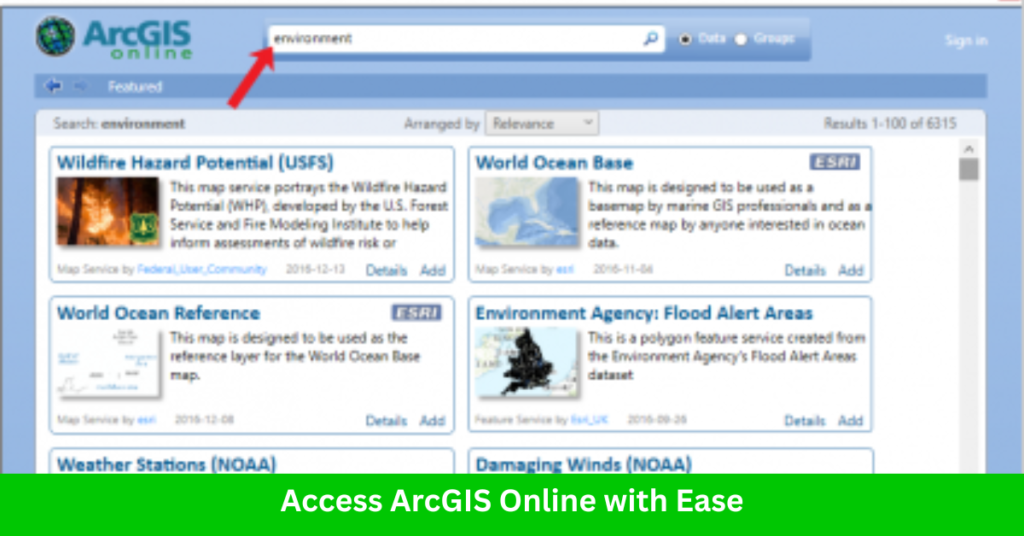
The integration doesn’t stop there. ArcGIS Pro lets you leverage online credits from ArcGIS Online for advanced tasks, such as geoprocessing, spatial analysis, and publishing workflows. From sculpting maps in the cloud to deploying them seamlessly for your organization, ArcGIS Online ensures collaboration and data sharing are easier than ever.
For GIS professionals, the synergy between ArcGIS Pro and ArcGIS Online is a game-changer, making geospatial analysis and cloud mapping accessible and efficient.
4. Faster Loading Imagery with ArcGIS Pro
Handling georeferenced imagery from drones and satellites has always been a challenge, but ArcGIS Pro is making strides in this area. With improved compatibility and functionality, ArcGIS Pro is now better equipped to process high-resolution imagery from sources like DJI drones and satellite data.
For organizations utilizing drones, ArcGIS Pro integrates seamlessly with Drone2Map, making it easier to process 3D data collected from aerial surveys. Whether it’s terrain modeling or structural analysis, this compatibility ensures smooth workflows for drone imagery users.
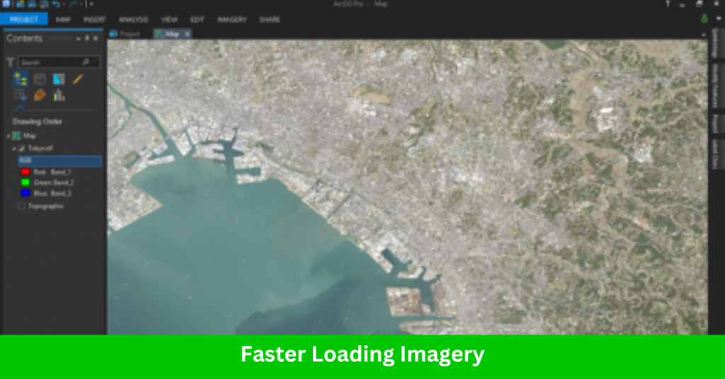
When working with satellite data, ArcGIS Pro can process XML files, enhancing its ability to manage large datasets effectively. While drag-and-drop functionality isn’t yet supported for XML files—something available in tools like SNAP—it’s clear that ArcGIS Pro is becoming more versatile in handling satellite and drone imagery.
These enhancements in imagery processing make ArcGIS Pro a more reliable choice for professionals working with georeferenced data, ensuring faster and more efficient analysis for GIS applications.
5. Georeference Like a Pro with Automatic Georeferencing in ArcGIS Pro
The introduction of automatic georeferencing in ArcGIS Pro piqued our interest, and we couldn’t wait to put it to the test. But how accurate is it in different environments?
To start, we tested in an urban area using two similar images. With building footprints highlighted in pink, we expected the sharp corners of the non-georeferenced image to align perfectly. However, the initial results fell short of expectations, with the tool struggling to achieve precise real-world placement.
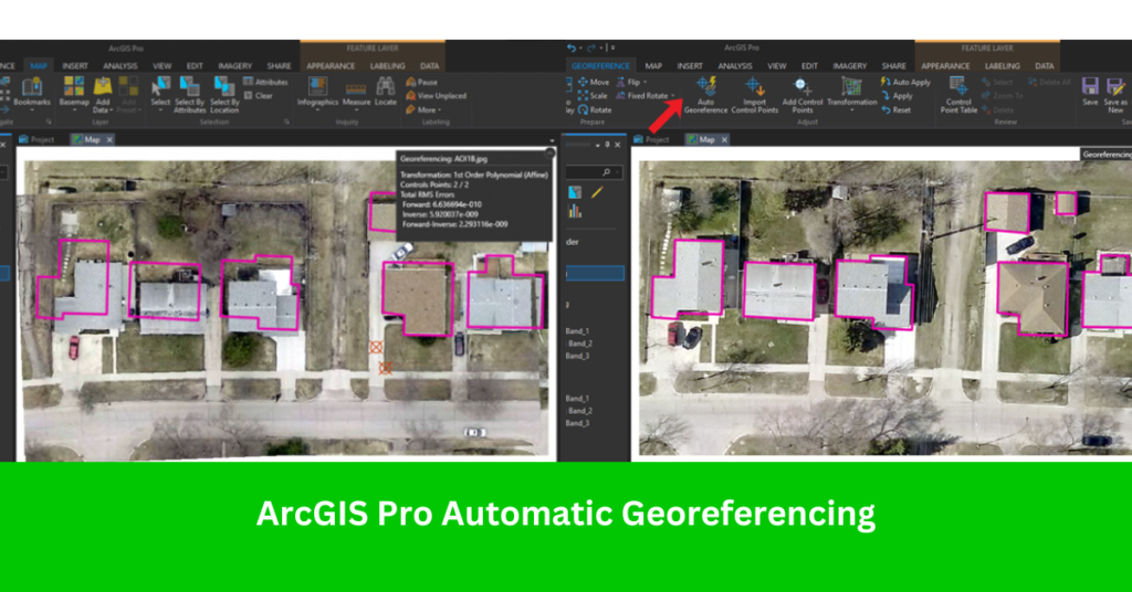
While the idea of automated georeferencing is exciting, it’s not yet foolproof and may require some manual adjustments to improve accuracy. However, we revisited the tool in a second test, and the results showed significant improvement.
If you’re working on georeferencing tasks, ArcGIS Pro’s automatic georeferencing is worth a try—it has potential, especially with refinement. For now, it’s a useful tool, but don’t hesitate to double-check and tweak your results for better alignment.
ArcGIS Pro History
ArcGIS Pro, Esri’s flagship GIS software, represents decades of innovation in geospatial technology. Launched in 2015, it was developed as a modern, more powerful replacement for the ArcMap platform, providing users with a streamlined, future-focused GIS experience.
Here’s a look at the key milestones in ArcGIS Pro’s evolution:
2015: The debut of ArcGIS Pro introduced a ribbon-based interface, 64-bit architecture, and advanced capabilities for 2D and 3D integration. It became the first Esri software to unify 2D and 3D workflows in a single application.
2016–2017: Esri added new tools like 3D Analyst and Spatial Analyst, enhancing the software’s capacity for advanced analysis and visualization. Integration with ArcGIS Online improved collaboration and sharing capabilities.
2018: ArcGIS Pro gained stronger Python support with ArcPy, allowing users to automate workflows and extend the software’s functionality. Tools like Network Analyst were refined for transportation and routing analysis.
2020: The introduction of Machine Learning and AI tools made ArcGIS Pro a robust platform for predictive modeling and large-scale data analysis, catering to industries like urban planning and environmental science.
Present: ArcGIS Pro continues to evolve, offering seamless integration with cloud services, improved imagery processing, and cutting-edge 3D visualization. It remains a cornerstone of GIS workflows across various industries.
From its inception, ArcGIS Pro has been a symbol of Esri’s commitment to empowering users with modern, efficient tools for spatial analysis and geospatial intelligence. It continues to set the standard for desktop GIS applications, bridging the gap between traditional GIS methods and the future of geospatial technology.
Read More: Top 15 Mapper Interview Questions & Answers
Strengths of ArcGIS Pro
1. Unified 2D and 3D Workflows
- Combines 2D mapping and 3D visualization in a single platform.
- Synchronizes 2D and 3D views, making it easier to analyze complex spatial data.
2. Modern, Intuitive Interface
- Ribbon-based design for easier navigation and better productivity.
- Context-sensitive tools and streamlined workflows reduce the learning curve for new users.
3. Advanced Geospatial Analysis
- Comprehensive toolsets for spatial, statistical, and predictive modeling.
- Machine learning and AI integration for cutting-edge analysis.
4. Enhanced Data Visualization
- High-quality rendering for maps, charts, and 3D scenes.
- Customizable symbology and real-time visualization capabilities.
5. Seamless Integration with ArcGIS Online
- Effortlessly publish and share maps, apps, and data in the cloud.
- Access Esri’s extensive online resources, such as basemaps and data layers.
6. Support for Big Data and Real-Time Analytics
- Handles large datasets efficiently, with tools like GeoAnalytics and image processing.
- Real-time tracking and mapping for IoT data and live feeds.
7. Customizability and Automation
- Python scripting via ArcPy for automating tasks and creating custom tools.
- Integration with R and other programming languages for advanced workflows.
8. Interoperability and Data Compatibility
- Supports a wide range of data formats, including CAD, LiDAR, and raster.
- Tools for georeferencing, projections, and data conversion ensure flexibility.
9. Industry-Specific Solutions
- Dedicated tools for transportation, utilities, natural resource management, and more.
- Extensions like Network Analyst, Spatial Analyst, and Image Analyst add specialized functionality.
10. Robust Learning and Community Support
- Extensive documentation, tutorials, and training resources available from Esri.
- A strong user community for support, collaboration, and innovation.
Use Cases of ArcGIS Pro
- Land Use Planning: Urban planners use ArcGIS Pro to analyze zoning, land suitability, and infrastructure for new developments.
- 3D City Modeling: ArcGIS Pro allows planners to visualize cities in 3D, making it easier to design buildings, roads, and other infrastructure in a realistic context.
- Traffic and Transportation Analysis: It helps analyze traffic patterns, identify bottlenecks, and plan new roads, public transport routes, and pedestrian paths.
- Natural Resource Management: Environmental scientists use ArcGIS Pro for habitat analysis, forest management, water resource planning, and wildlife tracking.
- Climate Change Analysis: The software’s advanced tools enable climate scientists to model and predict environmental changes such as sea-level rise, temperature fluctuations, and extreme weather patterns.
- Soil Analysis and Land Management: The software is used for soil sampling, land suitability analysis, and precision planting to maximize crop production.
- Disaster Mapping: ArcGIS Pro is crucial in mapping disaster areas like floods, earthquakes, and wildfires, helping responders visualize damage and plan recovery efforts.
- Site Selection for New Infrastructure: ArcGIS Pro supports site selection for new power plants, water treatment facilities, and telecommunications towers, considering environmental and logistical factors.
- Geospatial Data Integration: ArcGIS Pro facilitates combining multiple data sources, such as satellite imagery, aerial photos, and GPS data, for comprehensive analysis.
- Exploration and Site Analysis: Geologists and mining companies use ArcGIS Pro to explore mineral deposits, analyze soil and rock layers, and select optimal drilling locations.
- Geospatial Intelligence (GEOINT): The software is used for processing and analyzing satellite and drone imagery for intelligence gathering and mission planning.
- Land Parcel Mapping: ArcGIS Pro is widely used by surveyors for precise land parcel mapping, boundary identification, and legal land documentation.
- Property Value Analysis: Real estate professionals use ArcGIS Pro to analyze market trends, land use, and demographic factors to assess property values.
Read More: Top 15 Cadastral Mapper Interview Questions
Who Should Use ArcGIS Pro?
ArcGIS Pro is a versatile GIS platform that caters to a wide range of professionals, researchers, and enthusiasts across multiple domains. Its robust features, intuitive interface, and powerful analytical tools make it ideal for anyone involved in geospatial work. Here’s a closer look at who can benefit most from ArcGIS Pro:
- GIS Professionals
- Urban Planners and Developers
- Environmental Scientists and Conservationists
- Engineers and Surveyors
- Disaster Response Teams and Emergency Managers
- Utility and Telecommunications Professionals
- Real Estate Professionals
- Defense and Security Experts
- Health Professionals and Epidemiologists
- Forestry and Agriculture Experts
- Drone and Remote Sensing Experts
Pros and Cons of ArcGIS Pro
Pros of ArcGIS Pro
1. Advanced 2D and 3D Visualization
- Seamlessly integrates 2D and 3D spatial data.
- Allows users to create, analyze, and share 3D maps and scenes effectively.
2. User-Friendly Interface
- Ribbon-based design similar to Microsoft Office makes it intuitive for new users.
- Customizable layouts streamline workflows and improve efficiency.
3. Powerful Analytical Tools
- Supports spatial, statistical, and raster analyses for complex problem-solving.
- Includes robust geoprocessing tools and Python scripting capabilities.
4. Cloud Integration with ArcGIS Online
- Simplifies sharing maps, data, and applications on the cloud.
- Access to extensive global data sets and Esri’s Living Atlas.
5. Improved Performance
- Faster data rendering and processing compared to legacy tools like ArcMap.
- Optimized for 64-bit architecture, allowing better use of system resources.
6. Broad Industry Application
- Used across diverse fields, including urban planning, environmental management, defense, and telecommunications.
Cons of ArcGIS Pro
1. Steep Learning Curve
- Despite its intuitive interface, beginners may find its advanced features overwhelming.
- Requires training or experience to fully utilize its potential.
2. High System Requirements
- Demands a powerful computer with ample RAM, GPU, and storage for optimal performance.
- May not work efficiently on older or budget devices.
3. Cost of Licensing
- ArcGIS Pro is subscription-based and can be expensive for small businesses or individual users.
- Access to premium features and extensions often requires additional licensing fees.
4. Dependency on ArcGIS Online
- Requires an ArcGIS Online account to fully leverage its features, which may incur additional costs.
5. Limited Backward Compatibility
- Migrating from ArcMap to ArcGIS Pro may lead to compatibility issues with older data or workflows.
- Not all ArcMap tools and extensions are available in ArcGIS Pro.
6. Occasional Stability Issues
- Some users report crashes or bugs when handling large datasets or running complex analyses.
Best Alternatives to ArcGIS Pro
If you’re looking for powerful GIS software but find ArcGIS Pro too costly or resource-intensive, here are three excellent alternatives:
QGIS is a free, open-source GIS platform that offers a comprehensive suite of tools for spatial analysis, mapping, and data visualization.
Best For:
Small businesses, students, and researchers seeking cost-effective GIS solutions.
2. MapInfo Pro
MapInfo Pro is a commercial GIS software by Precisely, known for its robust mapping and spatial analysis capabilities.
Best For:
Businesses and professionals focused on market research and location-based analytics.
3. Global Mapper
Global Mapper is a versatile GIS application known for handling diverse datasets, including LiDAR and raster imagery.
Best For:
Users in forestry, environmental science, and surveying looking for practical GIS solutions.
Conclusion: ArcGIS Pro
ArcGIS Pro is undeniably a game-changer in the GIS industry, offering advanced features that cater to a wide range of geospatial needs. From seamless 2D and 3D integration to its robust analytical tools, cloud connectivity, and intuitive interface, it provides a comprehensive platform for professionals to visualize, analyze, and share spatial data effectively.
However, it’s essential to weigh its strengths against factors like cost and system requirements to determine if it aligns with your specific needs. For professionals, businesses, and organizations looking for cutting-edge GIS software, ArcGIS Pro stands out as a top choice for tackling complex geospatial challenges.
6 thoughts on “ArcGIS Pro Review: Transforming the Way We Map and Analyze”