Geographic Information Systems (GIS) play a vital role in spatial analysis, mapping, and data visualization. However, manual GIS workflows can be time-consuming and prone to human error. DeepSeek AI is revolutionizing GIS automation by leveraging artificial intelligence for automated mapping, data classification, and real-time monitoring. This guide provides a step-by-step tutorial on using DeepSeek AI to streamline GIS workflows, improve accuracy, and enhance decision-making.
A Step-by-Step Guide on Automating GIS Workflows with DeepSeek AI
Here we Explain step-by-step guide on How Automating GIS Workflows with DeepSeek AI:
1. Understanding GIS Automation with DeepSeek AI
What is GIS Automation?
GIS automation involves using AI-powered tools to process and analyze geospatial data efficiently. It reduces manual intervention and enhances accuracy, making GIS workflows more efficient for industries like urban planning, agriculture, disaster management, and environmental monitoring.
How DeepSeek AI Enhances GIS Workflows

✅ Automated Data Processing: Reduces human effort in collecting and cleaning GIS datasets.
✅ Intelligent Mapping: AI-powered mapping improves spatial accuracy and visualization.
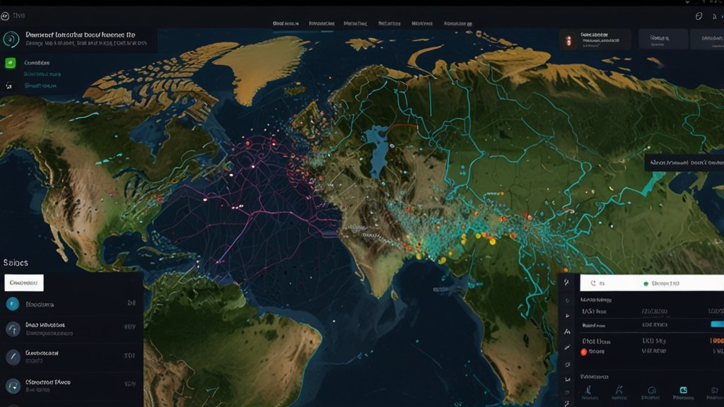
✅ Real-Time Monitoring: Detects changes in landscapes, urban expansion, and natural disasters.
✅ Predictive Analytics: Forecasts land-use changes and environmental trends.
2. Setting Up DeepSeek AI for GIS Automation
Step 1: Install GIS Software and AI Plugins
To begin automating GIS workflows, ensure you have the following:
- GIS Software: QGIS, ArcGIS, or Google Earth Engine.
- DeepSeek AI Integration: Install the DeepSeek AI plugin or connect it via an API.
- AI Frameworks: TensorFlow, PyTorch, or Scikit-learn for deep learning-based GIS tasks.
Step 2: Import Geospatial Data
- Collect datasets from sources such as NASA Earth Observations, OpenStreetMap, or Sentinel Satellite Imagery.
- Upload data to the DeepSeek AI interface for preprocessing.
- Convert raw spatial data into AI-ready formats like GeoTIFF, KML, or JSON.
Step 3: Data Cleaning and Preprocessing
- Remove duplicate entries and correct geospatial errors.
- Use AI-driven noise reduction algorithms to improve data quality.
- Apply coordinate transformations to align different datasets.
See Also: Top 10 GIS Apps Powered by AI: A Future Perspective
3. AI-Powered Automated Mapping
Automated mapping is a game-changer in GIS workflows. DeepSeek AI uses machine learning algorithms to identify patterns and create precise maps.
Step 4: Train AI Models for Mapping
- Use labeled GIS datasets to train DeepSeek AI’s image recognition model.
- Train AI to recognize land features, urban infrastructure, and water bodies.
- Fine-tune the model to improve classification accuracy.
Step 5: Generate Automated Maps
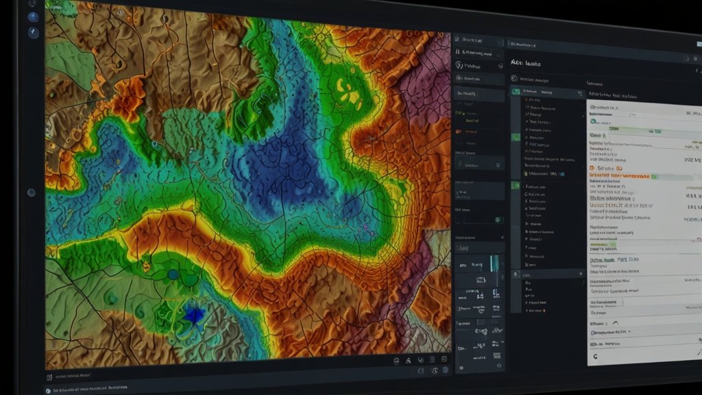
- AI processes geospatial data to create real-time vector and raster maps.
- AI-enhanced topographic and land-use maps improve urban planning.
- Automated map generation reduces manual digitization efforts.
See Also: Using DeepSeek AI for Predictive Spatial Analytics in GIS
4. AI-Driven Data Classification in GIS
Data classification is essential for land cover analysis, urban zoning, and vegetation mapping.
Step 6: AI-Based Data Classification

- Apply Deep Learning CNN (Convolutional Neural Networks) to classify land features.
- Use unsupervised learning for clustering geospatial data into meaningful categories.
- Generate AI-driven heatmaps to visualize spatial patterns.
Step 7: Object Detection in GIS
- Detect buildings, roads, and natural landmarks from satellite imagery.
- Apply AI-based anomaly detection to identify changes in land use.
- Use AI for real-time wildlife and deforestation monitoring.
5. Real-Time GIS Monitoring with DeepSeek AI
Real-time monitoring is critical for disaster response, environmental conservation, and smart city planning.
Step 8: Setting Up Real-Time Monitoring

- Connect GIS software with DeepSeek AI’s live data feeds.
- Use drone or satellite imagery for continuous updates.
- Enable automated alerts for natural disasters like floods and wildfires.
See Also: How DeepSeek AI is Revolutionizing GIS Automation
Step 9: AI-Powered Change Detection
- AI detects deforestation, urban growth, and climate-induced changes.
- GIS models can predict disaster risks based on real-time environmental factors.
- AI-integrated GIS systems improve emergency preparedness by providing instant alerts.
6. Case Study: Automating Urban Planning with DeepSeek AI
Real-World Application: Smart City Development

A city in California implemented DeepSeek AI for urban expansion monitoring:
- Automated Traffic Flow Mapping: AI predicted congestion hotspots.
- AI-Based Infrastructure Planning: Optimized road networks and public transport routes.
- Real-Time Environmental Monitoring: Assessed pollution levels and green cover.
🚀 Results: The city reduced traffic congestion by 30% and improved green space management using AI-powered GIS automation.
7. Future of GIS Automation with AI
The integration of AI and GIS will continue to evolve, making geospatial analysis smarter and more efficient.
Upcoming Trends:

🔹 AI-Integrated IoT Sensors for GIS Data Collection
🔹 Real-Time 3D Mapping with AI-Driven Drones
🔹 Predictive Spatial Modeling for Smart Cities
🔹 AI-Powered Environmental Conservation Strategies
Conclusion
DeepSeek AI is revolutionizing GIS workflows through automated mapping, AI-driven data classification, and real-time monitoring. By leveraging AI, organizations can reduce manual effort, improve accuracy, and make data-driven decisions efficiently.
GIS professionals, urban planners, and environmentalists can benefit from DeepSeek AI’s predictive capabilities to transform geospatial analysis. As AI technology advances, GIS automation will become a necessity rather than an option.
Frequently Asked Questions (FAQs)
Q1: How does DeepSeek AI improve GIS automation?
Ans: DeepSeek AI automates data processing, mapping, and monitoring, reducing manual GIS efforts and enhancing accuracy.
Q2: Can DeepSeek AI predict land-use changes?
Ans: Yes, DeepSeek AI uses predictive analytics to forecast urban expansion, deforestation, and environmental changes.
Q3: What industries benefit from AI-powered GIS automation?
Ans: Industries such as urban planning, agriculture, disaster management, and environmental monitoring benefit the most.
Q4: How can AI enhance real-time GIS monitoring?
Ans: AI integrates with satellite imagery and IoT sensors to track environmental changes and predict disaster risks in real-time.
Q5: What is the future of AI in GIS?
Ans: The future includes real-time 3D mapping, AI-enhanced climate modeling, and smart city development with AI-driven geospatial intelligence.
1 thought on “Automating GIS Workflows with DeepSeek AI: A Step-by-Step Guide [2025]”