
As the demand for geospatial data, infrastructure development, and real estate continues to rise, land surveyors are uniquely positioned to explore new business opportunities. If you’re a licensed land surveyor or a professional in geomatics, 2025 is the perfect year to expand your career by starting a niche business. In this blog, we explore the 12 best business ideas for land surveyors in 2025—each offering profitability, growth, and impact.
12 Best Business Ideas for Land Surveyors

1. Drone Surveying Services
In 2025, one of the most transformative business opportunities for land surveyors is offering drone surveying services. With advancements in UAV (Unmanned Aerial Vehicle) technology and affordable high-resolution sensors, drone surveying is revolutionizing the way spatial data is collected, analyzed, and delivered.

What is Drone Surveying?
Drone surveying involves using drones equipped with cameras, LiDAR, or thermal sensors to capture aerial data of land, construction sites, farms, and urban areas. This data is then processed into:
-
Topographic contour lines
-
3D terrain models
-
Point clouds
These outputs provide clients with highly accurate geospatial information faster than traditional surveying methods.
💡 Services You Can Offer:
-
Aerial Mapping & 3D Modeling
-
Construction Progress Monitoring
-
Topographic & Contour Mapping
-
Volume Measurements (e.g., stockpiles, earthworks)
-
Crop Health Analysis for Precision Farming
-
Roof Inspection & Asset Monitoring
-
Disaster Assessment & Urban Planning
💰 Why It’s Profitable in 2025:
-
Low Operating Cost After Initial Setup
Once you invest in a reliable drone, RTK GPS, and photogrammetry software (like Pix4D or DroneDeploy), the cost per project is minimal—especially when compared to traditional ground surveying. -
Fast & Scalable Data Collection
Drones can cover large and hard-to-access areas in a fraction of the time. This speed means more projects completed in less time, increasing your monthly revenue potential. -
Multi-Industry Demand
-
Construction companies need accurate volume and layout analysis.
-
Agricultural businesses want better crop monitoring and irrigation planning.
-
Real estate developers need marketing visuals and land planning maps.
-
Mining operations require regular volumetric updates and safety surveys.
-
-
Legal & Regulatory Changes
Many countries have now defined clear drone regulations, making it easier for professionals to obtain drone licenses and insurance—giving surveyors more confidence to enter the market.
🛠 Recommended Tools:
2. GIS Consulting Firm
As our world becomes more data-driven and interconnected, the need for location-based insights has never been greater. Geographic Information Systems (GIS) lie at the heart of this transformation.

If you’re skilled in spatial data analysis, cartography, or remote sensing, starting a GIS consulting firm in 2025 can be an exceptionally rewarding business.
What is a GIS Consulting Firm?
A GIS consulting business provides customized geospatial solutions to clients across various industries. This includes:
-
Data acquisition and integration
-
Spatial analysis and modeling
-
Interactive mapping and dashboards
-
Geodatabase design
-
Decision support systems
GIS consultants work closely with clients to solve complex problems using spatial intelligence.
💡 Services You Can Offer:
-
Urban Planning & Zoning Analysis
-
Environmental Impact Assessments
-
Utility & Infrastructure Mapping
-
Transport Network Optimization
-
Disaster Risk Mapping
-
Agricultural Land Use Planning
-
Retail & Market Location Analysis
-
GIS Training & Capacity Building
💰 Why It Works in 2025:
-
Exploding Demand for Spatial Intelligence
Governments, NGOs, and private companies are investing heavily in smart cities, infrastructure planning, and climate change adaptation, all of which require geospatial expertise. -
Applicable Across Diverse Sectors
Your GIS skills are valuable in:-
Transportation & logistics
-
Environmental science
-
Utilities (electricity, water, gas)
-
Healthcare (disease mapping, service access)
-
Disaster management & response
-
-
Flexible Business Model
You can work on a project basis, offer retainer contracts, or even launch subscription-based GIS dashboards. This gives you the freedom to scale based on your team size and specialization. -
Low Overhead, High Impact
All you need is a powerful computer, software licenses, and domain knowledge. You can even start from home with minimal startup costs.
🛠 Recommended Tools & Skills:
-
Software: ArcGIS Pro, QGIS, PostGIS, Mapbox, Google Earth Engine
-
Skills: Spatial analysis, remote sensing, cartography, Python/R scripting
-
Platforms: ArcGIS Online, Leaflet, GeoServer, Power BI for geospatial dashboards
3. Land Subdivision Planning
As urbanization accelerates and demand for real estate grows, landowners and developers are increasingly seeking to divide large parcels of land into smaller, marketable plots.

This is where land subdivision planning becomes a crucial and highly specialized service—perfect for licensed land surveyors and professionals with knowledge of property laws and land development.
What is Land Subdivision Planning?
Land subdivision is the process of dividing a single parcel of land into multiple lots that can be sold, leased, or developed independently. This involves:
-
Surveying and boundary demarcation
-
Layout and design of streets, access roads, and utilities
-
Zoning compliance and legal documentation
-
Approval from local authorities and municipal bodies
As a land surveyor, you’ll work closely with developers, property owners, architects, engineers, and local governments to create compliant and economically viable subdivision plans.
💼 Services You Can Offer:
-
Topographic Survey & Boundary Mapping
-
Subdivision Layout Planning
-
Legal Plotting and Registration
-
Road Access and Drainage Planning
-
Zoning & Building Code Compliance
-
Coordination with Urban Planners & Engineers
💰 Why It’s a Smart Business Idea in 2025:
-
High Demand in Growing Urban & Suburban Areas
With rapid expansion in cities and towns, there’s a significant need for subdividing land for residential, commercial, and mixed-use development. -
Essential for Real Estate Development
Developers can’t legally sell or build on subdivided land without proper survey plans and regulatory approvals—making your role indispensable. -
Lucrative Project-Based Fees
Subdivision planning is a high-value service, often billed on a per-project basis. Large subdivision projects can bring in steady income and repeat business from real estate firms. -
Requires Specialized Knowledge (Less Competition)
Because this field demands an understanding of municipal laws, civil engineering, and surveying precision, there’s less competition and higher perceived value for your services.
📍 Ideal Clients:
-
Real Estate Developers
-
Private Landowners
-
Construction Companies
-
Government Land Development Agencies
-
Housing Cooperatives & Builders
🛠 Recommended Tools:
-
AutoCAD Civil 3D – for designing plots, roads, and grading plans
-
GIS Software (ArcGIS/QGIS) – for analyzing land use and zoning regulations
-
Drone & Total Station Surveys – for accurate and up-to-date terrain data
-
Plotting Software & Layout Design Tools
⚖️ Legal Aspects to Know:
-
Zoning and building regulations
-
Minimum lot size requirements
-
Access easements and right-of-way
-
Drainage and environmental impact assessments
-
Approval process with planning commissions or municipal councils
Related Content:
12 Best Business Ideas for GIS Users in 2025
GIS Software Development: A Complete Roadmap for 2025
7 Powerful GIS Applications in Climate Science
4. Real Estate Mapping & Visualization
In today’s competitive real estate market, visuals sell. Buyers and investors no longer rely solely on static maps or photographs—they expect immersive, interactive experiences that help them understand a property’s value, layout, and potential. That’s where real estate mapping and 3D visualization services come in.

This business opportunity leverages your surveying and spatial analysis skills to create stunning visual tools for real estate agents, developers, architects, and property investors.
What Is Real Estate Mapping & Visualization?
Real estate mapping involves:
-
Creating precise, interactive property maps
-
Showing land boundaries, road access, utilities, zoning zones, and topographic details
3D visualization adds:
-
Digital 3D renderings of buildings, plots, and surrounding landscapes
-
Walkthrough animations of planned or existing developments
-
Augmented reality (AR) and virtual tours for client presentations
These visual tools help clients understand scale, orientation, design, and development potential—boosting both interest and sales.
💼 Services You Can Offer:
-
Interactive GIS-based Property Maps
-
3D Visualization of Land Parcels & Structures
-
Digital Twins for Real Estate Developments
-
Zoning & Utility Overlay Maps
-
Virtual Walkthroughs of Proposed Buildings
-
Web-based Property Dashboards
💰 Why It’s a Profitable Business Idea in 2025:
-
High Demand in Real Estate & Architecture
Developers and real estate agents want data-rich, visually engaging content to showcase land parcels, building designs, and development potential—especially for online buyers and international investors. -
Enhanced Buyer Experience = Higher Sales
Well-visualized properties sell faster and at higher prices. Visual storytelling plays a major role in buyer psychology, especially in competitive urban markets. -
Integration with Digital Marketing
Your services can be packaged with real estate websites, YouTube promos, Instagram reels, and listing portals—opening new markets for collaboration. -
Recurring Business Model
Large firms will need regular updates to visuals and maps as new units become available. This makes for reliable, long-term clients.
Ideal Clients:
-
Real Estate Developers
-
Property Agents & Brokers
-
Architectural Firms
-
Municipal Zoning Boards
-
Construction & Infrastructure Companies
-
Luxury Realtors & Resort Planners
🛠 Recommended Tools:
-
GIS Software: ArcGIS Online, QGIS with plugins
-
3D Modeling: SketchUp, Lumion, Blender, Twinmotion
-
CAD Tools: AutoCAD Architecture, Civil 3D
-
Visualization & Rendering: Unreal Engine, Enscape
-
Web Mapping Platforms: Mapbox, Leaflet, Google Earth Studio
5. Construction Layout Services
In the construction industry, accuracy is everything. A single mistake in the layout of a building or infrastructure can lead to costly delays, errors, and rework. That’s where construction layout services come in—helping ensure that every element is perfectly aligned, every dimension is accurate, and every structure is built as designed.

This business opportunity combines your surveying expertise with the critical need for precise layout services in construction projects. By partnering with construction companies, you can offer essential staking services for buildings, roads, and other infrastructure projects.
What Are Construction Layout Services?
Construction layout services involve:
-
Conducting precise staking and marking for buildings, roads, and other infrastructure.
-
Ensuring that construction is aligned with architectural plans, zoning requirements, and engineering specifications.
-
Providing detailed survey data to guide the placement of foundations, utilities, and roads.
Key layout services include:
-
Stakeouts: Marking exact locations for foundations, walls, utilities, and road alignments.
-
Building Site Surveys: Verifying property lines, setbacks, and existing conditions before starting construction.
-
Topographic Surveys: Mapping the terrain to account for elevation changes, water flow, and soil stability.
-
As-Built Surveys: Documenting the final location and dimensions of the construction once completed.
Services You Can Offer:
-
Building Stakeout Surveys
-
Road & Infrastructure Layout
-
Utility & Pipeline Staking
-
Topographic Site Surveys
-
As-Built Surveys
-
Construction Monitoring & Progress Surveys
💰 Why It’s a Profitable Business Idea in 2025:
-
High Demand in Construction & Infrastructure Projects
As urbanization and infrastructure projects continue to grow, there will be an increasing demand for accurate layout and surveying services to ensure that projects meet specifications. -
Reduced Risks for Contractors
Accurate layout surveys reduce the risk of construction errors and delays, making your services indispensable for contractors. It leads to faster project completion and fewer rework costs. -
Growing Infrastructure Investments
With investments in new roads, buildings, and smart cities, the construction sector is expected to remain a high-demand area for precise layout services. -
Repeat Business Opportunities
Construction firms require layout services for every new project they undertake. By establishing reliable relationships, you can secure ongoing, long-term clients.
🧑💼 Ideal Clients:
-
Construction Companies
-
Road & Highway Contractors
-
Municipalities & Government Infrastructure Projects
-
Commercial & Residential Developers
-
Engineering & Architectural Firms
🛠 Recommended Tools:
-
Surveying Equipment: Total Stations, GPS/GNSS Systems, Laser Scanners
-
Software: AutoCAD Civil 3D, Trimble Business Center, Carlson Software, Leica Geo Office
-
Field Mapping Tools: GIS Mapping Devices, Digital Theodolites
-
Drones for Site Surveying: UAVs for aerial site surveys
6. Environmental Survey Services
In an era where sustainability and environmental accountability are top priorities, businesses, governments, and developers must consider the ecological impact of every project. That’s where Environmental Survey Services come into play—helping clients make data-driven decisions that protect both the planet and their investments.

This business opportunity allows surveyors to apply their technical expertise in mapping, geospatial analysis, and terrain modeling to the growing environmental sector. Your services can help assess natural hazards, manage land responsibly, and comply with environmental regulations.
What Are Environmental Survey Services?
Environmental surveying involves:
-
Mapping and assessing environmental conditions of land before development
-
Identifying flood zones, erosion-prone areas, wetlands, and other sensitive regions
-
Evaluating potential environmental impacts of proposed construction or land use changes
Core components include:
-
Floodplain Mapping: Identifying areas at risk of flooding using elevation data, hydrology models, and historical records
-
Erosion Studies: Assessing slopes, soil types, vegetation cover, and water flow to predict erosion risks
-
Wetland & Habitat Mapping: Delineating ecologically sensitive zones that require protection
-
Environmental Impact Surveys: Supporting environmental impact assessments (EIAs) with geospatial and terrain data
💼 Services You Can Offer:
-
Flood Risk & Floodplain Mapping
-
Erosion Risk Assessments
-
Wetland and Vegetation Mapping
-
Pre-Construction Environmental Surveys
-
Soil & Land Stability Analysis
-
Watershed and Drainage Mapping
-
Support for Environmental Impact Assessments (EIA)
💰 Why It’s a Profitable Business Idea in 2025:
-
Government & Regulatory Compliance
Developers, municipalities, and infrastructure projects must often submit detailed environmental surveys to obtain permits. This creates a steady demand for your services. -
Rising Demand for Sustainability
As companies focus more on ESG (Environmental, Social, Governance) criteria, environmental data becomes crucial in planning and reporting. -
Risk Mitigation for Developers
Early identification of flood or erosion risks helps prevent future losses and lawsuits, making your work highly valuable. -
Grants & Funding Opportunities
Environmental projects often receive public and private funding, and your services can be tied into these opportunities as technical support.
🧑💼 Ideal Clients:
-
Environmental Consulting Firms
-
Urban Planners & Civil Engineers
-
Government Agencies & Municipalities
-
Infrastructure & Utility Companies
-
Renewable Energy Developers
-
NGOs & Conservation Organizations
🛠 Recommended Tools:
-
GIS & Remote Sensing: ArcGIS, QGIS, ERDAS Imagine, Google Earth Engine
-
Hydrology Modeling: HEC-RAS, SWMM, FLO-2D
-
Terrain & Elevation Tools: LiDAR, DEMs, UAVs/Drones with photogrammetry
-
Surveying Equipment: GNSS/GPS units, Total Stations, Soil Probes
7. Mining and Resource Mapping
In the high-stakes world of mining, accurate data is everything. From locating resources to managing extraction and ensuring regulatory compliance, mining companies depend on precise geospatial insights to operate efficiently and profitably. That’s where Mining and Resource Mapping Services come in.
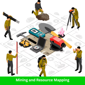
This business opportunity taps into your surveying and GIS expertise to deliver essential services for the mining and resource extraction industries—including volumetric calculations, boundary demarcation, and resource estimation.
What Is Mining & Resource Mapping?
Mining and resource mapping involves:
-
Generating high-precision spatial data of mining sites
-
Supporting exploration, extraction, and post-mining restoration through geospatial tools
-
Using drone imagery, GPS, and GIS to monitor site progress and manage resources
Key deliverables include:
-
Volumetric Surveys: Measuring material quantities (e.g., ore, overburden, stockpiles) to calculate volumes for production planning
-
Boundary Demarcation: Accurately defining legal mining boundaries and lease areas
-
Resource Mapping: Locating and visualizing mineral deposits using GIS layers, geology maps, and satellite imagery
-
Change Detection: Monitoring land deformation, land use, or terrain shifts over time
💼 Services You Can Offer:
-
Mining Lease & Concession Mapping
-
Stockpile & Pit Volumetric Surveys (via drone or LiDAR)
-
Geological & Resource Mapping (GIS-based)
-
Boundary Demarcation Surveys
-
Environmental & Topographic Surveys
-
Aerial Photogrammetry & Drone Mapping
-
Post-Mining Land Restoration Mapping
💰 Why It’s a Profitable Business Idea in 2025:
-
Boom in Resource Extraction Projects
As demand for rare earth elements, metals, and energy resources grows, so does the need for accurate spatial data in mining operations. -
High-Value Clients
Mining companies operate on large budgets and are willing to invest in services that improve efficiency, safety, and compliance. -
Technology-Driven Industry
The mining sector is embracing advanced geospatial technologies (like drones, LiDAR, and AI-powered GIS analysis) more than ever, creating space for skilled surveyors and mappers. -
Recurring Work Across Project Lifecycle
From exploration to reclamation, your services are needed at every phase of a mine’s life cycle—making for long-term client relationships.
🧑💼 Ideal Clients:
-
Mining & Quarrying Companies
-
Mineral Exploration Firms
-
Oil & Gas Companies
-
Government Mining Departments
-
Geology Consultants
-
Environmental Compliance Firms
🛠 Recommended Tools:
-
Surveying & Mapping: Total Stations, RTK GNSS, LiDAR, UAVs (Drones)
-
GIS Software: ArcGIS Pro, QGIS, Global Mapper
-
3D Modeling & Volumetrics: Pix4D, DroneDeploy, Surfer, AutoCAD Civil 3D
-
Geological Tools: Leapfrog Geo, Geosoft Oasis montaj, RockWorks
8. Property Boundary Dispute Resolution
Disputes over property lines are more common—and more stressful—than many realize. Whether it’s a fence built a few feet off, unclear ownership boundaries, or overlapping claims, land conflicts can escalate quickly. That’s where Property Boundary Dispute Resolution services step in, offering legal-grade surveys and authoritative documentation to settle issues with accuracy and professionalism.

This business opportunity positions you as a trusted land expert who combines technical surveying with a deep understanding of legal boundaries—helping landowners, lawyers, and developers resolve conflicts and avoid costly litigation.
What Is Property Boundary Dispute Resolution?
This service involves:
-
Conducting precise boundary surveys using total stations, GNSS, and historical land records
-
Demarcating property lines with physical markers, maps, and certified reports
-
Supporting land dispute cases with official survey documentation and expert testimony
-
Consulting on encroachments, easements, and rights of way
Types of disputes you can help resolve:
-
Residential property boundary confusion
-
Agricultural land encroachment
-
Overlapping titles or deeds
-
Fence line or wall disputes
-
Roadway or utility easement conflicts
💼 Services You Can Offer:
-
Official Boundary Surveys (with legal certification)
-
Property Line Demarcation & Marking
-
Title Deed & Cadastral Record Analysis
-
Survey Reports for Court Submission
-
Mediation Support & Expert Testimony
-
Subdivision & Land Partition Surveys
💰 Why It’s a Profitable Business Idea in 2025:
-
High Demand in Urban & Rural Areas
As land values increase and urban spaces tighten, boundary disputes are becoming more frequent. This creates constant demand for expert intervention. -
Legal Requirement for Land Transactions
Accurate boundary surveys are often required before land sales, construction, or redevelopment—especially in disputed areas. -
Trusted, Repeat Business from Legal Professionals
Lawyers, notaries, and real estate agents frequently refer clients for dispute resolution, giving you access to a recurring referral network. -
Peace of Mind Has Real Value
People are willing to pay for peace—resolving land conflict quickly and confidently has both emotional and financial payoff for clients.
🧑💼 Ideal Clients:
-
Private Landowners & Farmers
-
Real Estate Lawyers & Law Firms
-
Developers & Construction Companies
-
Municipal Land Departments
-
Housing Societies & Property Agents
-
Notary Public Offices
🛠 Recommended Tools:
-
Survey Equipment: RTK GNSS, Total Stations, Boundary Marking Tools
-
GIS & Cadastral Mapping: QGIS, ArcGIS, cadastral overlays
-
Legal Reference Tools: Local land acts, cadastral archives, land registry databases
-
Report Generation: AutoCAD Civil 3D, Microsoft Office, PDF map creators
9. Utility Mapping Services
Before any construction, excavation, or development begins, there’s one crucial question: What’s underground? Hidden pipelines, electrical cables, water mains, and fiber optics lie beneath our streets and fields—posing serious risks if disturbed. That’s where Utility Mapping Services come in, using advanced tools like Ground Penetrating Radar (GPR) to detect and map underground utilities with pinpoint accuracy.

This business opportunity allows you to deliver essential safety, planning, and compliance services to construction firms, engineers, municipalities, and utility providers—keeping people, property, and projects safe.
What Is Utility Mapping?
Utility mapping involves:
-
Detecting and mapping subsurface infrastructure such as water pipes, gas lines, sewer systems, electrical and telecommunication cables
-
Using non-invasive technologies like GPR, electromagnetic locators, and GNSS systems
-
Producing detailed utility maps that help prevent costly accidents and delays during excavation or development
Key deliverables include:
-
2D/3D maps of underground utilities
-
GIS-integrated utility data layers
-
Reports indicating depth, position, and type of buried assets
💼 Services You Can Offer:
-
GPR-based Subsurface Utility Detection
-
Underground Pipe & Cable Mapping
-
Utility Conflict Identification for Project Planning
-
GIS Database Creation for Municipal Infrastructure
-
As-Built Utility Surveys for New Developments
-
Utility Verification Surveys (pre- and post-construction)
💰 Why It’s a Profitable Business Idea in 2025:
-
Mandatory for Development Projects
Many governments and private projects require utility surveys before any digging or site work begins, making this a non-negotiable service. -
High Demand Across Sectors
Construction, telecom, energy, water, and infrastructure sectors all rely on accurate utility maps to plan and execute safely. -
Premium Service with Specialized Tools
Since GPR and underground surveys require technical skill and expensive equipment, you can charge premium rates for your expertise. -
Risk Mitigation = High Value
Preventing utility damage can save clients thousands (or millions) in fines, repairs, and downtime—making your services a must-have.
🧑💼 Ideal Clients:
-
Civil Construction & Excavation Companies
-
Utility Providers (Water, Gas, Electric, Telecom)
-
Engineering & Infrastructure Firms
-
Municipal Planning & Public Works Departments
-
Rail & Highway Project Authorities
-
Real Estate Developers
🛠 Recommended Tools:
-
Detection Equipment: Ground Penetrating Radar (GPR), Electromagnetic Locators, CCTV Inspection Systems
-
Positioning Systems: GNSS Receivers, Total Stations
-
GIS & Mapping: ArcGIS, QGIS, AutoCAD Map 3D
-
Visualization Tools: 3D Utility Modeling Software, Revit, Navisworks
10. Online Survey Data Portal
In the digital age, time is everything—and so is data. Developers, engineers, planners, and architects constantly need accurate, ready-to-use survey datasets, topographic maps, and satellite imagery to speed up their projects. That’s where an Online Survey Data Portal steps in—your opportunity to create a subscription-based geospatial platform that provides curated, downloadable, and searchable survey data anytime, anywhere.

This business idea combines your surveying and GIS skills with digital entrepreneurship, allowing you to monetize your data while helping professionals access critical mapping resources in just a few clicks.
What Is an Online Survey Data Portal?
An Online Survey Data Portal is a centralized, web-based platform that offers:
-
Topographic maps, DEMs, and terrain data
-
Survey datasets for land parcels, infrastructure, and natural features
-
Satellite imagery with multi-temporal and high-resolution options
-
Geospatial layers like zoning, land use, road networks, elevation models, and hydrology
-
Interactive map viewers and downloadable GIS file formats (e.g., SHP, GeoTIFF, KML)
💼 Services & Features You Can Offer:
-
Subscription Plans (Monthly, Yearly) for Unlimited Data Access
-
Pay-per-Download Model for Specific Datasets
-
Advanced Search & Filter for Region, Feature Type, Date, and Format
-
Custom Data Requests for Specialized Projects
-
Web Map Viewers for Previewing & Analyzing Layers
-
API Access for Integration with Third-Party Apps
💰 Why It’s a Profitable Business Idea in 2025:
-
High Demand for Quick, Remote Data Access
Professionals working on tight deadlines prefer instant, reliable data over waiting for traditional field surveys. -
Scalable Passive Income Model
Once your portal is live, it can earn revenue around the clock through subscriptions, downloads, and API access. -
Use Your Existing Survey Data
Turn years of collected fieldwork, maps, and GIS datasets into a revenue-generating asset. -
Growing GIS Market & Digital Transformation
With more companies shifting to cloud-based planning and BIM workflows, your platform becomes a crucial resource.
🧑💼 Ideal Users:
-
Civil Engineers & Construction Firms
-
Urban Planners & Architects
-
Real Estate Developers
-
Government Agencies & Local Municipalities
-
GIS Analysts & Environmental Consultants
-
Academic Researchers & Surveying Students
🛠 Recommended Tools & Tech Stack:
-
Web GIS Platforms: Mapbox, Leaflet, OpenLayers
-
GIS Backend: GeoServer, PostGIS, QGIS Server
-
Frontend Frameworks: React, Vue, or WordPress with Map Plugins
-
Data Storage & Management: AWS, Google Cloud, or DigitalOcean
-
Payment & Access Control: Stripe, PayPal, MemberPress, WooCommerce Memberships
11. Agricultural Land Surveying
As agriculture evolves into a data-driven industry, precision farming has become essential for maximizing yield, minimizing waste, and managing resources sustainably. That’s where Agricultural Land Surveying services shine—offering high-tech solutions like contour mapping, irrigation planning, and soil analysis to help farmers make smarter decisions.

This business opportunity lets you combine your geospatial expertise with the needs of modern agriculture—supporting small farmers, large cooperatives, and agri-tech startups in boosting productivity and sustainability.
What Is Agricultural Land Surveying?
Agricultural surveying focuses on:
-
Farm Mapping: Accurate boundaries, field divisions, crop zones, and land use classifications
-
Contour & Elevation Mapping: Identifying slope, drainage paths, and areas prone to erosion
-
Irrigation Planning: Designing efficient irrigation layouts based on topography and soil types
-
Soil Mapping: Classifying soil types, fertility levels, and suitability for various crops
-
Drone & Satellite Data Analysis: Crop health monitoring, NDVI analysis, and field condition tracking
These tools help farmers reduce input costs, conserve water, prevent erosion, and plan harvests more effectively.
💼 Services You Can Offer:
-
Digital Farm Boundary Mapping with GIS
-
Contour Mapping & Terrain Analysis for Irrigation
-
Soil Type & Quality Mapping
-
Precision Irrigation & Drainage Planning
-
Drone Surveys for Crop Monitoring
-
Land Suitability Analysis for Different Crops
-
Farm Management GIS Dashboards
💰 Why It’s a Profitable Business Idea in 2025:
-
Growing Demand for Precision Agriculture
With rising food demand and climate variability, farmers are adopting tech-based solutions more than ever. -
Government Support for Agri-Tech
Many countries now offer grants or incentives for digital farming and land mapping initiatives. -
Recurring Seasonal Projects
Mapping services are needed pre-planting, mid-season, and post-harvest—leading to continuous work. -
Low Competition in Rural Areas
Many regions still lack access to professional land surveying tailored to agriculture, offering untapped potential.
🧑💼 Ideal Clients:
-
Small & Large-Scale Farmers
-
Agricultural Cooperatives & FPOs
-
Agri-Tech Companies
-
Irrigation Consultants
-
NGOs working in Sustainable Farming
-
Agricultural Universities & Research Institutions
🛠 Recommended Tools & Equipment:
-
Survey Tools: GPS/GNSS receivers, Total Stations, Drones with multispectral cameras
-
GIS Software: QGIS, ArcGIS, AgLeader SMS
-
3D Terrain Tools: Global Mapper, AutoCAD Civil 3D
-
Agriculture Platforms: DroneDeploy, Pix4D Fields, FarmLogs, Cropio
12. Land Surveying Courses & Online Training
In today’s digital learning era, knowledge is more than power—it’s profit. If you’re a land surveying or GIS expert, there’s a fast-growing global audience eager to learn from your experience. From civil engineering students to aspiring GIS analysts and professionals switching careers, online training and tutorials are in high demand.

This is your opportunity to monetize your skills by creating and selling surveying courses, video tutorials, and live training programs—right from your home or office.
What Is a Land Surveying Education Business?
This business model revolves around creating and distributing educational content related to:
-
Fundamentals of Land Surveying & GIS
-
Practical Use of Surveying Equipment (Total Station, GNSS, Theodolite)
-
Topographic Mapping & CAD Workflows
-
GIS & Remote Sensing Basics
-
Drone Mapping & Data Processing
-
Legal Aspects of Land Surveying
-
Real-world Project Case Studies
You can host your content on platforms like Udemy, Teachable, YouTube, or even your own website.
💼 Products & Services You Can Offer:
-
Pre-recorded Video Courses (Beginner to Advanced)
-
YouTube Channel with Short Tutorials & Tips
-
Live Zoom/Webinar Classes for Real-Time Interaction
-
Downloadable E-books, Notes, and Practical Checklists
-
Certification Programs for GIS & Surveying
-
1-on-1 Mentorship or Career Coaching
-
Corporate or Institutional Training Packages
💰 Why It’s a Profitable Business Idea in 2025:
-
Global Demand for Geospatial Skills
Surveying and GIS jobs are growing rapidly worldwide, and many learners prefer flexible, online education over traditional classes. -
High-Profit Margin with Low Overhead
You create content once and sell it infinitely—with minimal operating costs. -
Multiple Monetization Options
You can earn from course sales, YouTube ads, sponsorships, affiliate links, and premium memberships. -
Authority & Recognition
Teaching online helps you build your brand, authority, and network in the surveying community.
🧑💼 Target Audience:
-
Civil Engineering & Geomatics Students
-
Entry-Level Surveyors & GIS Technicians
-
Working Professionals Switching to GIS Careers
-
Government Employees in Land & Urban Planning
-
NGO Workers, Environmental Analysts, and Freelancers
-
Surveying Firms Seeking to Train Their Staff
🛠 Recommended Tools & Platforms:
-
Course Hosting: Teachable, Thinkific, Udemy, Skillshare
-
Video Editing: Camtasia, Filmora, Adobe Premiere
-
Screencasting: OBS Studio, Loom
-
Presentation Tools: Canva, PowerPoint, Google Slides
-
Marketing Tools: ConvertKit, Mailchimp, SEO Blog via WordPress
-
Payment Gateways: PayPal, Stripe, Razorpay
Final Thoughts
The year 2025 brings new technologies, expanded markets, and smarter tools—making it the perfect time to start a specialized land surveying business. Whether you’re using drones, GIS software, or traditional instruments, these 12 business ideas can turn your skills into a sustainable and rewarding enterprise.
Frequently Asked Questions (FAQ)
1. What is the most profitable business idea for land surveyors in 2025?
One of the most profitable business ideas in 2025 is drone surveying services, due to their efficiency, accuracy, and wide applications in construction, agriculture, and real estate industries.
2. Do I need a license to start a land surveying business?
Yes, in most countries, you need to be a licensed land surveyor to offer professional surveying services. Requirements may vary depending on your location.
3. Is GIS knowledge important for land surveyors starting a business?
Absolutely. GIS (Geographic Information Systems) is a powerful tool that enhances data visualization, spatial analysis, and decision-making—making it essential for many modern surveying businesses.
4. How much investment is required to start a drone surveying business?
Initial investment can range from $5,000 to $20,000, depending on the drone model, software, and training needed. However, the return on investment is high with proper marketing and niche targeting.
5. Can I start an online business as a land surveyor?
Yes, options like selling digital maps, offering online GIS courses, or launching a survey data portal are excellent online business models for land surveyors.
6. Which industries require land survey services the most?
Top industries include:
-
Construction & Infrastructure
-
Real Estate
-
Agriculture
-
Mining
-
Government/Urban Planning
-
Environmental Management